Unpaved, With Good Intentions
Sunday was an uphill battle from the beginning. The plan was to somehow drive three hours from Moab, UT, to Monument Valley, which is on the Utah/Arizona border. After driving the 17-mile scenic loop road through Monument Valley, we would drive back up into Utah for another 4.5 hours to Bryce Canyon National Park. How would we fit it all in? How would I handle 7.5 hours of driving? How many times would Sam make fun of Bob Dylan whenever one of his songs played? I was wondering all those same things myself when I woke up Sunday morning.
The drive to Monument Valley was actually quite pleasant. The weather was great, we drove with the top down, and we managed to find enough to do and talk about on the way. As an added bonus, the closer we got to Monument Valley, the cooler the landscape became, so we spent a fair amount of time gawking out the windows at various rock formations and changing terrain.


This formation is called Mexican Hat Rock
You may not have heard of Monument Valley, but you’ve seen it in the movies. It was used as the backdrop for countless Westerns, Close Encounters, and the scene from National Lampoon’s Vacation when they drive off a cliff and Clark has to wander through the desert to find help. It’s basically a collection of massive, red rock formations that stick up out of the dessert in various interesting shapes for no apparent reason. The most famous “monuments” are the first ones you come to: the mittens, which you’ve probably seen in pictures. They look like this:
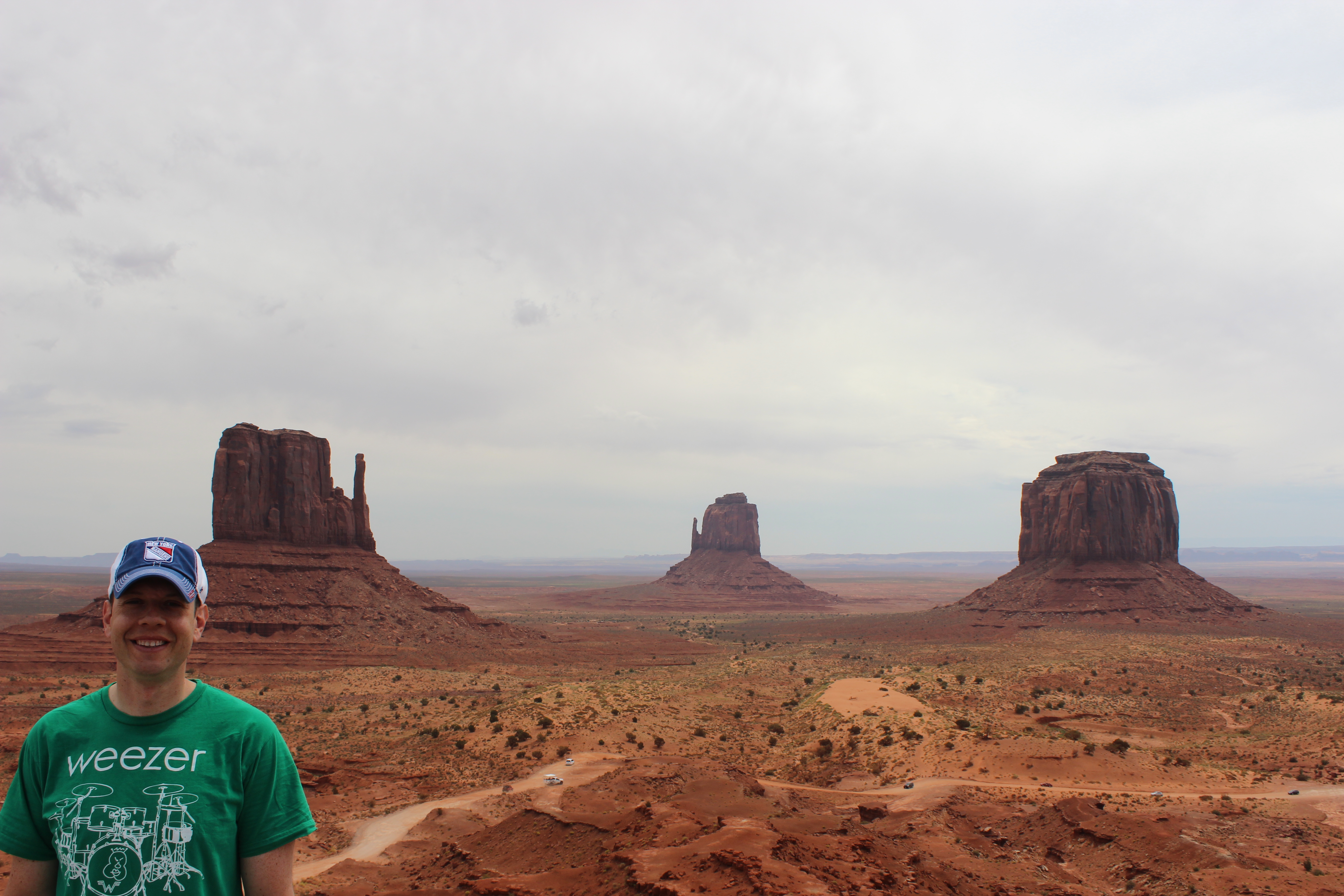
OK, so the pictures you’ve seen probably don’t have me in them. The monument on the right is called Merrick Butte. Butte is pronounced “beaut” but Sam naturally assumed it was pronounced “butt,” which provided great amusement. The amusement only grew in intensity when we got to the next two monuments, which are called Elephant Butte and Camel Butte because they’re shaped like those animals.

Elephant Butte

Camel Butte
He was less amused by the monument called the Three Sisters, but it was pretty cool nonetheless.

Three Sisters
Meanwhile, Monument Valley, like Four Corners Monument, is not a National Park and is on Navajo land, which means that, like Four Corners, the facilities are rather bare-bones. This time at least there was a real bathroom. But what nobody mentions until after you’ve paid the $20 entrance fee is that the loop road that takes you past the monuments is not paved. It’s a dirt road that’s badly rutted. Wait, let me rephrase that—it’s a dust road that’s badly rutted. A dirt road actually provides some sort of traction. This road was covered with such a thick layer of fine dust that it was like driving on a beach. There was no traction at all and the car got stuck a couple of times in inches-deep dust. This would have been difficult if the road were relatively flat or straight, but it is neither. Sharp turns, steep hills, deep dust sand, and deep holes is not a combination that makes for pleasant driving.
We were thoroughly amazed and awed by the monuments. We just wished that the road to see them would have been a little more like an actual road. The dusty road did add to the desert ambiance, I suppose, but I am left wondering what my $20 entrance fee pays for, besides the salary of the guy who collects the entrance fee.
A few monuments in, we came to a little ranch where you can take guided tours of Monument Valley on horseback. It immediately occurred to me that horseback would be an infinitely better way to see Monument Valley. Hey, it was good enough for John Wayne. I contemplated ditching the plan for the rest of the day and spending a few hours riding on horseback through the valley. But we’re already trying to jam too much into not enough time, so extending Monument Valley would have meant missing out on something else down the line.
Meanwhile, I was starting to seriously worry about the car, which was completely covered in dust and struggling to make it up the dustier hills. So after seeing six monuments up close and a few more from a distance, we turned around and headed back out.
The good thing about bailing out on Monument Valley earlier than expected was that it meant we’d get to Bryce Canyon sooner and have a little more time there. The bad news was that it was time for me to do more driving.
When I talk to people about these road trips they tend to react as if the thousands of miles we drive are done all at once. Like we just do nothing but drive for days and days. In reality, the driving is done in small chunks—two hours here, and hour there, three hours the next day, etc., with hours in between spent having fun at various destinations. This trip, however, is turning out to be more like people’s assumptions. A big part of that is that things are spaced further apart in the Southwest, so there’s more ground to cover between stops. In fact we’ve done so much driving that for the first time we’re starting to run out of things to say to each other. Making matters worse is when the destination involves more driving, like in Monument Valley. I drove for three hours just to be able to drive for a couple of hours. Then we drove for a few more hours to get to a National Park, and National Parks tend to be pretty heavy on driving, too.
It turned out that just getting to Bryce Canyon was an adventure itself. For starters, it was a sunny day but we started seeing intense lightning off in the distance, so we drove with the roof closed. Then the sky darkened. Then the sky opened up. It was one of those furious summer rain storms that just pelts the world with unimaginable amounts of rain to the point where you can barely see out your windshield, and then 15 minutes later the rain has stopped completely. Well, at least all that dust got washed off the car.

We were making pretty good time to Bryce when the GPS told me to turn right off the highway onto some other road called County Road 1870. I was a little unsure, so I tried to double check the directions on my phone using Google Maps, but I had no signal. CR-1870 went in the right direction, so I obliged. I came to regret this decision after about 15 miles, when the road suddenly became unpaved. As in pebbles. I was driving on my second unpaved road of the day, and this one was a road made of pebbles, with such tight twists and turns that I felt the rear wheels slip several times. And this went on for 15 miles, and the whole time the undercarriage of the car was being constantly pinged with pebbles kicked up by the tires. As if that wasn’t enough of a challenge, there were cows. In the road. Repeatedly. Apparently CR-1870 runs through some farmland in which cows roam free and occasionally find themselves standing in the middle of the unpaved road, even when a car comes.

Going to visit the chicken, I presume?
In fairness to the GPS, the CR-1870 route is physically shorter than just staying on the nicely paved Route 89 would have been. But besides the emotional trauma inflicted by this “short cut,” it took us almost six hours to get to Bryce. At that point we had only a little more than two hours before dark in which to see the whole park, or at least as much of it as we could cram in. Again a friendly Ranger helped us make a plan, and again it worked perfectly.
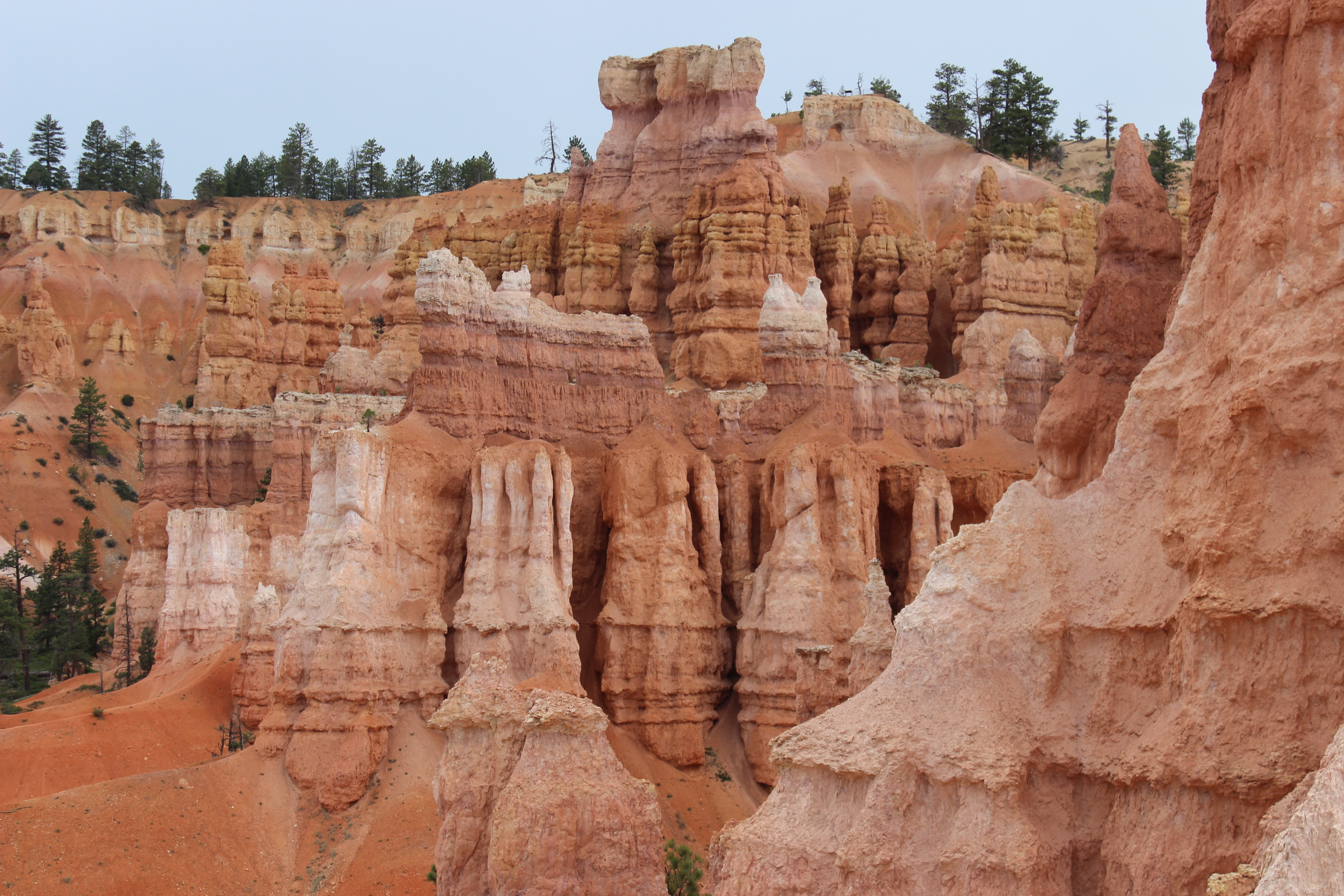
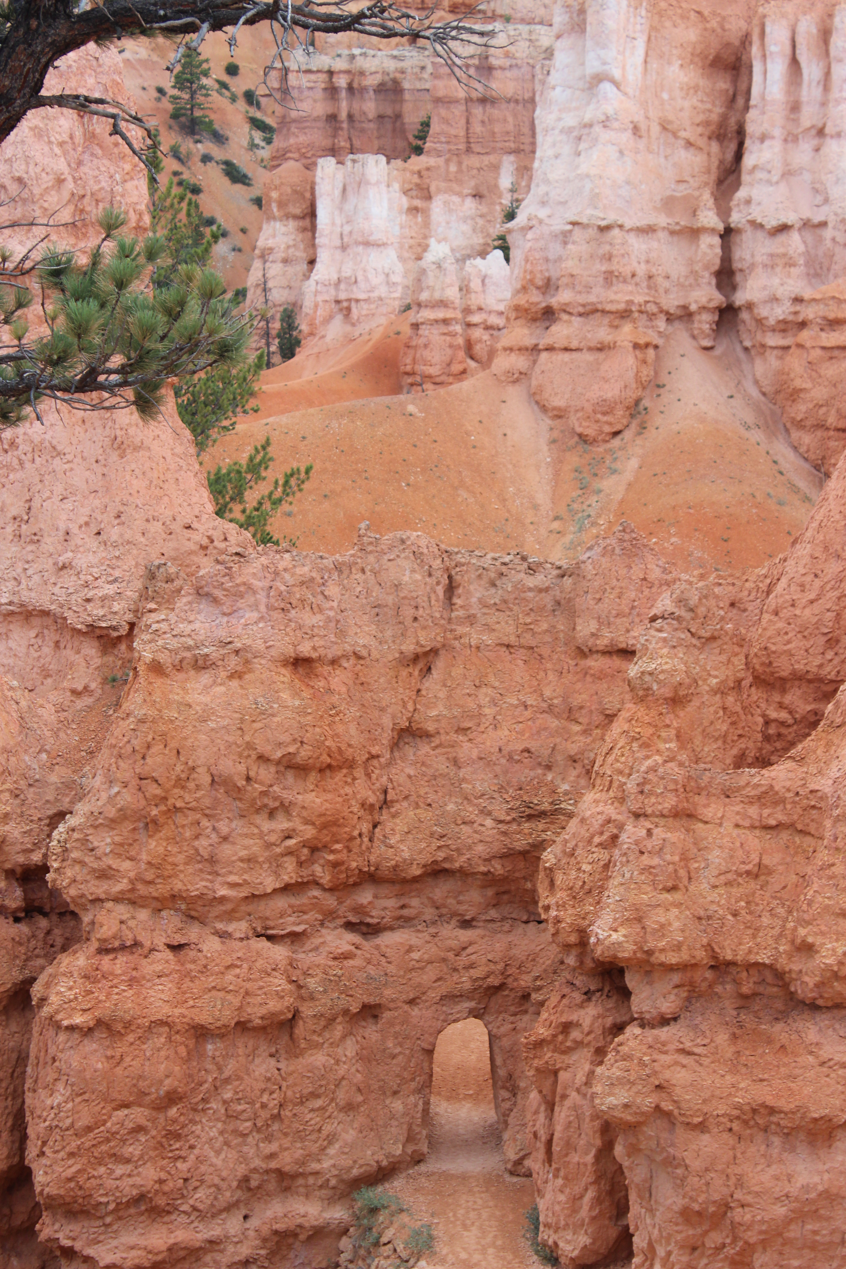
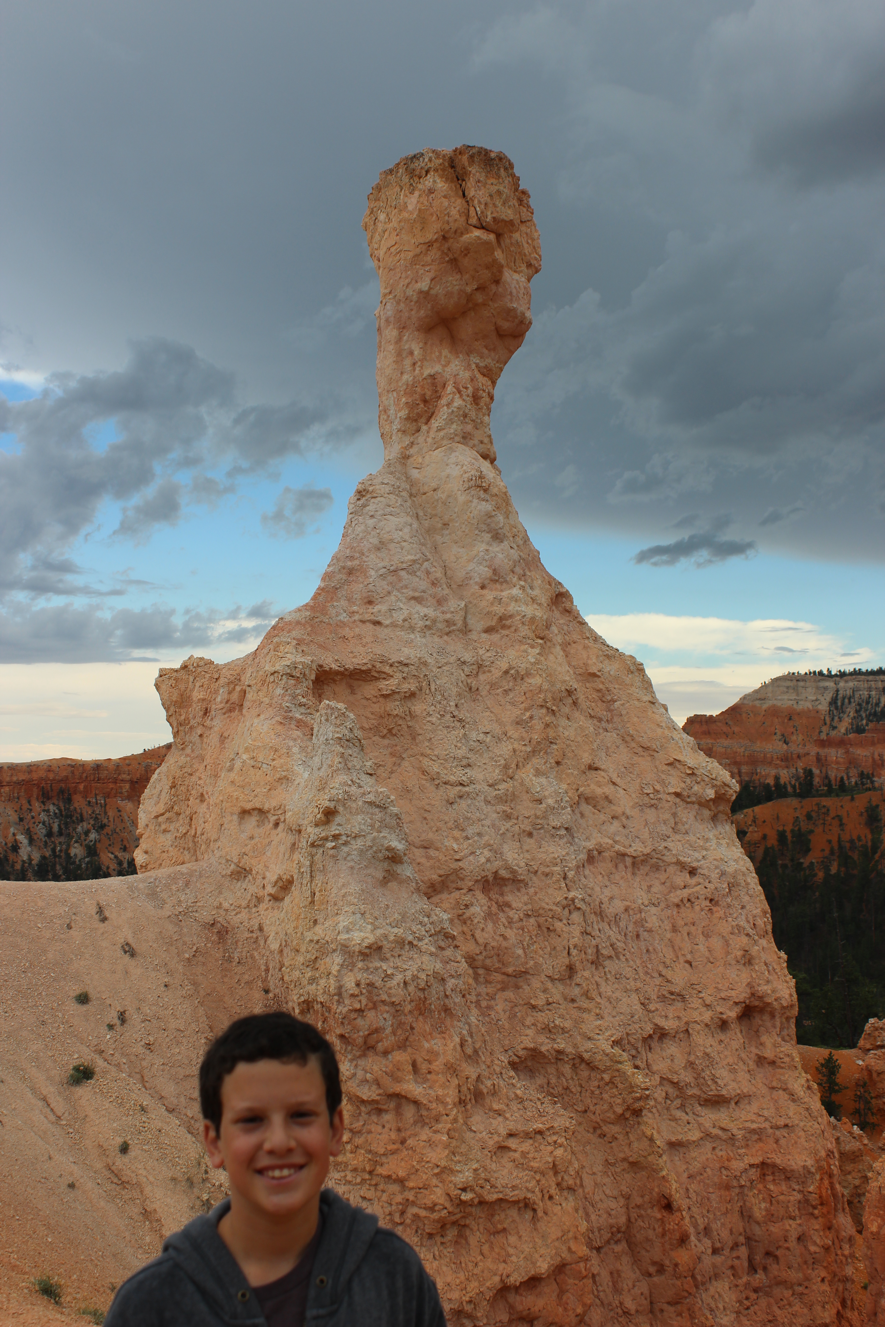
Bryce Canyon is filled with enormous, funky-shaped stone spires called hoodoos that look a little like a medieval Scandinavian village, or like an above-ground Atlantis, or like a city built by mentally disturbed garden gnomes.
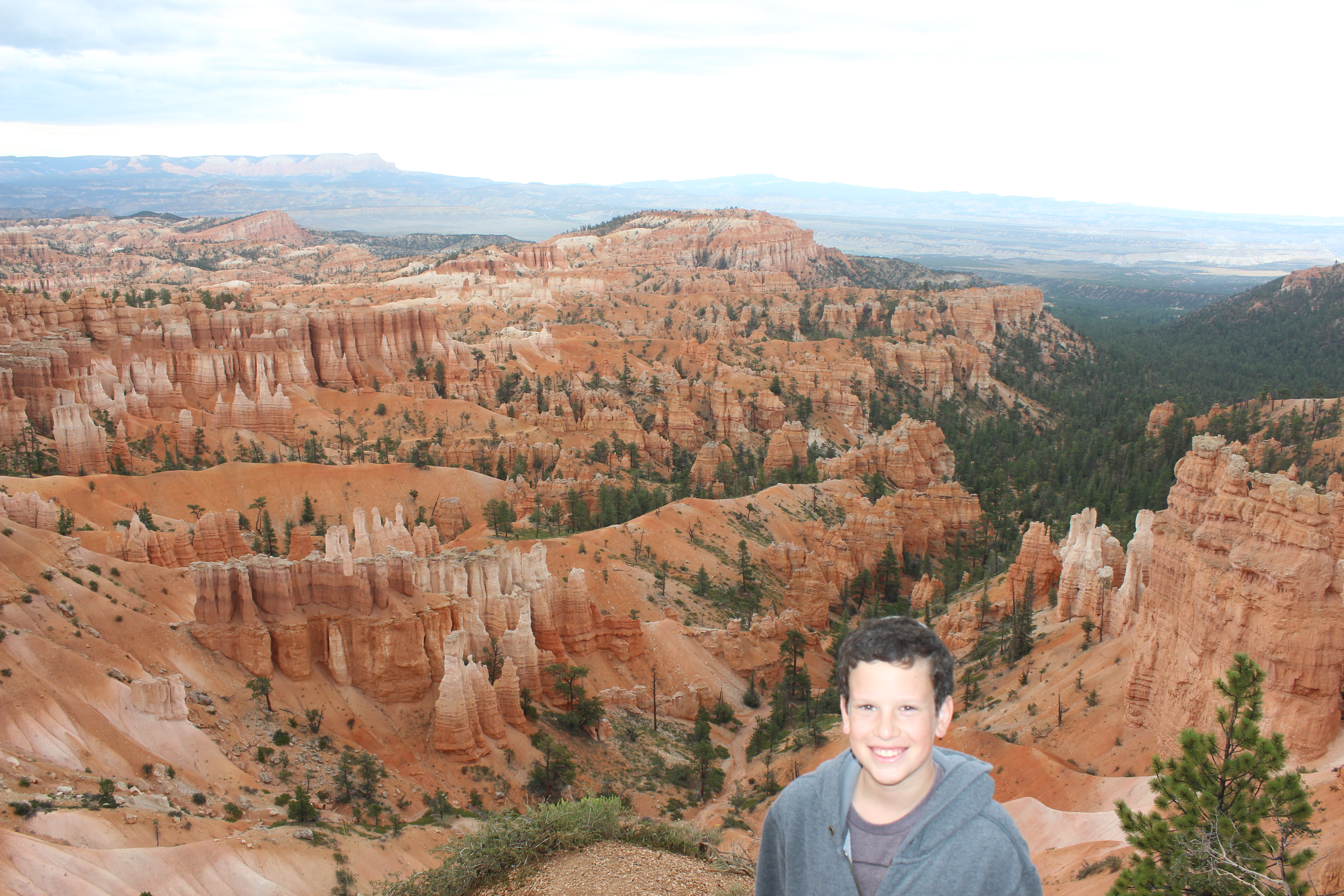


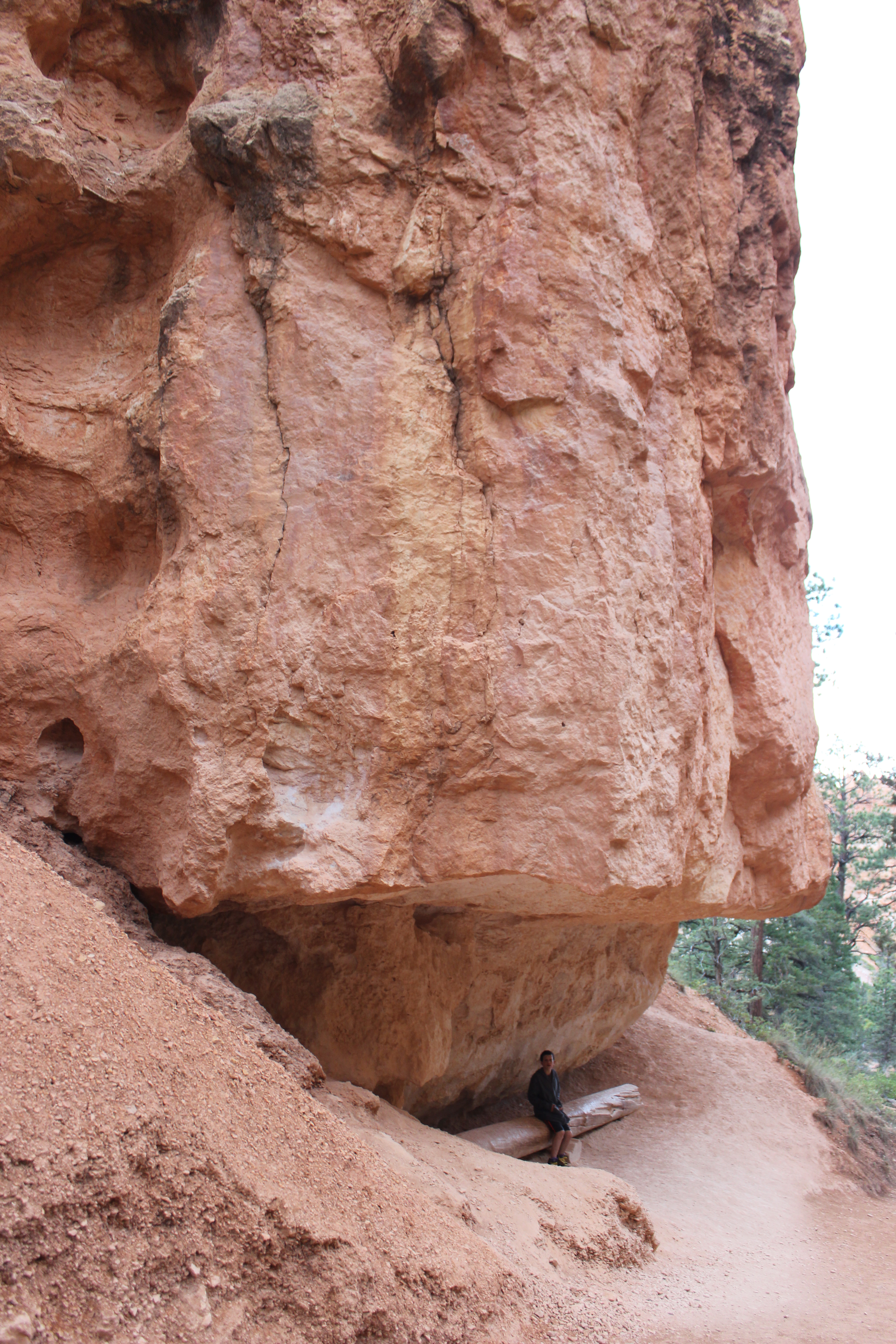
And most of the park’s hoodoos are inside a massive stone bowl called an amphitheater. There are several spots where you can park your car and get good views of the hoodoos from the rim of the amphitheater. But I wanted to get closer, and I also wanted to get out of the car. So when the Ranger suggested the most popular hike in the park, which is a three-mile loop that goes all the way down to the bottom of the bowl and around and back up again, and it’s really steep and narrow, it actually sounded like a good idea.
Oh boy, was it a good idea. The views were incredible whether we were above, below, or anywhere in between.

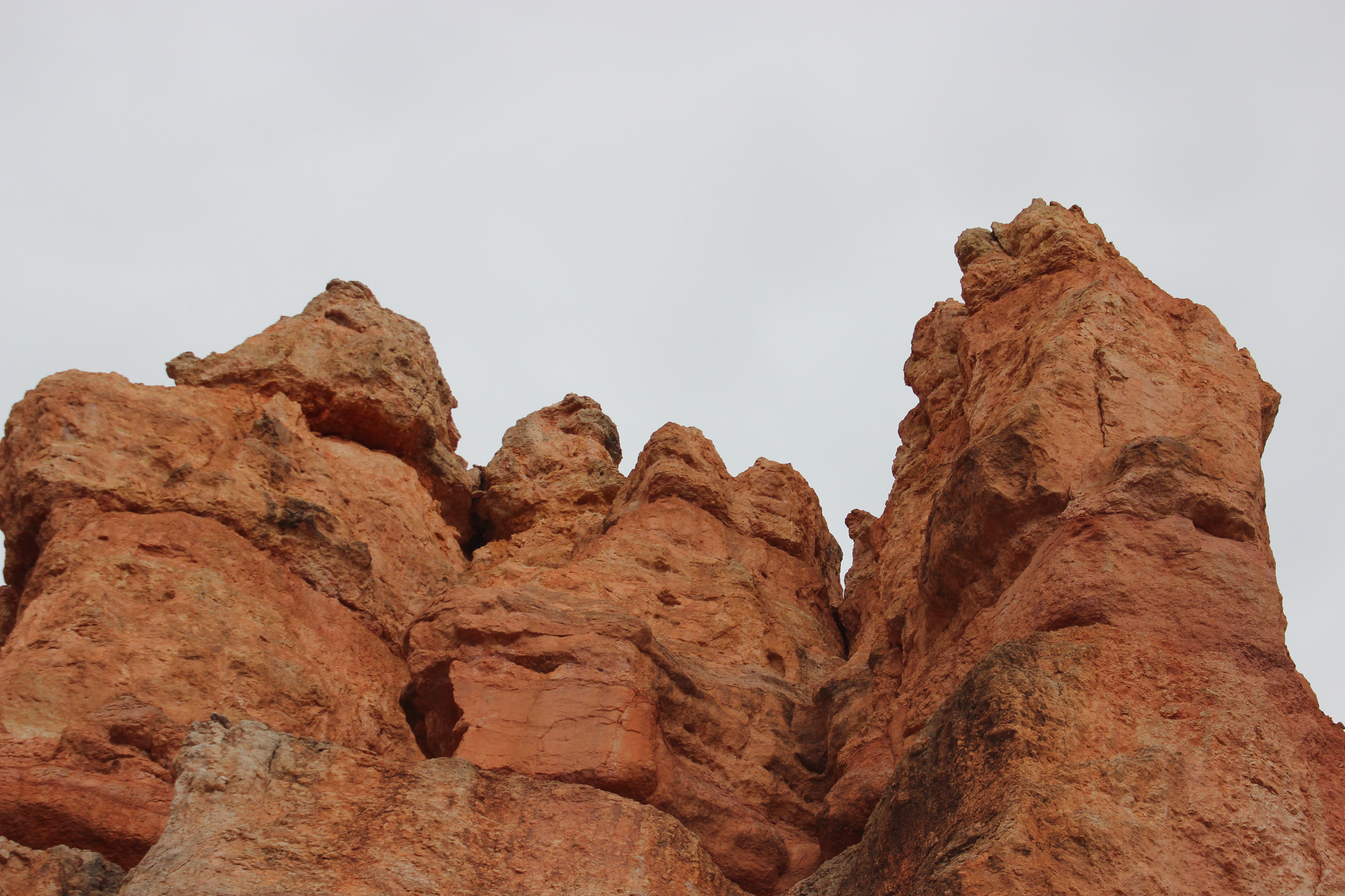

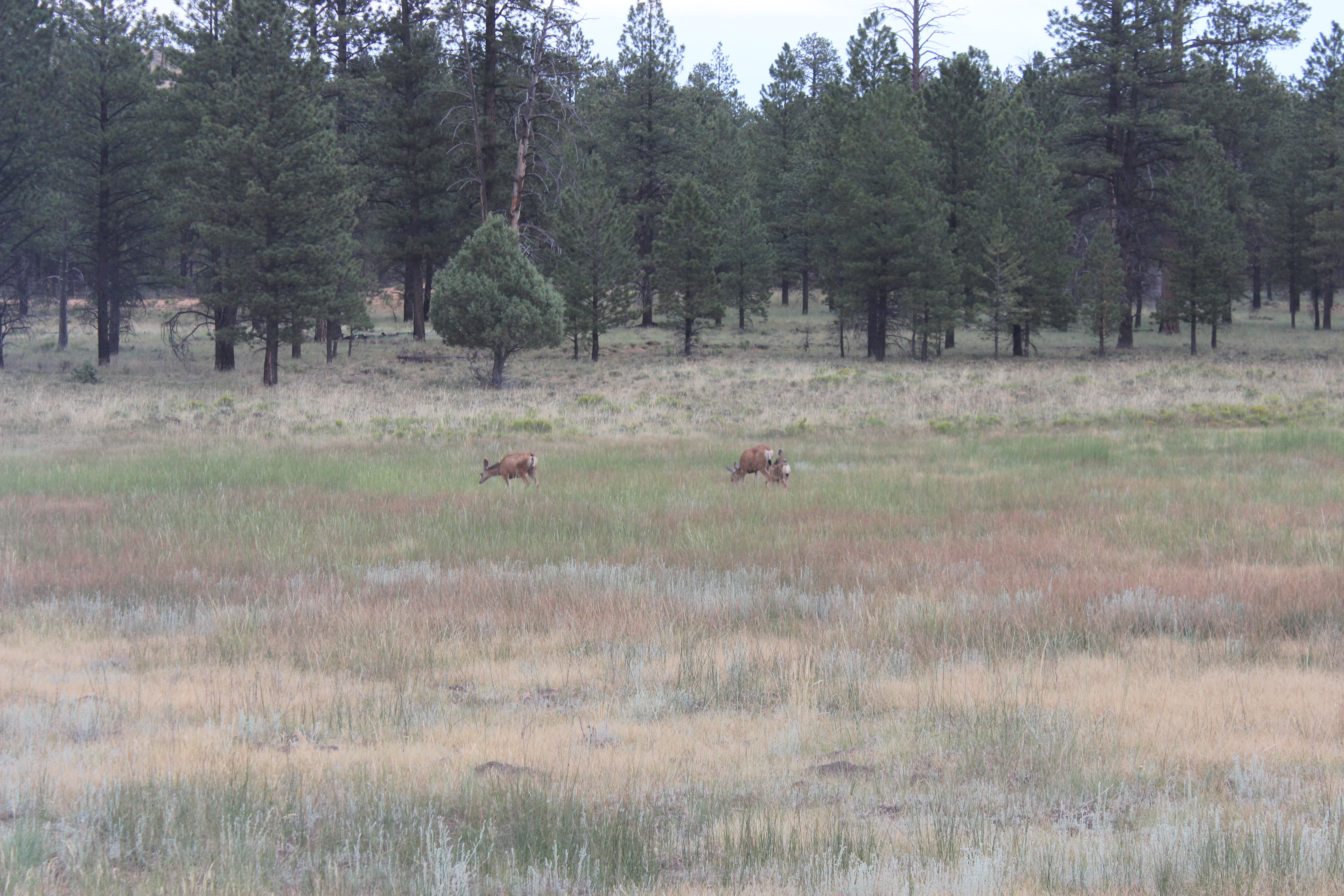
We got up close to hundreds of hoodoos, and we saw some wildlife along the way, which is always especially exciting for Sam. We saw a few deer, but mostly we saw chipmunks.


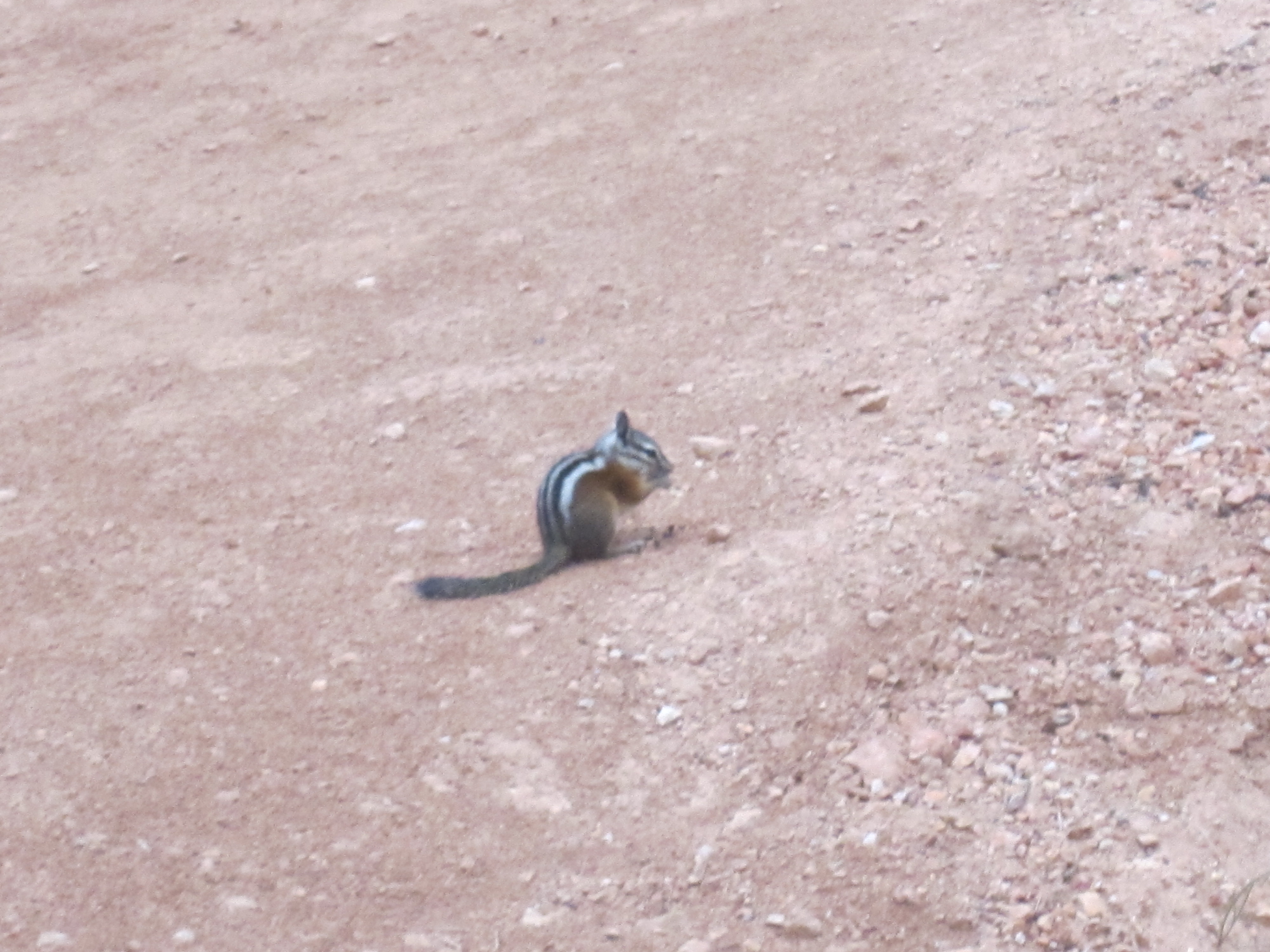

Sam adores chipmunks. They’re tiny and cute, they’re soft and furry, they’re fast, and they let you get pretty close before they dart away.

They’re basically attractive miniature squirrels. After a while Sam started to get annoyed at animals that weren’t chipmunks. When he thought he heard a chipmunk and it turned out to be a small bird, he scolded the bird: “Why aren’t you a chipmunk, bird?!”
We had so much fun admiring the hoodoos, admiring the chipmunks, and admiring the extraordinary views that we didn’t even mind the steep climb back up to the rim at the end of the hike. OK, that’s a lie. The climb was exhausting.
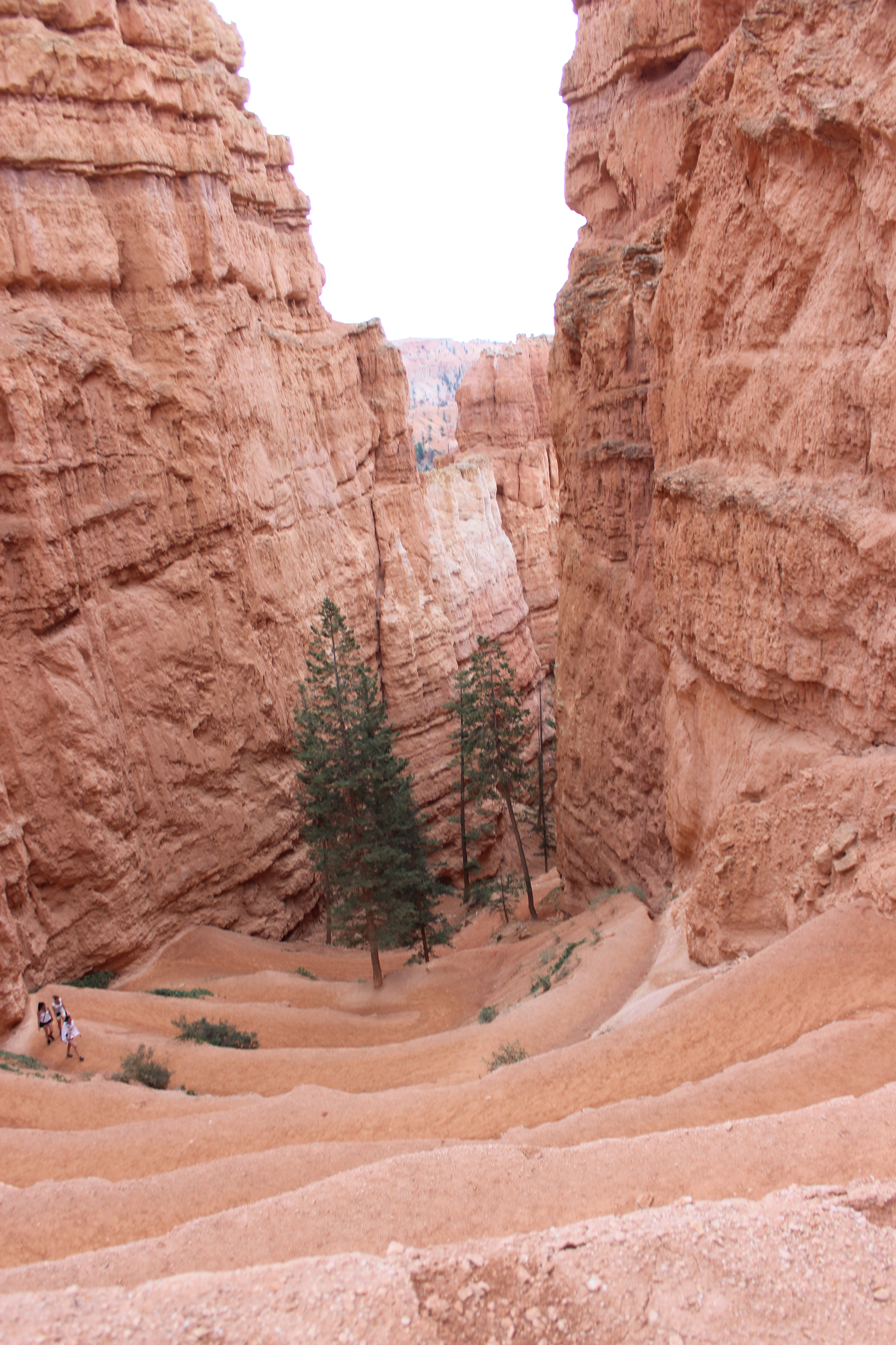
Yeah, we climbed this. Look how small the people are who are only halfway up.
But we made it back up before sunset, and we rewarded ourselves with a steak dinner before heading out in search of a place to spend the night.

The chipmunks have recently turned up all over my Teaneck neighborhood. I have been in the house forty years but I had never seen them before. As for the hoodoos — nothing like them in all of Bergen County! Hope to get to Bryce next month.