Wither Or Not
One of the major casualties of these road trips is my physique. In real life I’m at the gym pretty often and I’m always on my feet at work. On the road trips I spend weeks having a great time but getting little to no exercise, unless you count the little bits of walking here and there. I do a reasonably good job of eating healthfully on these trips and I tend to lose several pounds each trip, but I think most of the loss is from muscle atrophy.
After two or three weeks it becomes noticeable. This morning for some reason it was particularly glaring and unsettling. I’d show you a picture but you’re better off without one. And we’re spending almost the entire day in the car, and doing it again tomorrow, so it’s only going to get worse. I’m going to do some pushups in our motel room tonight, but it’s a drop in the ocean. I’ve got done serious work to do at the gym when we get home.
I’m Your Huckleberry
The big events for Wednesday were fighter planes and a shootout.
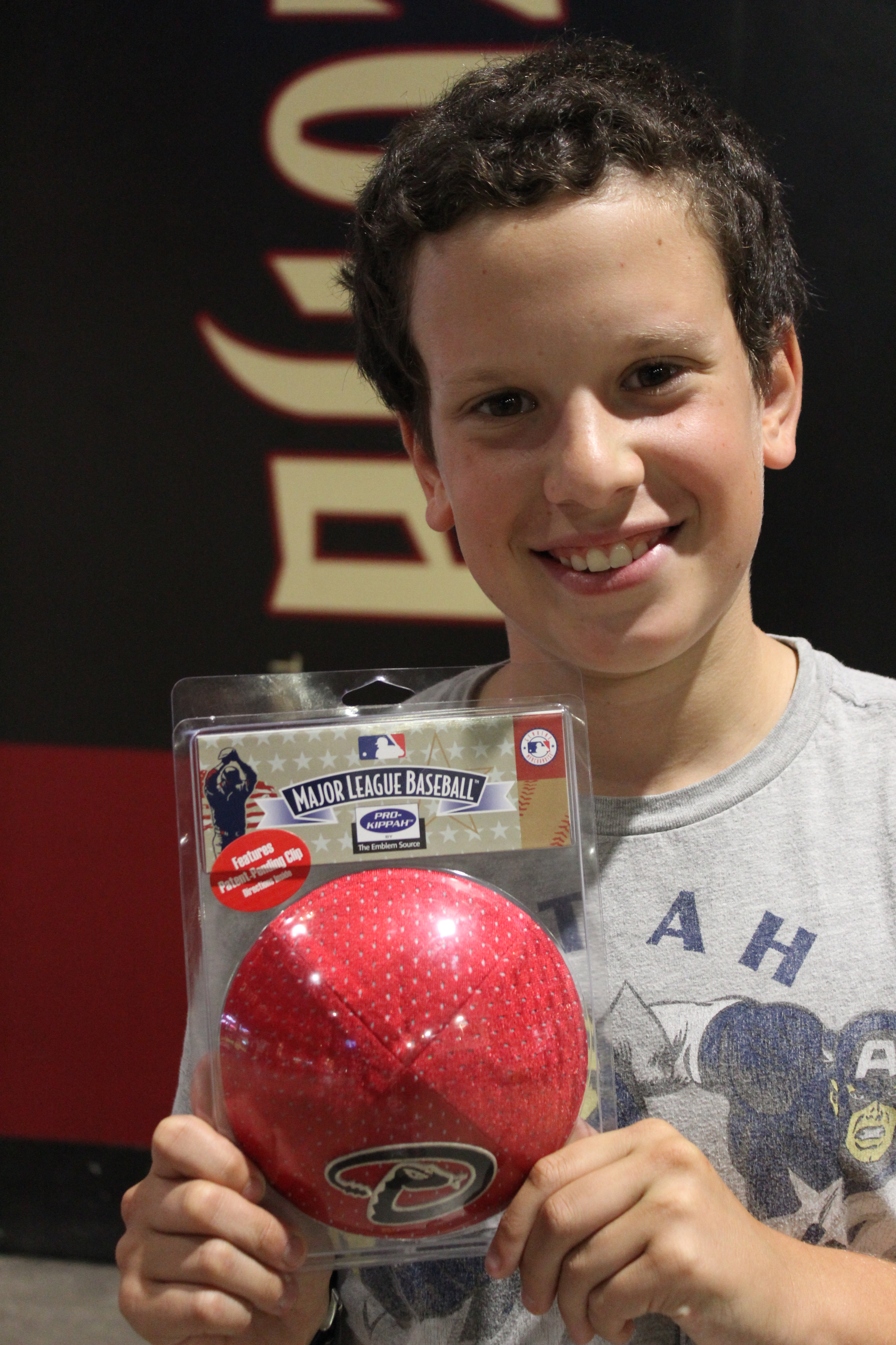
We woke up about two hours from Tuscon, so the first order of business was to get there. In Tuscon we hoped to do four things: visit an air and space museum that has an Air Force graveyard (for planes, not people), drive 27 scenic miles to the top of Mt. Lemmon, pick up food for Shabbos at a local deli, and get haircuts. (You may have noticed from the pictures that Sam has gotten pretty bushy.)
The challenge was to do all of these things by 2 p.m. so that we would have time to drive the hour to Tombstone (yes, that Tombstone) in time to see a reenactment of the famous shootout at the O.K. Corral. The problem was that the last show started at 3, so we really needed to hustle.
Also, Sam had no idea what Tombstone or the O.K. Corral were. So in the car on the way to Tuscon he watched the movie Tombstone, with Kurt Russel as Wyatt Earp and Val Kilmer as Doc Holliday. There have been a few movies made about the shootout, and Tombstone is easily the best of them. It’s rated R, which gave me pause before letting Sam see it, but I really thought it was the best way to make it all come alive, and I was sitting right there next to him. He ended up disliking the movie for the same reason it’s rated R: the violence. He understood and appreciated the story but he was really grossed out by all the blood.
But back to Tuscon.
The Pima Air & Space Museum has the third largest collection of military aircraft in the country. First is the Smithsonian in D.C. and second is the Air Force Museum in Dayton, Ohio. All I can say is that third place has never looked this cool.
You know how some museums give you a little sticker to put on your lapel that shows that you paid for admission? Well, on our first road trip we got those little stickers at the dinosaur museum in Bozeman, Montana. When we left the museum and got in the car, Sam took the sticker off his shirt and, on a whim, stuck it on the dashboard in front of his seat. Several months later the whole family went to the Museum of the Moving Image in Queens and we got little stickers again. Sam put his on the dashboard right next to the Bozeman sticker. And ever since then, every time we go somewhere that gives us a little lapel sticker, Sam puts it on the dashboard with the others. It’s been three years, and the dashboard is now so packed that he had to put a couple of stickers on the inside of the passenger door next to the dashboard. So far on this trip Sam has added four stickers. When we bought our tickets to the museum in Pima this morning, we got little orange stickers. We immediately looked at each other and smiled. I love that he gets excited about stupid little things like being able to add a new sticker to the dashboard, and I love that in ever museum that gives us one it’s a little happy secret between the two of us.
Of course, this museum didn’t need any help getting us to like it. It’s spread out over several acres, with exhibits inside a handful of scattered hangars but with most of the grounds used as an outdoor collection of aircraft of every type and from every era. The indoor exhibits were OK, but the real fun was the planes outside. You’re allowed to walk around by yourself and go right up to the planes, but it was 100 degrees in Tuscon today, so we wimped out and paid a few dollars for a tram tour of the grounds. This turned out to be a great decision, partly because of the oppressive heat but equally because of the knowledgeable narration of our tram driver, who is an Air Force veteran and who really knows his stuff.
Sam and I are not especially into planes. That said, pretty much every plane we saw was supremely awesome, and we saw more than 150 planes, including a Harrier jet, the first ever plane to be used as Air Force One, a military jet flown by Eisenhower, and so much more. I’m not going to bore you with all the details or all the pictures, so let me just say this:
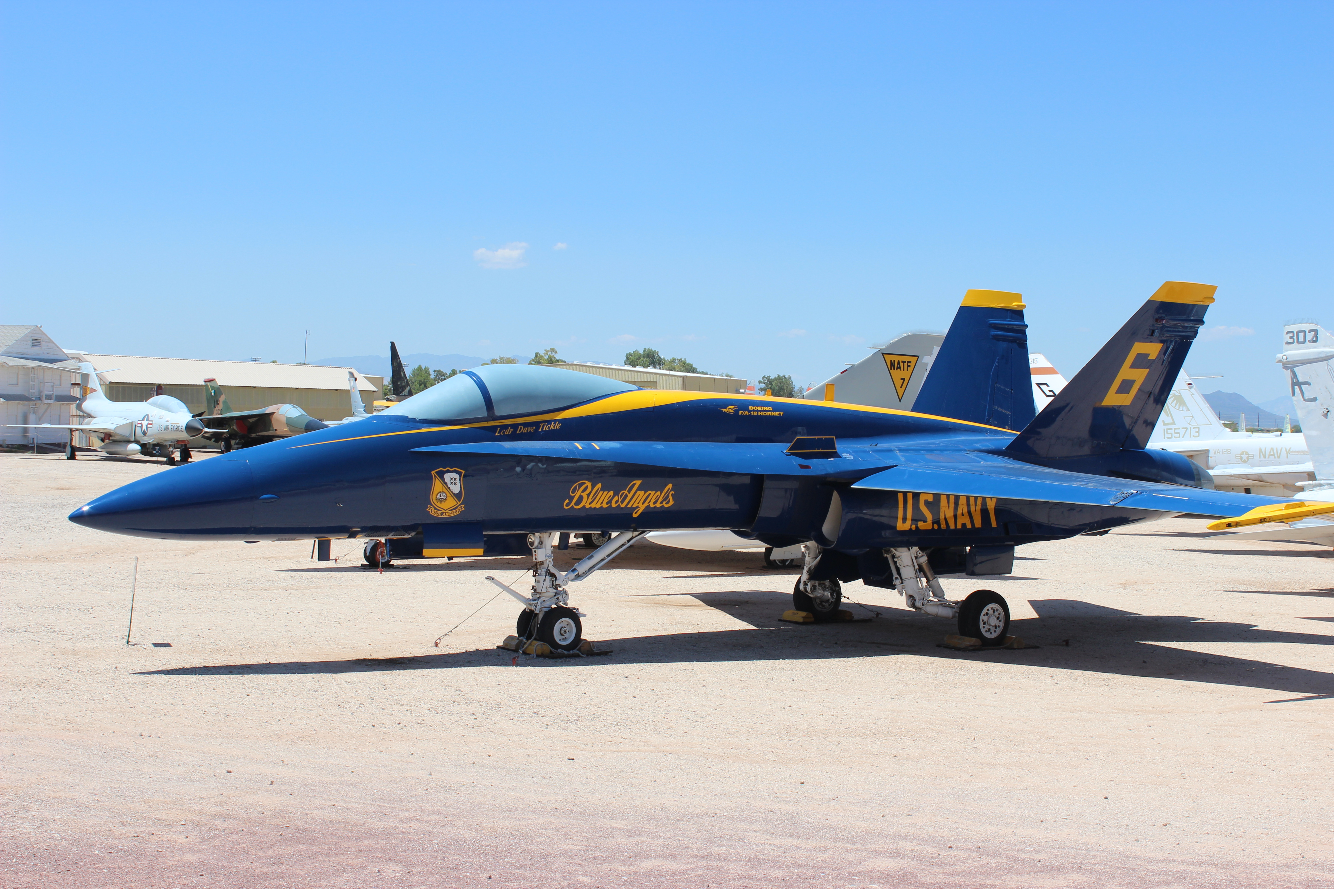
This awesome jet used by the Blue Angels was nowhere near the coolest plane we saw on the tour. Not even in the top 10.
Pima ended up taking a little longer than I expected but we weren’t too far off schedule. I decided to put the Mt. Lemmon Scenic Byway on the back burner in case something needed to be cut, and we headed to the deli that had our Shabbos food order waiting. Unfortunately the deli turned out to be completely on the other side of town and half of the roads to get there were under major construction. So by the time we finished getting the food it was already time to head to Tombstone. No Scenic Byway, no haircuts. But at least we’d be able to see the gunfight.
Before I get there, though, I feel the need to mention that the food was both unconscionably expensive and poorly packed. Most of the dishes we ordered were dumped into those Styrofoam clamshells that stack poorly and never stay closed. And the chicken soup was put in a large Styrofoam cup with no lid and wrapped with cling wrap. Cling wrap! On soup! You would think that a deli would have some idea how to deal with takeout orders. I hope the food is at least good. Heck, I hope the food makes it until Friday in one piece.
The ride to Tombstone is an annoying one, as the second half of the trip is on a one-lane road whose speed limit changes drastically and often, ranging from 65 down to 15. But we got there with about 15 minutes to spare before the show. What’s cool is that the whole town is on the National Registry of Historic Places, and a surprising amount of it is preserved, including not just the corral but the few blocks surrounding the corral and several original businesses and homes. The main street, Allen Street, is blocked off to vehicular traffic but does feature a couple of historic stagecoaches that give narrated tours. It’s populated with a mix of old and fauxld (That’s “faux old.” You heard it here first.) businesses, some of which are in the original buildings. The O.K. Corral is also on this street, and it’s been turned into a museum about not just the shootout but the history of the corral and the neighborhood in general.
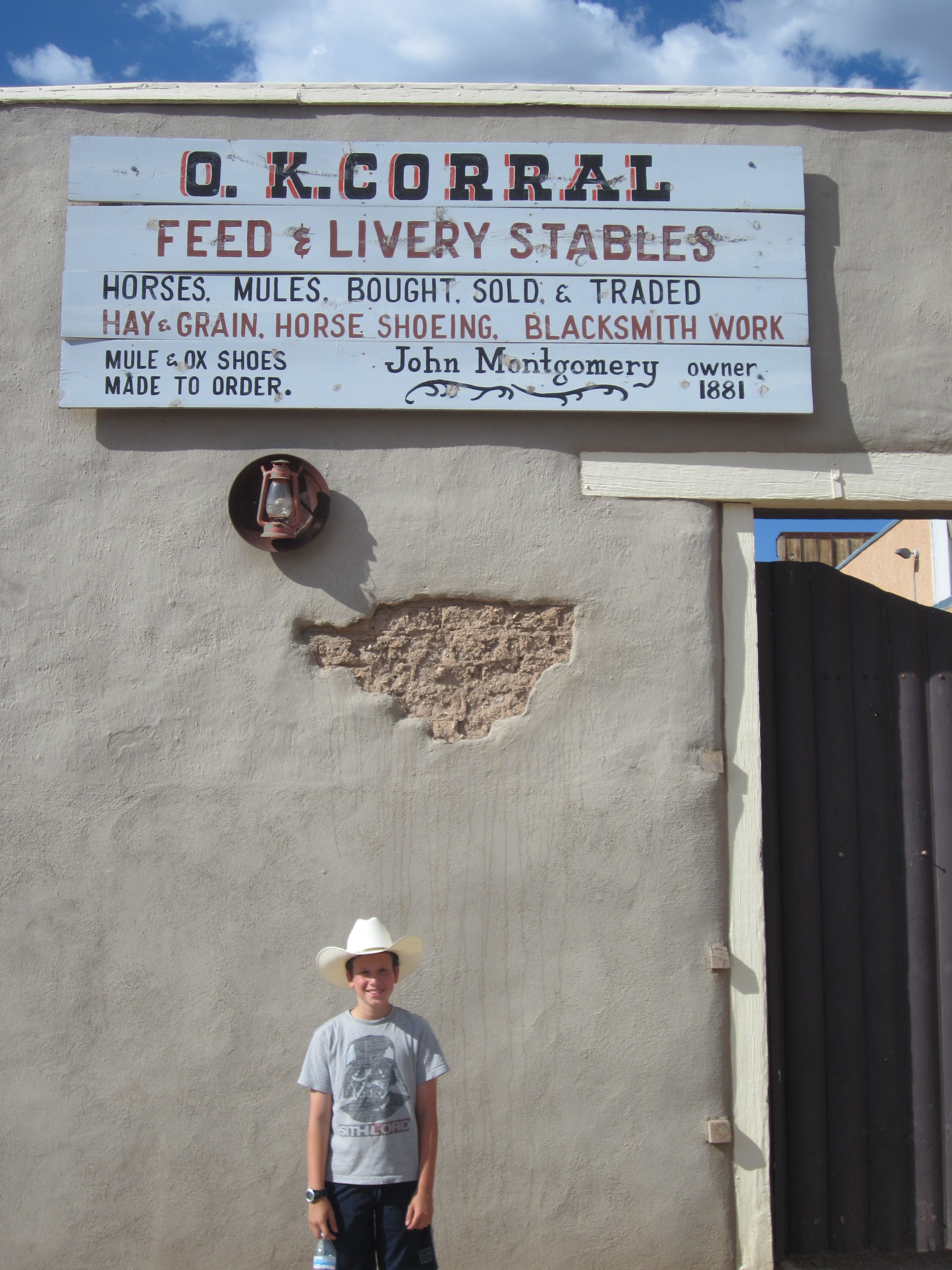

The horse stalls are now populated by historical items like carriages and saddles and such.
And as you can see, we are putting our new cowboy hats to good use.
One of the things explained on a plaque in the corral is that the shootout did not actually happen in the corral; it happened adjacent to the corral, right outside the photography studio where Doc Holliday was renting a room. But the bad guys came through the corral on their way to confront Holliday, and “The Shootout at the O.K. Corral” sounds way better than “The Shootout Outside Fly’s Photography Studio.” We did get to see the actual spot of the shootout, which is currently inhabited by animatronic Earps and outlaws. Fly’s is still there, and so is Doc Holliday’s room, which we got to see.

(The woman is Doc’s girlfriend, who supposedly watched the shootout from the window.)
Just steps from the actual location of the shootout is the little outdoor theater where the shootout and the events leading up to it are reenacted three times a day. The show was very cheesy but pretty cute and fun, and Sam got to pose with the actors when the show was over.

From left to right: Doc Holliday, Wyatt Earp, Sam, Virgil Earp, Morgan Earp
Sam and I have generally been getting along extremely well on this trip, but we did a bit of arguing both before the show and after, mostly due to misunderstandings and overreactions. How ironic that we went to see Wyatt Earp and we ended up needing someone to keep the peace. Eventually we pulled it together and wandered around the area a bit to see some of the historic sights. As a former journalist and general fan of newspapers, my favorite was the local paper, The Tomstone Epitaph, which claims to be Arizona’s first newspaper.
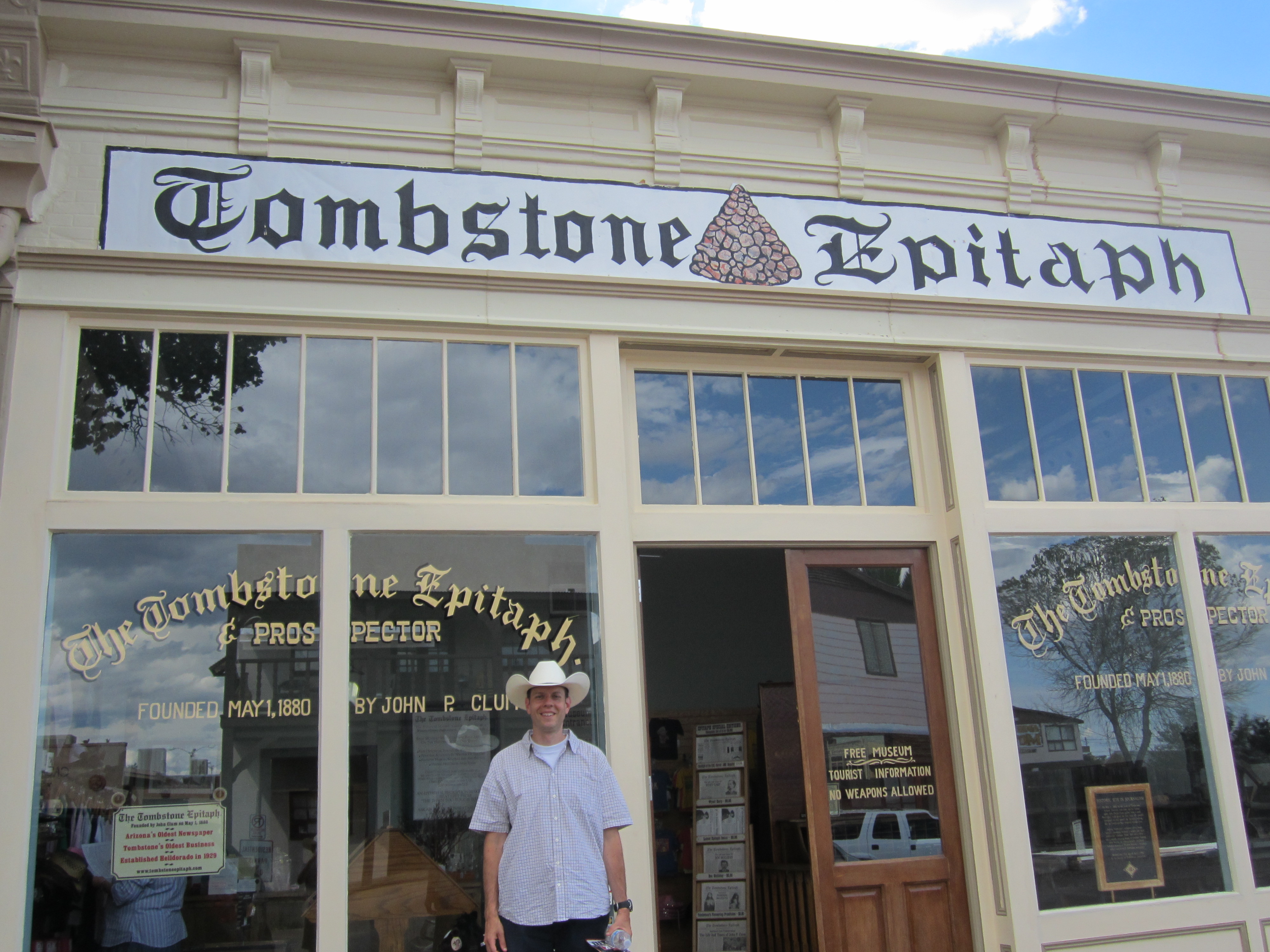
The Epitaph still publishes today, and $25 will buy you a yearly subscription. Inside there’s an exhibit about printing methods in the 1880s, and another about the life of founder John Clum. They also have copies of the current paper as well as copies of the edition that reported the shootout, and we got a copy of each for free with the price of admission to the corral.
I don’t want to get off on a rant here, but I generally despise Arizona’s politics. For years it was the only state not to celebrate Martin Luther King Day, and it only changed that policy in order to host the Super Bowl. It has fought tooth and nail in the courts to avoid separating Church and State. It has passed ridiculous laws that allow the authorities to discriminate against anyone vaguely Mexican-looking. And it refuses to recognize Daylight Savings Time.
What does all this have to do with anything? Well, Martin Luther King Day is in January so that’s not really an issue at the moment. But Tuesday at the state capitol there was a giant stone Ten Commandments statue, which I found not inspiring but just plain odd as I wondered who is helped by the presence of this statue. I love the Ten Commandments and I try actively to live by them, but I have no desire to display a giant version of them on my front lawn. And Tombstone is just 30 miles from the Mexican border, so on our way out of town we had to stop at a U.S. Border Patrol checkpoint to make sure we weren’t smuggling anybody north. And then as we crossed the border into New Mexico we lost an hour that we should have lost when we left California.
Right about when that hour disappeared we stopped off at a rest stop along the Interstate to make dinner. The nine days leading up to and including Tisha B’Av are considered a period of semi-mourning during which we don’t eat meat or listen to music or get haircuts or other such festive activities. After nine days of gross dairy dinners out of a box, we were thrilled to be using the grill again, and we rewarded ourselves with a hearty meal of ribs, broccoli, and cauliflower.
Today we got to see the coolest planes in the world and walk through history and finally eat some beef. We did a little too much driving today for my tastes and we missed out on the scenic byway and our soup is wrapped in cling wrap and we never did get those haircuts, but there will be plenty of pretty scenery over the next 10 days and we’ll keep an eye out for barber shops and … actually I have no idea what to do with the soup.
Going Nowhere Fasting

Fasting is never easy. I’m pretty lucky in that it’s generally not as challenging for me as it is for most people. I’m thirsty all day long and I get progressively hungry and irritable as the day goes on, but I don’t go through caffeine withdrawal, I don’t get debilitating headaches, and although I don’t enjoy it it’s nothing I can’t handle.
Today was probably the toughest fast I’ve ever had.
Today was Tisha B’Av (the ninth day of the Hebrew month of Av), a day of mourning (and fasting) for Jews around the world. It’s a miserable day in every possible way, and it should be, because mourning is not supposed to be enjoyable. It’s a particularly bad day to be on vacation, as nobody wants to be intentionally unhappy on vacation but there are many activities that are off limits, anything that turns out to be enjoyable brings feelings of guilt for having fun on a sad day, and fasting saps your energy so even if you wanted to have fun it’s physically difficult.
But when you’re in central Arizona, and the high temperature for the day is 105, and you can’t have even a sip of water, well, a difficult day just gets that much more difficult.
You should have seen the original itinerary for Phoenix when I started planning this trip. An early-morning hike to the top of the highest local peak for extraordinary views of the city. Horseback riding. Go-carting. Phoenix was going to be awesome! Then I realized we’d be in Phoenix on Tisha B’Av and suddenly the day looked much less impressive.
We started by sleeping late, a common strategy to help “shorten” the fast. Then we took our time leaving the motel and getting to Phoenix. By the time we arrived in downtown Phoenix it was almost noon. It was 102 degrees and climbing. Our first stop was not a hike but Heritage Square, the last remnants of the original town of Phoenix, which was settled in the 1800s. We were there to take a tour of the Rosson House, a historic Victorian that was built by a wealthy doctor who later became mayor. Victorian houses are extremely unusual in Arizona, and this one would be pretty special even in New England.
 Of course, a tour of an old house is not the kind of thing Sam gets excited for and it would have been cut from the itinerary if this were a normal day, but on a somber fast day it’s first on the list.
The tour was going fine for about 25 minutes or so until Sam got horribly ill. I should probably mention that Sam was fasting, too. Technically he has a few more weeks of being considered a minor according to Jewish law and thus is not obligated to fast. But since he’ll be fasting for real on Yom Kippur this year he’s been trying to “practice” by fasting as long as he can on fast days. This generally means he fasts until the official midpoint of the day, which gives him partial credit with G-d. Today he fell short of halftime by about an hour, suddenly feeling weak, light-headed, and pukey halfway through the tour. We excused ourselves and hurried back to the car, where he downed a bottle of water and a handful of pretzels and started to feel much better.
Next up was the state capitol building, the 21st we’ve seen. Most of them look pretty much the same–stately granite, giant columns, giants domes. Arizona’s is a little different and more suited to the climate, as it’s a bit shorter and looks almost like it’s made of adobe, though of course it isn’t. The dome is much small and low and thus isn’t as ostentatious as many of the others despite being covered in gold leaf.

Flanking the capitol on each side, however, are identical buildings for the two houses of the state government. I say “however” because these two buildings are more modern, made of drab concrete, and are so hideous as to seriously detract from the beauty of the capitol.
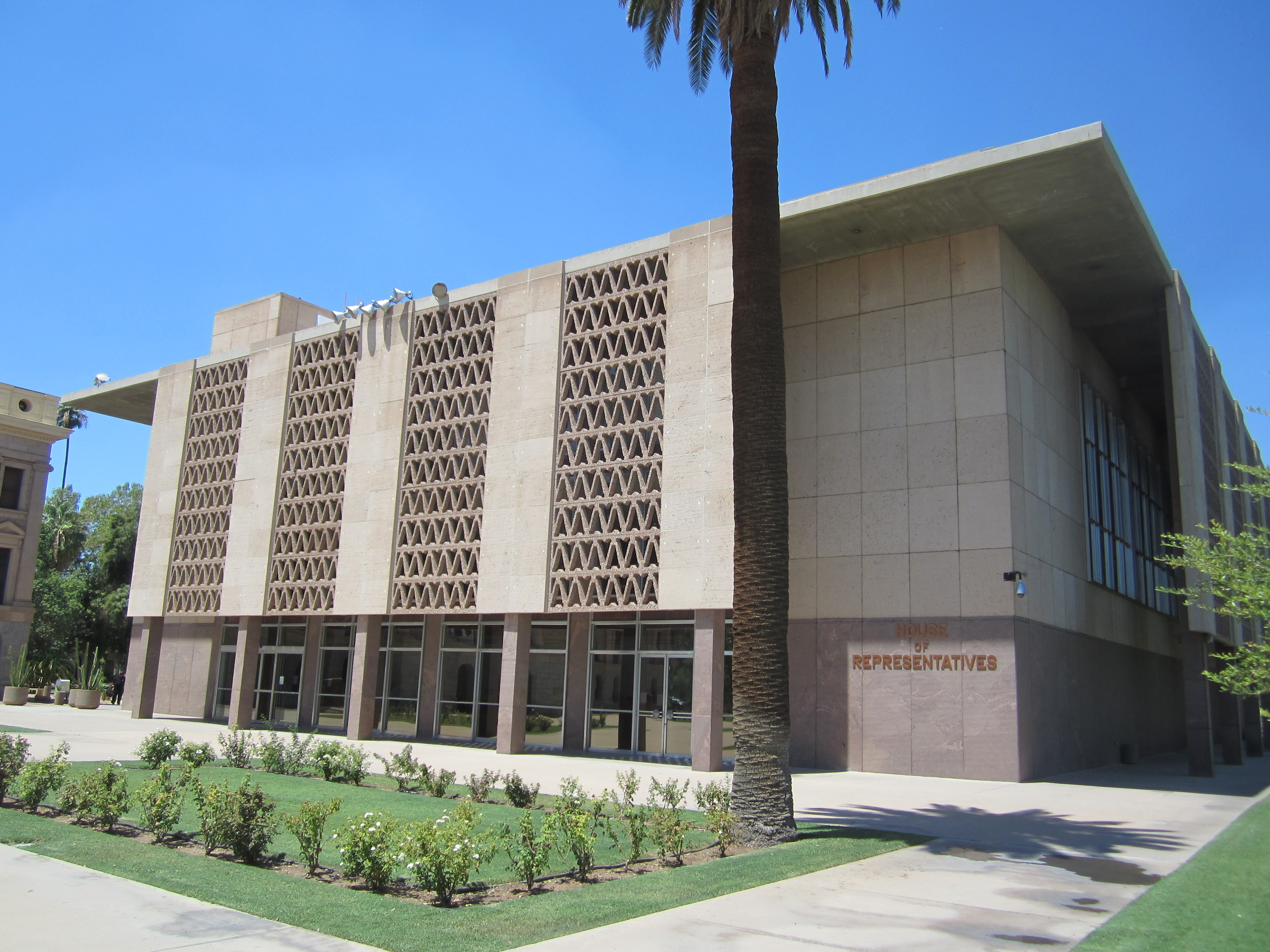
Yup. This ugly thing is just one half of a matching pair.
Directly across from the capitol is a very tasteful monument plaza containing a large Vietnam memorial, several statues honoring various people and groups, and one thing we’ve never seen before: a statue honoring the Bill of Rights, comprising 10 course stone monoliths, each with an Amendment carved into its face.

The most touching, at least for me, was the memorial for all Arizona workers who have died on the job. There’s a nice little marble plaque expressing gratitude for the workers’ efforts to improve Arizona, but what’s really striking is the accompanying statue: a young couple cradling a baby.
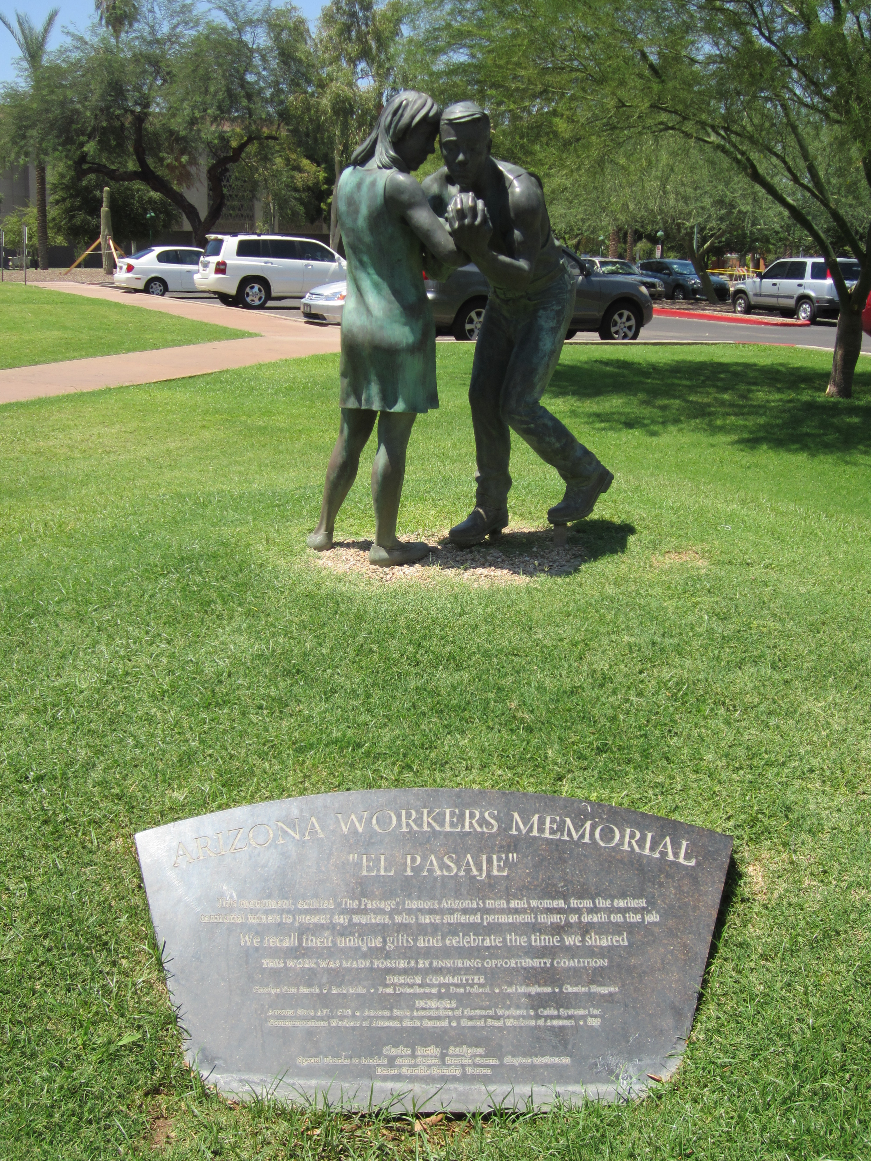
It’s heartbreaking, really, as it forces you to think not about the dead but about the families left behind, and specifically the children who will grow up without a parent.
We spent only a few minutes at the capitol before heading to Pueblo Grande, a museum and archaeological site that shows where and how the ancient Hohokam people lived from roughly 1125-1450. I figured a museum would be a good choice because it would be both somber and air conditioned. And it was. But the archaeological part was all outdoors and could be seen only via a walking path two-thirds of a mile long. By this time it was 104 degrees out. The museum gave us umbrellas for shade but they offered only minimal relief. By the time we left I was weak, listless, and deeply, deeply thirsty. And the car offered no shelter, as it was parked in the sun and was 113 degrees inside. The A/C took a good, long time to kick in.
As the tour guide at the Rosson House said, “We get three months of ‘Please G-d get me out of here’ and then the weather is very nice the rest of the year.” Well we’re right in the middle of those three months.
Our next stop was going to be the Torvea Castle, an interesting-looking castle with a supposedly interesting history, but the castle is wisely closed in July and August. So we just drove by for a quick look before moving on.

We were then supposed to visit the Desert Botanical Garden, a small garden of desert plants, but I knew there was no chance I could spend anymore time walking around outside. So we skipped the garden and went straight to Scottsdale to right a previous wrong.
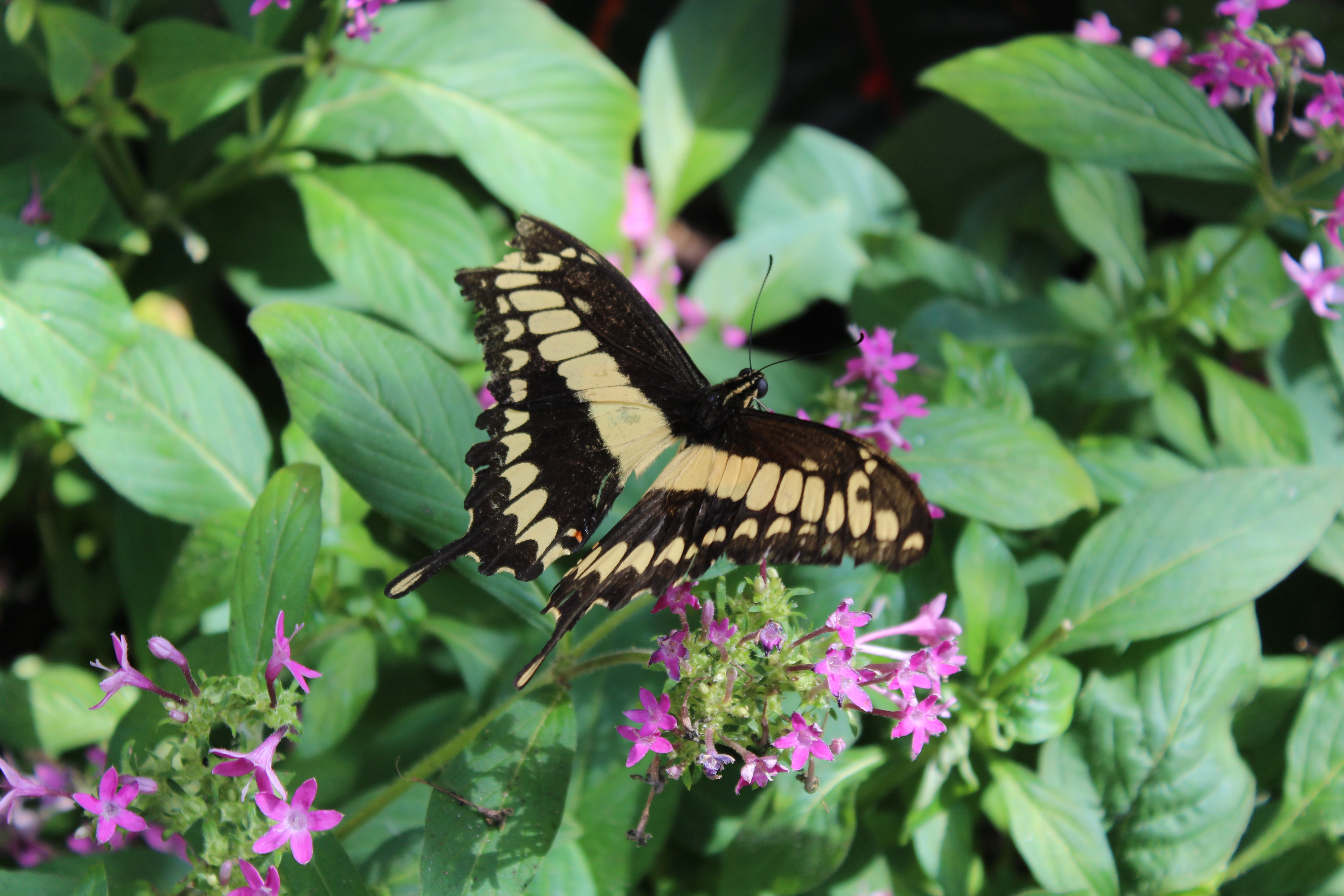
Remember a couple of weeks ago when we were in Springfield, Missouri, and we didn’t go to the butterfly pavilion because it was too far out of the way? Well there’s a butterfly pavilion near Phoenix, too, and it’s pretty far out of the way, too. But because we had cut out all the really fun and time-consuming stuff, we had more than enough time to see the butterflies this time around.
Butterfly Wonderland is the largest butterfly pavilion in the world. This surprised us a bit because it’s big but not so immense that we were left awestruck by its size. We were, however, left awestruck by its butterflies. Every color in the spectrum. Patterns that have to be seen to be believed. A range of sizes we didn’t even know existed. And most of the butterflies were friendly and fearless, letting us get right up close. A couple even landed on us momentarily before finding more comfortable perches. The plants and flowers alone were impressively varied in color and shape, but the butterflies were extraordinary well beyond what I could imagine.


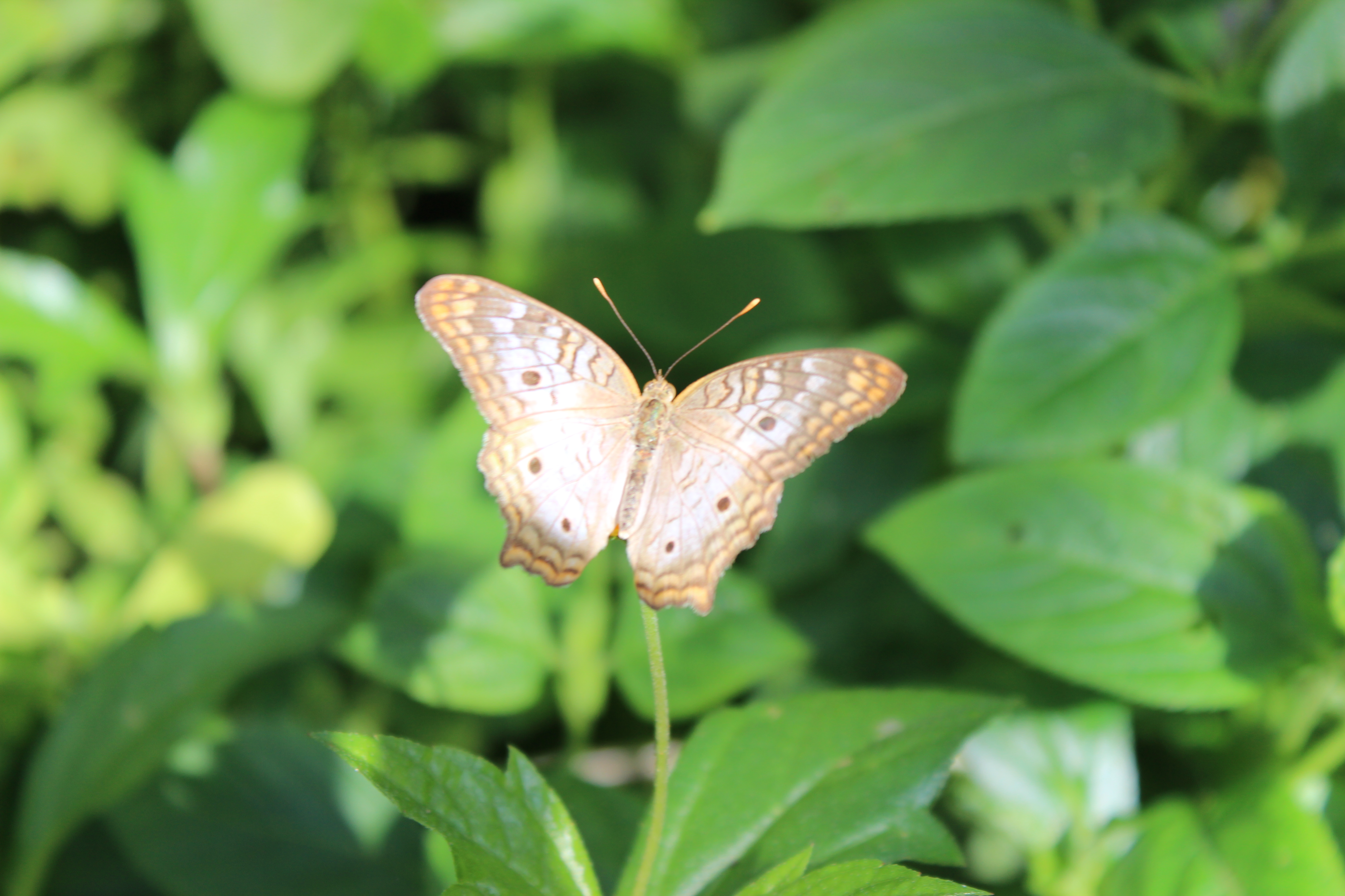
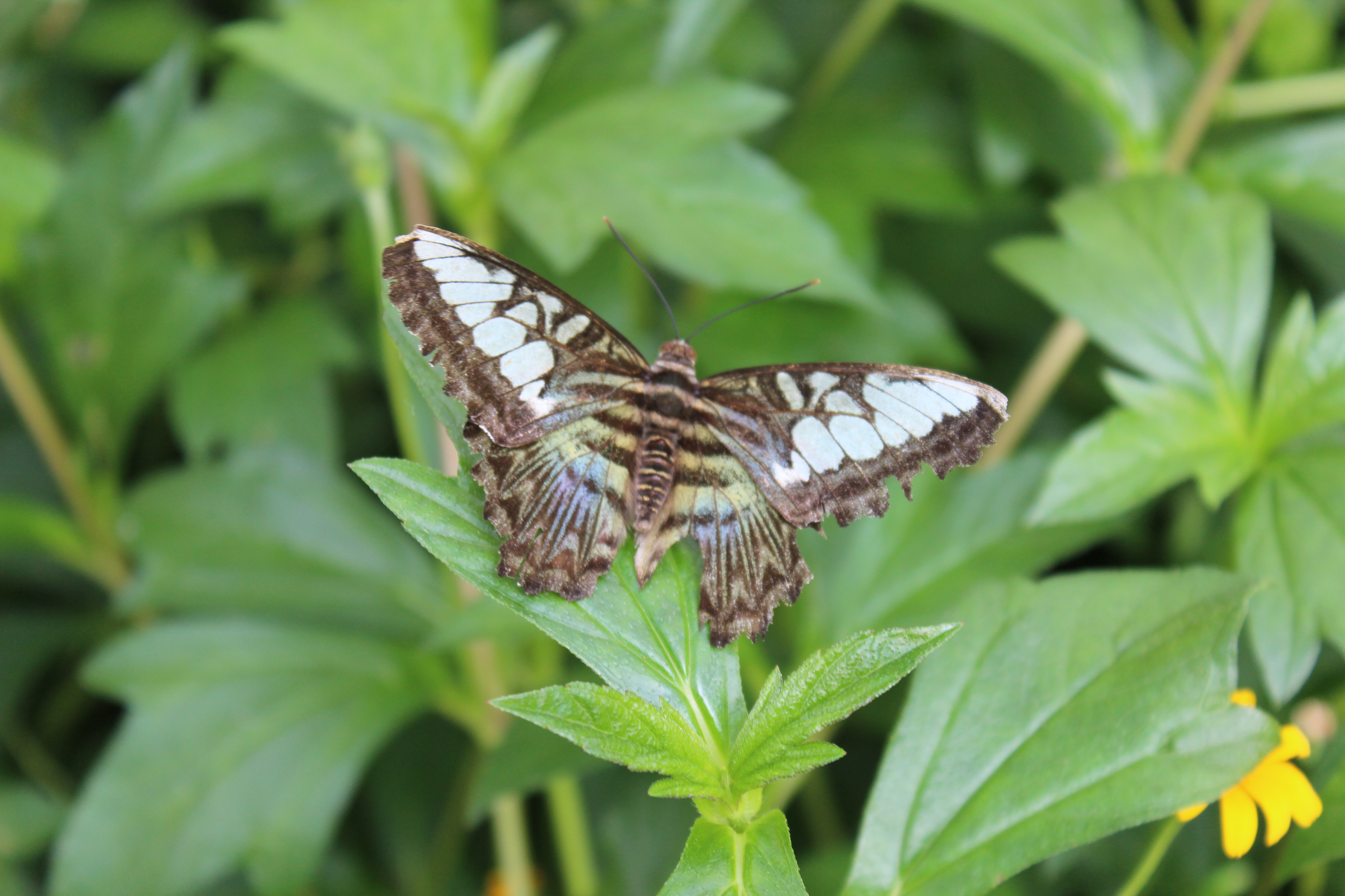
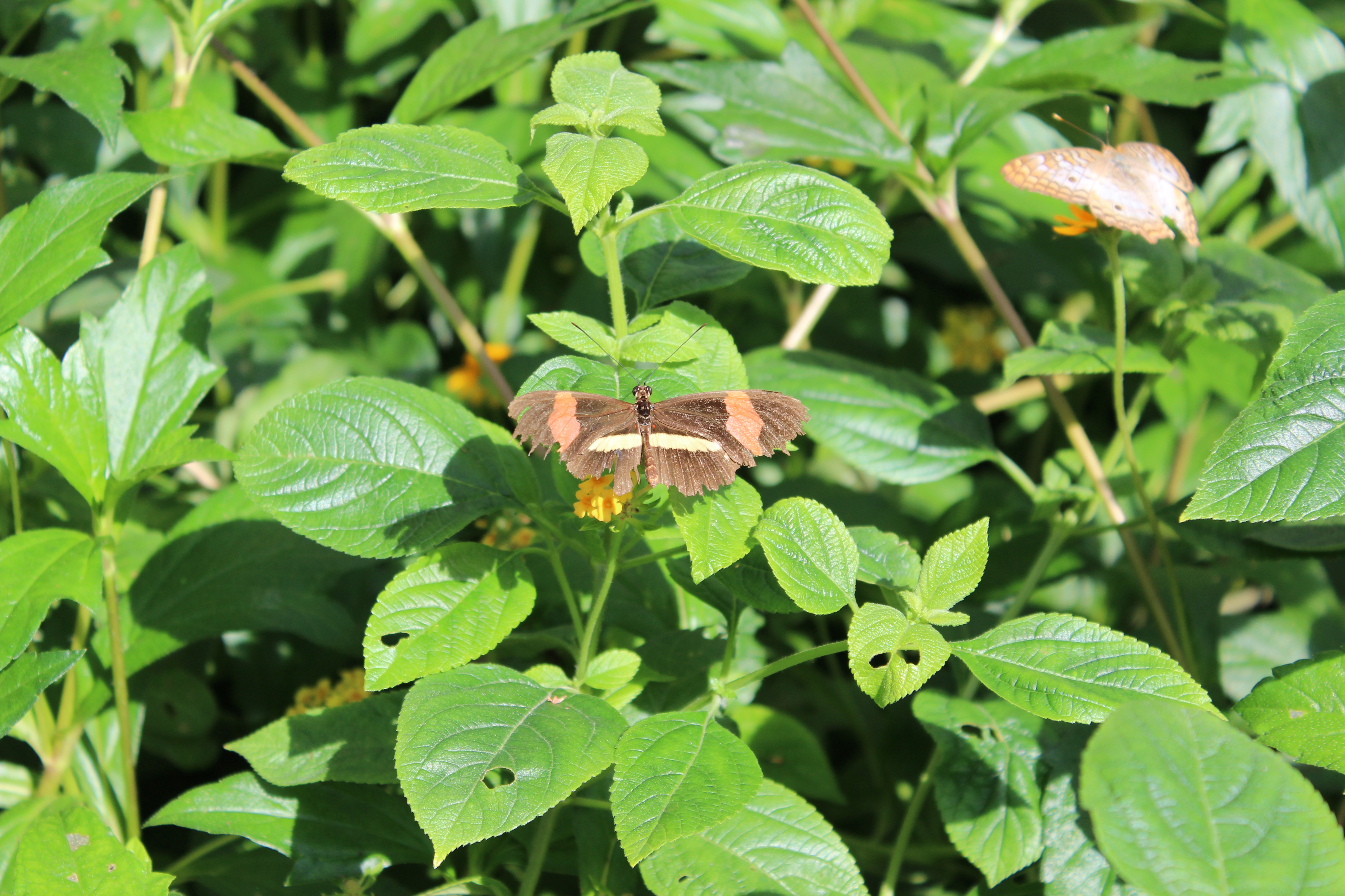
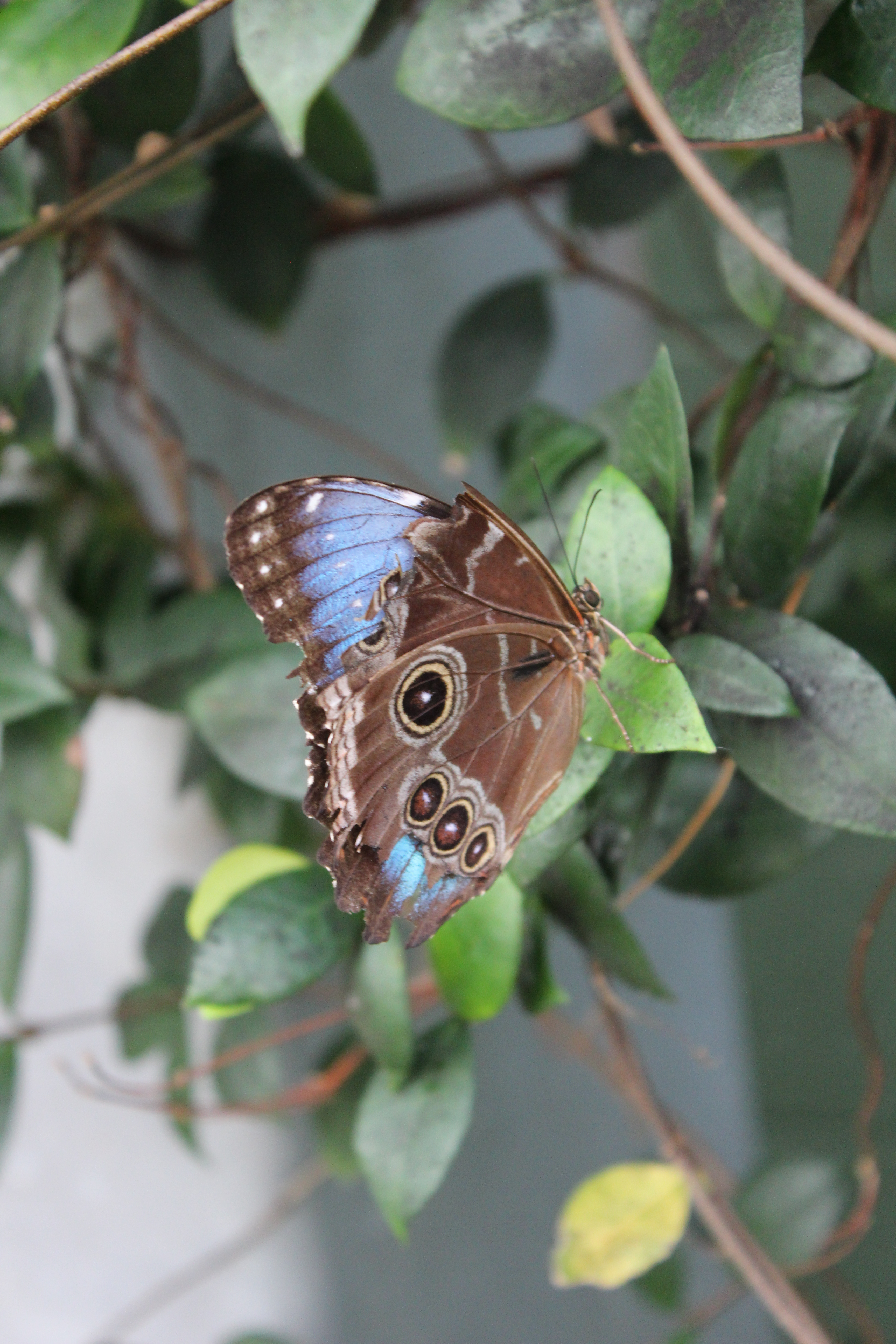


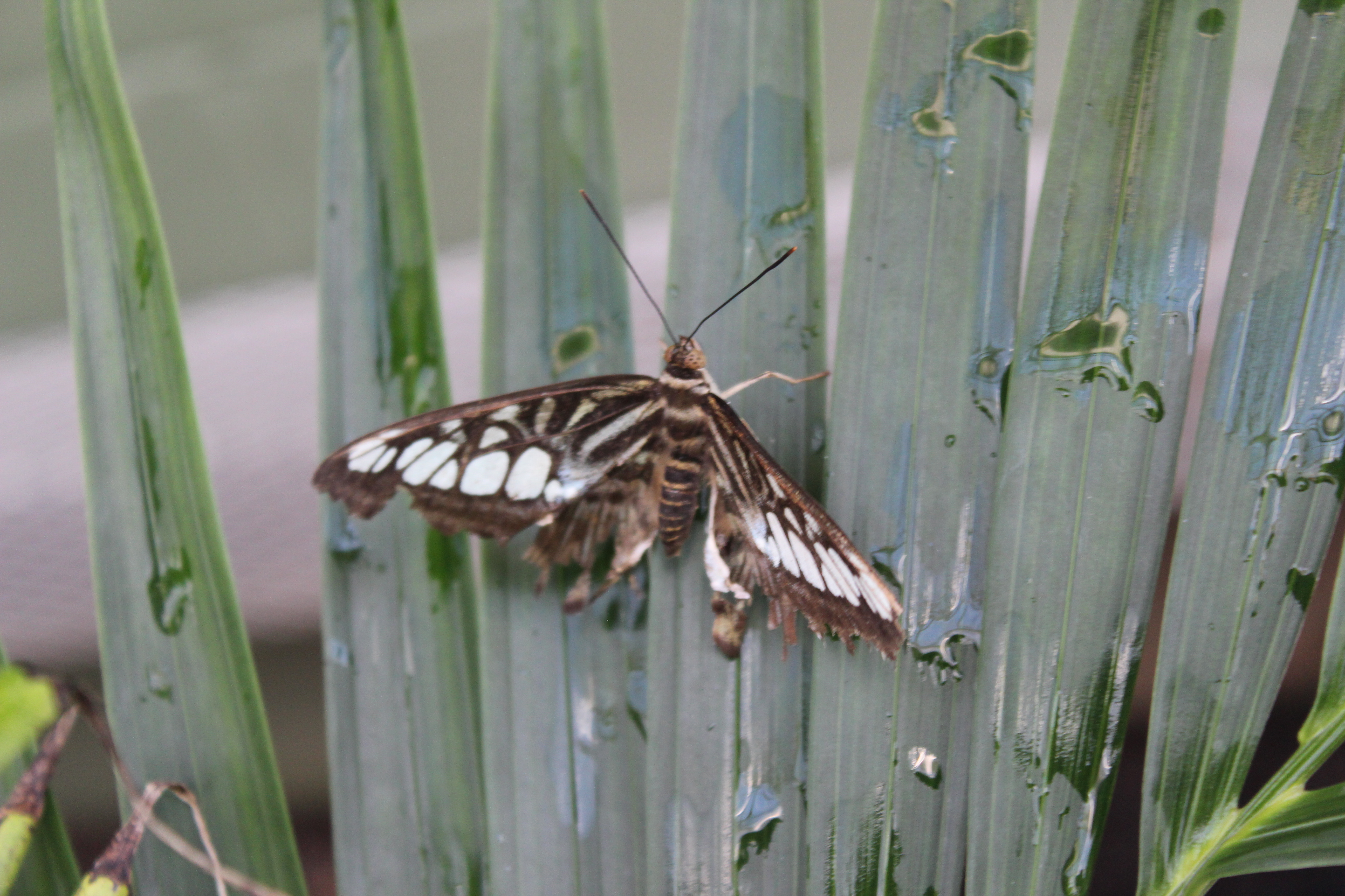

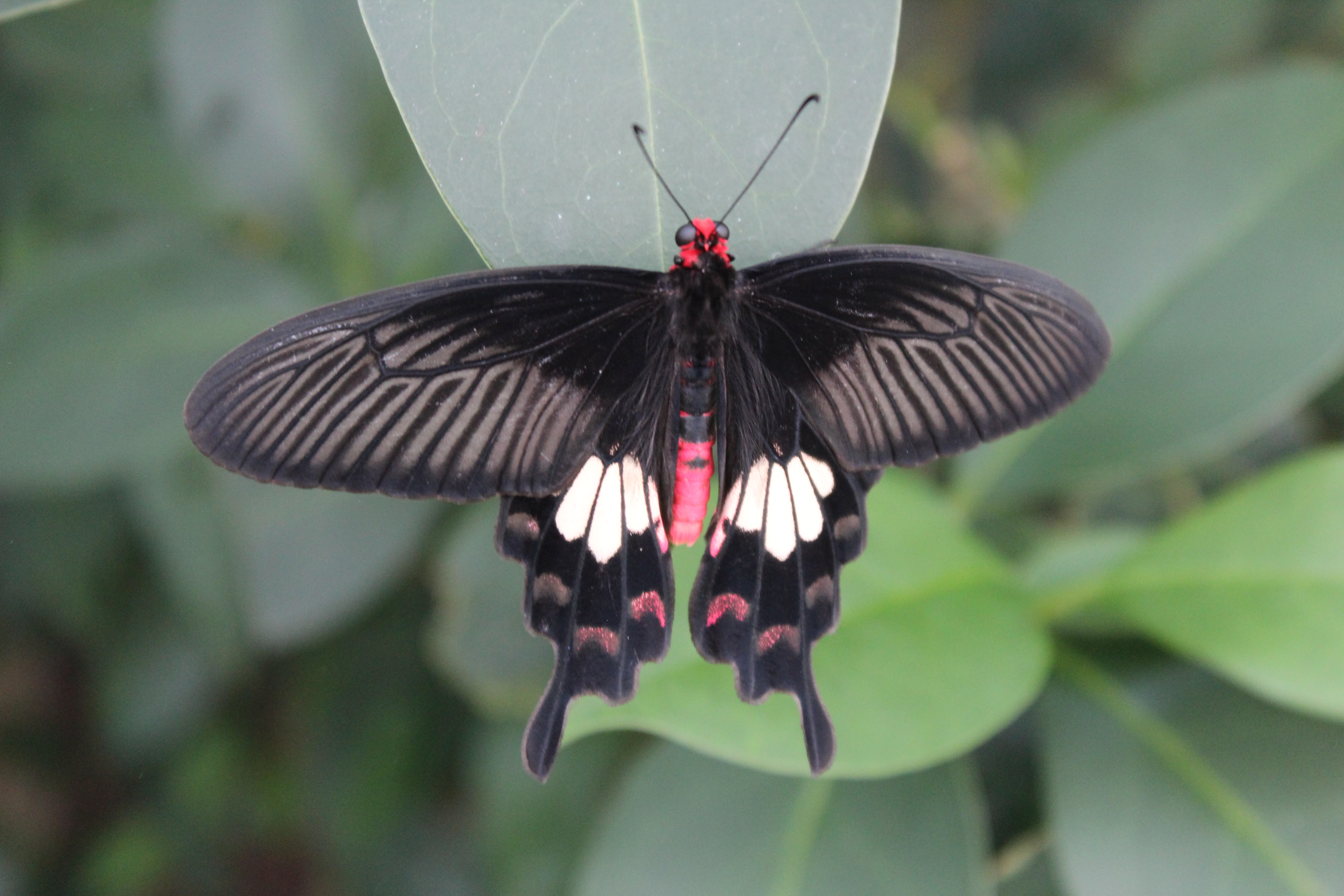
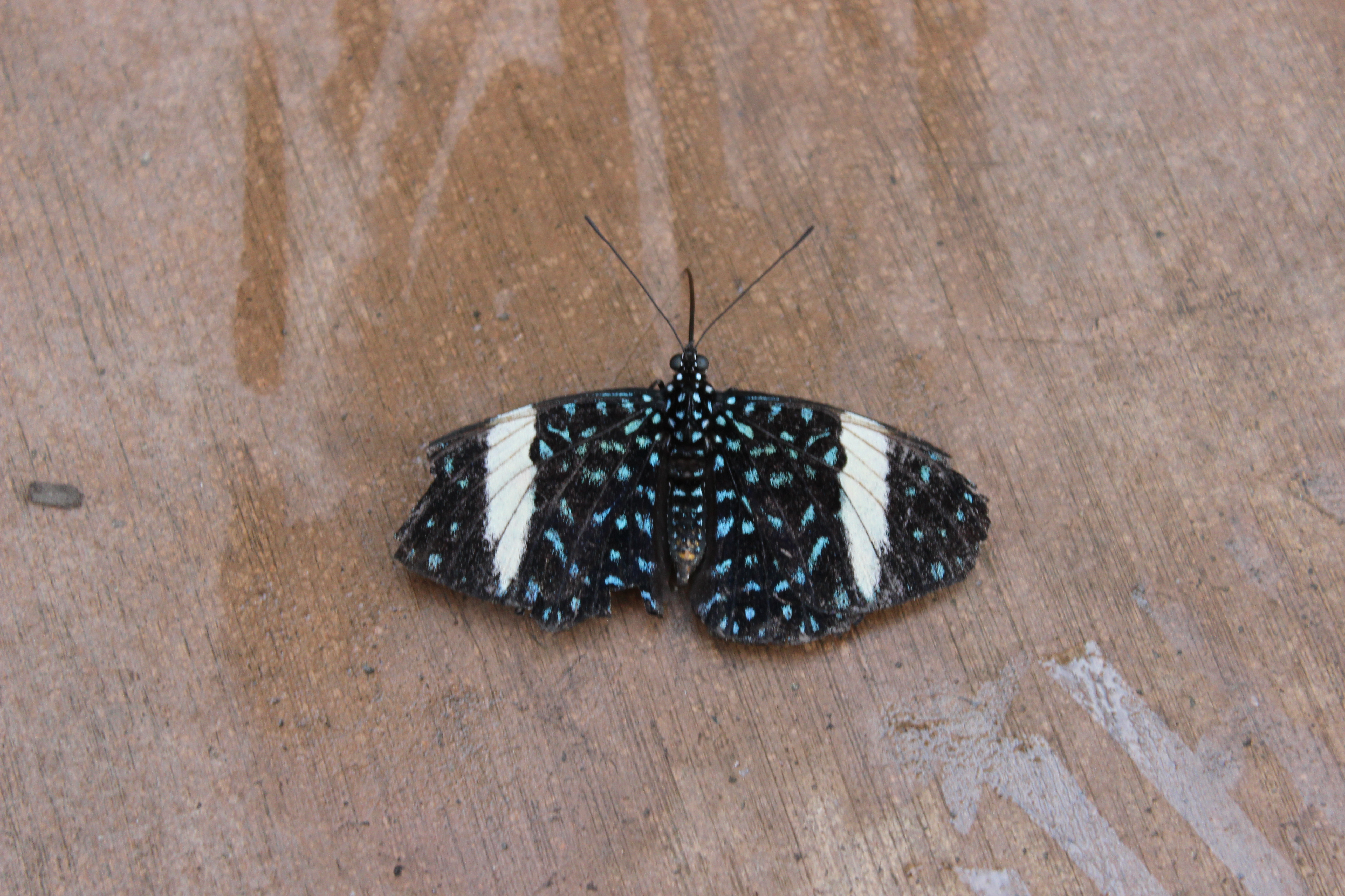
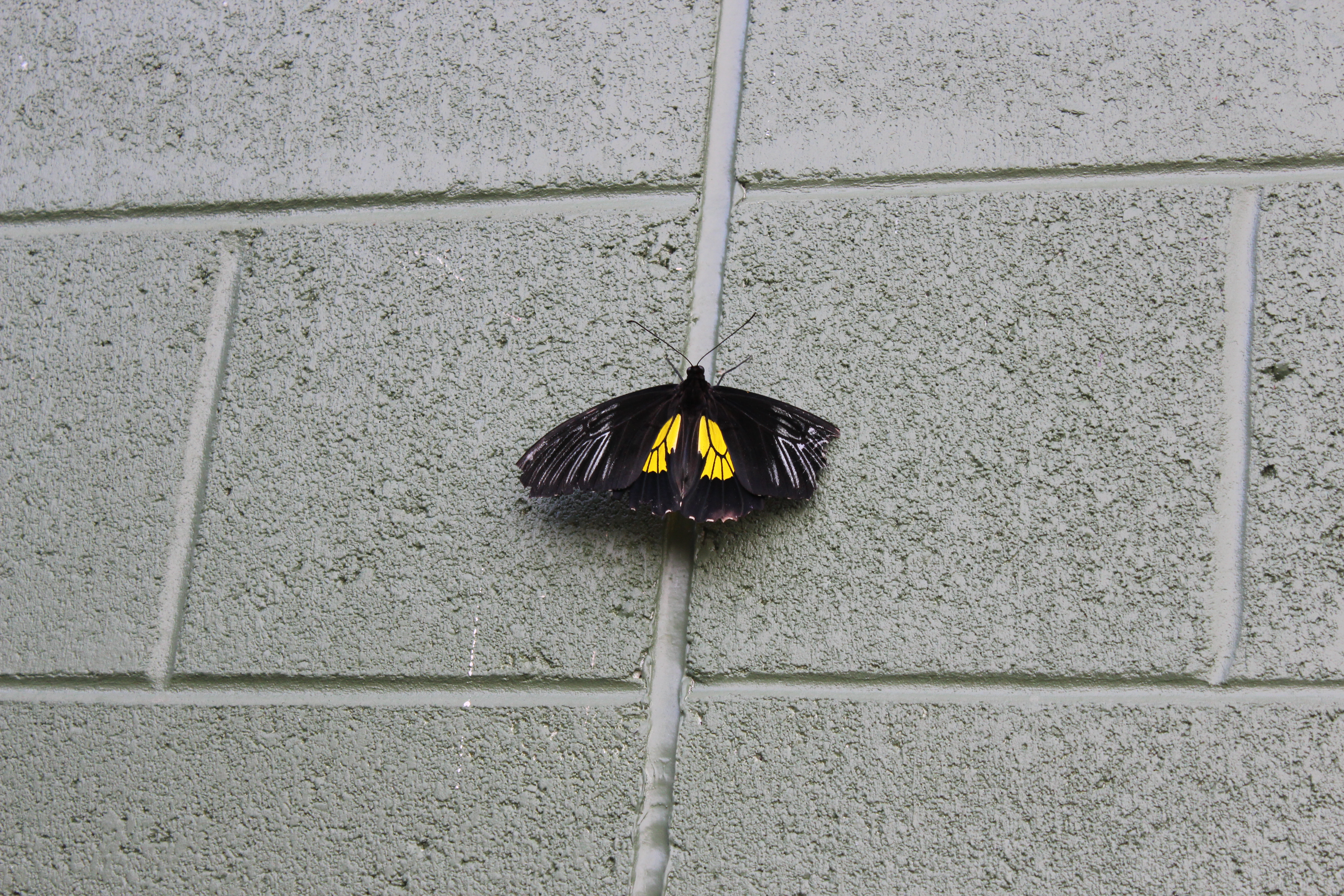

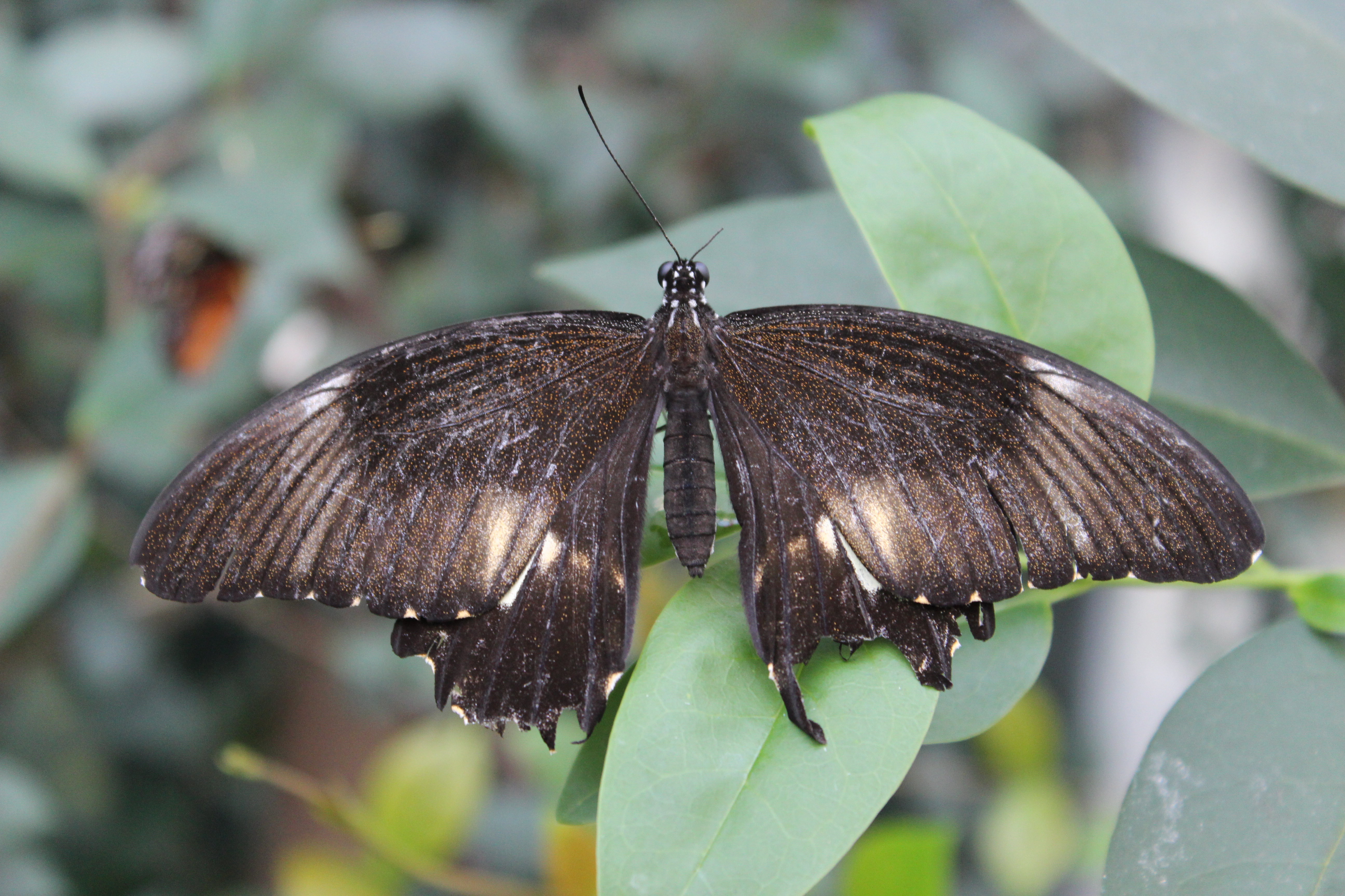
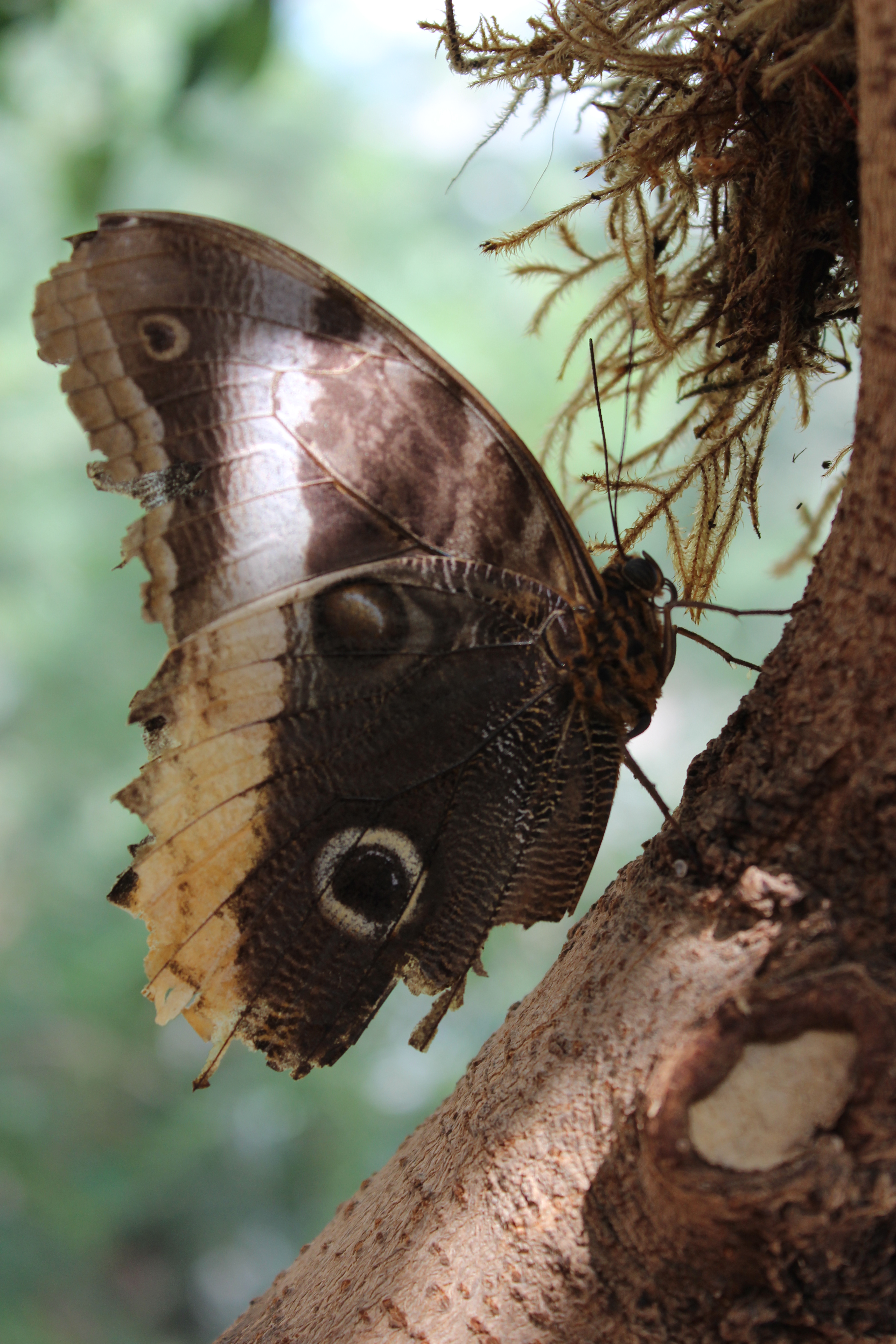
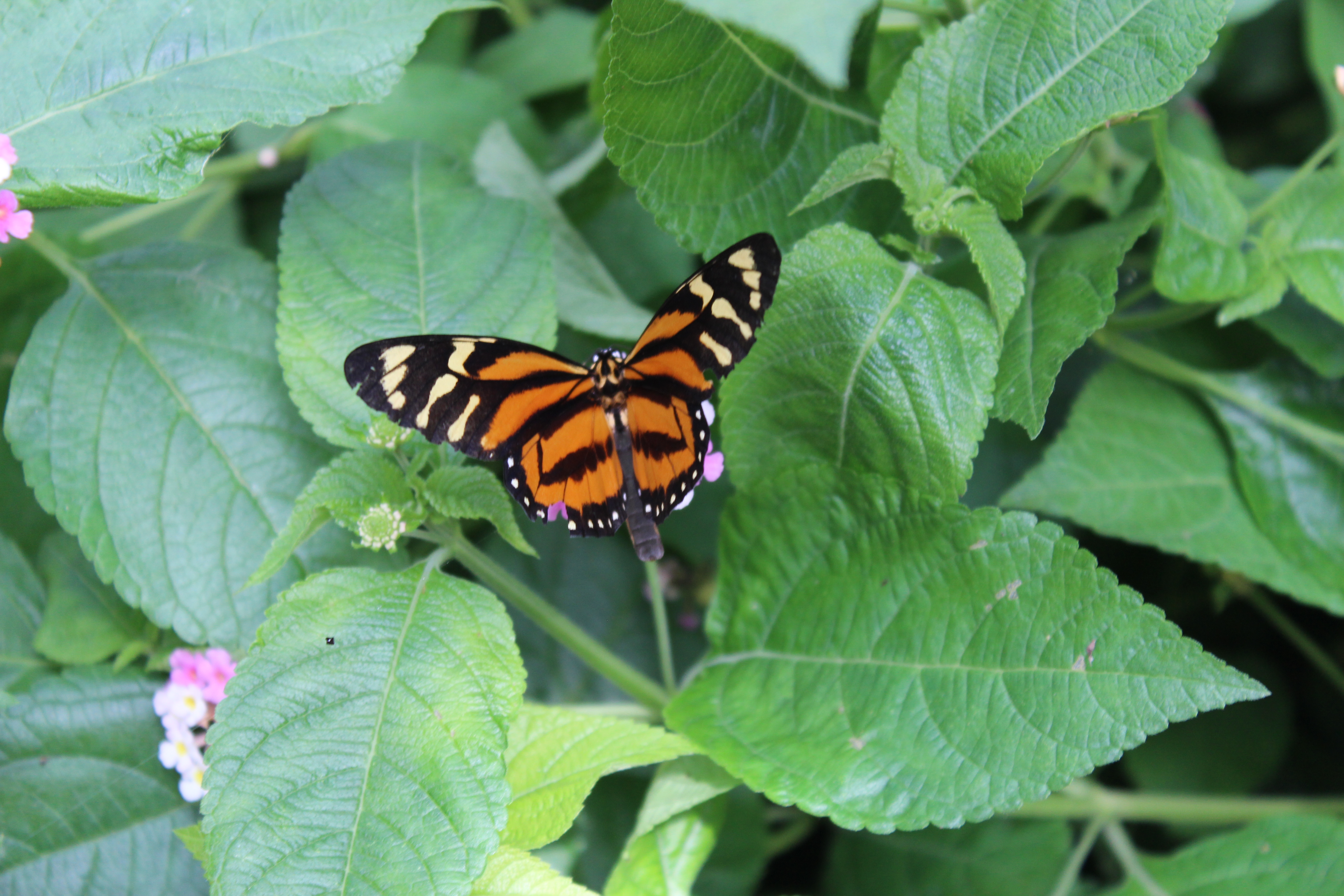
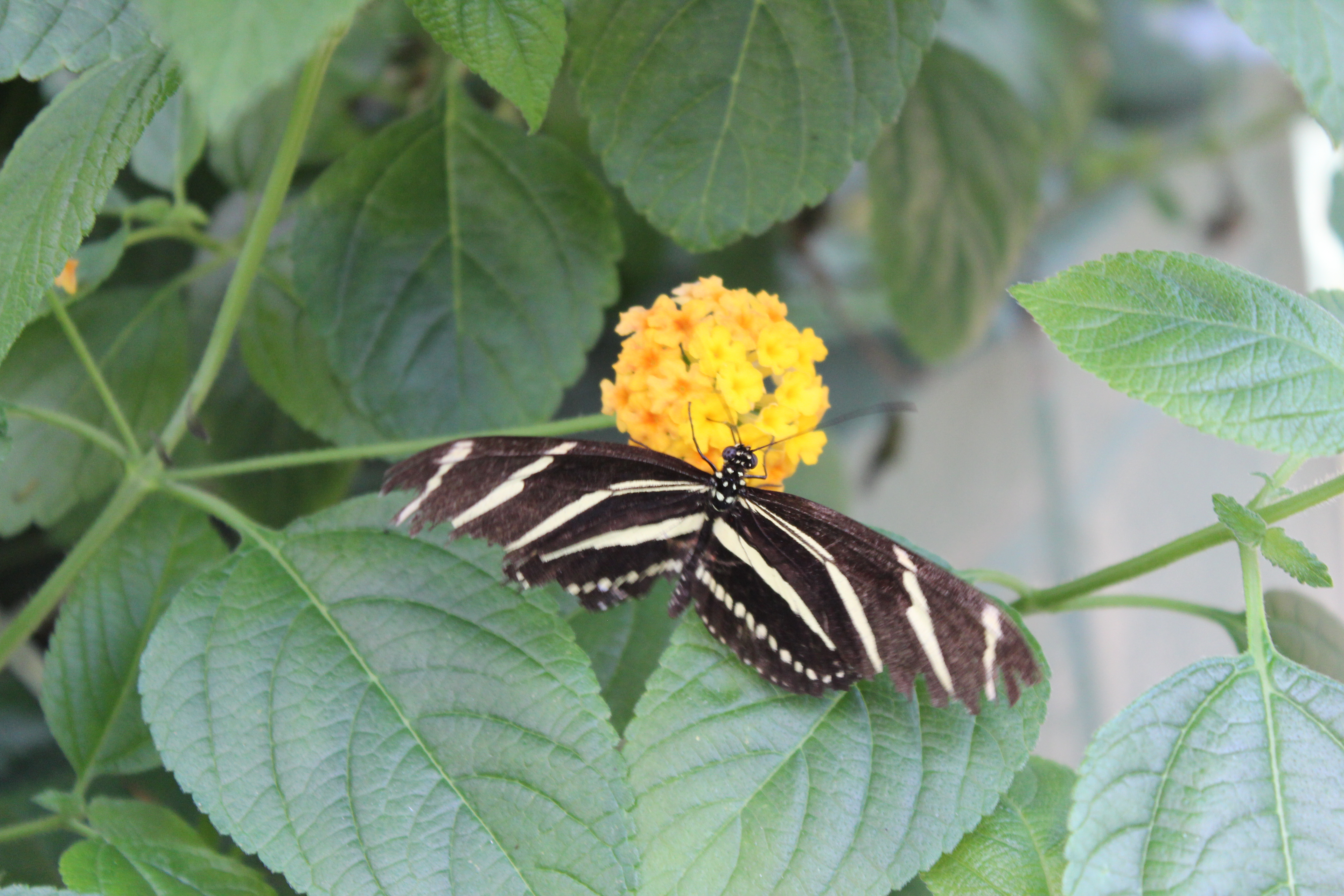

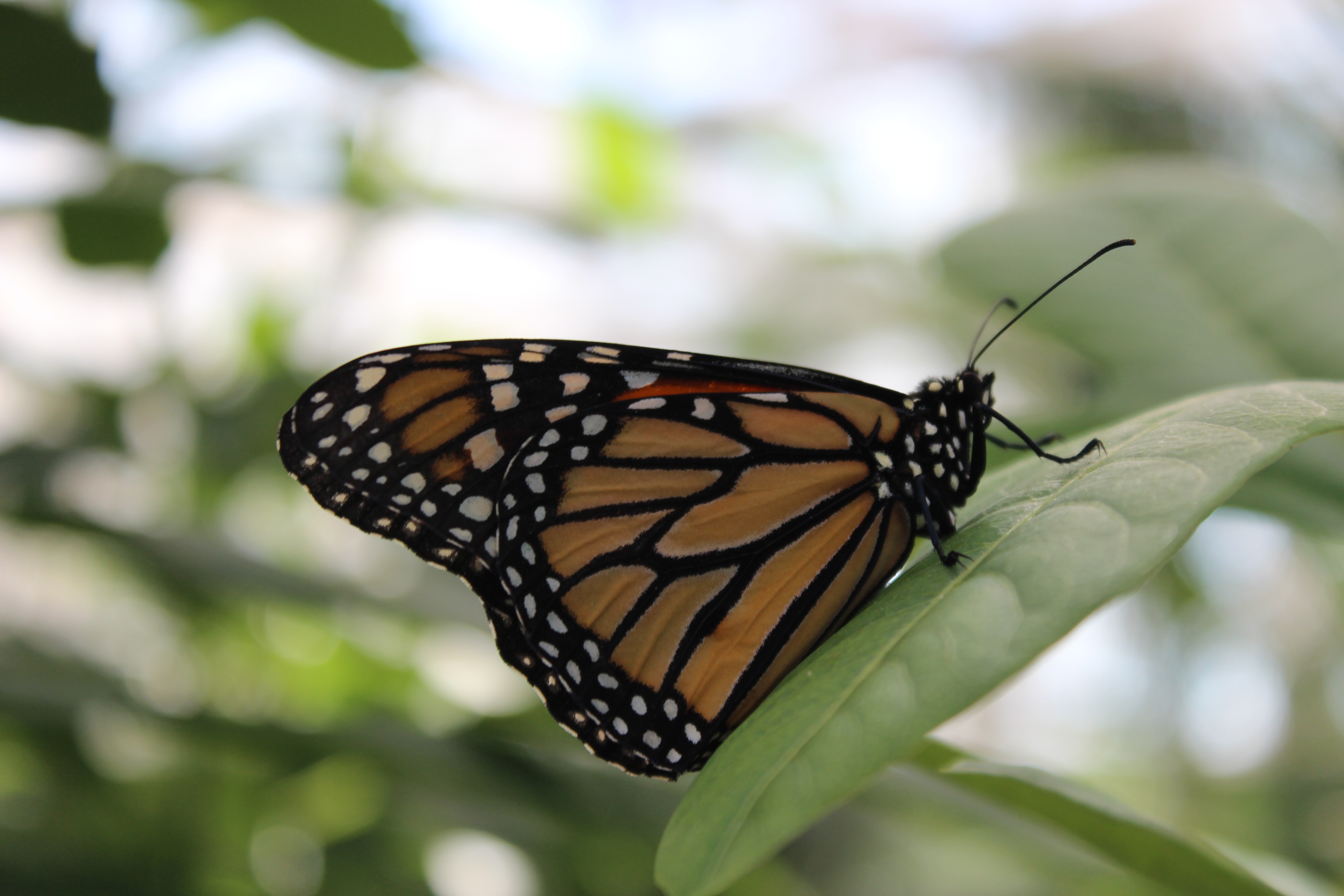
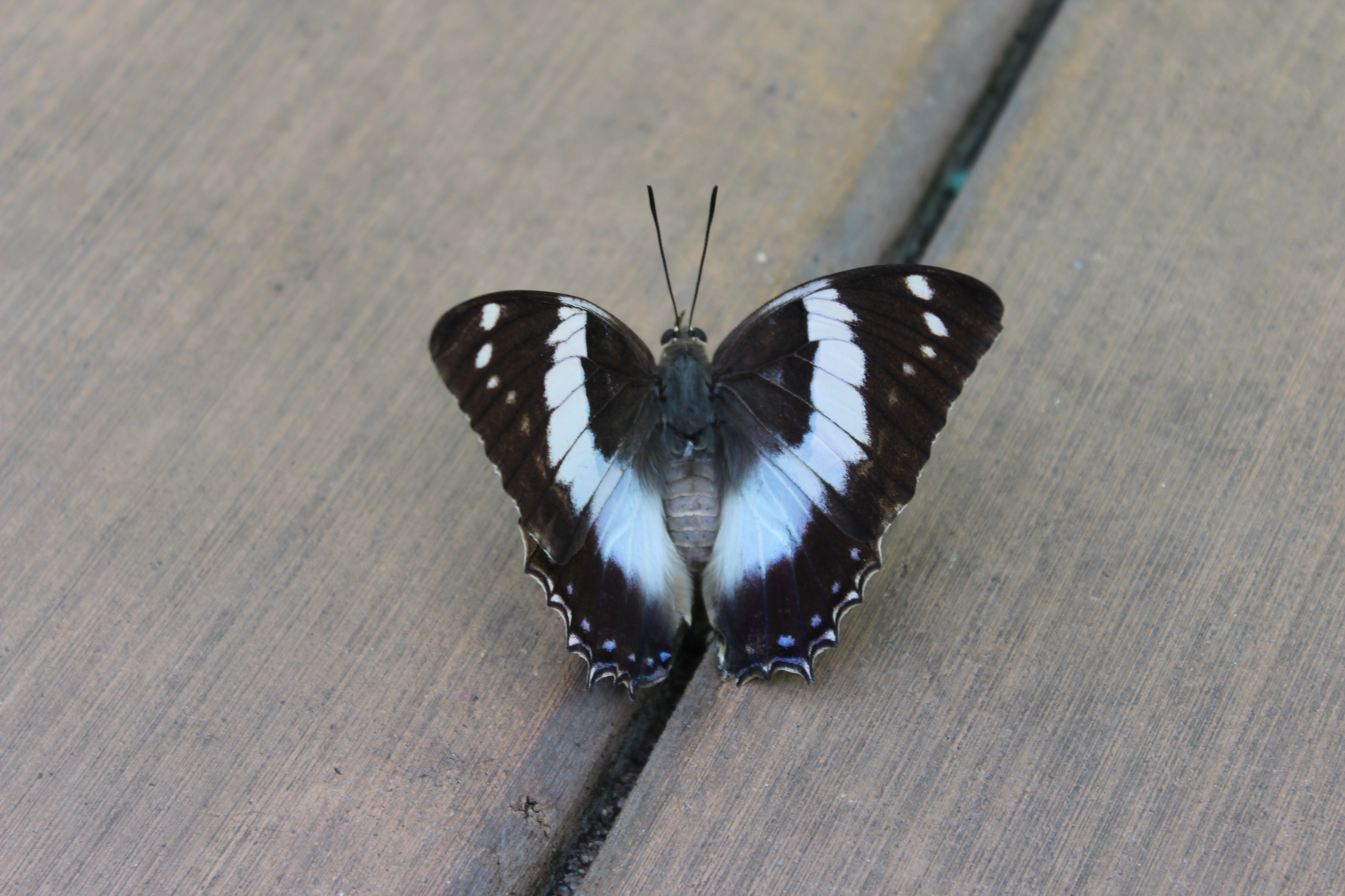

It’s hard to tell relative size from the photos, but the last one is huge (almost the size of my hand), and he/she landed on me a couple of times before settling on this windowsill.
Better yet, it turned out that Butterfly Wonderland is the flagship attraction in what is in the process of becoming a major family entertainment hub, complete with the area’s biggest aquarium, which is scheduled to open next December. However, Butterfly Wonderland already has one next-door neighbor: a mirror maze and laser maze. The butterflies reenergized us a bit, and we had the time, so when we finished with the butterflies we entered the mirror maze, which was lots of fun. Unfortunately we were a little too good at it and we were back out again in just a few minutes. So Sam tried the laser maze, which is a dark room with lasers pointing in all directions, making a Mission: Impossible-style obstacle course. Sam did pretty terribly on his first try, but then he went back in and did much better. It’s timed, and the operator said that anything faster than 150 seconds is a good score. Sam’s second run was 148, and he was pretty proud of himself. Then, because business was slow, the operator let Sam go in again, this time on the “expert” setting, which pretty much doubles the number of lasers. Needless to say Sam isn’t giving Tom Cruise much competition just yet. But we had fun and felt much better.
After the lasers we had nothing left on the plan for the day except the Diamondbacks game a couple hours later, so we stopped off to reload on some groceries for the week and then slowly made our way to the ballpark.
I normally would not attend a ballgame on Tisha B’Av, but balancing mourning and vacation leaves much gray area, and most of the game would be played after sundown when the day–and the fast–was officially over. Unfortunately this meant that I’d be breaking my fast at the game, which in turn meant I’d be breaking it on painfully insufficient and unsatisfying food (in this case, a container of cottage cheese).
Mercifully the stadium’s retractable roof was closed for the game, so while it was 100 degrees at game time it was a comfortable 79 inside. The ballpark is pretty nice, but because it’s basically an indoor stadium it looks more like an airplane terminal than a ballpark on the outside. Inside there are several nice touches but it’s a little dark. The scoreboards are enormous, plentiful, and informative. But the outfield wall infuriates me because it’s far more complicated than any outfield wall should ever be. Home runs should be simple: inside the park the ball is in play, and over the wall it’s a home run. But that’s not always true in this park.

The yellow line runs along the top of the wall, and anything above the line is a home run. Usually. Because the wall changes height often and in unusual ways. See the way the yellow line is vertical in those two spots? In those places any ball that hits the wall on one side of the yellow line is a home run, and on the other side of the line the ball is in play. It makes life harder on the umpires and more confusing for the players. I generally like this ballpark but the outfield wall needs improvement.
The Diamondbacks are an awful baseball team, so we didn’t get to see much interesting baseball. They were playing the Kansas City Royals, who have hit by far the fewest home runs in the majors this year but managed to hit three homers tonight. By the time we broke our fast the DBacks were down 6-1. That’s when things got really ugly. With two outs and Royals runners on first and second, the Diamondbacks had the runner on first picked off but botched the rundown completely, letting him advance safely to second while the other runner came all the way around to score, making it 7-1. The next batter was intentionally walked, and then the pitcher struck out but the catcher dropped the ball and the pitcher made it to first, loading the bases. This brought up Nori Aoki, who had not hit a home run all year. He hit a grand slam. 11-1. The crowd was small to begin with but it thinned out pretty seriously after that.
Meanwhile, with our fasting and mourning behind us, it was time to go shopping. Sam often gets a mini bat as his souvenir from baseball games but in the Diamondbacks’ team store he found something a little more exciting:

Yessir, and official Arizona Diamondbacks yarmulka! It even has built-in clips on the underside, which is his preferred method of yarmulka stabilization. That was one happy kid. A little later a cheerleader tossed him a Diamondbacks stress ball, making his night even better.
As for me, I was busy having some odd experiences of my own. So desperately thirsty from fasting on a 105-degree day, I bought the biggest soda in the ballpark, which is probably not actually a gallon of soda but is so enormous that I don’t think a gallon would be a bad guess. Mayor Bloomberg would have an aneurysm just from looking at this thing. It’s so big that it came with a coupon for a free diabetes screening. I guzzled down the first half gallon or so but then an obese guy sitting in my row came pushing through and somehow knocked the whole enormous thing out of the cup holder and onto the floor without even noticing he had just overturned a tanker truck full of Diet Pepsi. I was furious. Ordinarily I would have just sucked it up but I had had nothing to drink all day and I was only half done with the soda, which meant there was still enough soda in there to keep a beached whale hydrated for days. I wasn’t sure what to do but I figured that appealing to the kindness of the concession stand workers was my only hope. I took the empty cup back to the concession stand and told them what happened. Without hesitating, they took the old cup and gave me a new one, full. Needless to say I ended up with a little bit of soda leftover. Like a liter. Maybe two. But I was impressed with the kindness of the concession people. The team may suck and the ballpark may be indoors and the city may be 105 degrees, but they sent both of us home happy.
Where the Streets Have No Name
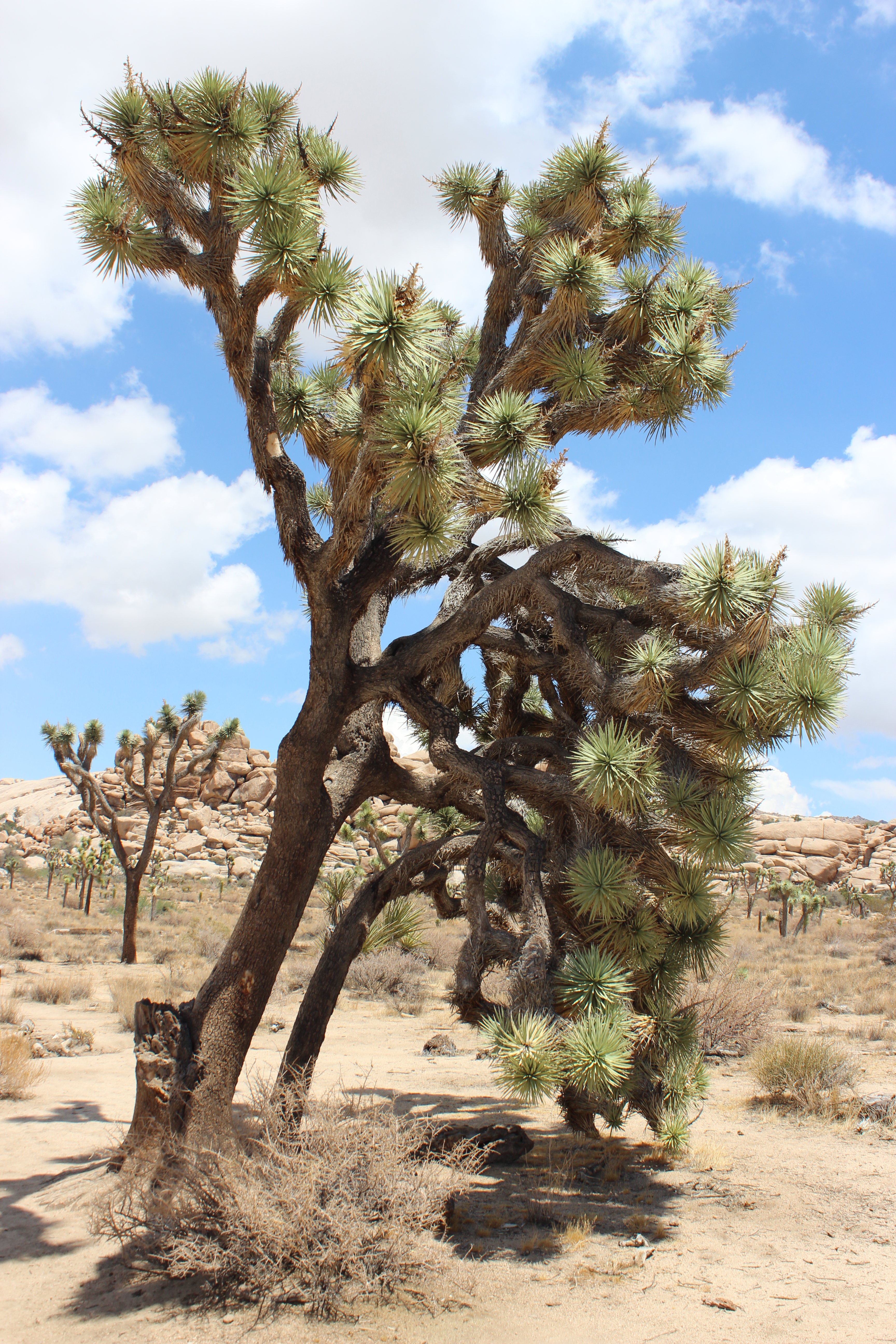
Monday was all about two things: Joshua Tree National Park, and driving through the desert.
We woke up In Beaumont, CA, which is about an hour from the entrance to Joshua Tree. So we started the day with an hour of desert driving. The park, of course, is also in the desert, so we spent the next several hours doing more desert driving. And when we were finished, we hopped on the Interstate and headed east toward Phoenix. Yes, more desert driving.
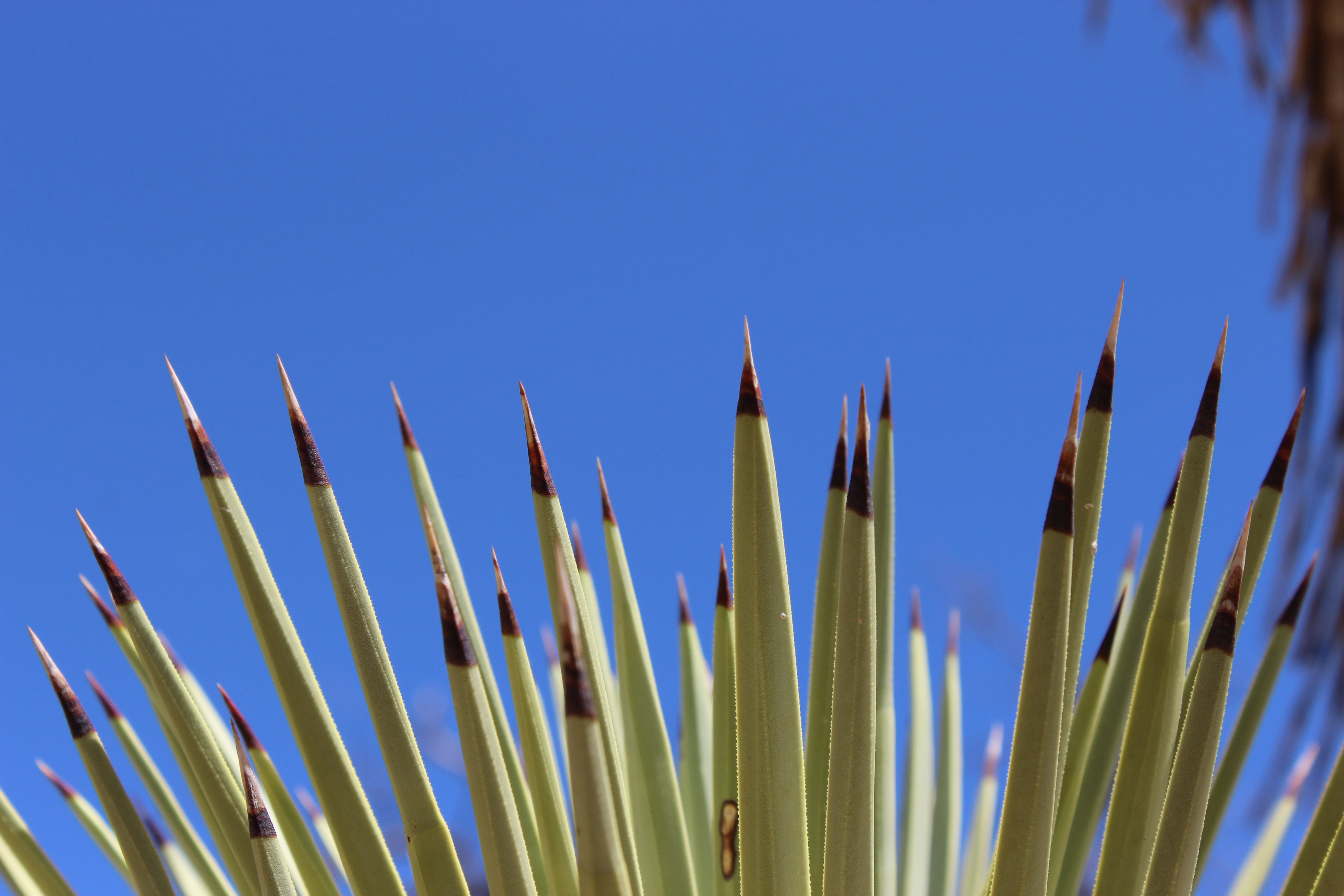
Joshua Tree National Park is known mostly for its thousands of Joshua trees, which grow in the Mojave Desert and very few other places. They’re kind of a mix between a cactus and a tree. They generally have standard tree-looking trunks and branches, but the ends of the branches are pom-poms of cactus spikes, kind of like a person was wearing cactus mittens. According to legend, the tree got its name from Mormon pioneers who thought the branches looked like the outstretched arms of Joshua leading the Jewish people into Israel.
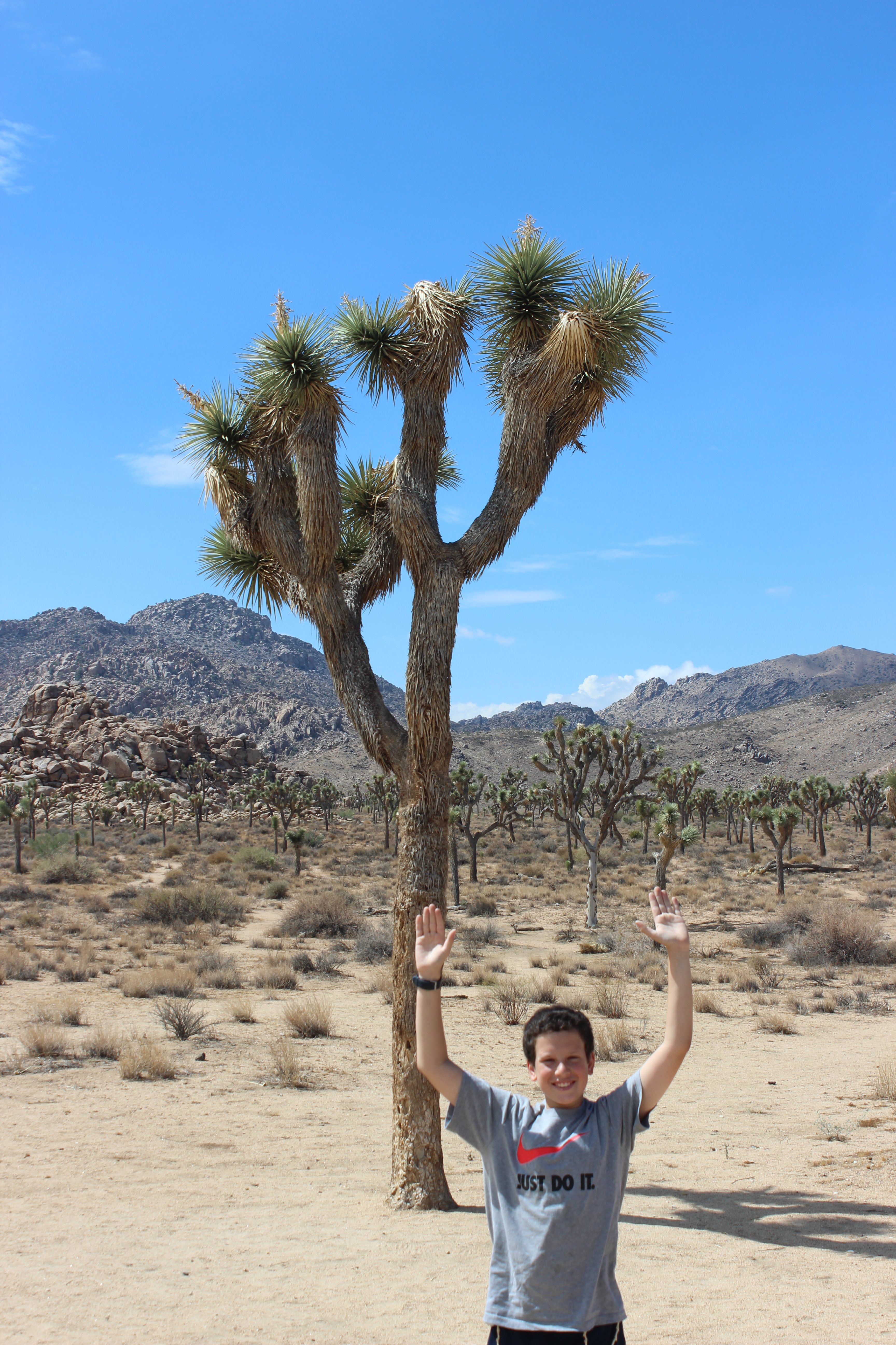
I’m not sure I see it, especially because I’m pretty sure that Joshua didn’t wear cactus mittens. But I’ll let this one slide.
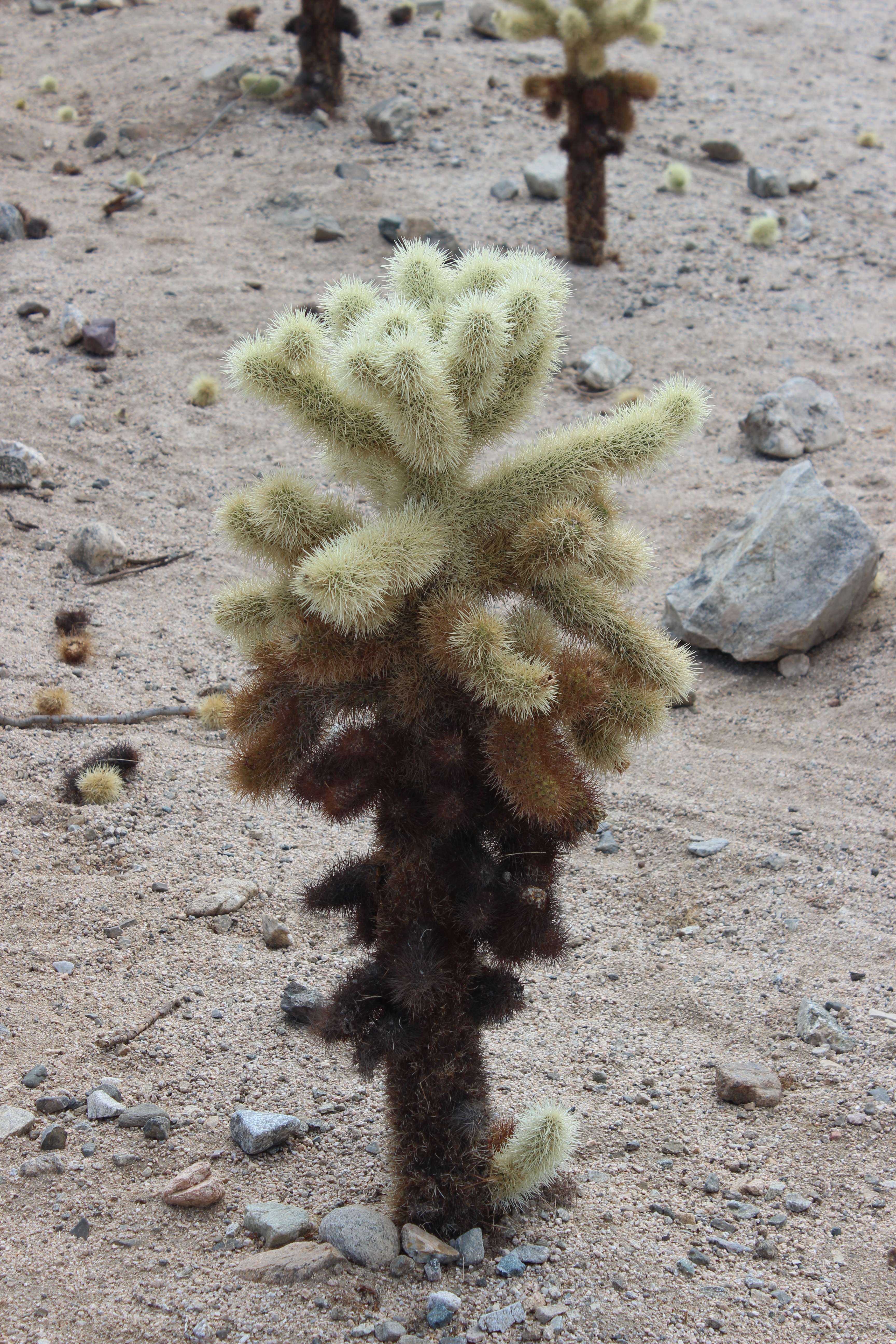
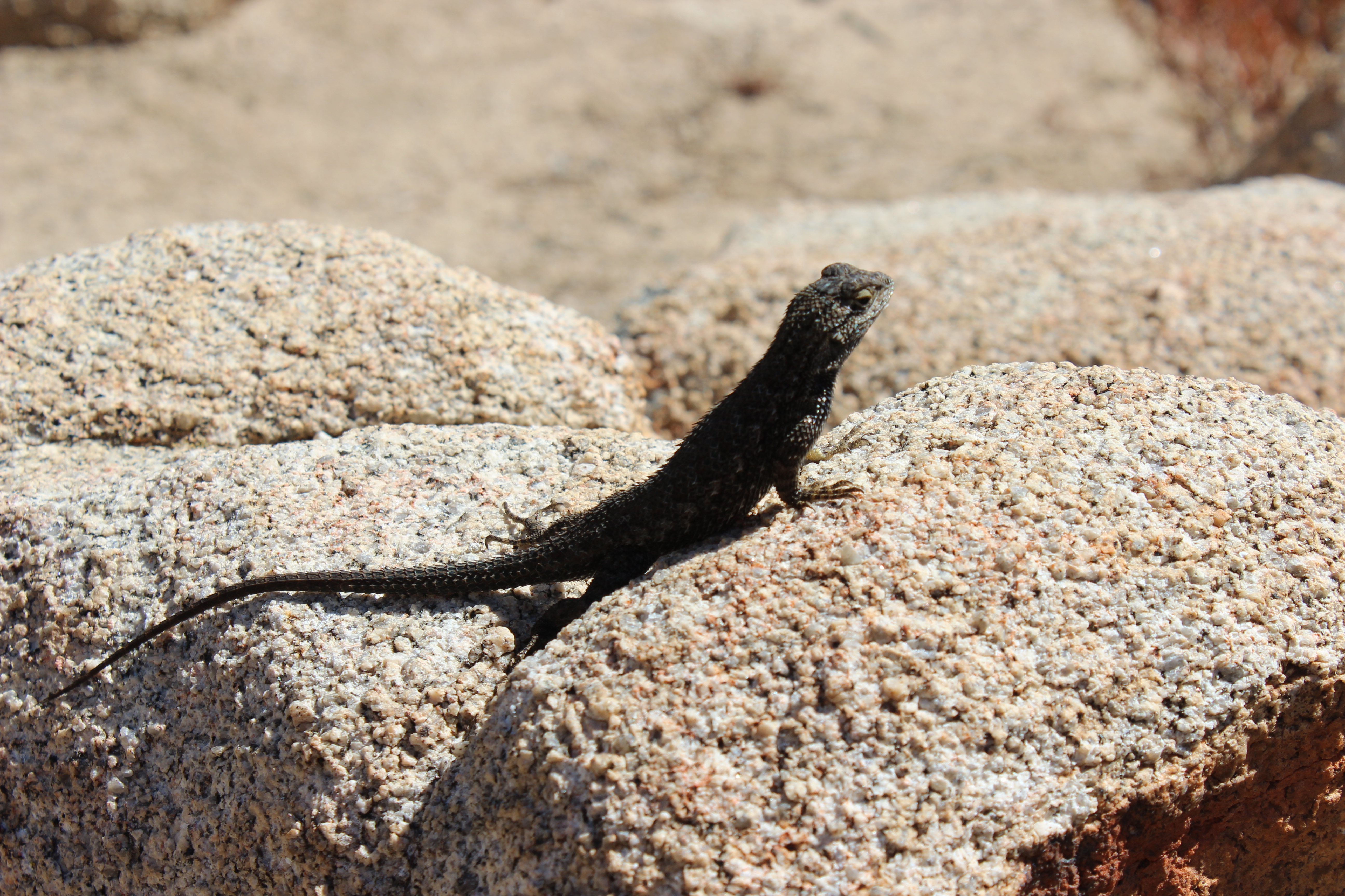
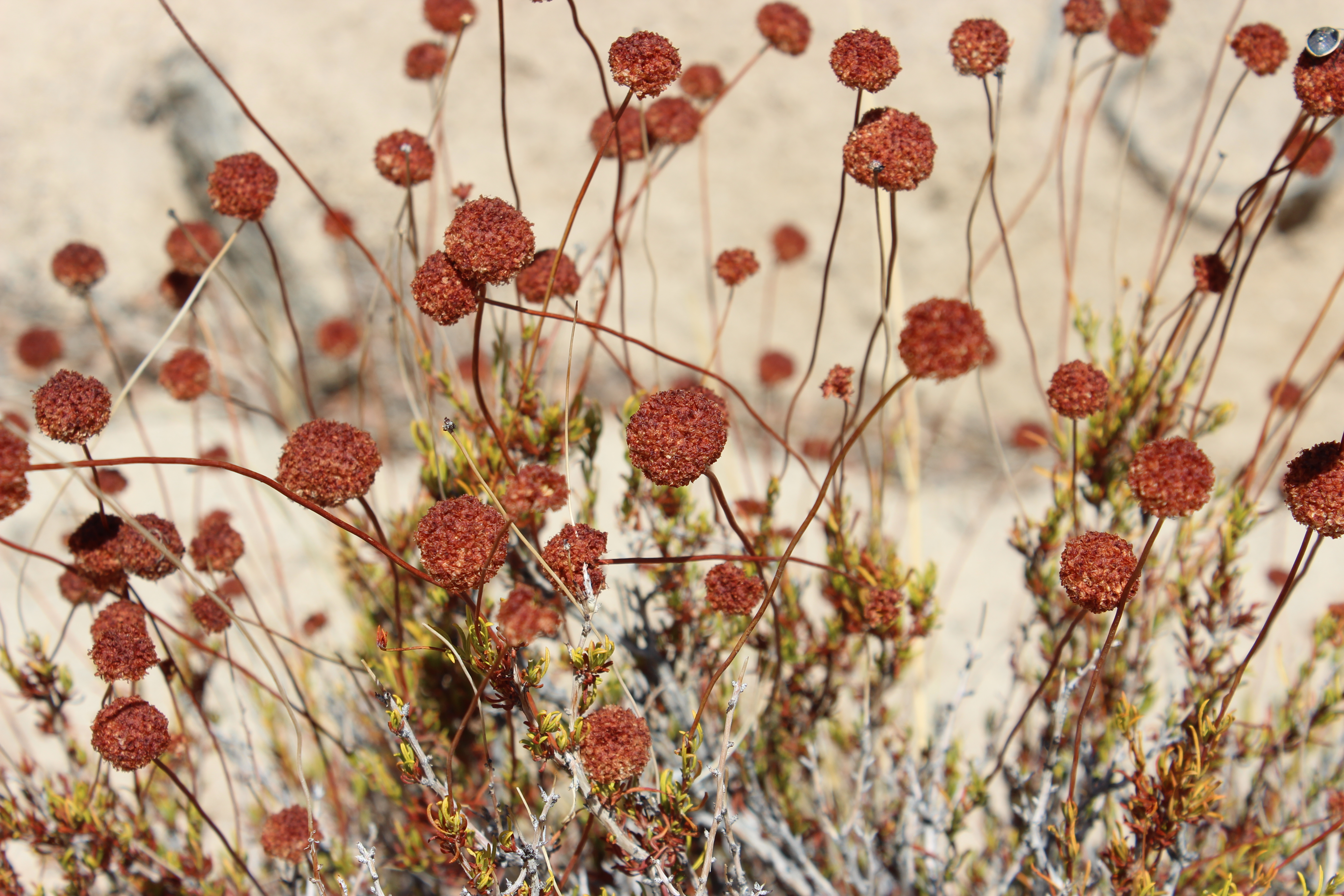
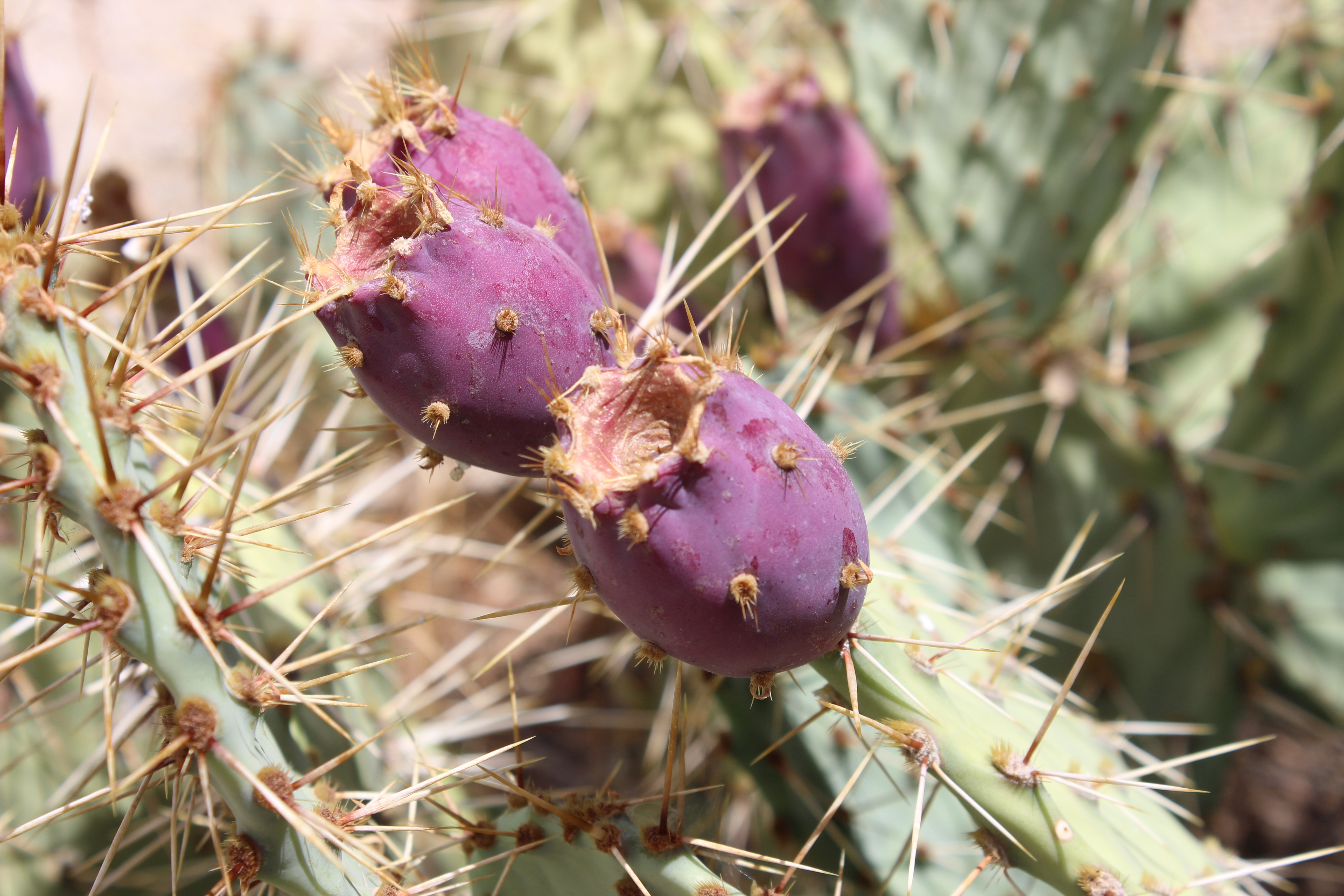
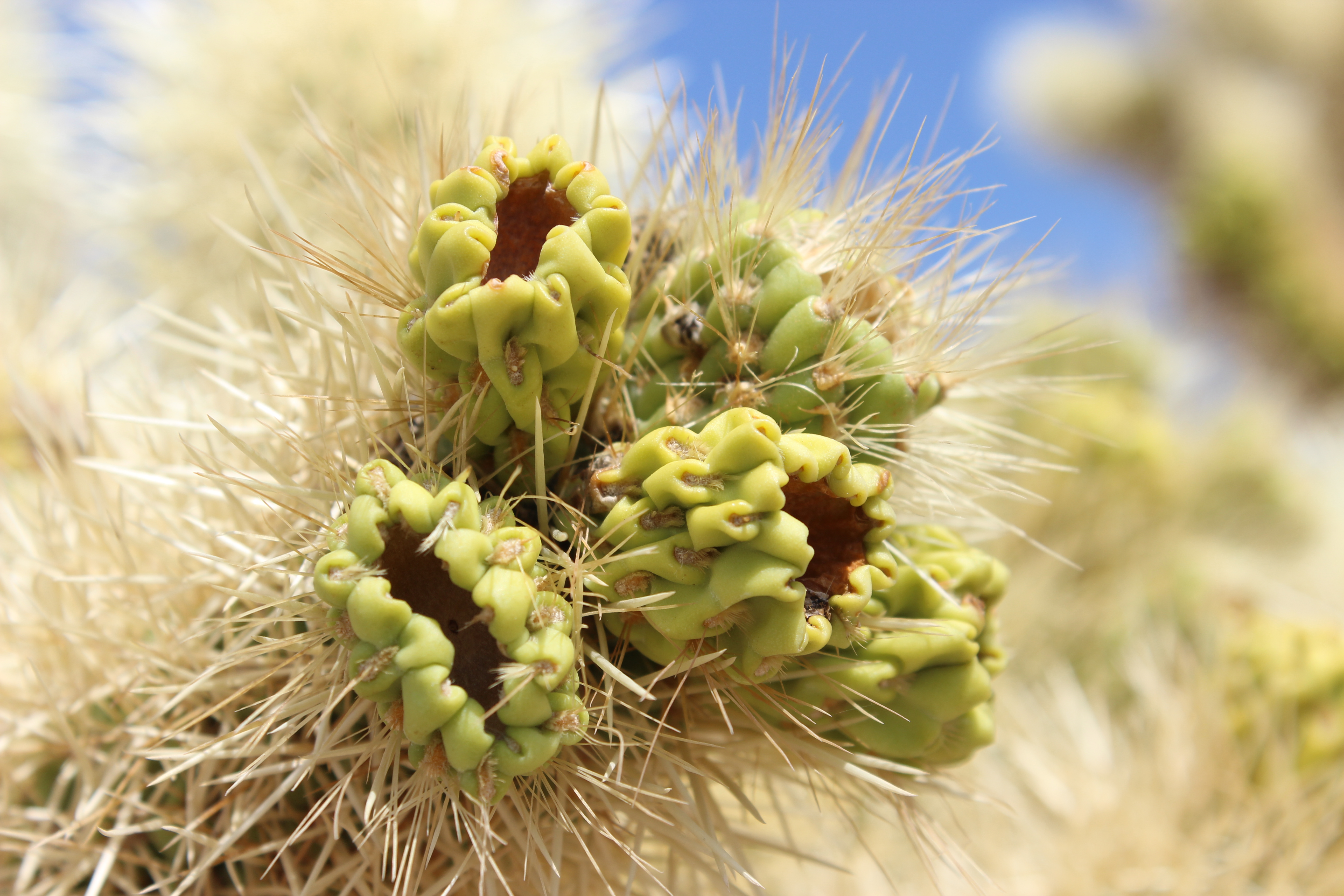
And of course we saw plenty of Joshua trees. But we also saw junipers, kangaroo rats, lizards of various kinds, and cholla cacti, which look soft and furry from a distance but are actually horrendously sharp and painful.
The temperature this time of year is usually over 100 degrees but we lucked out and it was in the low 80s with mostly clear skies, so we did a little bit of hiking, at least until Sam twisted his ankle. (Don’t worry, it’s nothing serious.) Meanwhile, here’s some of what we found:


This is what a Joshua tree looks like when it’s just a baby. Sam says it looks like a pineapple.

Skull Rock
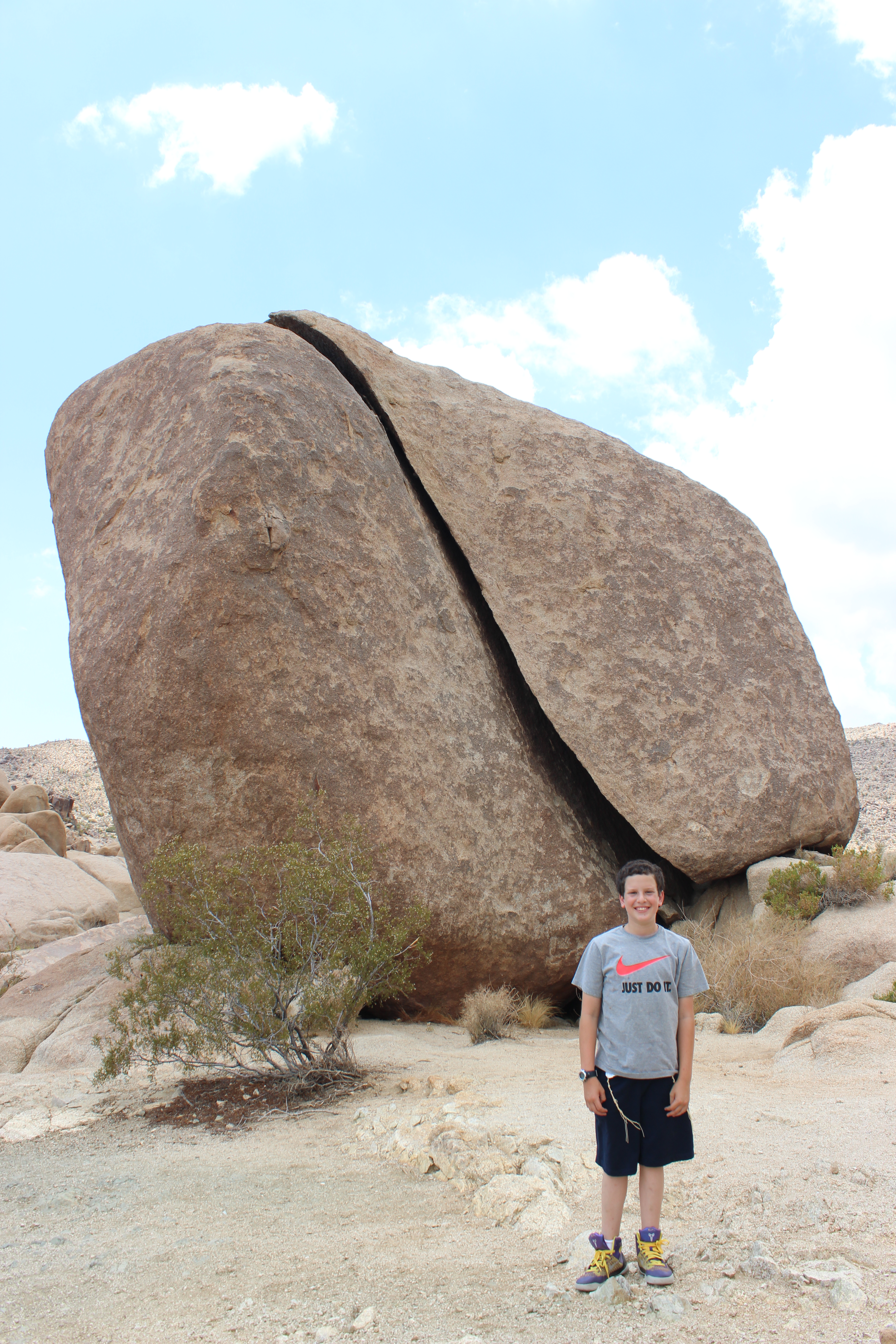
Split Rock
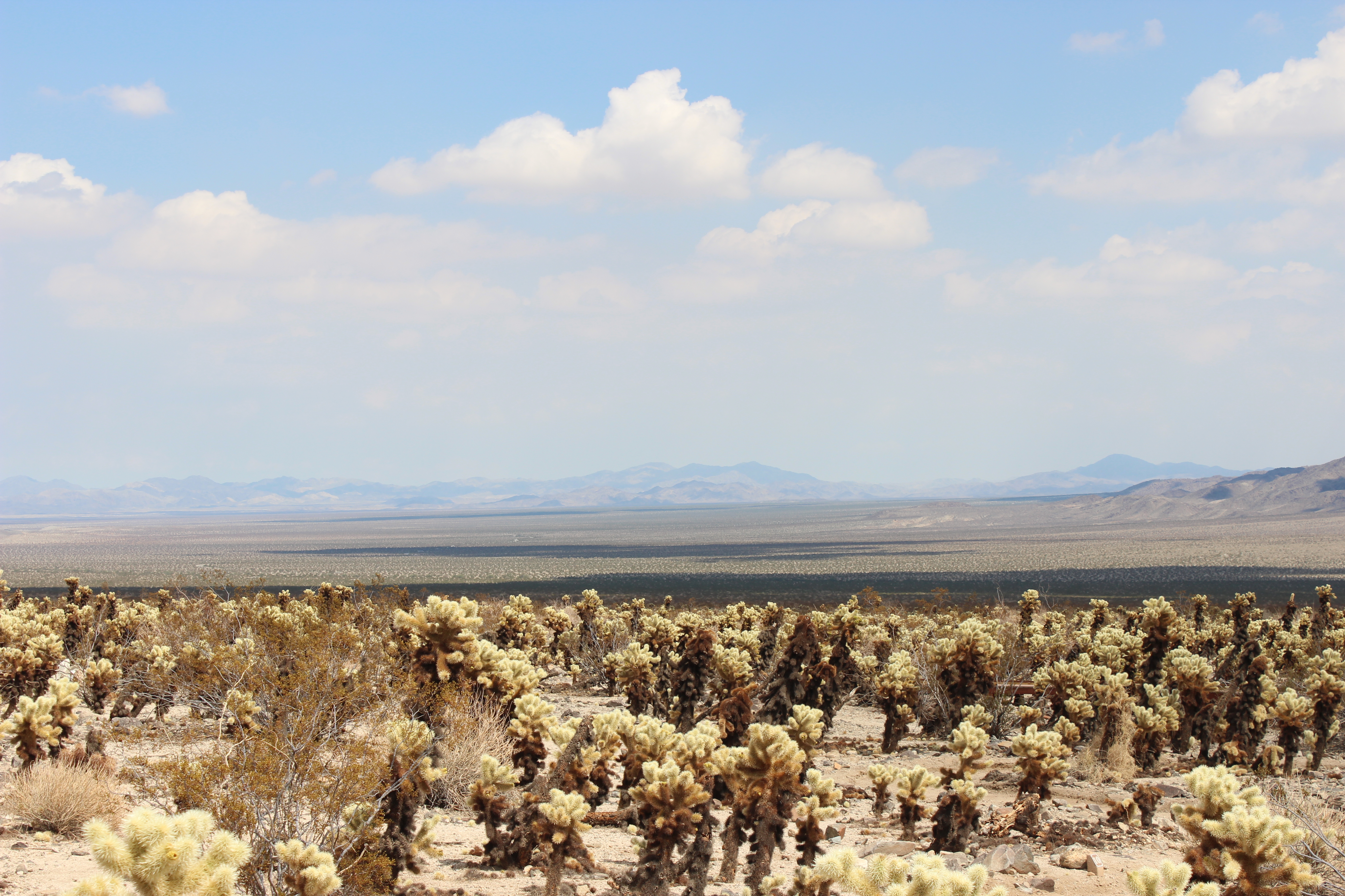
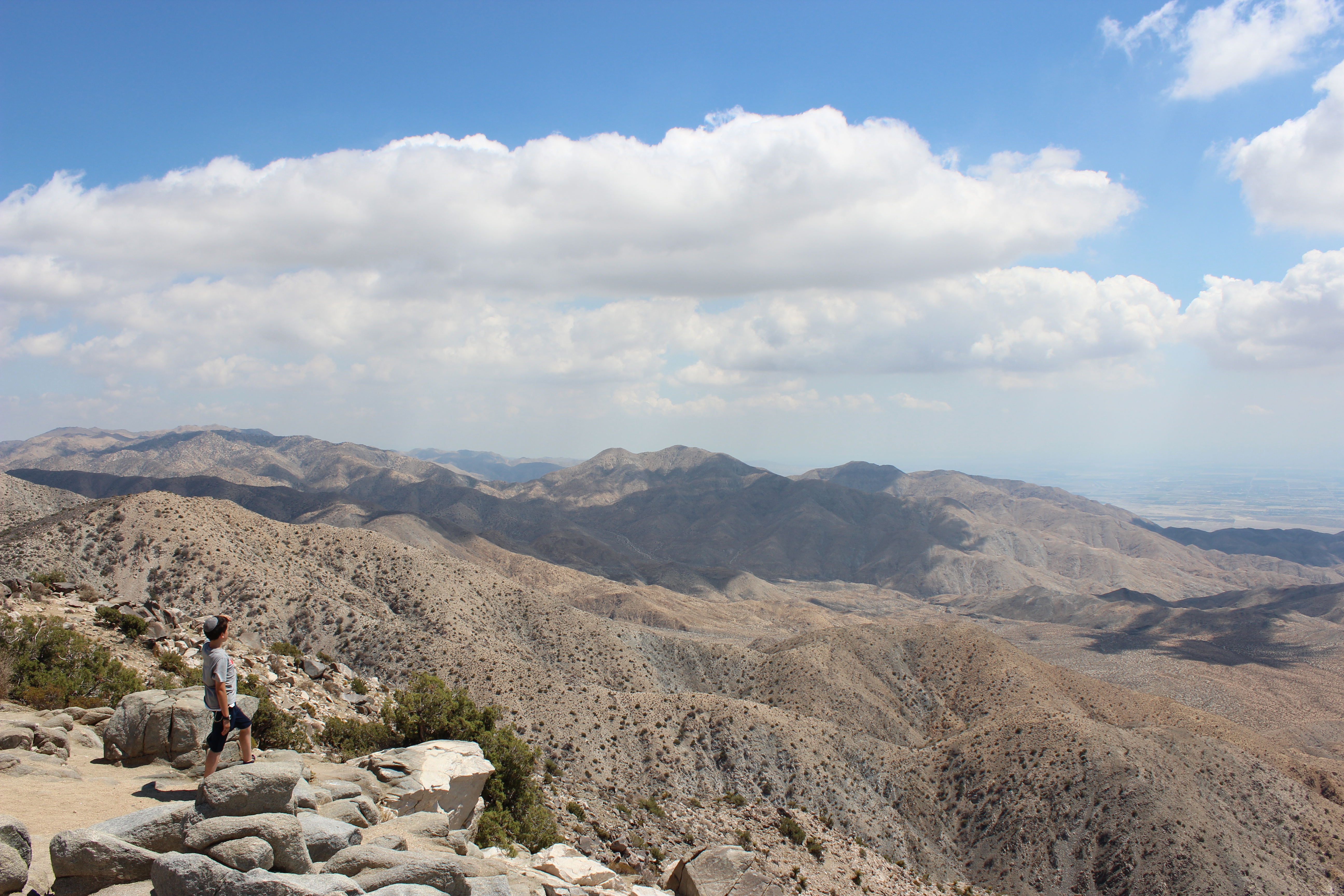
The Hamster looks out over Coachella Valley and the San Andreas fault.
I’m a little tired out from all the driving and the hot sun, so I’m going to let the Hamster take it from here.
Going Hollywood
Saturday night I did the most L.A. thing possible: I attended a premier. This wasn’t just any premier, though—it was the premier of a new show on Fox called Laughs, which airs Saturday nights and midnight and, more important, is both produced and hosted by my brother, Steve.
At the premier I got to meet comedians and TV execs, hang out with my sister-in-law, Sara, for the first time in forever, and watch the first episode of the show, which, as the name promises, is very funny. For me, the best moment of the show was when comedian Matty Litwack joked about bringing in an obituary for his third-grade current events assignment, which earned him a scolding from the teacher but inspired a psycho in his class to bring in obituaries for future assignments. The best moment of the night, though, was when we finished watching the premier and my brother interviewed a handful of comics, including Kim Coles from In Living Color and Living Single. I know my brother has his own show and everything, but he knows Sinclair from In Living Color, so now he’s really made it. And did I mention that Yakov Smirnoff was at the party? Yes, that Yakov Smirnoff.
The weirdest part about attending the premier was that it was too late at night for Sam, so he stayed back at the hotel with his mom while I went out. Which means that I drove somewhere by myself for the first time in three weeks. It was definitely a weird feeling not to have anyone riding shotgun.
Sunday morning things got back to normal, though. The three of us crammed into the car and met Steve and Sara at a vegan restaurant for brunch. I generally try to avoid vegan restaurants but these road trips are all about new experiences. Plus Steve picked the place and hey, it’s L.A.; if you’re going to eat vegan, this is the place to do it. I had fake scrambled eggs with fake chipotle sausage (or was it real chipotle fake sausage)? Sam had pancakes that were inexplicably made out of almond flour, with “bacon” that was more logically made out of tempeh. Sarah had some sort of fake burger on real bread. It was nice spending time with family we don’t get to see often, but the real fun for me was watching Sam deal with the vegan menu and his food. He’s a pretty open-minded eater for a 12-year-old boy, but he was even more skeptical than I was. In the end we all enjoyed our food and it was even pretty filling, and I was impressed with Sam’s culinary adventurousness.
After brunch it was time for Mommy to go, so we drove her to the airport and said our goodbyes. We were sad to see her go and we miss her already, but we’ll be back home in less than two weeks, and now the car seems so much roomier than it ever did before!
For the record, LAX is an awful, awful place. I don’t understand how an airport this big and this heavily used can be designed so terribly. Instead of having different roads to different terminals, there’s just one road that goes past every single terminal in numerical order. This means that everyone has to sit in horrible and unnecessary traffic before getting to the terminal they actually need. We were going to terminal 5, so we had to sit in traffic to get to terminal 1, then sit in traffic to get to terminal 2, etc. Ridiculous. Luckily Sarah made her flight but Sam and I were late for our next activity: a Dodgers game.
The stereotype is that Dodger fans arrive in the third inning and leave in the seventh. I have new-found sympathy for the latecomers, though, because most of them are probably trying to get there on time but get stuck in traffic. We ended up getting there just in time for the start of the second inning. The game was already tied 1-1 and looked to be an interesting one. Better yet, today was a giveaway—Sam got a pretty nice Dodgers backpack. Unfortunately the wonderful L.A. weather was far from wonderful. The temperature was only in the 80s but the humidity was almost 100%, and in the sun the heat was unbearable. Sam and I sat through just one inning and we were dripping with sweat. It was about this time that I noticed that the sunny seats (most of the ballpark) had largely emptied out and everyone was sitting in the bad seats at the back just to be in the shade. Eventually we left our seats, too, and watched the game while standing on the concourse behind our section. Thankfully, by the fourth inning the sky got cloudy and we were able to return to our seats for the rest of the game. Well, not quite the rest of the game—in the top of the eight the score was 3-2 Cubs when the Dodgers’ reliever, Brandon League, walked the first three batters on 14 pitches and then they all came around to score. The game was well past three hours old at this point so Sam and I cut out a little early. The Dodgers ended up losing 7-3.
While we were there we started counting up, and it turns out that Sam has been to games in 12 current ballparks and one defunct park (Shea Stadium, of course). He’s also toured 6 ballparks. We’re planning to see a game in Phoenix this week and possibly tour the ballpark in Dallas, so he’s still racking up ballparks. Honestly I was surprised that his total is that low, but he’s only 12; when I was his age I had only been to Shea. Then again, when I was his age the furthest I had been from home was Washington, D.C., and he’s been all over the country and all over the world.
But at this point he still hadn’t really seen L.A.—at least not the most typical touristy parts. So when we left the game we first headed to Santa Monica. Why Santa Monica? Well, you how the Route 66 song says it winds from Chicago to L.A.? Lie. The end of Route 66 is actually several miles west of Los Angeles, at the end of the pier in Santa Monica. And although we may be willing to leave a Dodgers game before the end, we’re not driving across the whole country to NOT finish the job.
At the very end there’s an odd-looking sign declaring “The End of the Road.” I say it’s odd-looking for a few reasons. First, it doesn’t resemble any of the official highway signs we’ve been seeing for the past three weeks; it looks more decorative and less official. Second, it’s actually a little bit past the end of the road. In other words, you can drive pretty close to the sign, but not all the way. It seems like it’s more of a tourist thing than a real highway designation. And sure enough, the sign was swarmed with tourists who most definitely did NOT just spend the last three weeks driving from the beginning to the end but were happily posing for photos anyway, and we had to wait a couple of minutes for our turn to pose.
Finding the sign, though, means that we are done with Route 66. Our journey, however, is far from over, and even though we are now headed east for the first time since we left home, we have much more to do and see before we’re back in our beds.
For starters, Sam wanted to see Hollywood. Specifically, he wanted to see the Walk of Fame and the famous Hollywood sign. Both of these are clichés, but I saw them both the first time I came to L.A. and I wasn’t going to deny Sam the privilege. We started with the Walk of Fame, parking in a lot just east of the corner of Hollywood and Vine and then making our way to the Chinese Theater, which is no longer called Grauman’s or Mann’s but is now named TCL Chinese Theater, after the company that now owns the place. Yuck. The whole experience was pretty gross. The area is filthy, it’s overcrowded with tourists, street hucksters, pot smokers, and homeless people. It’s exactly like a mile-long version of Times Square before Times Square got cleaned up. But Sam had fun looking for stars that he’s heard of, and I had fun watching him get excited to see the stars not just for The Muppets and J. Lo and Walt Diskey but also for Abbot and Costello, Ella Fitzgerald, Frank Sinatra, and Larry King. And of course, since we’ve been listening to (and singing) his version of “Route 66” for the past few weeks, we were both pretty happy to see Nat King Cole.
From there we drove up winding, hilly roads in order to get close enough to get a good view of the Hollywood sign. Many years ago you could go right up to the sign but nowadays it’s fenced off and guarded and you can’t get closer than several blocks away. So rather than push to get as close as possible we got reasonably close, found a good vantage point, and took the requisite photos.
By this time it was getting late and we were hungry. This was our last chance to eat in a restaurant for a few days, so we took full advantage, going to a nice place called Pat’s and having fish and chips. We were going to order the famous bread pudding but we were told it takes 35 minutes, and by this point it was already almost 9:30. So we skipped dessert in favor of the desert.
Specifically, we hopped in the car and drove for an hour or so east—yes, east—toward Joshua Tree National Park so that we can get an earlier start there Tuesday morning.
Reunion
Well it winds from Chicago to L.A.
More than 2,000 miles all the way.
Get your kicks
On Route 66.
Friday morning we awoke in our tepee, and then we headed west on the Mother Road for the last time on this trip. About an hour later we were in Los Angeles, fighting traffic on the way to LAX. Why LAX? To pick up Mommy!
Friday has been the most anticipated day of the trip for all three of us. Sam and I have a great time bonding and playing around and exploring the country, but we miss Mommy terribly, and every year the most anticipated day of the trip is the day she comes to visit.
The reunion was great. Of course, getting three people in the car means reconfiguring the whole back seat and all of our stuff, but we’re happy to be a little squished if it means we’re closer to being a whole family again.
Getting to Los Angeles means a few other things, too. It means we have reached the West Coast and have thus officially crossed the country on our cross-country road trip. It means we’ve completed Route 66–not all 2,448 miles of it, as we cheated a little by taking a several-days-long detour to visit various national pars and other nearby sights, but still, we’ve now driven Route 66. It means we will soon be turning around and heading back home (or at least in the general direction of home). It means more easily accessible kosher food, not just for the weekend but for much of the rest of the trip, as there are kosher restaurants in L.A., Phoenix, Tuscon, Dallas, and Memphis. And it also means that we’ll be seeing my brother, who is the host of a new show on Fox called Laughs that premiers tonight!
From LAX we went to the Pico-Robertson neighborhood to get lunch and pick up food for Shabbos. For some reason this took three hours. I’m not exaggerating for effect–it actually took three hours.
I’m just going to come right out and say it: Los Angeles sucks. Sure, the weather is nice. We’ll put that in the “pro” column. But there are so many things in the “con” column, starting with the traffic. Complaints about the traffic in L.A. is a bit of a cliche but Sam and I haven’t seen traffic since Chicago so we had almost forgotten how annoying it can be. But L.A. traffic is far more annoying than traffic anywhere else. I mean, we’re from New York; we know a thing or two about traffic jams. The thing about traffic in L.A., though is that it’s everywhere, in every direction, at all times of day. There are 1,800 major highways running through this town (OK, this time I’m exaggerating a little) and most of them are at least four lanes wide in each direction, and yet they’re completely packed in both directions all the time. And it’s not just the highways–the side streets are packed and moving at a crawl at all times, too.
Also, in terms of driving, there’s no such thing as slowing down here. Traffic lightens up for a second and it goes from a dead stop to 70 mph for about 15 seconds. Then it goes right back down to zero. Immediately. I cannot tell you how many times I stopped short on Friday.
Making matters worse is that the city is so ridiculously spread out, and randomly so. Nothing is near anything else, so you have to drive everywhere, and you have no idea how long it will take because it’s 12 miles away but, you know, traffic.
Also, it’s really dirty here. And not just the ground, but the air. And again, this is coming from a New Yorker. In theory the weather is nice and the views are beautiful but the smog is so thick that it’s hard to be impressed with the weather because the sky is a hazy gray when it should be blue.
Also, I’m not loving the hypocrisy here. I’m referring specifically to the environmental activism. I had to pay for bags at the supermarket, and I was encouraged not to use bags at all. Meanwhile there’s no real public transportation and nobody’s driving in the HOV lanes, so the city used fossil fuels out the wazoo and the air quality rivals Beijing. But hey, they’re not using grocery bags, so they’re totally saving the planet.
Anyway, after some frustration with traffic and phony environmentalism, we finally started having some fun. We took a Warner Bros. Studio tour, which was pretty awesome. We drove through phony New York streets where all sorts of classic TV shows and movie scenes were filmed–Friends, Newsies, Annie, and the famous upside-down kiss in Spider-Man. (Insider fact: movie rain drops are bigger than actual rain drops and they were dripping into Toby Maguire’s nose and drowning him, so they stuffed cotton balls loaded wit Vaseline up his nose and that’s why Kirsten Dunst removed the mask only up to his nose.) Our tour guide, John, is a bit obsessed with Pee-Wee’s Big Adventure, so he showed us the fake storefront where the fortuneteller told Pee-Wee that his bike was in the basement of the Alamo, and another fake storefront that was the burning pet store where Pee-Wee saved all the animals and then saved the snakes last and passed out. Apparently the fainting was not planned but Paul Reubens is actually terrified of snakes and passed out for real, and Tim Robbins left it in because he thought it was funny. I love that movie, so I really enjoyed this part of the tour and ended up bonding with the tour guide over it.
We also saw the jungle set (with real plants) where all sorts of stuff has been filmed, including Kermit singing “The Rainbow Connection” in The Muppet Movie, and we walked through the prop house and walked onto the set of Ellen. We even got to walk onto the preserved set of Friends Central Perk set and sit on the couch.
And this year is the 75th anniversary of Batman, so there was tons of Batman stuff on the tour, including a visit to a garage where they keep all the actual, fully-functioning vehicles from both the Michael Keaton/Val Kilmer/George Clooney movies and the Christian Bale movies. That part was pretty awesome, and I think my favorite part was when Sam and I each got to turn on the real Bat signal to summon Batman.
Shabbos was nice, too. Shabbos on the road trips tends to be very relaxing but also a bit boring. Not this time. With Mommy here, we had all sorts of catching up to do, peanut butter songs to sing, and the day passed by very quickly.
Now I’m off to the premier of Laughs, which was not originally on the schedule but is about as L.A. as it gets. I just hope the traffic isn’t too bad on the way there.
Surreality and San Bernardino
At 6 a.m. Thursday morning, the phone in our motel room rang. It was the front desk calling to tell me that the credit card I had given them 11 hours earlier was rejected. The day only got more bizarre from there.
Eventually I fell back asleep, and when we checked out a few hours later we got an apology and some money off the price of the room. And as I was walking out of the lobby, another guest at the motel who had been sitting nearby (a burly man in his late 40s with a bushy mustache) jumped up from his chair, ran up to me, shook my hand, and said, “God bless you, sir.” I assume it was somehow related to the yarmulka I was wearing, and I had no idea how to respond. “You too,” I stammered with what I hope was a smile.
When we got in the car we noticed that it was 104 degrees. and it was only 10:30 a.m. It got much hotter as the day went on.
We began the day in Needles, California. In The Grapes of Wrath, the Joads get pretty excited when they get to Needles because it means they’ve finally reached California. They camp out by a little stretch of the Colorado River and the menfolk take a dip to both wash and cool off. Sam and I were planning to do pretty much the same thing this morning. In fact, there’s really very little to do in or around Needles besides jumping in the Colorado. In the book, one of the Joad children, Noah, likes the river so much that he spontaneously decides to leave the family and live by the river. So it must be pretty refreshing, right?
The best way to enjoy the river is Moabi Regional Park. But I found out only this morning that the place is really focused on people who are camping there and/or have boats. You can buy a day pass, but the day pass people aren’t allowed to use the actual river, only in a relatively stagnant inlet that gets pretty oily from all the boats and is thus good for boating but not for swimming.
This meant that instead of spending the entire morning in Needles, spending the afternoon driving, and the evening in Barstow (the next real town along 66), we were spending the morning driving, spending the afternoon in Barstow, and spending the evening who-knows-where.
We needed a new plan and we needed one fast. At first I figured we would just spend more time in Barstow but it turns out that there’s not much more to do in Bartsow than there is in Needles. There’s a historic train-station-turned-shopping-plaza, and there’s yet another Route 66 museum, and that’s about it.
Then Sam reminded me about the Wigman Motel and suddenly everything fell into place.
The Wigwam Motel is a Route 66 legend: a chain of erroneously named motels started in 1949 with individual cabins rather than one big building full of rooms. The cabins are all shaped like tepees (not wigwams) but are actually relatively modern concrete structures with real beds and even bathrooms inside. The Wigwam Motel is the inspiration for Sally’s traffic-cone-themed Cozy Cone Motel in the movie Cars. There used to be several locations scattered around the country but there are just three left now, two of which are on Route 66. One of those is in a town in eastern Arizona that we skipped while we were exploring National Parks. The other is the most well-known of the three and is in San Bernardino, California. I came across it when doing research about Route 66 and when I told Sam he said we should definitely try to stay there if we could. I put it on the list but I didn’t know if it would work out, especially since I expected us to stay overnight in Barstow tonight. But with the day moving faster than we’d planned, the tepees were suddenly possible. And sure enough, they still had rooms available.
All that we needed was a plan for what to do all day along the long and winding road that would get us there. If Route 66 is good for anything, it’s oddball attractions like the Wigwam Motel. Luckily I was able to find a couple of prototypical Mother Road amusements and we were soon on our way.
The stretch of Route 66 between Needles and Barstow is pure desert. Route 66 enthusiasts call it the ghost town section, because the few towns in between are barely even there, and there are a few that used to be there but no longer are. Bagdad is probably the most well known former Route 66 town. The only trace of it now is the Bagdad Cafe, which was reopened years later a few dozen miles down the road in a different tiny desert town called Newberry Springs. The one in Newberry Springs is just about the only visible business in that town, and it’s the one that inspired the 1987 movie Bagdad Cafe.
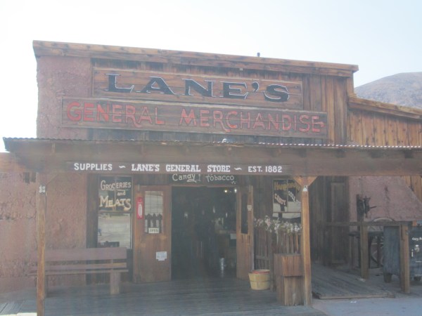
But along that stretch of road there is an actual ghost town in the more traditional sense, too. A few miles north of Route 66 is Calico Ghost Town, a refurbished version of a silver-mining town that boomed in the 1880s and 90s but then fell apart soon after. The remains of the town were purchased in the 1950s by the owner of Knott’s Berry Farm and turned into an Old West ghost town theme park of sorts, part tribute to the original Calico and part cheeky tourist trap loaded with old-timey gift shops and silly gags.

It was 109 degrees when we got there, so the Calico ice cream shoppe (when discussing old-timey stores, “shoppe” is the legally required spelling) was doing brisk business. We also enjoyed touring the original 150-year-old silver mine and wandering through the town’s various buildings, like the woodshop, the jail, the blacksmith, and the saloon.

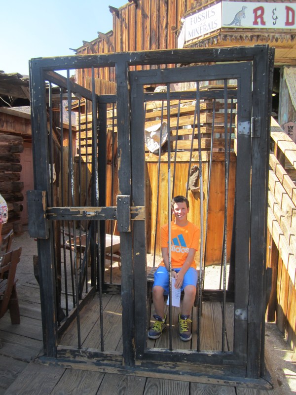
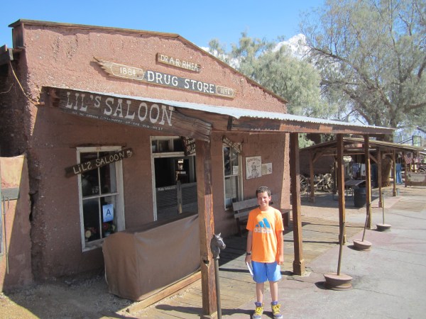
The place is not so great that I would go too far out of my way for it, but as long as we were passing by in need of something to do, it turned out to be a fun way to spend an hour or two, even in the brutal heat.
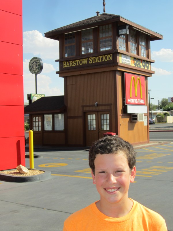
We ended up spending only a few minutes in Bartsow. We skipped the Route 66 museum, but we did stop by Bartsow Station, the old train depot that now houses a few fast-food chains and a handful of little shops. It’s cheesy but there are some nice touches, like the old train cars used for seating at the McDonald’s there, and the fact that one of the restaurants there is Subway–probably an unintentional pun but appropriate for a train station nonetheless.
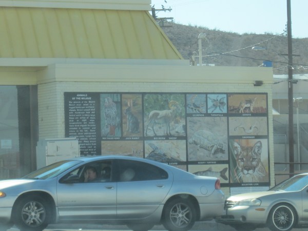
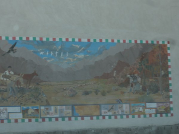
There are also several murals on the sides of buildings along 66, which were cute.
The Joads, incidentally left Route 66 at Barstow, heading north at that point in search of farm work. The Hamster and I are looking for adventure, not farm work, so we continued on 66.
About 20 miles further down the road is another perfectly quirky, fun stop called Elmer’s Bottletree Ranch. Never been to a bottletree ranch? That’s because this is the only one in the world. It’s a collection of around 200 “trees” made out metal poles with variously colored glass bottles stuck on them.


There’s plenty of other random old junk involved in the decoration: typewriters, street signs, a stripped down Jeep, and old rocket, etc.


It’s all in the front yard of a guy named Elmer Long, who happened to be home when we were there and he came out to chat with us and the handful of other folks who were wandering through his “forest.” He explained that he’s always been a collector and he and his dad amassed all sorts of cool old stuff and he figured that this was the best way to display it all. He’s still adding to it, and he’s got a pile of bottles and other stuff that’s basically the waiting room.

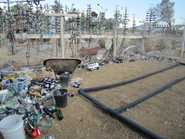
He talked a little about trespassers, and about chickens, and about his annoying neighbors, and he posed for pictures with the two blonde women visiting from Belgium. And yes, Elmer looks exactly how you think he looks.

We spent the next hour or so watching as California turned from desert into regular land with trees and multilane highways and regular stores, and the temperature dropped to a downright chilly 98 degrees. Soon we were checking into our tepee, which turned out to be much nicer than we had a right to expect: air conditioning, wifi, a flat-screen TV, a full bathroom, and even a suede couch. Plus it’s much more quiet then our room at the Quality Inn the previous night.


At this point we didn’t know what we were more excited about–sleeping in a tepee, or finishing all the cities mentioned in the Route 66 song.
You’ll go to St. Louie,
Joplin, Missouri.
Oklahoma City looks oh so pretty.
You’ll see Amarillo,
Gallup, New Mexico,
Flagstaff, Arizona,
Don’t forget Winona,
Kingman, Bartsow, and San Bernardino.
We sang the song and celebrated with cheers when we finished that verse.
And we weren’t quite done for the day, either. We had a quick dinner in our tepee and then headed out to see San Bernardino’s minor league baseball team, the Inland Empire 66ers. (Yes, it’s a terrible name, but what do you expect from an affiliate of the Los Angeles Angels of Anaheim?)
We sat right behind the 66ers’ dugout, and a couple of innings into the game the team mascot, a furry red something named Bernie, climbed up onto the dugout to do his shtick. After some dancing and hamming he tossed Sam a ball, and while Sam was admiring it Bernie immediately covered him in Silly String.
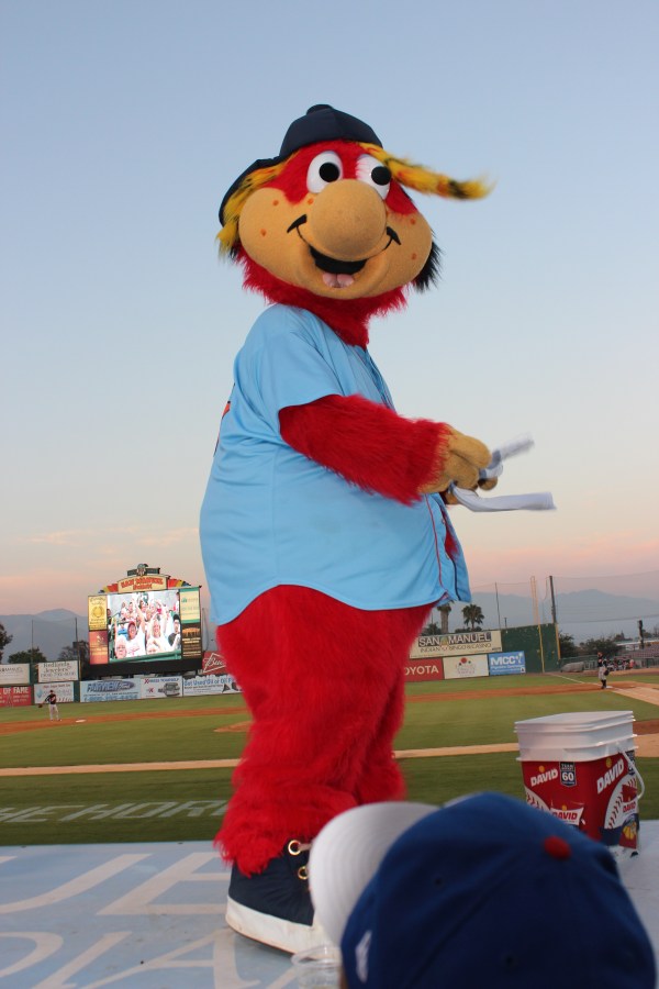

We laughed, and spent the next few minutes pulling off all the string, only to get hit again with what must have been the other half of the can of Silly String. It was a thrilling game that the 66ers ultimately lost, 3-2. During the game I noted that the manager, former Major Leaguer Denny Walling, didn’t know how to put a lineup together. For starters he’s using a DH who is hitting just .220 with no power. And his cleanup hitter, Cal Towey, is batting .285 (highest on the team) with just a handful of home runs while his number 3 hitter, Dennis Raben, is batting .260 with 17 homers. I told Sam those two guys needed to be switched in the lineup so that Towey can bat more often and can also get on base ahead of Raben. Not to mention the fact that Raben is 27 and no longer a prospect, while Towey has more growth potential and should be both showcased and challenged. As the game ended Sam ran up to the dugout, as did several kids and a few adults. Out came Denny Walling, and he tossed Sam a ball. Then Sam asked him why he doesn’t switch Towey and Raben in the lineup. I couldn’t believe he had the guts to mention it, and I wasn’t close enough to hear the conversation but I was watching, and it was clear that Walling was intrigued by Sam’s question. So were the adults who overheard him. Walling responded by asking Sam why he thought they should be switched. Sam explained. Walling said something about wanting Raben to bat in the first inning so that he can hit a homer and give the team a lead. I think it’s cool that he took the time to talk to Sam but I also think it’s clear he doesn’t know what he’s doing.
And thus we drove back to our tepee, a perfectly surreal end to a perfectly surreal day.
The Scenic Route
Wednesday morning started in Alaska.
We decided to take a scenic route from Flagstaff to Los Angeles by heading south first to Sedona, a town in the mountains and right alongside Coconino National Forest. We were on the road for just a few minutes when Sam asked if I could get a little closer to the 18-wheeler in front of us so he could check its license plate. At the National Parks he found a couple of the state license plates he had been missing, including Hawaii. But for the past few days he’s been stuck on 49 states and has been in search of Alaska. Sure enough, the truck had Alaska plates. Victory!
Tomorrow we start over at zero.
Sedona, in case you were wondering, is a lovely town with lots for vacationers to do–golf courses, spas, art galleries, and restaurants. Sam and I are interested in exactly none of those things. We were there to see rocks. Red ones. We started at Red Rock State Park. Big mistake. About two minutes after paying the $8 entry fee we realized that, besides a decent but very far-away view of Cathedral Rock (one of the more well known of the red rocks), the park is pleasant enough but not unique in any way.
A couple of miles away we found a different state park whose name escapes me. It also was completely underwhelming but it does own the most famous view of Cathedral Rock–the one with the reflecting pool. I’m still stymied in my efforts to upload photos to the blog, so you’ll just have to take my word for it. Eventually I’ll get this photo thing sorted out, I really will.
[Photo to come]
The guy at Flagstaff Extreme suggested that we pay a visit to the other colossally famous rock, Bell Rock, which is a few miles away. He said there’s a hiking trail that takes you right up to the base of the rock and that there are always people climbing it, which is fun to see (or do yourself). I had no intention of doing any rock climbing but his advice about seeing downtown Flagstaff and about where to find a place to stay were accurate, so I went with him on Bell Rock too.
The rock itself is really interesting to look at, as it looks like a big bell from certain angles but looks completely different from other vantage points. And boy, is it red.
[Photo to come]
Unfortunately the only parking lot near the trail requires something called a “valid recreation pass” so we parked only long enough to take some pictures and never got terribly close to the bell.
So ultimately Sedona was underwhelming, especially after seeing the red monoliths in Monument Valley. Still, it was a beautiful drive through beautiful scenery in beautiful weather, so I’m not complaining.
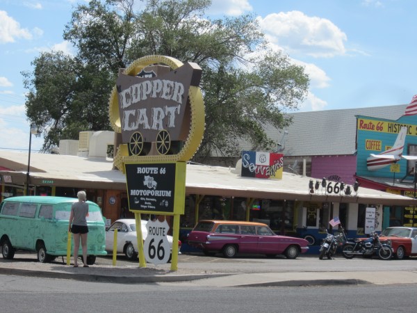
Next it was back to our old friend Route 66. In Arizona it passes through some especially quirky little towns full of functioning and iconic Route 66 businesses. We especially liked a tiny town called Williams, which featured all sorts of historical Route 66 attractions as well as one faux-historical attraction: the Historical Route 66 Zip Line.

Our main goal for the day, however, was to see some alpacas.
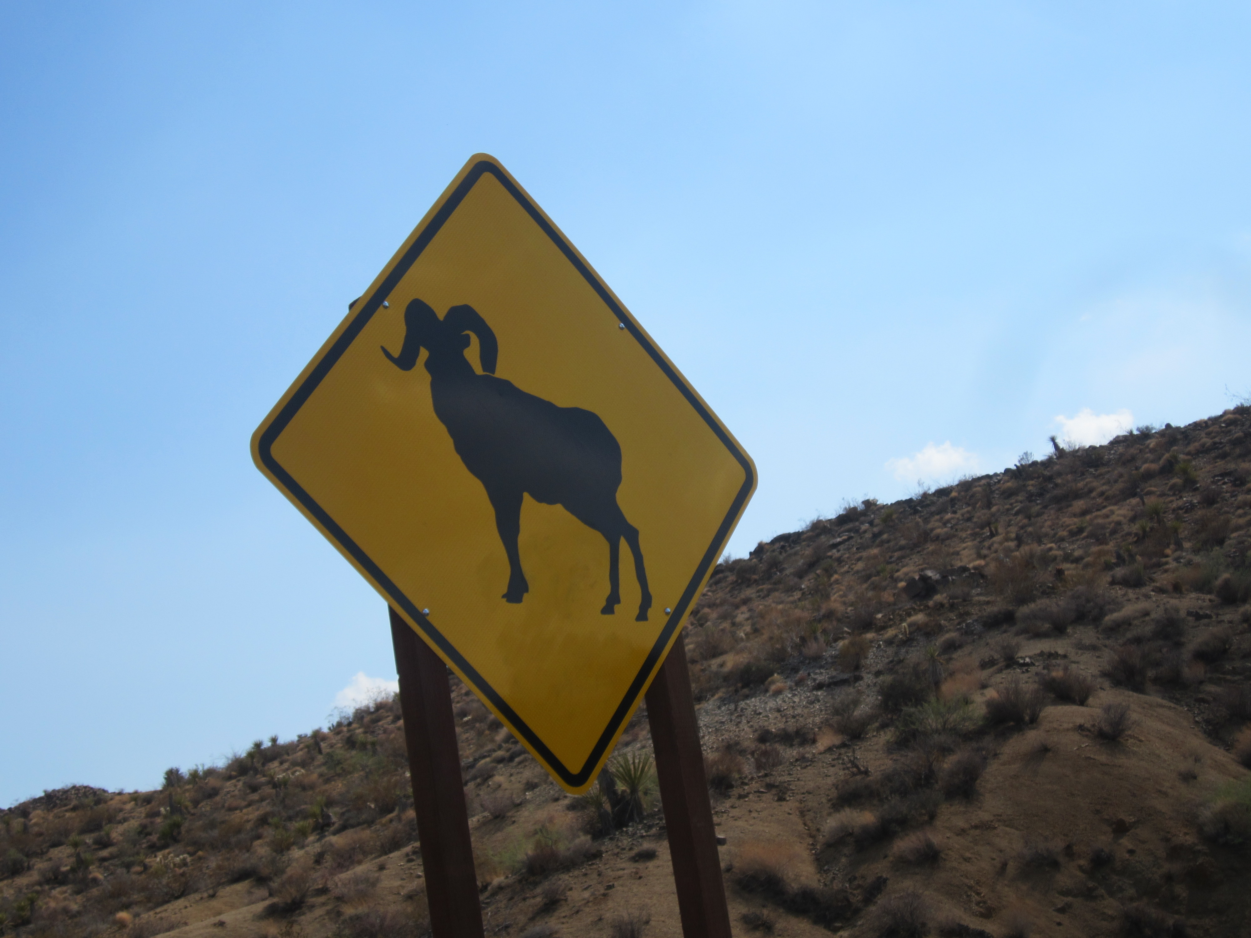
After Flagstaff, Kingman is the biggest Arizona city that Route 66 passes through. There’s not a ton to do in Kingman that’s of interest to us–a Route 66 museum, a historic locomotive, a train museum. But just east of Kingman is an alpaca ranch called Alpacas of the Southwest that gives tours for $6 per car. Sam loves animals and he especially loves fluffy animals. I love weird stuff that I can’t do at home. So we’ve been getting progressively excited for the alpacas for the past few days. In fact we started joking about how “alpaca” sounds like “I’ll pack a” and we starting making stupid jokes about it by saying things like, “Are you cold? Alpaca sweater!” and “Alpacas a nice lunch.”
The ranch is small and is run by a husband and wife who are, I would guess, in their early 60s and own 42 alpacas, which they use both for wool and for breeding. The ranch normally closes at 3:30 but they were kind enough to take us at 4:00. The husband gave us the tour, which really was just a talk about alpacas in general and the ranch specifically while we stood in the barn watching and petting alpacas. It was all pretty interesting, considering we knew nothing at all about alpacas when we got there and we now know almost enough to start breeding them. Plus they’re really freaking soft! Sam even got to feed a couple of them, which he loved.


Almost as interesting was some of the other stuff going on at the ranch while we were there; specifically, the owners also have five dogs that are bred in France and Italy specifically for the purposes of protecting flocks from wily predators like coyotes (which the rancher pronounced as “KAI-oats”). They also have a pig roaming the grounds, which we learned is rather annoying but it keeps away snakes, which are otherwise unavoidable in northern Arizona.

Like all good businessmen, this one ended the tour in the gift shop, where he sells various products made from wool from his own alpacas. Alpaca wool is much softer than sheep wool and can get even softer depending on the quality of the animal it comes from–and this guy has some quality alpacas. We bought some socks, which will keep our feet warm and dry at home and, just as important, gave us the excuse to add “alpaca pair of socks” to our repertoire of terrible alpaca puns.
And as he walked us out, the rancher said to me, “Now that business is all done, I want to say that I support Israel.” His comment completely took me by surprise and it took me a minute to process. It was pretty random but nice to hear, considering what so many misguided people around the world have had to say about Israel and about Jews in the past few weeks.
But back to Kingman. Originally I had planned to spend the night in Kingman, but it was still pretty early in the evening so we decided instead to drive to our next destination: Needles, California. If you’re taking Route 66 or I-40, Needles is the first town you hit in California. There’s a small mountain range between Kingman and Needles, and the two roads have very different approaches to it. I-40 dips south beneath the mountains and will get you to Needles in a little under an hour; Route 66 takes twice as long because, as it sometimes does, it takes a more scenic route, this time through (and over) those mountains. The part of the road that tackles the mountains is called Sitgreaves Pass and is famous for its winding, steep path, its harrowing switchbacks, and its desert views. In fact you’ll find Sitgreaves Pass on various lists of coolest/craziest/prettiest/most thrilling drives in America.
I always check a few of those lists when I start planning a road trip to see if there are any spectacular drives that I can reasonably include. This time there were a few that were a little too far out of our way to bother with, and two that were worth serious consideration. One was US 12 near Bryce Canyon, but it was on the wrong side of the park for us, and would have taken so much time that we would have had to cut out something else. Another was Kolob Terrace Road, which can be found inside Zion National Park and seemed like a no-brainer at first. But as it turns out, the road is in a remote part of the park and has no outlet, so it would have required a 1.5-hour drive from the Visitors Center and then that very same 1.5-hour drive right back. So it didn’t happen. The third was Sitgreaves Pass, which not only goes somewhere useful but is literally part of the road we’re taking. And since we still had at least two hours of daylight, the choice was easy.
The drive was exactly as advertised–thrilling, beautiful, dizzying, and a bit terrifying. As it leaves Kingman it goes through a barren wasteland dotted by occasional trailer homes. It’s at that point you realize that the pavement is in pretty rough shape. Then you look straight ahead and you see the mountains that this crumbling pavement will take you through.
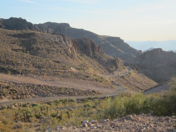
Soon the road starts climbing a little and winding a little. And then a little more. Just before the really hairy part begins there’s a service-station-turned-gift-shop that’s so Route-66-ish it still has the original tall, skinny gas pumps from the ’60s.

Then it’s nothing but cliffside switchbacks on a badly cracked road for about a half hour.

Just when you get to the other side of the mountains and the road starts to calm down again you realize that you’re officially in a desert and it’s become unreasonably hot out despite the setting sun. And that’s about when you arrive in Oatman, a tiny Old West town with saloons and everything.


And when I say “everything” I’m including the several donkeys who are randomly walking the streets. Yes, donkeys.
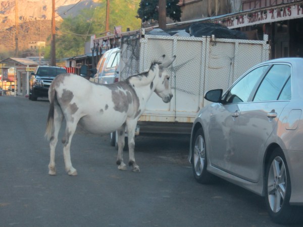

In fairness, there was a donkey-crossing sign a couple of miles back.

Some more desert, a couple more little towns, and finally we reached the California border. We’re not quite at the end of Route 66 and we’re nowhere near the end of our journey, but we have now literally crossed the country.
Needles is not a big city by any measure. But it is hot. By the time we got to our motel the sun had set but the temperature had somehow risen to 104. A half hour later, when it was completely dark, things cooled off to a much more palatable 101. And if the temperature wasn’t strange enough, our motel certainly is.
We’re staying in a brand new Quality Inn which is in the same building as a Rodeway Inn and they share a lobby. When we arrived the only woman working in the lobby was going back and forth between the two front desks answering the phones of both motels. Unfortunately for everyone involved, she is the slowest-moving hotel industry employee I have ever seen. We were the only people in the lobby but almost 10 minutes passed before she finished checking us in. It turns out that her lack of speed is complemented by her lack of skill. First the keys she gave us didn’t work. She reset them and they worked perfectly. But when I got the door open the family who was already in the room was pretty surprised to see us. Well, I’m not so sure it was a family–there was a man in his late 50s and two girls who looked about 16 and were both wearing towels while sitting in bed watching TV. You’re welcome to draw your own conclusions and write your own backstory, but this is a child-friendly road trip and I’m sticking with “family.”
Eventually everything got sorted out but we didn’t enter our actual room until about an hour after we arrived at the motel.
It was a long and strange day. But I bet it was even longer for the truck driver who came all the way from Alaska.
Tightrope Walking
I cannot overstate how anxious and terrified I was about Tuesday going horribly awry.
The plan was to visit Antelope Canyon in the morning and then meet back up with Route 66 in Flagstaff in the afternoon. Antelope Canyon, if you don’t know, is on just about every list of coolest/craziest/most beautiful places in the world. In fact it was just one of those lists that made me think of visiting Antelope Canyon in the first place, and I was thrilled to see it was basically on our route. In fact, we drove right past it on our way to Bryce Canyon a few days ago.
But Antelope Canyon is on Navajo Land, and the website is a little confusing, so I’ve been calling the Navajo office for days and days to get things sorted out but they never answer the phone and never call me back despite several messages. It doesn’t help that we have had extremely spotty cell service for the past several days as we’ve been in mountains, deserts, and National Parks, and our motel Sunday night had no wifi. Monday night when we checked into our motel I finally got online again in a bit of a panic and discovered that Antelope Canyon can only be visited with a guided tour. I frantically started looking up and calling tour companies but it was already late at night and only one place picked up the phone. She said she was completely booked for Tuesday. This was not good. This was definitely not good. I was expecting Antelope Canyon to be one of the highlights of our whole trip, and it looked like we might not be able to go at all.
Making things worse was that what I thought was a single canyon is actually two: Lower Antelope Canyon and Upper Antelope Canyon. They’re very close to each other and very similar but different tour companies visit each one and I couldn’t seem to find any useful information about which one is better. There are many more tours available for Upper Canyon than there are for Lower Canyon, and the Upper Canyon tours are more expensive, but I couldn’t find any real reason for the disparity, so I had to assume that Upper Canyon is the better one.
Also, I discovered that the best time to go is midday when the sun is highest, as the way the light bounces off the canyon walls is what gives it its beauty. But of course those tours sell out fastest.
What I decided to do was to wake up early and get to Antelope Canyon as early as possible. On the way there, I would call every tour company until I found one willing to take us, even if that meant going at off times and missing out on the fun stuff we had planned in Flagstaff.
Working in our favor was Arizona’s stupid refusal to observe Daylight Savings Time, which meant that it Arizona time is an hour earlier than Utah time. This gave us a chance to get to Antelope in time for the first peak-time tours if any still had room for us.
One by one, Sam dialed each tour company for me as I drove. We called the Upper Canyon places first. The first tour company didn’t answer. The second had room for us on the 12:30 tour! This meant we could see the canyon and see it at the ideal time of day. But it also meant that we would not get to Flagstaff until about 4 p.m. and would thus miss out on the awesome treetops ropes course we were planning to do there (the last entry to the ropes course is at 3). It was worth the trade-off, but it was a tough blow as we had both been excited for the ropes course. So I continued calling tour companies.
The third was sold out for the day. The fourth had room only on their 3 p.m. tour. The fifth didn’t answer. Then I lost cell service. When I got it back we were only about half an hour away from the Canyon and quickly running out of time. I was getting more anxious. Finally I started calling companies that tour the lower canyon. There are only two such companies. The first one I called said they don’t take reservations and that they run tours every 15 minutes. This sounded promising. Then he said that, while they’re already busy today, we would probably have to wait only about half an hour or so to get onto a tour. This was very good news. We were on schedule to arrive at around 9:30 a.m., which meant we’d be on a 10:00 tour, we’d see the canyon, and we’d even get to Flagstaff early. I started wondering if maybe we should forget Flagstaff and see both canyons–lower at 10 and upper at 12:30. Sam was very upset at this idea. He was adamant that he did not want to miss out on the ropes course. So it was settled–we’d see the lower canyon and then head to Flagstaff. It wasn’t ideal but it was good enough. I was relieved that it was going to work out but I was still tentative about seeing the “wrong” canyon.
When we arrived at the lower canyon we were once again greeted by unpaved dirt roads. I don’t know what the Navajo Nation has against asphalt and I can’t decide if this aversion is charming or infuriating. Also, the offices of the tour company, Ken’s Tours, were a little wood shack and some benches. My anxiety was sticking around a little longer.
We got there at around 9:40. We were told the next available tour was at 10:30. It was a bit more of a wait than I expected, but at least we were on a tour. While we waited I asked someone the difference between the two canyons. It turns out that the main reason the Upper Canyon is so much more popular is that it’s above ground versus below ground and it’s a little wider and flatter, so it’s easier to walk through. The Lower Canyon tour involves descending and ascending a few steep ladders. Honestly, this made the Lower Canyon a little more attractive to me. And I figured it could only be a good thing that our canyon was the less crowded one.
As soon as we stepped into the canyon, I knew things had worked out for the best. There are words to describe the beauty, the uniqueness, and the otherworldliness of Antelope Canyon, but I have spent all day trying to think of them and put them together into coherent sentences and I am still at a loss. Please be patient with me.
Antelope Canyon is a slot canyon, which means that it’s basically a ridiculously narrow canyon, like a slot has been carved into the earth. In fact, from above it looks like a big jagged crack in the desert, kind of like a cartoon earthquake.
[For reasons beyond my comprehension I am still unable to upload any new photos to this blog. This is especially frustrating today because the wifi connection is pretty strong and because the pictures from today’s activities are especially good and especially important to your appreciation of the day’s events. Alas.]
Inside, however, is a completely different story. The walls are not jagged but smooth and gently curved but in random directions, as if they were made of frosting that was spread by a giant, drunken pastry chef. The incredible shapes of the walls alone would make this place worth visiting. But that’s not all. The curvature of the walls and the tiny slivers of sunlight that sneak through the crack above combine for some of the coolest colors and light effects you’ll ever see.
Our tour guide showed each person individually how to change the light settings on their cameras to maximize the awesomeness. He even set up Sam’s iPhone so that it took some pretty extraordinary shots. But no matter which way we turned the view was so incredible as to be barely comprehensible. Every picture I took was the best picture I’ve ever taken. And a few second later, someone else took a picture in the exact same spot and get a completely different effect because the sun had moved ever so slightly. Sam and I were comparing pictures tonight and he and I have totally different pictures of the same canyon walls. Some of mine are better, some of his are better, and sometimes both are extremely cool but in different ways and with different colors.
[Many mind-blowing photos to come.]
When the tour was over Hamster and I didn’t even know what to say to each other, except to quote the kid in the video clip above at the very end of The Incredibles. I couldn’t believe that what we had just seen is on the very same planet that I’ve been living on all this time, and in the same country, no less.
And it was only noon. The sky was clear, the sun was out, and we headed to Flagstaff with the top down and huge grins that wouldn’t go away.
[Photo to come.]
We were so exited to get there and do the ropes course that instead of stopping to put together a real lunch we just ate peanut butter out of the jar while we drove. Our love of peanut butter, the fantastic weather, and our giddy moods led us to compose an entire song about the awesomeness of peanut butter. (I considered recording video of us singing this song but decided our peanut butter ballad is best left between the two of us.)
Lots and lots of construction on the highway slowed our progress toward Flagstaff considerably. I was planning to visit either Sunset Volcano or Walnut Creek, which are both National Monuments on the outskirts of Flagstaff, but we had to forget about that as time continued ticking away. In the end we made it on time for the ropes course, but the course takes 3-3.5 hours so it was going to be all we did in Flagstaff.
It was plenty. When we got there someone was screaming for an ambulance. Sam was immediately terrified and ready to call the whole thing off. It turned out that a kid was goofing around and climbing a tree that was not part of the course and when he slipped a branch stabbed him pretty badly in the leg. Sam was a little reassured that the injury was unrelated to the course but he was still nervous. I calmed him and convinced him to press on. A few minutes later we found out that we would be the only people in the last group of the day, meaning we had the whole course to ourselves. This turned out to be true in more ways than one, as the guides stay on the ground as insurance rather than leading you through the course, which means it was totally on us not just to get through each obstacle but to properly clip and unclip ourselves at all the right places and times. The autonomy made it both scarier and better, as every challenge passed was an accomplishment entirely our own.
The place has a kids course but Sam is old enough and tall enough to be allowed on the adult course, and I thought it would be much more fun if we went through the same course together, even if it meant we had to bail out if there was something Sam couldn’t do. I had no idea what I had signed us up for. Usually anything with “Extreme” in its name is considerably less extreme than it wants you to believe it is; Flagstaff Extreme Adventure Course lives up to its billing. The course has five levels, each one higher in the trees and more physically demanding. There were twisting bridges, tightropes, zip lines, swinging log bridges designed with increasing creativity and sadism, and so much more.
[Photos to come.]
About halfway through we had to grab a big rope and swing across a long expanse, only to then have to grab onto a cargo net and climb the net to get to the next platform.
Sam rocked it. He kept up with me through every challenge, level after level. We had been chatting with the guide on the ground the whole time, and after we finished the second level he called up to us to say we were the first peaople from the east coast who weren’t out of breath at that point. I asked him if many people quit before finishing all five levels. He told us only 25% actually finish. Sam and I looked at each other: challenge accepted.
As it got continually higher and more difficult Sam handled it like a pro. By the end of level three we were getting tired but we pressed on. Level four was a killer. Everything swung. Everything twisted. It required upper body strength that we had when we arrived but had mostly used up by this point. But we did it.
[Photo to come.]
When we got to the platform to start the final level we had been climbing and balancing and pulling and zipping for almost two and a half hours. Everything ached. Our hands felt like leather. I couldn’t believe Sam had gotten even this far. I asked him if he wanted to continue. He debated, first internally and then aloud. He was spent, but he didn’t want to quit. But he had nothing left. But he wanted to finish. We looked ahead at what was included in the final level: an unreasonably long twisting bridge. A pirate crawl. Swinging pogo sticks. A shaky ladder. Olympc rings. And just when you have absolutely no upper body strength left, another cargo net.
[Photo to come.]
Sam decided that four levels was enough for the day. He was annoyed at himself for not finishing but the guide quickly reminded him that it was an adult course and most adults don’t even get as far as we did, let alone finish. I was so proud of Sam for his mental and physical strength that I let him spend much more in the gift shop than his usual budget. He settled on a red T-shirt, the color of the last level we completed. He earned it.
Exhausted but proud of ourselves, we checked into a surprisingly nice Quality Inn for the night, but it was only about 6 p.m. and the weather was absolutely perfect and I wanted to explore Flagstaff a little while we had the time. I asked one of the Flagstaff Extreme guys for a suggestion and he said we should just wander around downtown Flagstaff, which is centered around Route 66. (It’s actually called Route 66 here!) I asked the same question of the woman at the front desk of the Quality Inn and she said the same. That settled it. After a quick and well-deserved car wash we jumped back on Route 66 for the first time in almost a week and we headed downtown. Downtown Flagstaff is pretty tiny–just a few blocks in each direction–but it’s lively and quaint and hip and charming all at once. Historic bars and restaurants and shops mingle with new ones, and people of all ages were walking around, and there were even a handful of parking spots scattered around. The locals’ recommendations panned out perfectly.
Eventually the exhaustion and hunger were too much for us and we went back to the motel to have dinner and get ready for bed. As I write this Sam is asleep in bed, wearing his new red T-shirt.
I was so scared that this day would be a disaster but instead it was thrill after thrill. Every single thing worked out exactly perfectly, or even better. It wasn’t just one of the best days of this trip, it was one of the best days, period.
Zionism
[Please excuse the lack of photos in this post. I’m not sure whether the problem is with WordPress or with the mediocre motel wifi connection, but every time I try to upload anything I get an error message. I’ll circle back to this post and the others in a day or two when the tech issues have been resolved.]
I don’t think my hopes could have possibly been higher for Zion National Park. Several friends raved about it. Every list of the best National Parks mentioned it prominently. Plus today many of the Jews in New York attended a rally outside the UN in support of Israel, and although we couldn’t be there we were in a park called Zion, so there had to be something to that, right? Yeah, I know it’s a bit of s stretch, but Israel is at war and my family is hiding from rockets and Jews in my own country are being told to go to gas chambers by neighbors and classmates who claim to be advocating for freedom and equality. It seems like the whole world has gone into a tailspin while I’ve been running around the country playing and having fun, so I’ve been dealing with a little bit of guilt. You can forgive me just this once if I see some sort of symbolism in my visit to Zion.
On a lighter note, the day started with great promise. The sun was out, the heat was reasonable, we drove with the top down, and our journey to Zion–sorry, the drive to Zion–took less than an hour and a half. We entered the park from the east, which meant we had a 20-mile drive through winding roads to get to the Visitors Center, but along the way we saw a bighorn sheep and lots of interesting rocky hills that looked like they were made out of still-liquid cake batter. We didn’t realize it at the time but we learned at the Visitors Center that bighorn sheep have only recently been reintroduced at Zion and are pretty rare sightings, so we were rather lucky to see even just the one.
We also stopped off for our first hike of the day, a 1.5-hour hike up rocky terrain that was not easy but ultimately gave us incredible views of the canyon below.
From there we drove through an extraordinary mile-long tunnel through solid rock that deposited us in a different world, where we were suddenly surrounded by monstrous sandstone cliffs.
When we got to the Visitors Center, however, things started going downhill. I knew the park has a free shuttle bus that makes several stops at points of interest throughout the park. What I didn’t realize was that the bus is mandatory–no private vehicles are allowed in the main parts of the park. The purpose of this Draconian rule is noble: to manage crowds and to cut down on pollution and damage to the park caused by those crowds. I appreciate these goals, I really do. But this policy caused several problems. The biggest was that there was nowhere to park. When you require everyone to leave their cars behind, the very least you should do is to give them somewhere to put their cars. Parking at the Visitors Center is woefully inadequate for the number of visitors required to park their cars, and of course the lot was full when we arrived. So we were told to exit Zion and park our car in the neighboring town, Springdale, where we could take a free shuttle bus to the park. Oh hooray, we get to take a bus to get to the bus! I actually got pretty lucky and found a parking spot a mere half-mile from the Visitors Center. It doesn’t sound too bad, but Zion is a hiking park; there’s not really anything worthwhile you can see or do without going on at least a couple of hikes. But now I had to hike before I could even start my hiking! First a half-mile walk from the car to the Visitors Center to talk to a Ranger and hash out a plan for the rest of the day, then a half-mile back to the car to pack up what we needed for our hikes, then a half-mile back to the Visitors Center to catch the shuttle bus. We had walked 1.5 miles and we hadn’t even been hiking yet.
Leaving our car behind for the entire day also meant that we had to carry everything we would need for the entire day (camera, extra lens, two cans of sunscreen, two jackets, six water bottles, etc.) all at once. All that gear and water meant we had to carry extra weight on all our hikes, which made them more uncomfortable and more difficult and more sweaty. And then after getting extra sweaty we had to share our stench by getting on a bus full of other park visitors. Our hikes were not just more physically taxing, they were also less enjoyable. Our first hike, the Riverside Trail, runs alongside the Virgin River and allows hikers to wade in the river at several points. This was a welcome treat on a very hot day. But I couldn’t bear the thought of carrying different footwear for different hikes, not to mention towels and a change of clothes, so we left the sandals in the car, wore sturdy, comfortable shoes, and stayed out of the water. I considered taking our shoes and socks off temporarily, but the banks of the river were so muddy that it would have been a messy disaster.
And of course we forgot to pack snacks, so when we were famished after our first two hikes we then had to take the shuttle all the way back to the Visitors Center and walk that half-mile back to the car again to grab something to eat, then walk that half-mile a fifth time to catch the bus and resume our park visit.
Eventually I got over my annoyance at the park’s lack of user-friendliness that I’ve come to expect from National Parks and we enjoyed ourselves. The park is breathtaking. Unfortunately the best parts of the park were completely inaccessible to us, as they are to most people. The Subway, which is by far the coolest-looking part of the park, can only be seen as part of a 12-hour hike that requires permits and hiking skills and time that we don’t have. The Narrows, a hike through the river in the narrowest part of the canyon, is similarly demanding. Less intrepid hikers can just do the very beginning of the hike and turn back, but today heavy rains and flash floods were expected, so the Narrows was off limits. The third of the three most awesome parts of the park is Angel’s Landing, a cliff-top that offers extraordinary views of the canyon but requires a five-hour hike, parts of which are so steep and narrow that you have to hold onto chains to pull yourself up and keep yourself from falling off the edge of the world. Honestly I would have liked to give that one a try despite its harrowing nature, but I was with a 12-year-old and there was no way he could even hike on flat terrain for five hours, let alone balance on steep cliff edges going uphill the whole time.
The is the first park I’ve been to where all the really cool stuff is only for the most skilled and experienced and none of it can be enjoyed by normal people. As I was planning our day with the Park Ranger everything seemed like a consolation prize.
Our first hike, the one alongside the river, was highly recommended but turned out to be a little blah. The scenery was nice but not spectacular, the river was so muddy that it looked more like chocolate milk than water, and I was starting to wonder why everyone seems to love Zion so much.
The more we hiked, though, the more the day started to turn around. Our next hike was a relatively short one called Weeping Rock because it takes you to a wall of the canyon that leaks water and thus is partly covered by hanging gardens. The walk was pretty, the hanging gardens were cool, and we started to see a bit of wildlife (mostly squirrels but an occasional chipmunk, a couple of lizards, and a few mule deer in various places).
It was at about this time that we had to go all the way back to the car for snacks, but on the bus trip back we saw several deer, including an impressively antlered buck and a pair of does walking with three adorable fawns.
Our last hike of the day was the best. We walked about half a mile to what is called the Emerald Pool but is, in fact, brown. But instead of turning around and going back to the trailhead we picked up another trail called Kayenta, which was longer and took us in another direction and gave us new views of the canyon and the foliage. It also brought us to more hanging gardens and a group of teenage boys who started yelling across the canyon to hear their own echoes. We were hundreds of yards away from them but heard them clearly, and Sam eagerly joined in the yelping and was rewarded by hearing his own echoes and the boys’ responses.
While this was all going on the sky was getting progressively cloudy, and occasionally we heard thunder. Normally thunder does not worry me but it’s different when you hear it echoing off canyon walls. It’s louder, it’s longer, and it’s exponentially more ominous. It never did really rain though–just a few drops here and there, so the canyon made it out to be scarier than it really was.
By the time we exited the trail we were exhausted. But I was starting to get it. The voice recording that played every time we were on the shuttle explained that the park’s name comes from the Hebrew word for “place of refuge” or “sanctuary.” This road trip has been exhausting and we miss our beds and our family and friends, but it’s also been something of a sanctuary for us, a refuge from the events of the world, which have been so depressing and infuriating that I’ve been relieved to be able to tune out, at least to a much greater degree than I would if I were home.
On our way out of the park we saw two separate and large groups of bighorn sheep, one group climbing the rocks and the other nibbling shrubs along the side of the road. Their numbers are still dangerously low but clearly at least a handful of sheep have found their Zion.
Further along the road, outside the park, we passed a farm where we saw buffalo. My eyes were on the road so Sam spotted them first, and gleefully pointed them out to me. His glee turned to horror, though, when he noticed that right next to the farm was a restaurant called Buffalo Grill.
In the end we had a really good day and the park really is quite beautiful, even if it doesn’t have the same ease of use of most other National Parks and it didn’t quite live up to my (probably unrealistic) expectations. Honestly I think my favorite part of the day was watching Sam spend half the day trying to call his sister, who got her phone at camp today for reasons too complicated to explain here. We didn’t have reception in most of the park, and she didn’t have reception in most of the camp, so he kept calling her every time he got a signal and she kept trying to call him but they didn’t really get anywhere until we were leaving the park and they finally spoke for a few minutes. They bicker a lot when they’re together and it’s always nice to see glimmers of real caring and love between them. I’ll take that over a National Park every time.
