The Long and Winding Road
Today we drove the most exciting and breathtaking section of US 1. (We also spent just as much time driving on other highways, but I’ll get to that later.)
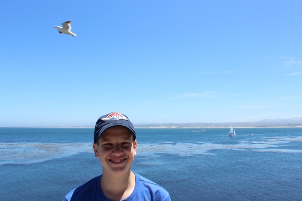
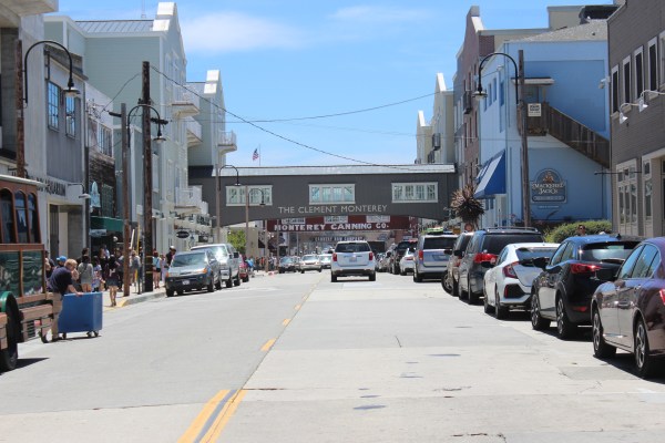
We started the day with an hour-long drive south from Santa Cruz to Monterey. (We also spent most of an hour driving north to Monterey, but I’ll get to that later.)
Monterey is a cute seaside town known mostly for its bay and its aquarium.


Despite rave reviews online, Sam and I were both largely unimpressed with the Monterey Bay Aquarium. It was nowhere near as robust or creative or fun as the National Aquarium in Baltimore or the New York Aquarium, or even the Tulsa Aquarium, and we were in and out in little more than an hour. Still, it had its moments. For one, it takes advantage of its location right on the water by offering several balconies with gorgeous views of the bay.
Other highlights included our introduction to the bluespotted jawfish, a small bottom-dwelling fish that uses its mouth to dig out a little cave home beneath a rock, spitting the rocks out at the cave’s entrance. Don’t worry, I got it all on video.
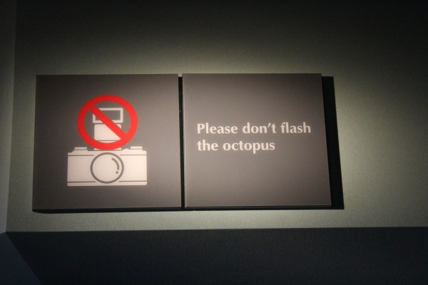
We also had a sudden urge to take off our shirts when we saw the octopus tank, but a sign above the tank kept us in line.
Oh, and there was also a live outdoor performance explaining the history of the city and the aquarium. Thanks to a woman in historical costume, we learned that, during and immediately after World War II, Monterey was known for as the sardine capital of the world, thanks to its booming sardine fishing and canning industries, but overfishing led to the disappearance of the sardine population within just a few years. By 1950 the city’s canneries were all shuttered.
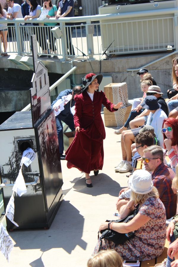
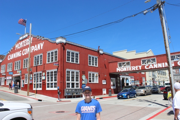
Today the buildings that once processed all that fish have been converted into retail space, with all sorts of tourist-oriented shops and restaurants populating the neighborhood still known as Cannery Row.
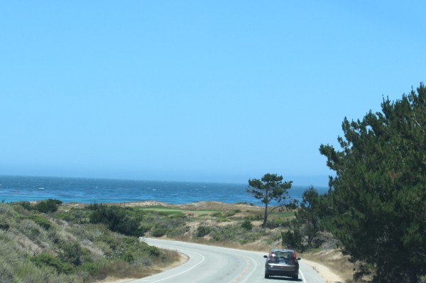
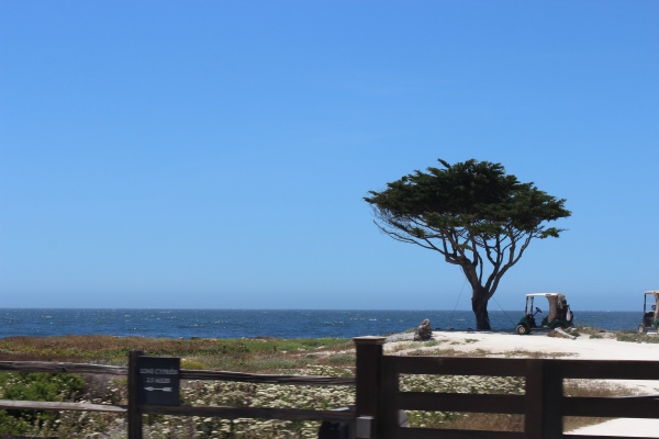
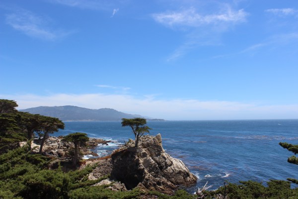
Just south of Monterey is the famed PGA golf course Pebble Beach. US 1 passes right by the golf course, but for $10.75 per car you can turn off the highway and onto a 17-mile private road that cuts through the community and the golf course, providing stunning views of the course and the white sand beaches and the ocean, sometimes all at once.
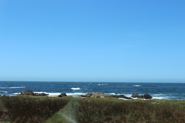
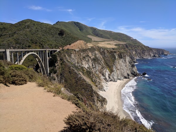
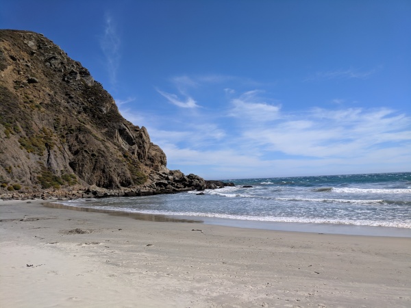
Back on US 1, we drove about 25 miles down a winding coastline on the edge of cliffs that plunged right down into an ocean so blue and gorgeous that the sky must have been jealous. This took us to Big Sur, a region loaded with beaches and forests and state parks. Our first stop was the iconic Bixby Bridge, which did not disappoint.
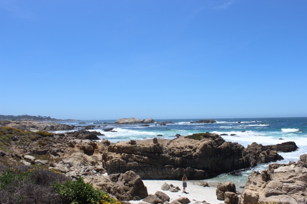
From there we headed to Pfeiffer Beach, a private beach just beyond Big Sur State Park, but as we turned onto the private road that would take us there we were stopped by an employee who was blocking the road and turning away all visitors because the parking lot was full. It was about 3:30pm, a time of day when many beachgoers tend to head home, so he told us we could check back in 15 minutes or so and maybe by then some folks would leave and we’d be allowed in.
We gave up and headed further south to our next destination, but before we got far we came upon a gas station and stopped to use the bathroom. By the time we got out, we decided we would give Pfeiffer Beach one more try, and sure enough the road was open and we were allowed in. To get to the beach we had to drive two miles down a narrow, winding, rutted road, but once we finally got to the end we found parking with no trouble, changed into flip-flops, and made our way onto what might be the most unusual beach I’ve ever visited.
I guess you could say it was a … wait for it … Big Sur prize.
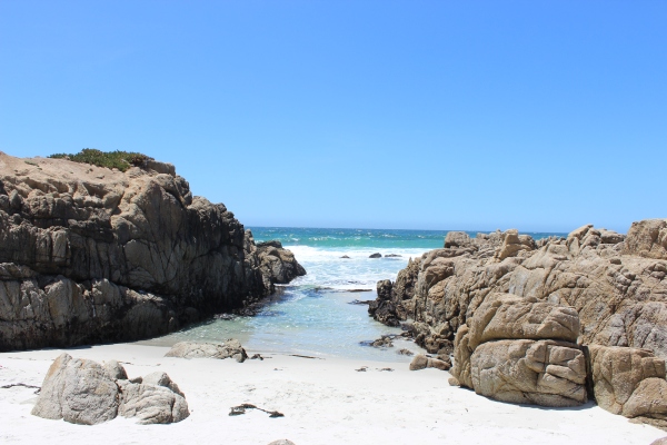
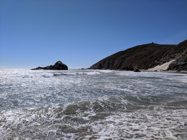
An enormous rock formation split the beach into two smaller beaches, but years of waves and salt had worn a hole through the rock, making a kind of doorway for water to come through. Other large rock formations a bit further out had similar natural arches as well.
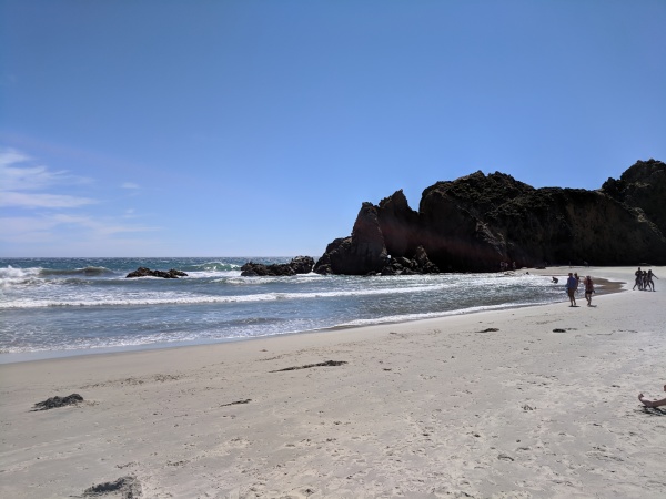
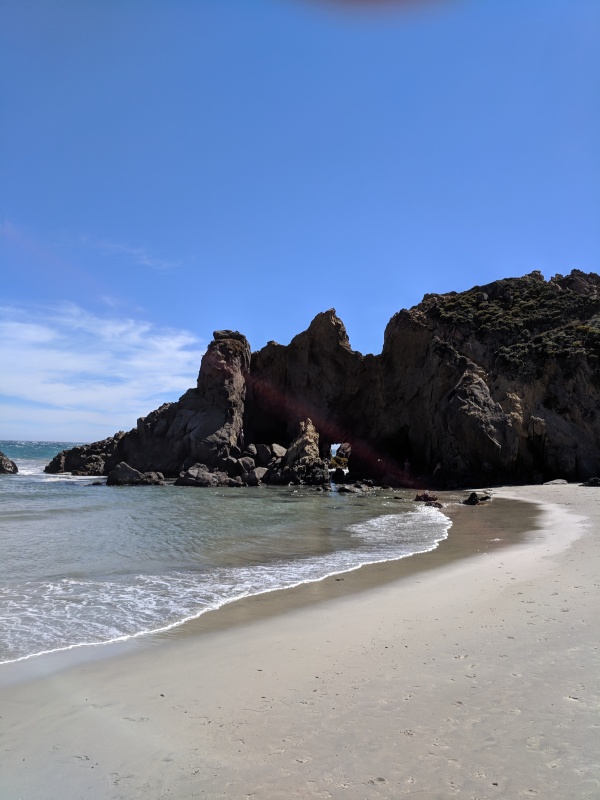
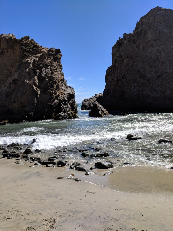
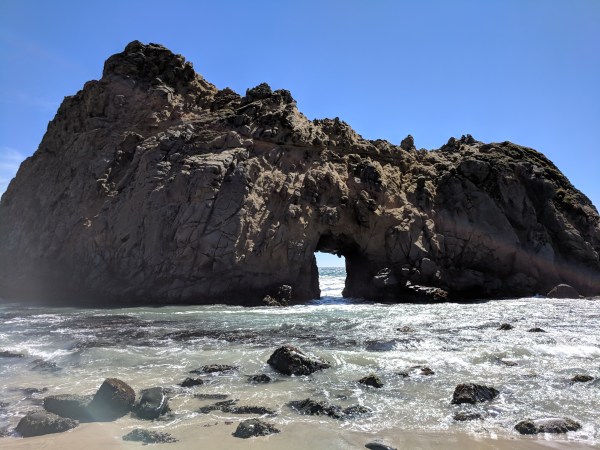
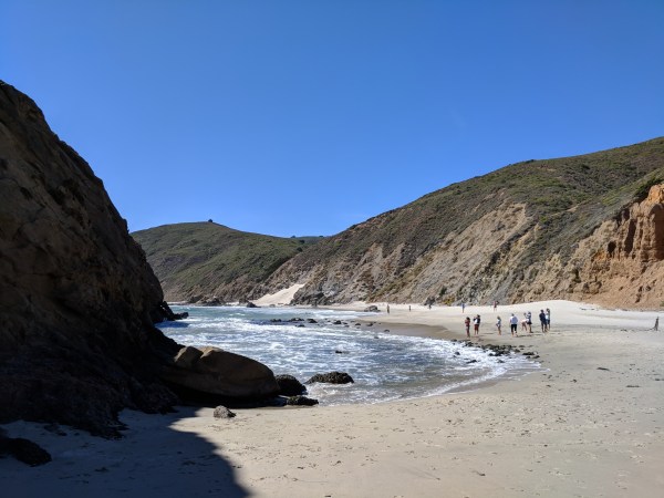
Meanwhile the sun was bright and hot but the wind was so strong that we were quite cool, and the incredibly soft sand was cool to the touch as well. When we put our feet in the ocean we were shocked by how cold it was. (I’m guessing it was somewhere between 45 and 55 degrees). We had a great time wandering around different parts of the beach, seeing the rocks and arches from different angles, watching the waves smash against and through them.
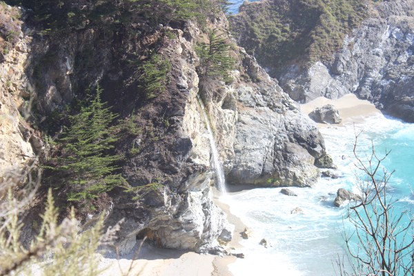
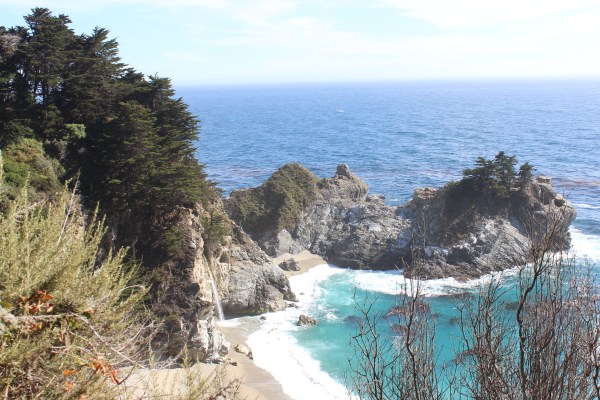
A few more miles down the road was yet another state park (Julia Pfeiffer Burns State Park, to be specific). This park is not very big but it has a picnic area and a cool waterfall, so we figured it was worth a visit and would also be a good place to have dinner.
A short path leads from the parking lot to an overlook where we were able to see Mcway Falls, a 60-foot waterfall that drops directly onto a beach that looks more like a tropical lagoon. If I had seen it in a movie I would have thought it was too perfect to be real, but there it was before my eyes.
Back in the picnic area we had an early dinner of hanburgers, and we were back in the car just after 6pm.
Our next stop was Hearst Castle, the massive and gaudy structure built decades ago by magazine magnate William Randolph Hearst, but it’s a couple of hours further south in San Simeon, so the plan was to get to San Simeon tonight and tour the castle tomorrow morning.
Under normal circumstances, we would have continued south down US 1, but about 16 months ago a massive fire did so much damage that a 60-mile stretch of US 1 just north of San Simeon has been closed ever since. To get around the closed section, drivers have to head about 15 miles east and take US 101 instead, and then head back west to US 1 once they’re past the closed section. That’s not terribly inconvenient–unless you happen to be in Julia Pfeiffer Burns State Park with no cell reception and you didn’t think to check your route in advance. I had a strong suspicion that I had to head back north a little ways on US 1 to get to a road that crosses over to 101, so that’s what we started to do. Seven or eight miles later, we still had no reception but we came to a restaurant/inn and I pulled in so I could ask for directions. An employee there gave me some good news and some bad news. The good news was that I had guessed right and I did indeed need to head north in order to cross over. The bad news was that I had to drive much further north than I expected–all the way back to Monterey!
A few miles later, cell reception returned and Waze confirmed what the guy at the restaurant had told me. Luckily, it was still relatively early in the evening, so we had time to do all that driving. I had been driving much of the day and wasn’t really looking forward to another 3.5 hours in the car, but it went quickly, and by 10pm we were checked into a decent motel in San Simeon, just a few miles from Hearst Castle.
It was a long day of driving (almost 300 miles altogether) and we were exhausted by the time we got to San Simeon, but there were so many extraordinary sights and fun experiences that it was a good kind of exhaustion. As I write this, Sam is already sleeping soundly, and is probably dreaming of detours, picturesque waterfalls and bridges, beautiful beaches, seaside golf courses, and rock-spitting fish. I just hope he doesn’t flash the octopus.
