Yosemite Hamster
The Hamster and I had been looking forward to visiting Yosemite National Park for about a year, and today was finally the day.
Yosemite is consistently rated among the 10 best National Parks, and the Hamster and I love National Parks. It’s mostly known for its many impressive waterfalls, and the Hamster and I love waterfalls. And the Hamster would finally have the opportunity to be Yosemite Sam.
Almost all of the most popular sights in the park are centrally located in an area called Yosemite Valley, so named because it is literally a huge, relatively flat, rectangular valley bordered by massive granite cliffs. Outside of Yosemite Valley there are millions of acres of mountains and forest of impressive beauty, including a couple of sequoia groves and several waterfalls, but the vast majority of visitors to Yosemite focus almost exclusively on the valley. From the south entrance, where we were staying, it takes almost 1.5 hours of driving just to reach Yosemite Valley, so even though we were staying only a few miles outside the park entrance, we knew we had a long drive ahead of us.
We woke up early, raring to go. Before we even got inside the park, though, we got some pretty disappointing news. Our first planned stop was Glacier Point, a long road just south of Yosemite Valley that leads to a short hike that leads to a scenic overlook of some of Yosemite Valley’s most iconic scenery. Just outside the park’s entrance was a sign announcing that the road to Glacier Point was closed. We asked about it at the entrance and were told that it was closed due to wildfires and would probably remain closed all day.
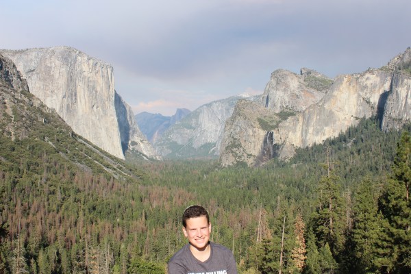
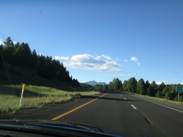
We were disappointed, of course, but we shook it off and headed straight for Yosemite Valley. Cars enter Yosemite Valley through a long tunnel, and the view waiting for you the moment you exit the tunnel might be the best view in the entire park. You’ve certainly seen pictures of it; in fact some computers come with a photo of the aptly named Tunnel View as the desktop background. This is what it usually looks like:

I didn’t take this photo; this is the desktop wallpaper version
Let’s deconstruct this into its individual components for a second. The trees comprising the bottom half of the photo are Yosemite Valley. The huge granite cliff on the left side is El Capitan, one of Yosemite’s most recognizable features. The two connected peaks on the right side are the Cathedral Rocks. The white vertical stripe below the Cathedral Rocks is Bridalveil Fall, a 620-foot waterfall that is one of the park’s most visited waterfalls. And far in the distance, jutting up into the cloud right in the middle of the photo, is Half Dome, maybe the park’s most iconic geological feature.
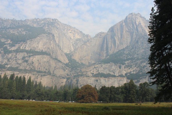
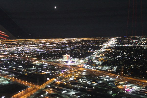
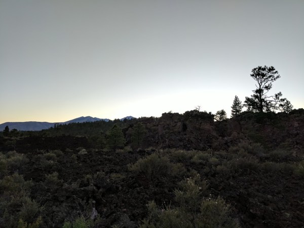
This view was by far Sam’s most anticipated moment of the entire day, his main goal for our visit to Yosemite. But smoke from that wildfire that closed Glacier Point Road had spread for miles, covering the entire valley with a thick smog. This was the Tunnel View we got as we entered Yosemite Valley:

We could make out only the outlines of the biggest cliffs, and we couldn’t see the waterfall or Half Dome at all. It’s still kind of majestic in it’s own way, but it’s far short of the original.
We wanted to get to the Visitor Center as early as possible so that we could get a parking spot before the park and its parking lots filled up, but on the way there we had to stop off at Bridalveil Fall so we could see up close the waterfall that we couldn’t see from afar. It didn’t disappoint.

I should mention that late August is a lousy time to see Yosemite’s waterfalls. Peak waterfall season is in Spring, when snowmelt contributes to the flow of water and makes the falls nice and full. By this time of year, some of the park’s waterfalls have already dried up, and those that still flow have diminished considerably over the past month or so. Nonetheless, we enjoyed the short hike to the falls, and the pretty view once we got there.
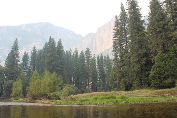
On our way to the Visitors Center we stopped off once more to catch a better view of Half Dome and to see the massive Yosemite Falls. The smog definitely diminished the views somewhat, but they were still much better than what we saw at Tunnel View.
Yosemite Falls has two parts, the Upper Falls and the Lower Falls. The much larger Upper Falls is seen here as a thin white stripe coming down from the top of the granite cliff a bit to the right of center. The dark shading around it shows how wide it is when it is at its fullest in Spring. Lower Falls is tougher to spot; it’s a short white line just above the trees, a little bit left of center.

I took this photo while standing on Sentinel Bridge, a spot known for its stunning view of Half Dome, both above the trees and reflected in the very calm waters of Merced River. The smog makes it much less striking, but you can still make out Half Dome’s outline here, both in the sky and the water.
When we finally got to the Visitors Center, we noticed something we haven’t seen at all on this road trip before today: humidity. We’ve had plenty of intensely hot days but, as they say, it’s a dry heat. Today the smog and clouds kept the temperature down in the 80s for most of the day, but the humidity steadily increased, becoming pretty unbearable by midday.
If I can digress for just a second, the area where the Visitors Center is located is called Yosemite Village, and it’s exactly that. There’s a deli, a post office, an art gallery, a museum, a general store, and even a cemetery. When we saw signs for the cemetery, Sam and I wondered what kinds of people might be buried there (Park Rangers? Idiots who die in the park doing reckless things like feeding bears?), and Sam was appalled that the park’s management missed the opportunity to call it “Yosemetery.”
Anyway, back in the Visitors Center, a Park Ranger helped us plan a robust itinerary for the rest of the day that included two hikes and a rafting trip, leaving room for a trip to Glacier Point at the end of the day if the road ever opened up. (Spoiler: it didn’t.)
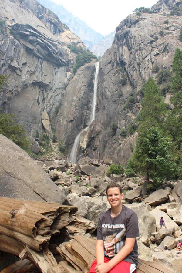
Our first hike was the shorter of the two, an easy half-hour loop to get a close-up view of Lower Yosemite Falls. We had stopped off at a CVS the previous night to buy a knee strap for Sam so he’d be able to hike without pain, and it worked. My blister, meanwhile, was still a little painful even bandaged up, but I was so excited to make the most of our visit to Yosemite that I didn’t mind the pain.
I was a little cranky as we walked to the waterfall, partly because of the smoke’s effect on our day but mostly because of our visit to the general store. You know when you’re in a very crowded store for much too long, and the combination of crowding and time use up all your patience and make you a little crazy and anxious and claustrophobic? That’s what happened to me today. So I needed to decompress as we left the store and headed toward the waterfall, but the humidity and the continued crowds were making it difficult. But then Sam turned to me at one point and suddenly exclaimed, “YAY!” with such a huge, excited grin that I couldn’t help but feel better. For the rest of the day, Sam would yell “YAY!” at random points here and there, just to express how excited he was to be there and how much fun he was having. And every time, I answered his “YAY!” with a “YAY” of my own.
The Lower Falls, meanwhile, turned out to be worth the trip.
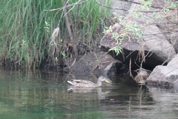
From there we took one of the park’s free shuttles to a different part of the Village in hopes that a longshot would pan out. When I woke up this morning I had a message waiting for me from my friend Heather, who visited Yosemite earlier this summer. She recommended renting a raft, which I didn’t even know was a thing. It turns out that, for $30 per person, you can steer an inflatable raft for three miles down the Merced River, which runs through the middle of Yosemite Valley. But the rafts get snatched up quickly, so I wasn’t confident we’d be able to get one. This time, luck was on our side. Not only did we procure a raft, but we were able to have one all to ourselves. (They normally put four people in each raft when they’re busier, but crowds were a bit smaller than usual today.)
As we got our raft orientation, the humidity reached a truly oppressive level and I was wondering if we were making a big mistake. Then we had to carry our raft about 200 yards to the riverbank, and I was sure we were making a mistake. But as we got onto the water Sam and I looked around and immediately realized how incredible it was. We drifted slowly down the calm, glassy river, surrounded on all sides by landscapes so extraordinary that we couldn’t even find words to express our wonderment. Behind us was Half Dome, in front of us was a stately stone bridge, to our left were towering pine trees, to our right were constantly changing views of Yosemite Falls, and visiting us now and then were the cutest, most playful ducks I’ve ever seen. Dipping feet and hands in the cold river now and then did a lot to alleviate the heat, and as we paddled down the river the smoke finally started to lift and the sky began to clear. Without question, the rafting trip was the highlight of the entire day.


“YAY!”


The only negative of our rafting trip was that, because the water levels are low this time of year, there were a few spots were the river was so shallow that we had to get out of the raft and pull it several yards until the water got deeper again. We did this barefoot, and Sam ended up scraping up the bottoms of his feet a bit in the process. That, in turn, necessitated the canceling of our final hike, a one-hour hike that would get us close to Half Dome for a supposedly great vantage point. Sam felt bad about causing us to miss out, and apologized heartily. But by this point we had gotten clear views of Half Dome from so many different angles that I wasn’t terribly disappointed about missing out on the hike.
That left us time to right the most important wrong of the day. Now that the sky was finally clear, instead of heading straight out of the park I took a slight detour. Exiting Yosemite Valley, I zig-zagged a little and got us back to the parking lot at Tunnel View. As I had hoped, the view was much better. In fact, it was downright desktop wallpaper worthy.
It was a perfect way to end an incredible day. We got back into the car and headed out of the park absolutely beaming. As we approached the park’s exit, we found a secluded picnic area that was a perfect place to have dinner. To celebrate our day we grilled the steaks I bought in Las Vegas, and as we ate them we watched the sun inch lower through a grove of fragrant pine trees.

Hours later, I’m still smiling.
General Sherman and the Three Bears
The upside of the ridiculous amount of driving I did on Sunday was that we woke up Monday morning just a few miles outside of the south entrance to Sequoia National Park.
As usual, we started at the Visitors Center. But unfortunately we got some bad news right away. Our plan was to drive north to the middle of the park (stopping along the way to see the main sights and do a bit of hiking) then head west and make our way out of the park.
We were hoping to do all this by 4 p.m. so that we could visit Cat Haven, a sanctuary for wild cats that’s also sort of a petting zoo. Cat Haven is just outside Sequoia NP to the west, but their last tour is at 4, so we had to hurry. I asked the Park Ranger for help planning our day under these particular constraints, and she immediately delivered the bad news: wildfires just outside the park’s west entrance had shut down that road, and if it wasn’t reopened, we’d be unable to reach Cat Haven at all, let alone by 4. In fact, when we were done touring the park we’d have to turn back around and exit the way we came in, which would not only be annoying, it would add an extra two hours to our evening drive to Fresno.
This was not the way we were hoping to start the day.
With less time pressure, we planned our stops and figured we would check in with a different Visitors Center that’s more centrally located once we got to that section of the park later in the day. By then, maybe the road would be clear and everything would fall back into place.
Almost as we got back in the car, we started encountering exactly the kind of natural beauty for which National Parks are best known, as well as some of the park’s namesake sequoia trees, and we spent quite a bit of time pulling over to appreciate the sights.


Eventually we made our first planned stop, which was at Tunnel Tree, a massive sequoia that fell over decades ago. It’s called Tunnel Tree because a tunnel has been carved through the enormous horizontal trunk, allowing cars to drive right through. We did, of course.
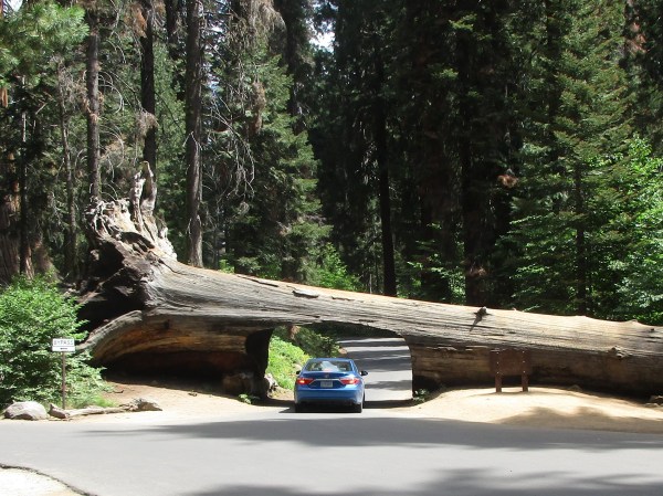

If you’re wondering, these two photos were taken by Sam, who got out of the car to do so just before I drove through the tree. While he was taking the first photo (from behind the car), someone called to him to let him know that he was standing right next to a bear.
The park is home to several hundred black bears, and Sam had almost backed right into a baby black bear and its mama. Luckily, Sam was more bothered by the encounter than they were, and came running back into the car unharmed.
When we finished driving through the tree we circled back around to try to catch a glimpse of the bears (from a safe distance this time). We did more than that: the baby bear turned out to have two other young siblings, and for several minutes we got to watch all three play. And they were adorable!


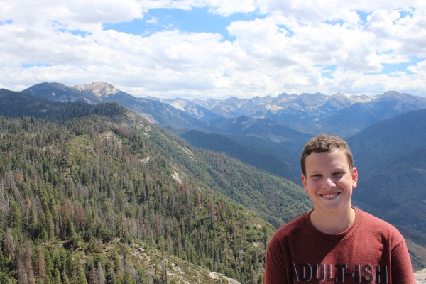
It’s hard to follow a show like that. Fortunately, our next stop was a showstopper in its own right: Moro Rock, a large, roundish rock that juts out a bit from a perch high above a picturesque valley. There’s a thin, winding path to the top that includes almost 400 stairs, but the breathtaking views from the top easily make the exhausting climb worthwhile.

Moro Rock, as seen from far below

The view from the top
The Park Ranger we met earlier had recommended that we visit Crescent Meadow, so that’s where we went next. A stream runs along one side of the meadow, and the other three sides are surrounded by a sequoia grove. It’s absolutely gorgeous.

The Ranger said that park wildlife can often be seen grazing there. Unfortunately, the only wildlife we saw there were a couple of squirrels and a very hungry woodpecker.

Also, poor signage in the parking lot near the meadow led us to believe that, rather than just picking one vantage point, we were best off walking the relatively short path that loops around the meadow. This turned out to be false in the sense that the loop path is more than 2 miles long, and we could have simply observed the meadow from a couple of easily accessible spots near the parking lot and then moved on.
On the bright side, the path took us through the sequoia grove, and we got to see some impressive trees up close without any of the crowds that flow through the more popular hiking paths. To give you a sense of the size of the trees, look for us in each photo:


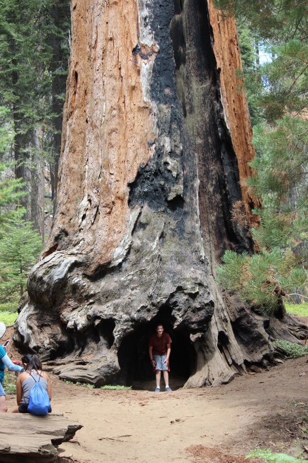
That last tree is called Chimney Tree because, if you walk through that hole Sam is standing in, you can stand in the center of the tree, which is hollow, and look straight up to the sky:

These, by the way, are not even such big sequoias. The biggest trees in the park get named, and they have well-trodden hiking trails taking people right to them. We were planning on taking one of those trails next (specifically, the very creatively named Big Tree Trail). But after climbing 400 stairs to the top of Moro Rock and then walking more than 2 miles around the meadow, I was developing a blister and Sam’s knee was throbbing.
(Sam, who has been going through a bit of a growth spurt this summer, has started having occasional knee pain while the various parts of his body catch up with each other. I had the exact same problem at his age, and the solution is simply to wear a knee strap. Sam left his at home because his knee had been feeling fine, but our National Park hiking has caused him some trouble.)
I was able to bandage my blister easily but Sam had no remedy for his knee, so I agreed to skip Big Tree Trail and Congress Trail, which is a 2-mile loop past many of the park’s named trees.
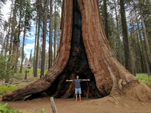
One thing I refused to skip, though, was General Sherman, which is not merely the biggest tree in the park but is the biggest tree (by volume) in the world. It’s the most popular spot in the entire park, and hundreds of people were already there when we showed up.

Again, for scale, find the tiny people by the base of the tree
Getting to General Sherman requires a relatively easy walk down a paved half-mile slope, and then back up, which would be no big deal if Sam’s knee weren’t bothering him. But he soldiered through, and after waiting on line, we finally got our photo op.
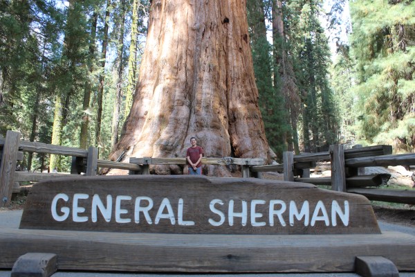

In case you’re wondering, General Sherman is 275 feet tall, and its base measures 36.5 feet across and 103 feet around. Its thickest branch is 6.8 feet across, and the whole tree weighs 1,385 tons.
After hiking back up to our car, we headed for the Visitors Center. There we learned that, yes, the wildfire had been contained and the road we needed was now reopen. This was great news, except that it was already 3 p.m., and it would take us approximately 1.5 hours to reach Cat Haven, so we were going to miss it anyway.
Oh well. At least we’d have a relatively direct drive to Fresno before heading north toward Yosemite for our next adventure.
With less time pressure, we stayed at the Visitors Center a little longer to shop for souvenirs and watch a movie about the bears that live in the park. Inspired by the video, Sam declared as we got back in the car that he wants to be the head of the National Parks Service someday, so that he can take better care of the bears and all the other plants and animals throughout the country. On our way out of the park, we spent much of the drive game planning the career path that would get him to such a position.
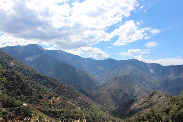
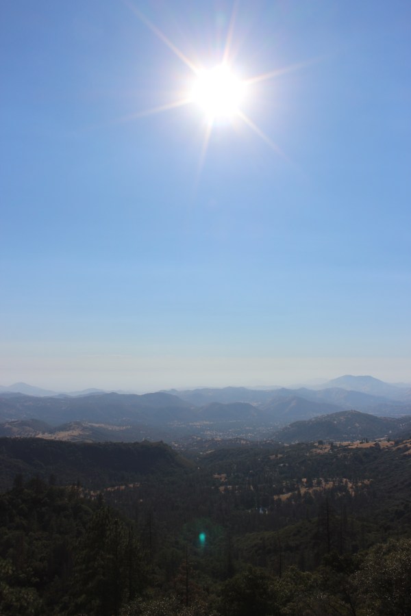
We stopped only once more, this time to admire a scenic overlook of Kings Canyon once we had crossed into its namesake National Park, which abuts Sequoia NP and features similar sequoia groves and scenic vistas.
Driving from one National Park to the next means smaller highways with no rest stops, and today we had to be creative about finding a place to grill dinner. (To give you an idea of the smallness of these roads, today we drove through the town of Merkins, CA. Population: 8.) Back in New York, Sarah came to the rescue, finding us Al Radka Park, a small public park in Fresno that has a beautiful baseball field, a small playground, and, most important to us, a picnic area. The park, of course, is named for the late, great Fresno radio personality Al Radka, but you already knew that.
One of the perks of visiting a park that features giant trees is that there’s shade almost everywhere. Yesterday we stood in 124-degree sun, but today stayed mostly in the high 80s–at least until we got to Al Radka Park. Apparently Fresno is going through a heatwave, and we sweated through dinner in 105-degree heat, even as the sun was setting. We spent the day gazing at trees, and as it ended, we needed one more than ever.
Burning Men

We thought it was hot in Las Vegas. Vegas was nothing.
Sunday morning started with a quick trip to the airport to drop of Sarah so she could fly home and get back to real life.
Down to only two road-trippers, we rearranged the car to make things more accessible, and headed out into the desert.
Two hours later, we had crossed into California and entered Death Valley National Park.
When Sam and I first started planning this trip, the idea of driving across Death Valley was pretty vague. We didn’t even know it was a National Park, and we certainly didn’t know that there was so much to see there. In my mind, I pictured myself spending a couple of hours driving across this:
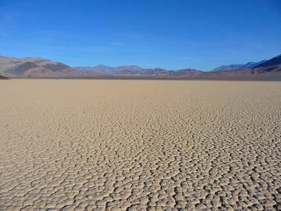
I learned today that the area in the photo is a dry riverbed called the Racetrack. But nobody’s allowed to drive on it, and even getting close enough to see it requires a 4×4 and several hours of driving, followed by some hiking.
We did, in fact, drive across Death Valley, entering from the east (as most people do) and exiting several hours later on the opposite side. But in between we saw some pretty extraordinary things.
Our first stop was Dante’s View, a scenic mountaintop view of the salt flats below.

It is named, of course, after the Italian poet Dante Alligheri, whose poem The Inferno describes a descent through the nine circles of hell, the lowest level offering the most unbearable punishments for only the most despicable sinners. From this mountaintop in Death Valley, one looks down into one of the hottest, lowest, and unforgiving places on Earth. The metaphor of a descent into hell is not the most cheerful of welcomes to the park, but it’s kind of fitting.
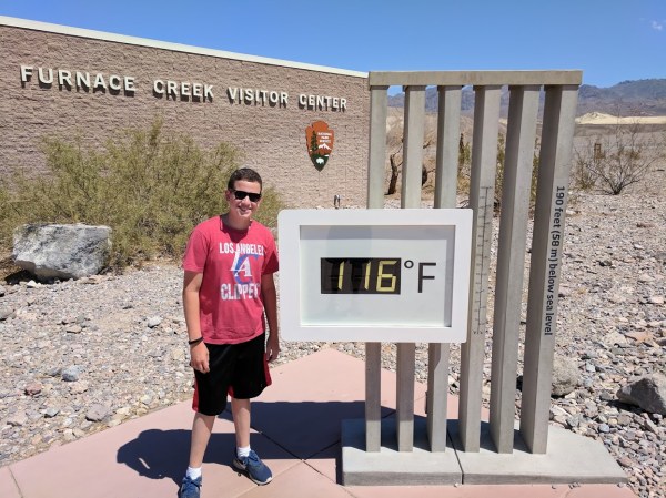
In case you’re wondering, it was about 10:30 a.m., and roughly 110 degrees.
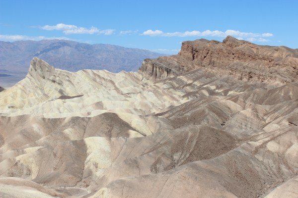
From there we took a quick detour to Zabriskie Point, another scenic viewpoint, this one requiring a five-minute walk up a paved hill, which is pretty easy in two-digit temperatures but noticeably less fun in today’s conditions. Nonetheless we made the short climb and enjoyed the view, especially the color striping in the rock formations.
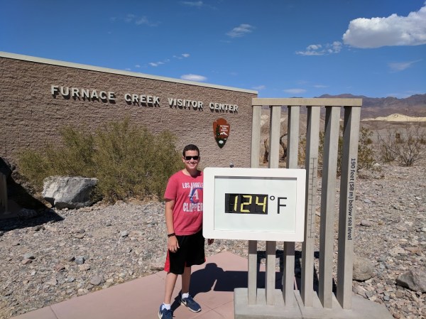
Up next was the Visitors Center, which has a big digital thermometer outside just for fun (and photo ops).
Inside, we watched a short movie about Death Valley. A helpful Park Ranger customized an itinerary for us that would include four more sites. He also told me that they were expecting the temperature to climb into the 120s and asked if we had enough water in the car (we did). Then he warned me that the road I’d be taking out of the park included a steep decline for about 20 miles; he suggested that I use low gear on this decline instead of my brakes, because sometimes when people use their brakes the whole way down, their cars burst into flames.
Wait, what?!
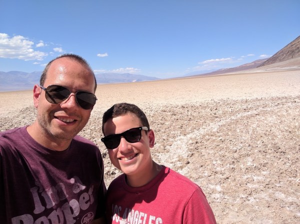
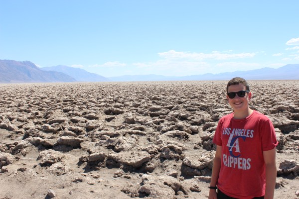
Yeah. Anyway, after we had a quick lunch in the car (while it was idling, so we didn’t die of heatstroke), we backtracked a bit and headed toward Badwater Basin, a salt flat that is the lowest point in North America.

Even cooler is that you can walk right out onto the salt.
Some people walked out pretty far, but Sam and I chose to stay relatively close. We were only out of the car for a few minutes, but that was enough to drench us with sweat. And with the exception of the covered parking at the Visitors Center, all parking areas are in direct sunlight. Even a nice, air-conditioned car heats up pretty quickly when you park it in 120-degree sunlight.
Our next stop was another salt field a few miles away. This one is called the Devil’s Golf Course, because the salt here is crystallized, creating a rocky, jagged landscape where you can barely walk, let alone play golf.
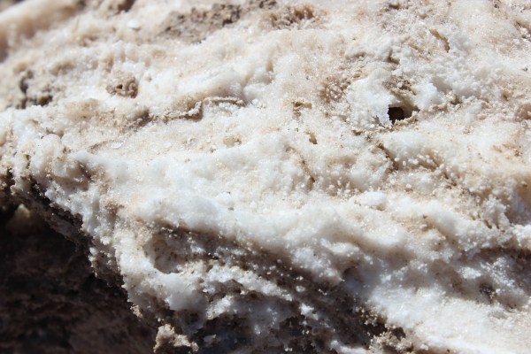
The real fun of the Devil’s Golf Course is the popping sounds. On especially hot days, the salt crystals get so hot that some of them explode, making a tiny popping sound kind of like a bowl of Rice Krispies. It was hot enough today, but we had trouble hearing the pops because the handful of other people and cars that were there were making too much noise. Eventually enough people left that I was able to hear a few pops, but Sam never did.
As we drove, we noticed that we could literally see the heat. You know how the air kind of wiggles right above a hot BBQ grill or above very hot sand at the beach? The air was wiggled everywhere we looked. It was mostly cool, and a little terrifying.
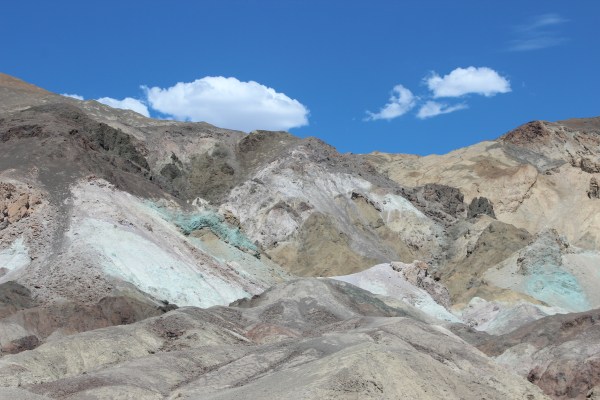
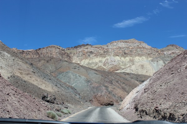
Up next was a one-way road called Artist’s Drive because it takes you past multicolored rocks that look like they’ve been painted but in fact come by their colors naturally. It was extraordinary, partly because of the rocks, and partly because the winding road kept surprising us with new views as we never knew what was waiting around the next bend. (It was also nice to be able to view things without leaving the car.)


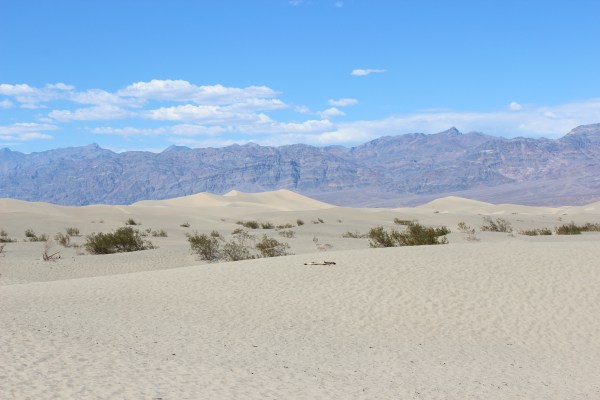
Our final stop within the park was going to be the massive Mesquite Sand Dunes. Our route took us back past the Visitors Center again, and by now the thermometer had moved considerably.
By the time we got to the sand dunes, it was so hot out that Sam refused to get out of the car. Part of me wanted to hike across the dunes to the top of the tallest one, but that part of me melted in the sun and I took only a few steps onto the sand before retreating to the relative comfort of the car.
Surprisingly, Death Valley is the largest National Park in terms of acreage, and getting out of the park required almost two more hours of driving. Happily, some of that driving was over the kind of steamy, stark roads I had imagined the entire park to be.

The car, to my surprise, was doing fine at this point, and when we finally got to that long downhill section I made sure to take the Ranger’s advice about downshifting. I am happy to report that my car did not burst into flames. Not even once.
Including Death Valley, Sam and I have now been to 20 National Parks together (plus lots of National Monuments, National Historic Parks, National Recreation Areas, etc.). It was definitely a memorable milestone.
Unfortunately, unlike most other National Parks, we didn’t get out of the car much, which meant I had done hours of driving even though we had really only gone to one place all day. And even once we escaped from Death Valley, we still had hours of driving through deserts to grapple with. We’re going to be spending Monday in Sequoia National Park, and there’s no direct way to get there from Death Valley. After leaving the park, I spent almost five hours driving down one- and two-lane “highways” with traffic lights, random intersections, and shockingly few signs of civilization. I was exhausted.
It was on one of these desert highways, by the way, that a hungry coyote was wandering as he looked for something to eat. Lucky for him and for us, it was broad daylight and I saw him in plenty of time to swerve around him. But our sudden spate of animals on the road has reached disturbing levels.
Meanwhile, we normally have dinner at highway rest stops, but these highways were much too minor for such amenities, and I started getting a bit nervous about finding a place to make dinner. Luck was on our side, though, as our route took us directly through a state park at just about 6 p.m., which was not only a good time for dinner but also let me get out of the car for about 40 minutes at a time when I badly needed to. As we pulled up to the empty picnic area, we noticed a few adorable bunnies resting in the sand. They scurried off when they saw us, but we had a nice dinner of hot dogs and string beans. About an hour later we finally emerged from the desert to see the temperature drop as grass and trees began covering the landscape, followed soon by farms.
All told, I drove about 500 miles today for a total of about 9 hours. But we made it to our motel by about 9:30, a Comfort Inn that is not very nice but totally serviceable and, more important, just 15 minutes from Sequoia.
As I collapsed on the bed, I checked the weather forecast for Sequoia: it’s going to be a mere 110 on Monday. Good thing we’ve got plenty of water.
Joshua
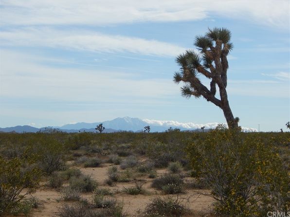
As we drove through various desert landscapes today, we passed hundreds of Joshua trees. I was happy to see them, as the Joshua tree is my favorite tree.
It is easy to look at the Joshua tree’s craggy bark, gnarled branches, and spiky flowers, and come to the conclusion that it is ugly. Most people reach this conclusion.
This is the wrong conclusion.
The Joshua tree is the most beautiful of all the trees. Its beauty does not come from impressive size or attractive colors or distinctive leaves or pretty flowers. It provides little shade, bears no edible fruit, and its wood is of little use.
Its beauty does not come from its outward appearance or its utility. Its beauty comes from its struggle.
The Joshua tree grows where no other tree could. It grows in the harshest of conditions–extreme heat, punishing winds, prolonged drought. But these hardships do not shake its determination. It reaches defiantly toward the harsh sun and the dry, withholding sky. In conditions where most plants cannot even exist, the Joshua tree thrives.
Every spike is there to fend off predators and soak up what little moisture can be found. Every kink in its branches is there because it got pushed around but did not give up.
The more twisted and gnarly it is, the harder it has struggled and the more it has overcome. Its perseverance is an inspiration. If it can overcome such punishment and survive here, surely we can persevere (and even thrive) despite our own hardships.
The Joshua tree is beautiful because it is ugly.
What Happened in Vegas
Getting to Vegas a full day early not only gave us some time to take things a bit slower, but also to enjoy the city more thoroughly than we had originally planned. We drove up and down the Strip (including going out of our way to see the “Welcome to Fabulous Las Vegas” sign), we wandered around inside the over-the-top lobbies of a few hotels, we took the monorail, we showed Sam how to play the slots (and, in the process, got him kicked out of the casino for being underage), we rode in the world’s tallest Ferris wheel (the High Roller, of course) for great views of the city during the day, we rode to the top of the observation tower at the Stratosphere (it’s the tallest observation tower West of the Mississippi) for great views of the city at night, we went to a minor league ballgame (the Las Vegas 51s, the Mets’ Triple-A team), we lounged at the hotel pool, we saw Floyd Mayweather’s entourage at the MGM Grand, and we took in a show (Cirque Du Soleil).
Photos of all these things are below, but first, a few thoughts on my first trip to Las Vegas:
- I can’t believe it took me 42 years to get here. Airfare is relatively cheap and the weather is pretty reliable. Why didn’t I come here sooner?
- There’s a ton of stuff to do here. I mean even beyond the gambling, drinking, clubbing, and various activities that are illegal in most other states. You like magic? There are 10 different magic shows at major hotels (David Copperfield, Penn and Teller, Criss Angel, and a bunch of guys you and I never heard of). You like dead musicians? There are concerts by tribute bands and impersonators of the Bee Gees, Michael Jackson, the Rat Pack, and about a dozen others. You like the 90s? Richard Marx is here, as are Boyz II Men. You like Cirque du Soleil? They have five shows here at five different hotels. You like rides? New York New York has a rollercoaster, Circus Circus has a full amusement park inside the hotel, and the top of the Stratosphere tower has four terror-inducing rides 110 stories above the Strip, including one where you literally just jump off the tower wearing a harness that slows you down as you get near the bottom. You like cheesy, fake tourist traps? The Venetian has gondola rides on a fake river and Paris has rides to the top of their fake Eiffel Tower. There’s quirkier stuff outside the strip, too. On Friday we went to a playable pinball museum where, for $20 in quarters, all three of us played dozens of old pinball machines and a handful of classic arcade games. (Sarah and I even made it onto the high score board on Tetris!)
- Everything here is a casino. The supermarket is a casino, the baseball stadium is a casino … there are slot machines and video poker machines in almost every store and business.
- Driving down the strip is exactly like it is in movies and TV shows. Palm trees line the divider, massive casino hotels line both sides, and there’s so much going on that it’s hard to decide where to look.
- The Strip makes Las Vegas look like a bustling city, but once you get a few blocks away from the Strip Las Vegas is not so much a city as it is one giant, soulless suburb. Strip malls and one-story houses for miles and miles in every direction, with almost no highways, office buildings, apartment buildings, or even discernible neighborhoods. For the past couple of decades Las Vegas has been one of America’s fastest-growing cities, but that’s because it’s surrounded by desert, so they just keep expanding the city’s border by building the same exact ranch house with light-brown stucco a million times until they hit the mountains. Driving around to the kosher restaurants and supermarkets, we kept thinking that we were lost because everything looks exactly the same. And looking down on the city from the High Roller or the Stratosphere, it’s easy to see that everything outside the Strip is uniformly flat until the light brown buildings end and the light brown desert starts.
- For a city that is literally built around vice, Las Vegas has a shockingly large Jewish population. The number of kosher restaurants here is impressive for any city that’s not New York, Los Angeles, Miami, and Chicago. There’s not much variety (every restaurant is Israeli, whether meat or dairy), but the sheer number rivals Philly and DC. There are even two nonkosher supermarkets that have robust kosher sections with fresh meat, baked goods, prepared foods, and more. All in a city known for gambling and prostitution.
- Vegas is not nearly as family friendly as the city’s marketing leads you to believe. Yes, there’s lots for kids to do, but to get to kid-friendly shows you have to walk through casinos and bars. There are ads for strip clubs and burlesque shows everywhere you turn. Even the innocent-looking candy shop we went into had a whole section of penis-shaped candies.
- I know it’s the City of Sin, but I was nonetheless surprised by how drunk everyone is, and not just an nighttime. Las Vegas rivals New Orleans for the number of tourists who are staggeringly drunk by 10 a.m.
- So many bros. So. Many. Bros.
- Even with all the negatives, we had a great two-and-a-half days here, and I would totally come back again. But probably without the kids.
Without further ado, here’s some visual evidence of our adventures:

If you don’t have time to visit the casino AND buy groceries, just visit the casino that’s inside the supermarket

The Las Vegas 51s have one of the coolest logos in baseball, but by far the ugliest ballpark.
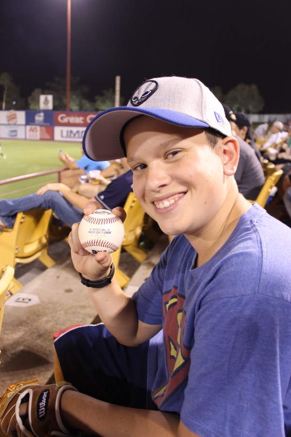
The streak continues! We only stayed for three innings because we had tickets to Cirque, but Sam still managed to convince the home bullpen to toss him a ball.
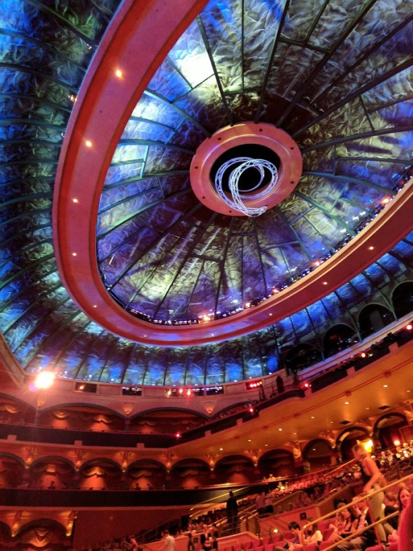
At Cirque, the ceiling of the theater was extremely cool, but it was nothing compared to the stage, which was sometimes a floor and sometimes a swimming pool of changing depths.

Concentrating at the pinball museum

That’s our initials at spots 7 and 8

The view from the top of the Ferris wheel
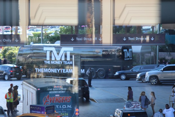
Mayweather arrives at the MGM Grand

View from the monorail


Which is better: the Las Vegas sign itself, or the sign that tells people where to find the sign?


The Strip at night, as seen from the top of the Stratosphere
See how flat it is? And how the lights just suddenly stop? That’s not the horizon, it’s just where the city ends and becomes desert.

The lady in the doorway is about to jump off the 108th floor. She paid $119 for the privilege.
Dam, That’s Big!
With our second day of Grand Canyon adventure scuttled by torrential rain (in the desert!), we skipped ahead on Thursday to our next stop, the Hoover Dam.
To get there, we had to drive a chunk of Route 66 to Kingman, Arizona, before heading north on a different highway. It felt weird driving on a long stretch of the exact same road we drove on our Route 66 road trip three years ago, seeing the same signs and businesses again.
The last time we were in Kingman, we had fun visiting an alpaca farm, and Sam wanted to take this opportunity to stop buy and pet the alpacas, but the farm was closed for a private event, so on we drive to the Hoover Dam.

Let me just start by saying that visiting the Hoover Dam is very different in real life from how it’s portrayed in the movies. In the movies, the protagonist is the only person there, and he/she drives right over it and then stops in the middle to have a conversation/argument/proposal/moment of introspection. Absolutely none of that is possible in real life.
First, the Hoover Dam is not on the way to anywhere. You have to get off the main highway and then drive for three miles down an extremely windy road in order to get there. Then you have to stop at a security checkpoint and get waved through once they’re reasonably certain that your car is not a bomb. When you finally get to the dam, there’s a very slow-moving line of cars driving across it, as well as about 1,000 pedestrians wandering around, taking photos, and going into the wrong bathroom (I’ll get to that later). The bottom line is that there are no private moments here. This is not a place for introspection or major relationship milestones, it’s a power plant that’s popular with tourists.
[Most people learned in high school that the Hoover Dam was built during the Depression, commissioned by President Hoover not necessarily to create temporary jobs for those who built it but in fact to use the Colorado River’s energy (the same energy that carved the Grand Canyon) to produce huge amounts of electricity, thus increasing supply and lowering costs for struggling Americans. It had the side benefit of creating Lake Mead, a massive lake that provides year-round enjoyment in the form of an oasis in the middle of a desert, but that was a byproduct. The dam is an engineering marvel, and it is beautiful in an industrial sort of way, but it has always been first and foremost a power plant.]
Also, the Hoover Dam is not free. You can drive across for free, but if you want to get out of your car, you’ve got to pay $10 to park. Want to visit the Visitor Center? That’s another $10 per person. Want a tour? The power plat tour is $30 per person, but if you want to include the actual dam in your tour, that’s $50. You might say that the place is dam expensive.
I actually did say that while we were there. One of the best parts of our visit was the opportunity to make “dam” puns all day. As soon as we got there, Sam announced, “I need to pee. Where’s the dam bathroom?!” We joked about the dam view, the dam tourists, and any other dam thing we could think of. We had a pretty great dam time.
Originally we had planned to take the full tour, but it was such a dam ripoff that we decided to just wander around on top. My favorite part (other than all the dam jokes we made) was the clock towers. The dam straddles the border between Arizona and Nevada, and on each side there’s a tower displaying the time in that state.


As you can tell if you look closely at these photos, the time in both states is the same, which kind of defeats the purpose of the separate clocks. The two states are in different time zones, but Arizona doesn’t believe in Saving Daylight, so for about seven months each year, it’s the same time on both ends of the dam.
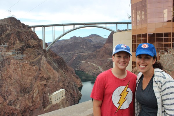
As we walked across the dam enjoying the views, we noticed something else interesting. A largely unknown but almost as impressive part of the scenery is a massive arch bridge that spans the Colorado River and perfectly frames the desert mountains behind it. In fact, you have to drive over the bridge to get to the dam. Standing on each one provides a stunning view of the other.
By the time we finished walking across the dam and back again, I needed the dam bathroom myself. Lucky for me, there is a shockingly ornate public bathroom built right into the dam.

Notice the gold door and the Art Deco sign outside
This is what you see when you walk through that gold door: black marble, and more gold
Now would be a good time to point out the two women coming out of the men’s room. Clearly they did not notice the sign outside that says “MEN’S ROOM,” or the white lettering on the black wall that says “MEN’S ROOM,” so as they were walking up those stairs and I was walking down, I said to them, “This is the men’s room.” They ignored me, so I said louder, “This is the dam men’s room!” They ignored me again, and as they walked into the men’s room they exclaimed in disbelief, “Oh! This is the men’s room!”
Dam idiots.
When we stopped in the gift shop, I dared Sarah to tell the guy at the counter that he had a nice dam store. She did, and then asked him how many times he’s heard that joke. To our surprise, he earnestly said she was the first one to say it. So I guess it was a dam good joke.
Anyway, once we finally got our car out of the dam parking lot, I decided that we needed to drive over the dam. It is a road trip, after all, and we’ve driven some pretty extraordinary places. Driving over the tallest dam in the world seemed like something that we had to do.

Before heading to Vegas, we had one little stop to make. We couldn’t visit the alpaca farm back in Kingman, so we did the next best thing: we stopped in at Alpaca Imports, the world’s largest alpaca store. They sell products made from alpaca wool, not live alpacas as the store’s name might suggest, but Sam and I each bought a pair of alpaca socks we’re very excited about, and we quickly switched from “dam” jokes to “alpaca” jokes. (“Are your feet cold? Alpaca pair of socks.”)
Less than an hour later clear skies had replaced the rain clouds and the towering casinos of the Las Vegas Strip had replaced the desert scenery.
Rained Out
Today was supposed to be one of the highlights of our whole trip. The plan was to spend the day whitewater rafting in the Colorado River at the bottom of the Grand Canyon, then take a helicopter flight back up to the Western Rim, and then go on the Sky Walk (that glass bridge that juts out over the canyon).
But as we drove to our tour operator’s pickup spot, it started raining hard, and two hours later it hasn’t stopped. The tour operator sent a ranger to check on the dirt road that takes us to the river, and he said it’s not even close to driveabile, with some sections indistinguishable from the river itself. Our tour was cancelled.
Thanks to the lightning, the Sky Walk is also closed, and helicopter tours aren’t running.
We’re hugely disappointed, obviously.
With few other options, we’re going to head to the Hoover Dam and Las Vegas a day early, and maybe see a show in Vegas tonight.
Sigh. At least we’ll be able to sleep late tomorrow.
From Grand to Bizarre
Our day at the Grand Canyon’s South Rim was fantastic!
The canyon itself is much bigger and more impressive than we anticipated or could even fathom. There are dozens of viewpoints, and each one somehow offered a completely different vista than the others. We spent the whole day exploring almost every section of the park, and we couldn’t stop staring.
Because the temperature was an entirely bearable 92 degrees, we even gathered the courage to hike down into the Canyon. The home was exhausting (especially the return trip back up the step trail to the rim) but was one of the highlights of the day. I’d love to go into more detail and post photos, but it’s very late and we have a very early start tomorrow exploring the West Rim, so I’m going to skip ahead a lot. For now, it must suffice for me to say that we observed proper mule etiquette.


We ended our day at the Grand Canyon by grilling burgers and corn at a secluded little rest stop as the sun set. And that’s when everything started getting weird.
First, there was the lightning. It started moments after we got back in the car to leave the park. Think of the most intense lightning storm you’ve ever seen, and then add a whole bunch more lightning. There wasn’t a drop of rain, but I had to drive 45 miles directly toward a lightning storm so intense that it looked like G-d had just invented electricity and was taking it out for a spin to see what it could do.
While the three of us were busy focused on the sky, the cars in front of us suddenly ground to a halt. Literally zero movement. We had no idea why. Waze had no idea why. I started worrying that the road was shut down and we’d never arrive at our motel, which was still almost two hours away even if our car was moving. After about five minutes, we started moving again, only to stop completely again about 100 yards later. That’s when we saw enough to piece together what had happened.
A car coming in the opposite direction had hit an enormous male elk, but not too badly, because the car was damaged in only the front corner. The car was still sitting in the middle of the road, and the driver was standing right next to it, borrowing the cell phone of the driver in the car directly in front of me. The driver right in front of me had apparently asked the elk-hitter if he needed help, rather than just drive past him. The elk, meanwhile, was sitting in the grass just to the side of the road, staring at both cars and occasionally turning his head to stare right at Sam.

And that’s about when the rain started. It was light at first, but then spent the next half hour alternating between drizzling and blindingly ferocious, rarely stopping in between.
We were a little freaked out from the elk, a little freaked out from the rain, and a little freaked out from driving in the middle of nowhere with no street lights, so I drove considerably slower. That turned out to be a very good thing, because it allowed me to avoid hitting the cougar that wandered across the road in front of us a few minutes later.
I told you things got weird.
All the delays caused us to arrive at our motel at almost 10 p.m.. All I wanted was a shower and a bed, but, like I said, things got weird.
First, as we pulled into the motel parking lot, we almost drove over a deer that was lying dead in the road, clearly having very recently been hit by some other driver. Then we saw the dozen or so middle-aged guys having a big, loud, tailgate party right outside their motel rooms. Then I went to check us in, but the office was dark. A sign told me to ring the “night bell.” I did, and out came a very nice lady who informed me that they are out of refrigerators, so I would not be getting one despite having reserved one about a month ago when I reserved the room. (A lack of refrigerator is a pretty big problem when you have a cooler full of raw meat and melted ice packs.)
I almost walked away, but Sarah convinced me to find a solution, and we ended up convincing the woman to let us put our food in the motel’s employee fridge. I was uneasy about this but I was too tired to put up much of a fight.
When we finally got to our room, the door was covered in insects of various kinds. I have a thing with insects that borders on legitimate phobia, so I once again insisted that we find another place to stay. Sarah insisted on at least looking inside. I made her go first. She said the coast was clear, but when I got inside I immediately started noticing bugs in various parts of what would have been a deeply unappealing room even if it had been entirely free of vermin.
At this point I just about had something slightly short of a meltdown. Shivering with disgust and anger, I put our stuff back in the car and drove back around to the closed office. When I rang the night bell, a completely different woman came out. I tried to explain the problem. She offered us a different room. I stood firm, gave her back the key, and drove away.
Pro tip: DO NOT STAY AT GRAND CANYON CAVERNS INN. Not ever.
Our new problem was that the whole reason I chose this motel was because there are painfully few options in the area, and we are being picked up for a rafting trip at 7 tomorrow morning, so we couldn’t really stay out of the area, either. Thankfully, Sarah found us a different rundown motel with a vacancy, but 25 minutes away in the wrong direction. I checked online reviews for the place, and they ALL specified that it’s clean. At this point, it was the best we could do, so I drove past the dead deer once again, this time headed for the Canyon Lodge in Seligman, AZ.
While all this happened, Sam had dozed off in the car. He woke up while we were on the way to Seligman, so we filled him in on the lunacy he had missed. “Adventure!” he exclaimed, disappointed he didn’t get to witness the horrors of the Grand Canyon Caverns Inn firsthand.
When we finally got to the Canyon Lodge, it was past 11 p.m. Sarah had the guy at the front desk promise that our room was clean and bug-free. Thankfully, it is. The shower is pretty good, too. So if you’ll excuse me, there’s a bed that I very badly need right now.
Imperfect Perfection
Today was weird.
We woke up before 6 a.m. to catch our flight so we could land in Phoenix at around 10:30 a.m. local time, giving us a whole day to do fun stuff. The only problem is that there wasn’t much fun stuff to do.
The first order of business was to pick up our rental car, which turned out to be a bright blue Toyota Camry. (Thanks, Enterprise, for the free upgrade!)

The plan was to head straight to Wal-Mart, Costco, and a kosher butcher to stock up on all the things we usually bring from home, and then to get lunch. But it was 107 degrees in Phoenix today, so instead of buying fresh food only to leave it in a steaming hot car, we went to lunch first, which turned out to be an adventure all by itself.
We went to Samarkand, a Russian and Uzbek restaurant that turned out to be closed because it was hosting a private party. So we ended up at a place called Oasis Grill. Based on the name, you’d probably guess they serve Israeli food, and you’d be right. You’d also be right if you had guessed that they serve Chinese food, or Thai food, or Korean food, or Jewish deli, or American classics. It was the busiest menu I’ve ever seen, and for a kosher restaurant, that’s really saying something.
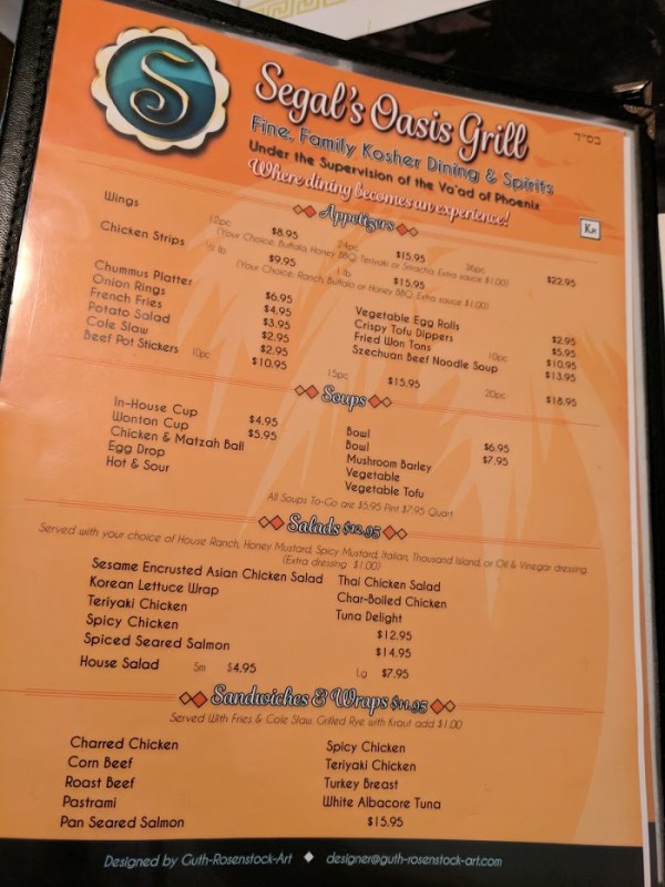
There’s also a whole page of various Asian dishes, and a whole page of kebabs.
Pro tip: never order the Thai Chicken Salad in a place that also serves Chummus.
The food ended up being delicious, and not terribly expensive, so we were quite satisfied when we got back into our disgustingly hot car to go shopping. Somehow it was already 3 p.m. by the time our shopping was done. This was not really a problem, because we had no plans to do anything of substance in Phoenix. We’ve already road-tripped through Phoenix, so there was nothing in the area that we were burning to do. (Get it? Burning? Because it’s hot here?)
We were also a little jet lagged, which is something we’d never experienced on a road trip. Because we always drive from home, we experience time zone changes only one hour at a time, which is much easier and often barely even noticeable. Today we jumped three hours at once, which left us kind of tired, hungry at the wrong times, and generally feeling just a little bit off.
Oh, and did I mention that we have an extra traveler with us? My wife usually flies out to meet us somewhere during the course of our trips, but this time she’s joining us for the first leg because it includes the Grand Canyon. She’ll be with us all week, and then on Sunday she’ll fly home from Vegas while we continue for the second half.
Of course it’s great to have her with us (and for me to have another potential driver). But the different car, the extra passenger, the jet lag, the errands, and the lack of exciting activities all added up; more than 12 hours into our trip, it still didn’t feel much like a road trip.
Leaving Phoenix turned out to be exactly what we needed to turn the day around. We headed north in I-17 toward Flagstaff, and when Waze told me that my next turn wasn’t for 81 miles, it started to feel more like a road trip. We cranked up the music, cranked up the speedometer (the speed limit was 75 for most of the way), and finally started to really enjoy ourselves. We joked about funny street signs …


… appreciated the occasionally gorgeous views …
… and by the time we got to our first real destination, we were totally in a road trip frame of mind.
That destination was Montezuma’s Castle, a visually impressive, ancient apartment building built into the side of a cliff sometime around the year 1100, and which is still remarkably intact, considering nobody’s lived there in roughly 600 years.


For the first time all day, our timing was perfect; we arrived about half an hour before the park closed, which was more than enough time to gaze at the structure from different angles, read the plaques about its history, and buy Sam’s first gift shop souvenir. That also left us enough time to drive to Flagstaff and do something fun there before dark.
Two years ago, when Route 66 took us through Flagstaff, we had a great time conquering the Flagstaff Extreme ropes course, but we also had a few other fun things we never got to do. We only had enough time for one today, but it was a pretty good one.
We arrived at Sunset Crater Volcano National Monument, appropriately, about an hour before sunset. That gave us enough time to grill dinner at one of the picnic areas within the park, and then tackle an easy but scenic hiking trail through a fascinating landscape of volcanic lava, experiencing sunset at a place named for it, and getting out of the park before it got too dark.


The hike made Sarah and me increasingly nervous as the sky slowly darkened and the end of the trail was nowhere in sight, but we made it back to our car before it got too dark, and the late hour meant that we had the whole picnic area and trail (and much of the entire park) all to ourselves.
The day may have started out strangely, but the last few hours got us right back into our road trip groove. Now if we can just sleep off this jet lag …
Plans Taking Flight

As each of our road trips wound down, The Hamster and I started talking about where our next trip might take us. As last summer’s trip through some previously unexplored corridors of the Midwest came to an end, we were a bit stymied when it came to where we could drive this summer.
With five multistate, multiweek road trips under our belts, our experience makes planning the details of each road trip a lot quicker and easier. At the same time, with fewer and fewer must-see corners of the country left unseen, we need to be a little more creative in the broad strokes. Now that we’ve visited all 50 states (many of them multiple times), we needed a new approach.
So this time, we start our road trip with an air trip.
While trying to map out chunks of the country that would make a good trip, we came to the realization that there are still a few major National Parks we haven’t visited, and we decided that would be the–ahem–driving force behind this summer’s trip. Most notably, we have yet to see the Grand Canyon or Yosemite. Those became our anchors; between them, we realized we could see the Hoover Dam, Las Vegas, and Sequoia National Park (all of them places we haven’t been). Along the way, we could do something I’ve been wanting to do ever since we started road-tripping: drive across Death Valley.
The only problem with this plan is that we’ve been just about everywhere between home (New York) and the Grand Canyon. The solution: for the first time ever, we’ll start our road trip on a plane. Tomorrow morning, we’ll leave our beloved Toyota Solara convertible behind and catch a flight to Phoenix, where we’ll pick up our rental car and begin our 10-day, three-state mini-trip. Next Thursday we’ll drop the rental car off in San Francisco and fly back home.
In a lot of ways, this trip will be easier than its predecessors. It’s shorter, which means we have less to pack and less to plan. But it also will be tougher, because when we land we’ll have to do a lot of shopping for all the things we normally bring with us that aren’t allowed on a plane (like propane canisters) or aren’t practical (drinks, paper goods, raw meat, and the traditional giant barrel of pretzels from Costco).
We also have no idea how to fit all of this in the rental car, which Enterprise tells me is a “Hyundai Elantra or similar.”
In other words, despite our years of experience, there are a lot of unknowns attached to road trip #6. But one of the main purposes of all of our trips has been to do just that: jump into the unknown.
I’m ready for takeoff.
