The Boys Are Back in Town
The Hamster and the Hall
What a day!
We woke up at Val’s house in Burlington to the sound of chirping birds, which is something we often get at home but haven’t heard even once in our almost three weeks of motels. It wasn’t long before we were saying our goodbyes and heading south toward Springfield, MA, to see the Basketball Hall of Fame.
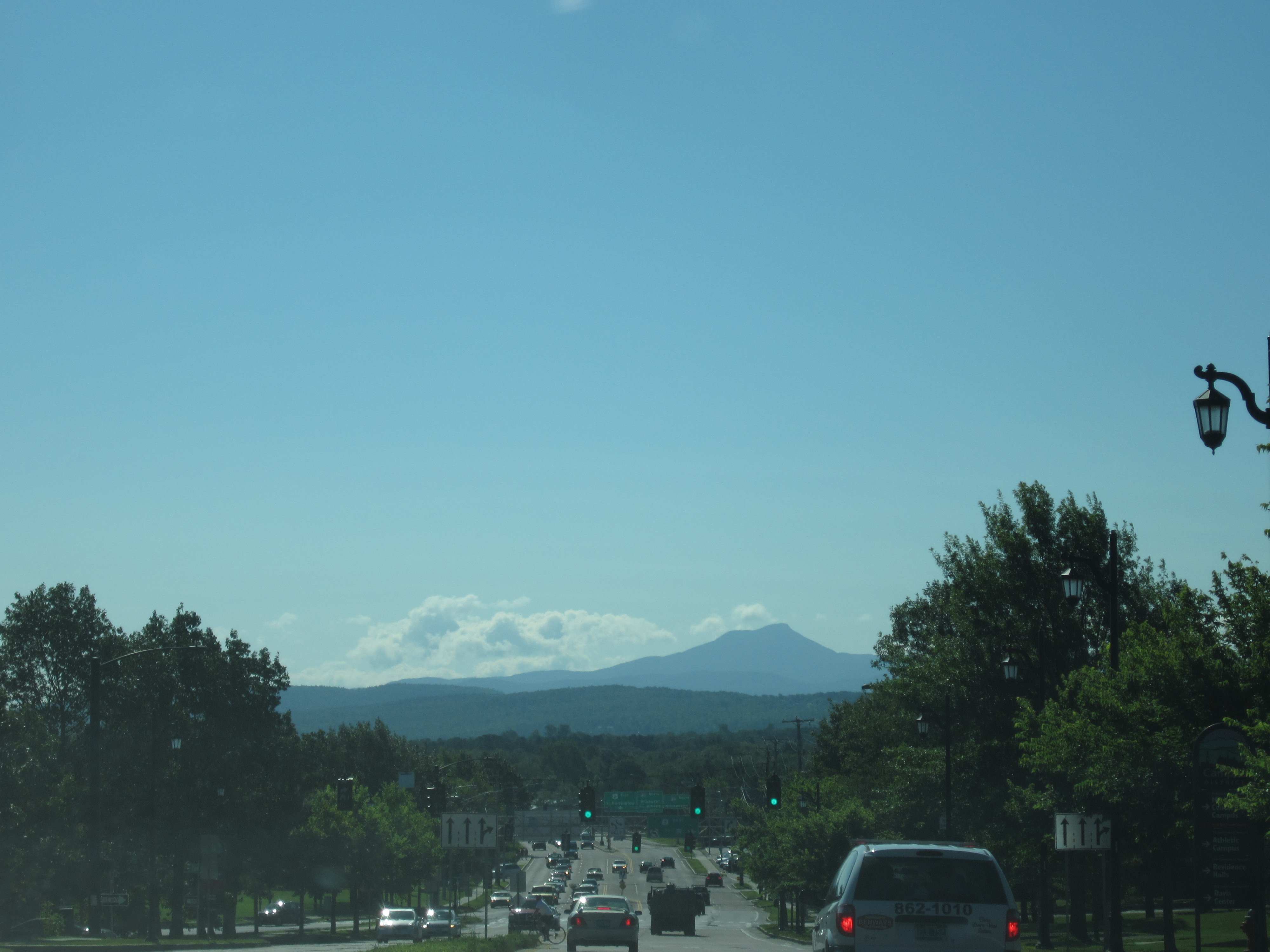
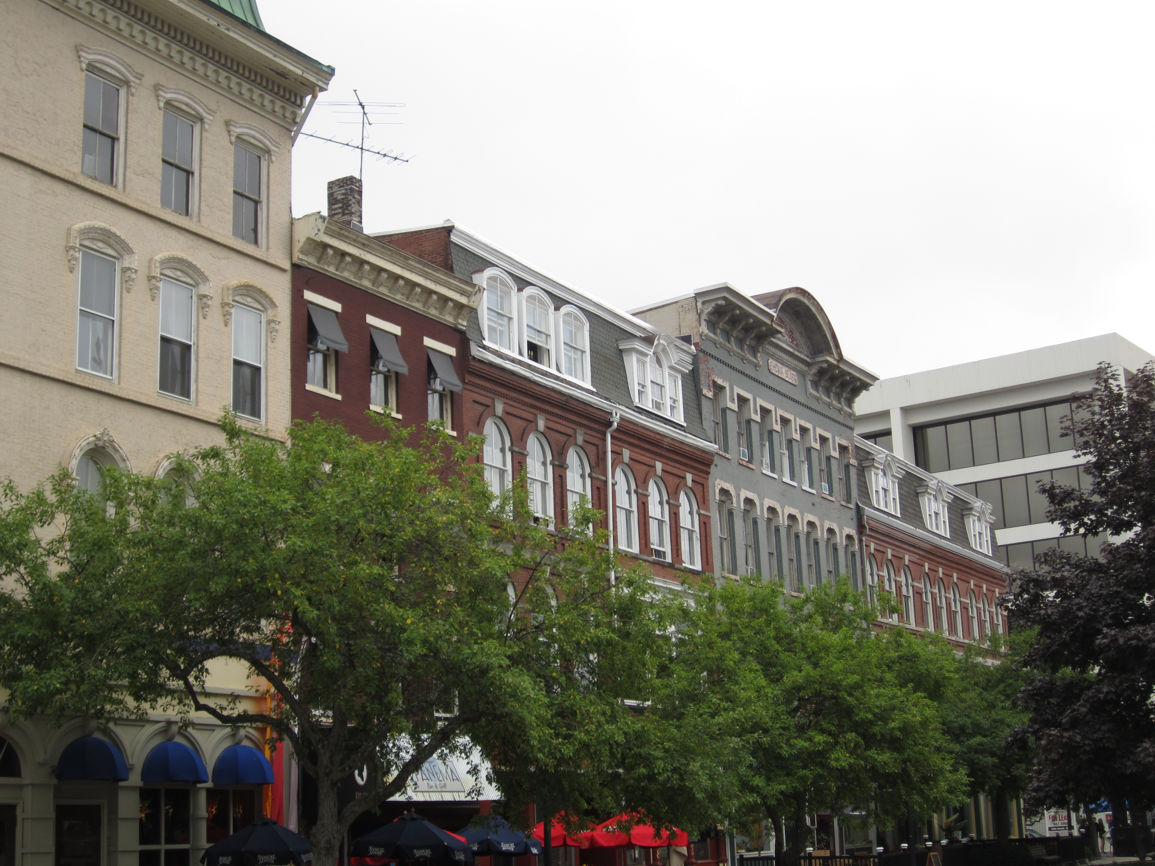
The weather was beautiful once again and we drove with the top down, singing and dancing to whatever songs came up, reminiscing over the many highlights of the trip thus far, and (finally) thoroughly enjoying endless scenic views like this one:
But before we left Vermont we had a couple of stops to make.
The first was at a bakery in Norwich, not to eat but to meet up with someone who would not be done justice by the simple term “old friend.” I don’t think it’s possible to describe my relationship with Heather in just a couple of words. From when I was five years old and my family moved to a house down the block from the Graf family until I was in high school, I practically lived at their house. The Grafs convinced me to join the local Little League and took me to my first Mets game, both of which changed my life though none of us knew it at the time. We came from different backgrounds but I quickly became good friends with Heather’s twin brother, Darren, and my sister and Heather were instant BFFs. We spent each other’s holidays at each other’s houses, we played in each other’s backyards and driveways, and they were like our second family. Meanwhile Heather and I were in the same class every year from fourth grade through ninth. We all went to different high schools, then different colleges, and then my parents divorced and we moved out of the neighborhood. Heather ended up in New Hampshire and, except for my sister’s wedding, I didn’t see Heather for close to 25 years. But she was vacationing in Vermont this week, and after a few false starts we were finally able to meet up this morning. Heather’s mom, who was like my extra mom for so much of my childhood, came too.
It was so great catching up on each other’s lives and families and on everyone else from the old neighborhood that I completely lost track of time. One hour stretched to two, and through it all Sam behaved admirably despite being completely bored. By the time we parted I started to worry that we’d have to rush through the Hall of Fame. Not worried enough, though, to skip our next stop.
One of the big things that Vermont and New Hampshire are known for (among many others) are their many covered bridges. But the longest covered bridge in the world is actually in New Brunswick. So of course a few days ago when the Hamster and I were on our way back to Maine from New Brunswick we drove about 20 minutes out of the way to drive over the Hartland Bridge, more than 1,200 feet of one-lane wooden bridge quaintness. The second longest, however, connects Windsor, Vermont, and Cornish, New Hampshire, and was only a little bit out of our way en route to Springfield.

The Cornish-Windsor Covered Bridge may be only the second-longest in the world, but it’s two lanes wide, so the little sign near the bridge boasts that it’s the world’s longest two-lane wooden bridge. It was nice to see the bridge but nicer still to see the warning above the bridge on the NH side: “Walk your horses or pay two dollars fine.”
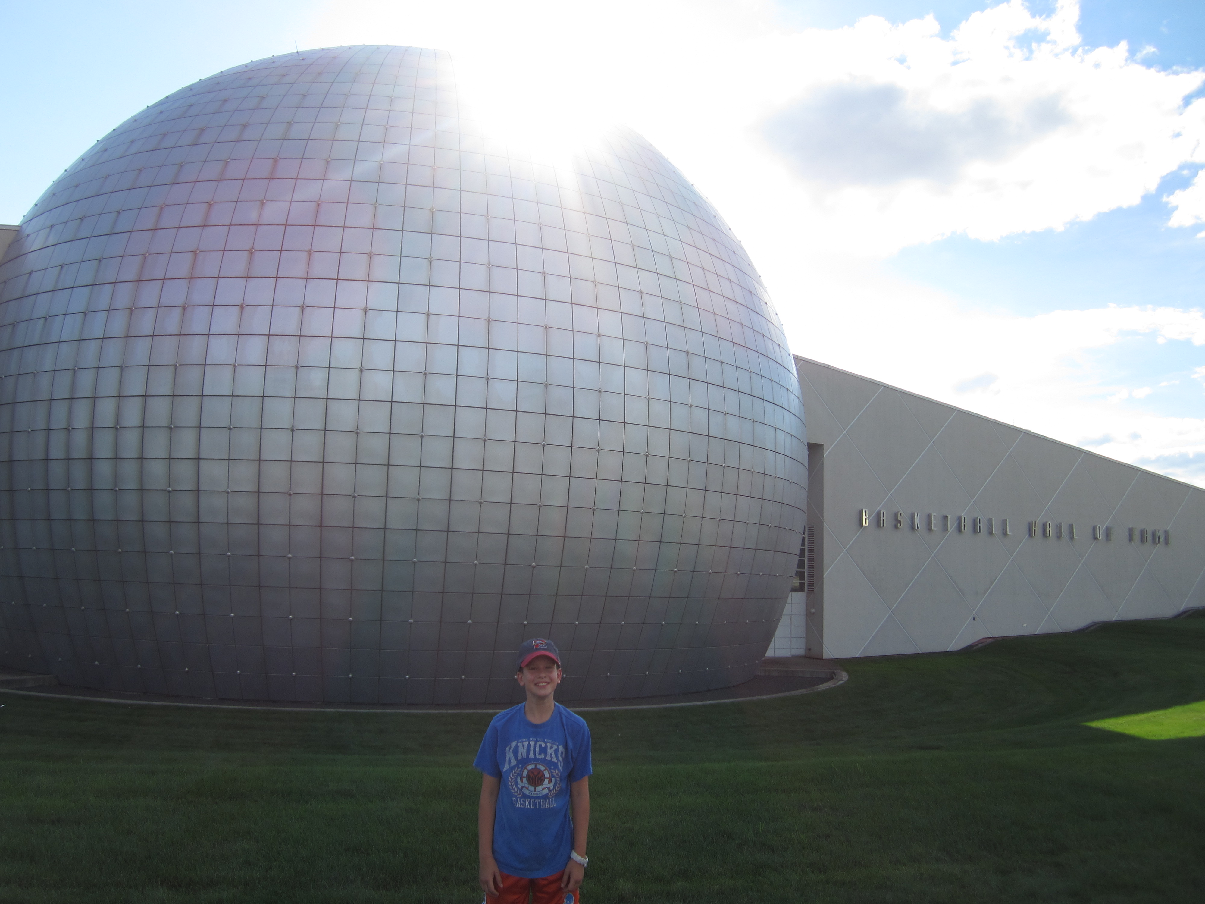
Behind us were a bridge to the past and a bridge to New Hampshire. Ahead was only the Basketball Hall of Fame. We got there about an hour and a half before closing time, which was plenty because Sam neither knows nor particularly cares much about the history of the game or who is enshrined there and spent most of his time with the interactive exhibits.
First, though, we walked slowly through what they call the Hall of Heroes (photos and blurbs of the actual inductees). We’ve now been to the halls of fame for baseball, football, rock ‘n roll, tennis, and basketball, and each one has a completely different way of honoring and displaying its members. The Basketball HOF is inside a three-story building that’s shaped like a giant basketball. One the first floor is a full-court basketball court with plenty of balls so everyone who wants can shoot around. The second floor is the exhibits, the memorabilia, and the interactive stuff. The top floor is the hall itself, and the walls are curved because of the round shape of the building. The inductees each have a large, backlit photo from their primes on the curved wall in rows. The result is that you can see the inductees from all three floors, and it looks almost as if they’re looking down onto the court to watch everyone play.

We started at the top. As usual, I took my time looking at each photo and reading several of the blurbs (which I must point out were extremely well written) while Sam breezed through looking for the handful of names he recognized. Soon he was ready for the second floor.
One thing the basketball hall has over the others we’ve seen is fun. There were all kinds of games and activities on the second floor. We posed with the NBA championship trophy. We recorded a brief TV broadcast in which we mentioned some fake basketball highlights. We shot arcade hoops. We measured our shoe sizes, heights, jumping abilities, and wingspans against famous NBA players.
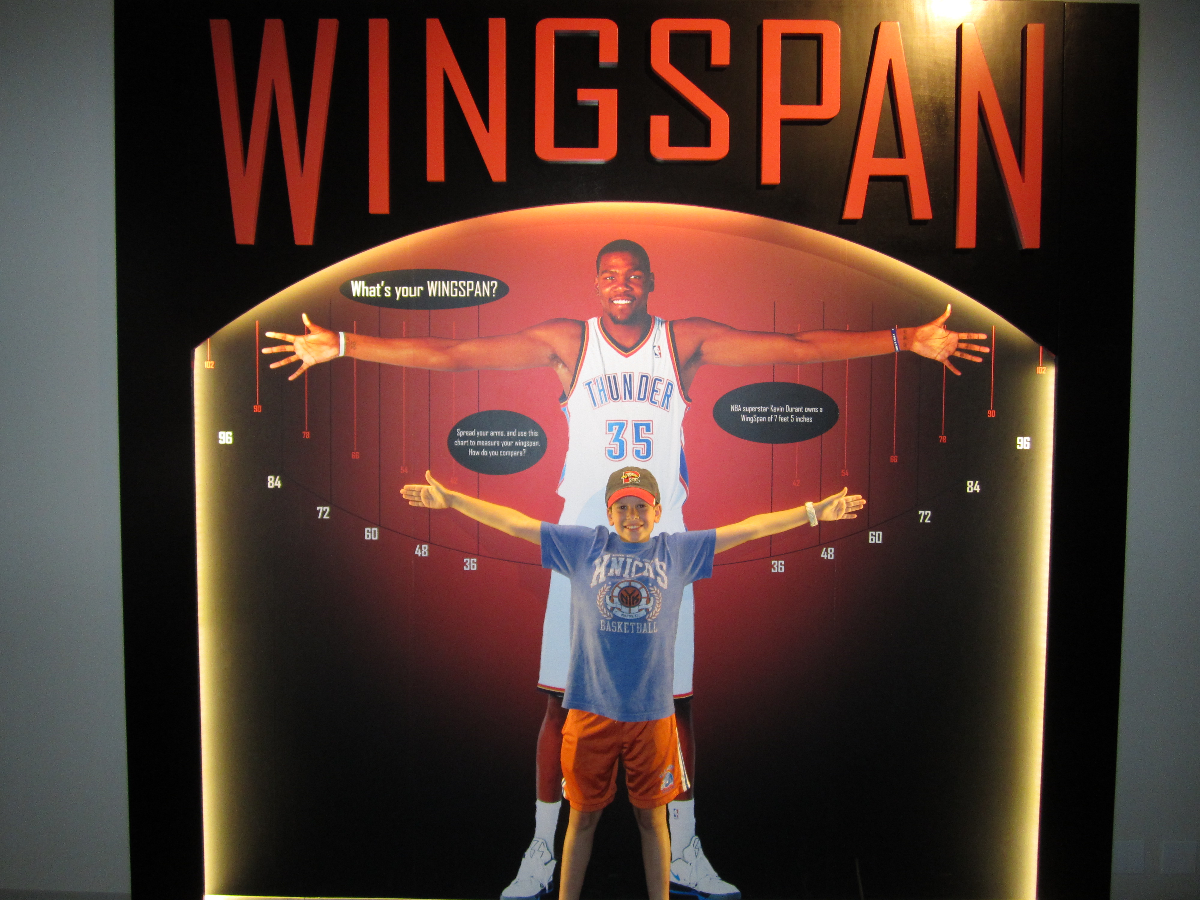

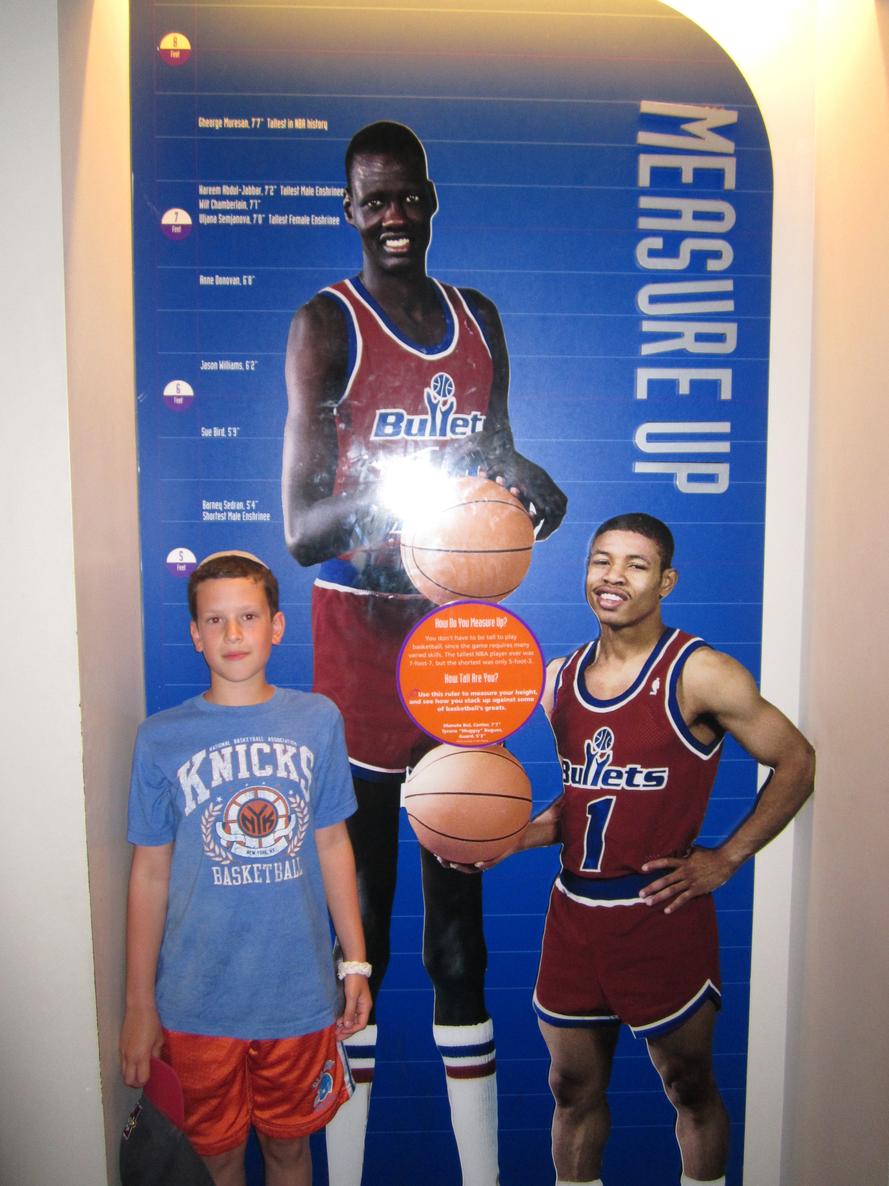
We learned that my wingspan is not that much shorter than Kevin Durant’s despite his significant height advantage, that we are both dwarfed by Shaq’s shoe size, and that Sam still has a little growing to do if he wants to play pro ball. Here he is with Spud Webb and Dikembe Mutombo:
Despite his height disadvantage, he’s still got skills, es evidenced by the monster dunk he threw down (on a 5-ft hoop):
We also learned that Sam still has a little growing up to do regardless of his future career path.

That’s Bill Walton’s nose, in case you were wondering.
It was great watching Sam run from exhibit to exhibit thoroughly enjoying himself. But the best part, surprisingly, came when we got to the first floor close to closing time, and Sam suggested we play a little one-on-one. With the Hall-of-Famers looking down on us from above we both went all out and had a great time trying to best each other. I had the height advantage, but the Hamster still managed to squeak out a 5-4 victory. I guess he just wanted it more. We play one-on-one in our driveway at home pretty often, but this one little scrimmage instantly became one of the highlights of the road trip.
It was just after 5 p.m. when he got back in the car, so we had some time before dinner. Eventually we stopped somewhere to cook; to celebrate our last night on the road I grilled a nice, thick London broil I had bought at a supermarket back in Bangor. It was delicious, but the best part was where we ate it:
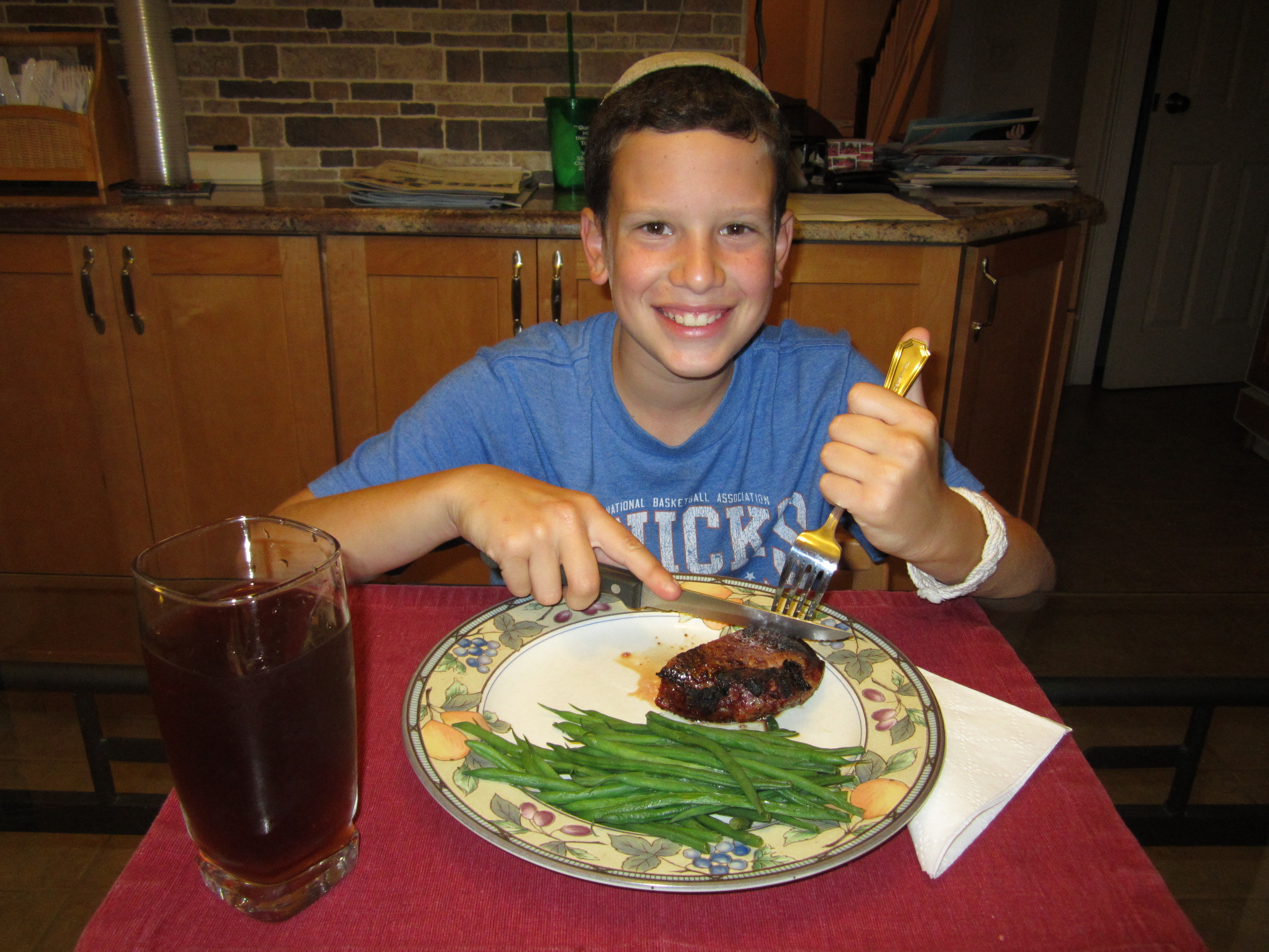
Home! Yes, that’s real silverware and a real plate and glass but, most important, it’s our kitchen. We made great time getting home and tonight we sleep in our on beds. The boys are back in town.
This trip has included great experiences and some real frustrations. Some of my favorite excursions were the Hopewell Rocks, indoor skydiving, Pez, whale watching, the West Quoddy Head Light, Ben & Jerry’s, and the Red Sox game. But also on that list are the unexpected highs that arose organically from being together: playing tennis in Newport, playing catch in Portland, playing basketball in Springfield, singing along to “Life is a Highway” with the top down as we drove through Connecticut on the first day, chanting “U-S-A” as we left New Brunswick, hunting for state license plates, and all the general silliness that happens when two immature boys spend three weeks in a car together.
Tomorrow you’ll hear from the Hamster one last time. Meanwhile, I’ve got to get started planning next summer’s road trip …
Stronger Than the Storm
You know that old line they say about the weather in a whole bunch of places? “If you don’t like it wait an hour and it’ll change.” That was our experience in Vermont today.
Any good road trip requires a fair amount of flexibility, and that’s been especially true this time around. Today it became essential.
The one positive that’s come from all the fun stuff we’ve missed out on because of bad weather or bad timing is that we’ve got time to spare. So for once we didn’t set an alarm or set up a wakeup call. We woke up late enough to miss breakfast at our motel, and we’ve already gone through the cereal we brought with us, so for breakfast we improvised: Chex Mix! It’s 50% Chex, right? So it can’t be that bad for you.
The sun was shining, the sky was a beautiful blue, the mountains were green, and the Vermont state capitol was small (It’s the smallest state capitol in the country) but stately, with brightly colored flowers centered along the main entrance and a shiny gold dome on top that was reflecting the gleaming sun to an almost blinding degree.

Better yet, it’s accessible. Most state houses are surrounded by so many other government buildings that there’s nothing but government for several blocks in every direction. Not so in Montpelier: the shops of downtown Montpelier start on the next block. Montpelier High School is just two blocks away. And incredibly, there’s metered street parking right in front of the building. We literally parked right in front of the state capitol; this is something you cannot do in any other state. I thought it was really cool. Sam was more concerned with doing his Rocky impression on the capitol’s front steps.
With no time pressure, I figured this would be a good time to get a haircut. I had been searching for a barbershop in cities all over the northeast for the past week, and every one I found was either closed or too busy. Sure enough, there’s a barbershop–striped pole and everything–two blocks from the capitol, and it was open, and they took me right away. We were in and out before Sam even had a chance to get bored. We were 2-for-2 in improvisation, and it wasn’t even noon yet.
Our plan for the rest of the day was to go to Stowe and take a gondola ride to the top of Mt. Mansfield, which is the big mountain there. The weather was beautiful, we drove with the top down, and on the way there I was thinking to myself that after three tries we’d finally be able to get a great mountaintop view.
Along the way we passed a Cabot store. I’m a big fan of their cheeses. More important, Sam is a big fan of their cows. At the Portland Sea Dogs game there was a guy from Cabot running around with a large inflatable cow. Sam asked him about it and he explained that he gives one out to a fan every game. Sam didn’t end up getting the cow, but I mentioned that Cabot is headquartered in Vermont so he’s been asking nonstop if we can go to Cabot. The actual creamery is out of the way and probably doesn’t stock inflatable cows, so we didn’t go. But once we saw the store I figured it couldn’t hurt to stop in and look for a cow. They didn’t have inflatables but they did sell squishy stress cows, one of which is now in thr trunk of our car. 3 for 3.

A Hamster and a cow walk into a bar …
Is wasn’t much longer before we arrived in Stowe. As we parked the car at the base of the gondola ride, we noticed that the clear blue sky had been replaced by ominous clouds covering the top of the mountain.

By the time we got into the gondola it was raining. By the time we got to the top of the mountain, we couldn’t see a thing.
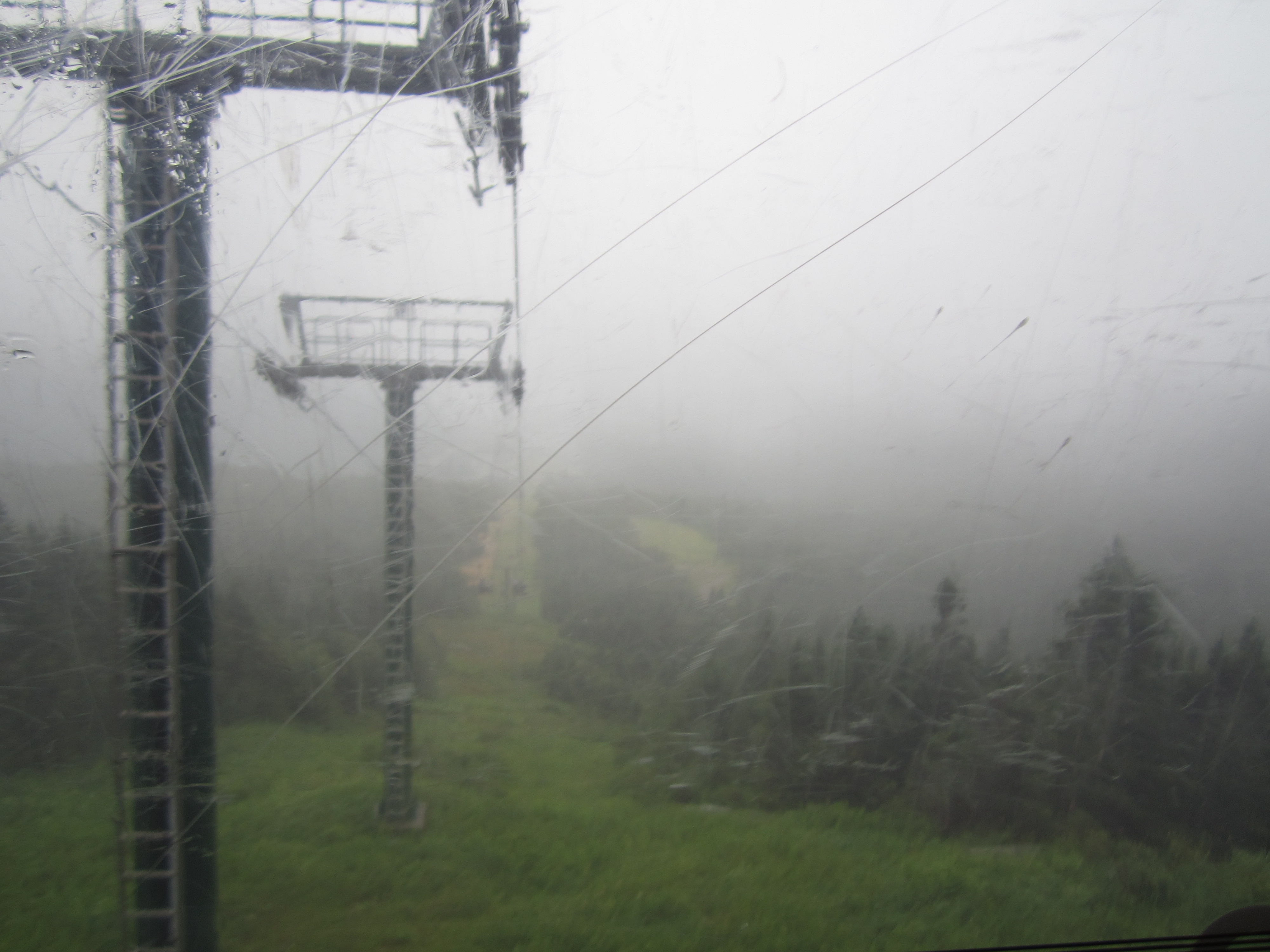
Yet another beautiful mountaintop view
Our next stop was going to be Smuggler’s Notch for various fun mountain activities, including a ropes course. But it was raining so hard that outdoor activities were out of the question. It was time to improvise once again. Luckily, we had a pretty good alternative: Circus Smirkus, a nonprofit one-ring circus where all the performers are kids. When choosing activities on our road trips I try to avoid things that we can do at home, like zoos and science museums, in favor of unique local experiences. Ringling Brothers comes to New York every spring, but Circus Smirkus is only in Vermont, and they’re performing for only a couple more days before shutting down for the season. It seemed like a perfect fit for a rainy afternoon. But there were two problems:
1) We didn’t have tickets.
2) The show was at 2 p.m., it was already 1:15, and the show was back in Montpelier, which is a 45-minute drive from Stowe.
I called the circus and they said they still had tickets available but only via walk-up on site. So we headed back to Montpelier, driving in rain so hard it was sometimes blinding for several minutes at a time. Meanwhile we hadn’t eaten lunch, and now we had no time to stop. So we improvised yet again: peanut butter, straight from the jar. Sam managed to reach both the peanut butter and the spoons while I drove. Creamy for him, Super Chunk for me. It wasn’t glamorous, but it did the job. And Sam was thrilled that he was allowed to eat right out of the jar. 4 for 4.
We got to the circus just as it was starting, bought our tickets, and because of the small venue we were much closer to the performers than we’d be at Madison Square Garden even in the very best seats. And the circus was great! The show was called “Oz” and used the plot of The Wizard of Oz as a backdrop for all the action. The performers were fantastic, Sam laughed and oohed and ahhed, and by the time the show was over the sun was starting to peek out again. We had such a good time that we viewed getting rained out of Smuggler’s Notch as a net positive.
Finally it was time for what might have been our most interesting stop of the day: my old friend Val’s house in Burlington, VT. Val and I were tight in high school but we haven’t seen each other in 20 years, and I was about to show up on her doorstep for a meal and a bed. With my 11-year-old son. I had no idea what to expect.
It ended up being a really nice reunion. Val and her family couldn’t have been more welcoming. Dinner was delicious, and I don’t have to remember my room number or take the key card with me everywhere I go. The best part was that Sam and I finally had peers to hang out with. As much fun as these road trips are, and as much fun as Sam and I have together, I end up starved for adult conversation and Sam ends up longing for kids to play with. Tonight we both got our fill. Val’s kids are younger than Sam but it didn’t matter. They played flag football, they played with the family’s chickens (they have six), they talked trash about opposing NFL allegiances, and after dinner they got completely absorbed in a Wii game. Meanwhile, Val and I got to compare notes on classroom technology (she trains teachers on tech stuff for a living), parenting, the local politics of diversity, and stuff to do in Vermont.
Today was one of the last days of our road trip, and it was a really good one. It wasn’t the most thrilling or the most adventurous, but we were finally able to use the rain to our advantage, we got a uniquely Vermont experience, I got to reconnect with an old friend, and Sam made a few new ones.
You Can’t Always Get What You Want
How hard can it be to see a moose?
We saw lighthouses and lobsters and L.L. Bean. We saw sea dogs. We ate blueberries. We were pretty thorough with Maine. But the one thing Maine is known for that we didn’t see is moose. Well, we saw that chocolate one last week, but Maine has the biggest population of moose in the U.S. (around 25,000 of them), so we figured we’d bump into one or two of them sooner or later. The only problem is that the part of Maine where the moose generally hang out is in the north, and that would be pretty far out of the way for us. But since we had some time to spare, the Hamster and I decided Monday night to drive out to Moose Town and see if we could find a few of its biggest residents.
Moose Town, incidentally, is not the name of an actual place. It’s just what we started calling the region known to harbor moose. Anyway, from the Maine/Canada border to Moose Town was about a four-hour drive, partly because of the distance but also because there are no real highways that go to Moose Town. The best time to see moose is at around sunset, and the original plan for the Bay of Fundy would’ve gotten us to Moose Town at right around sunset. But once we decided to schlep out to Hopewell Cape for the flowerpot rocks, that schedule got pushed off significantly.
So the plan was to drive for about three hours Monday night, find a place to stay about an hour outside of Moose Town, and then search for moose first thing Tuesday morning. However, it quickly became clear as we were driving that there’s no place to stay on the way to Moose Town, because there’s nothing there. And there are no street lights either, or stores, or gas stations. It was an eerily dark drive through nothingness that became unnerving as we got further and further and the barren landscape stayed the same. It was getting later and later, I had already driven 500 miles that day all over New Brunswick and rural Maine (after having driven 300 miles the day before), I was exhausted, and so many bugs were hitting the windshield that eventually I could barely see through it to the nothingness that surrounded us. At one point the road we were on was closed for construction, and all the other options were dirt roads. I didn’t let on to Sam, but I was terrified. I’m sure it would’ve been considerably less unnerving in the daylight, but it was so dark I didn’t think daylight would ever come. It felt like I was in the first 15 minutes of a horror movie, and the plot was about to really get going.
Desperate, we called Sarah for help. She’s been working as our travel agent/logistics team, finding us places to stay, booking us rooms, being a sounding board for last-minute changes to the itinerary, and taking care of everything at home while we’re off exploring the world. She couldn’t find anywhere for us to stay. It was either schmancy B&Bs along Moosehead Lake, or it was random motels with names like the Wolf’s Tooth Inn or the Bear’s Head Lodge. I wasn’t looking for a particularly nice place, but after our bad motel experience in Saint John, I had little stomach for a crappy, rundown motel and I just wanted a national chain where at least I had a pretty good idea of what I’d be getting. No such luck. The closest chain motels were in Bangor, hours out of the way. I was getting increasingly unnerved, but still trying to be brave for Sam. Finally Sarah found a trailer park called Abbot Trailside Lodging that supposedly had four rooms available in one little building on the property. Also, there was no front desk, just electronic keypad locks on the doors so that when you booked a room they’d give you the code to get in. It sounded way beyond sketchy, but the pictures of the rooms on the place’s website looked impossibly nice, and it was almost 11 p.m. and I was desperate.
Of course the place turned out to be wonderful. One of the nicest places we’ve stayed all month. The outside was nothing to look at, but our room was spacious and spotless and gorgeous.
We slept well and we woke up just a few miles from Moose Town refreshed and ready to see some moose. It was pretty overcast and chilly, which I figured would work to our advantage because moose don’t do much wandering around in the heat of the day. So we drove, and we drove, and we drove. Soon we started seeing road signs warning us to be on the lookout for moose.


We were on the lookout. No moose. We drove a little further. A little slower. No moose. We drove almost completely around Moosehead Lake, which is absolutely beautiful but today was visited by no moose. We even stopped in at a state park and asked a ranger where we could see some moose. She told us to drive another 10 miles north to Kokadjo, which is known locally for its moose and its scenery and … its small population.

We went there. No moose. We stopped a couple of joggers and asked them. They told us to go where we had already been, and that at sunset they’re all over the place. Grrr.
I would’ve happily waited around until sunset but then we would’ve missed out on our next activity, which was driving to the top of the tallest mountain in the northeast. The road to the top of Mt. Washington closes at 6 p.m., and it’s four hours away from Moose Town. So we gave up on the moose and headed for the mountain.
We were disappointed but we knew seeing moose was hit or miss, and we were still running on leftover excitement from the Hopewell Rocks. Then as we were leaving Moose Town, top down and wind in our hair (OK, Sam’s hair and my scalp) Kelly Clarkson’s “Stronger” came up on my iPod and we both immediately started dancing and singing along, and any lingering frustration over the lack of moose melted away. (Hey, don’t judge me. You know that song is on your iPod too, and you know you sing along whenever it comes on.)
One of the weird things about this road trip is that, until this week, we’d barely had any long drives. An hour here, 45 minutes there … everything in New England is so close to everything else that there hasn’t been much road on this trip. We’ve made up for it in spades this week. We drove a little over 1,300 miles the first two weeks of the trip, and we’ve driven almost 1,200 in the last three days. And today it rained off and on for most of the day, which didn’t help.
Anyway, before we got to Mt. Washington, which is in New Hampshire, we had one more stop to make on the way out of Maine: the tiny town of Bryant Pond. As you may have discerned by now, I’m a big fan of quirky roadside attractions, but only if they’re not too far out of our way. You should see some of the oddities that made my original list but ended up on the cutting room floor because they were far enough off our route as to not be worthwhile. A giant chair, a locomotive painted to look like Thomas, a 1/4-scale replica of New Hampshire’s Man in the Mountain, and much more. Paul Bunyan and the giant blueberry were literally directly in our path, so they made the team. Bryant Pond’s claim to fame is that it was the last town in America to switch over from the old candlestick phones to the dial system (in 1981!), and to commemorate this they put up a 14-foot candlestick phone on Main Street outside the post office. And Bryant Pond was only about 10 minutes out of our way, and a good excuse to stretch my legs, so we made the stop. We saw, we photographed, we moved on.

An hour later we were pulling up to the booth at the entrance to the Mt. Washington Auto Road. Between the moose hunt and the distance to New Hampshire I had been driving for roughly the past six and a half hours, but I was still excited to make the half-hour winding drive to the 14,000-foot peak of the mountain. A nice man came out of the booth to collect our fee and … wait … he wasn’t there to collect our fee after all. He was there to tell us that the mountain was closed. Yeah. Closed.
Apparently it had rained so much on the mountain overnight that the gravel was soft and loose, so they closed the mountain for the day. My heart sunk. I had driven hundreds of miles to go nowhere. I felt like Clark Griswold when he gets to Wally World.
Today we were going to see moose and climb a mountain. We did neither. I knew the moose were a crap shoot but I figured the mountain was a sure thing. And now I still had to drive another 2.5 hours to Montpelier, VT, where we’d be spending the night. And it was raining. And I had to pee.
I set the GPS to the Econo Lodge Montpelier, and off we went. Sam and I had been yapping all day about all sorts of things–music, license plates, his upcoming birthday, the food we have left for the last few days of our road trip, the folly that was Ghostbusters II, the probability that he’ll be allowed to get a pet cow–but we were very quiet for the next half hour or so.
Then, as we progressed toward Vermont, something occurred to me. We had been planning to take a tour of the Ben & Jerry’s factory in Waterbury, VT, on Wednesday, but now we’d be getting to Vermont a couple of hours earlier than we had expected. They give tours until 8 p.m. If we hurried, and we didn’t stop along the way to make dinner, we could probably make it there in time for the last tour, or maybe even an earlier one. Maybe the whole day wouldn’t be a washout after all. I reset the GPS for Waterbury.
We made great time, and got to Ben & Jerry’s just in time to get into the 7 p.m. tour. The tour was fun, they gave us a free taste of a test flavor called Milk & Cookies (it was so good), and we didn’t even argue in the gift shop. It was exactly what we needed.
By this time it was close to 8:00, and we still hadn’t had dinner. We were planning to find a place to grill burgers, but it was getting dark and it was still drizzling, and Vermont is so small that there are not a lot of rest stops along the highways. I had an idea. I took Sam to the Ben & Jerry’s ice cream stand that’s right next to the entrance to the factory tours, and suggested that we each get a big cone and call it dinner. He agreed. I had a scoop of Late Night Snack topped with a scoop of Chunky Monkey, and Sam had a scoop of Chocolate Therapy topped with a scoop of Chocolate Fudge Chunk.
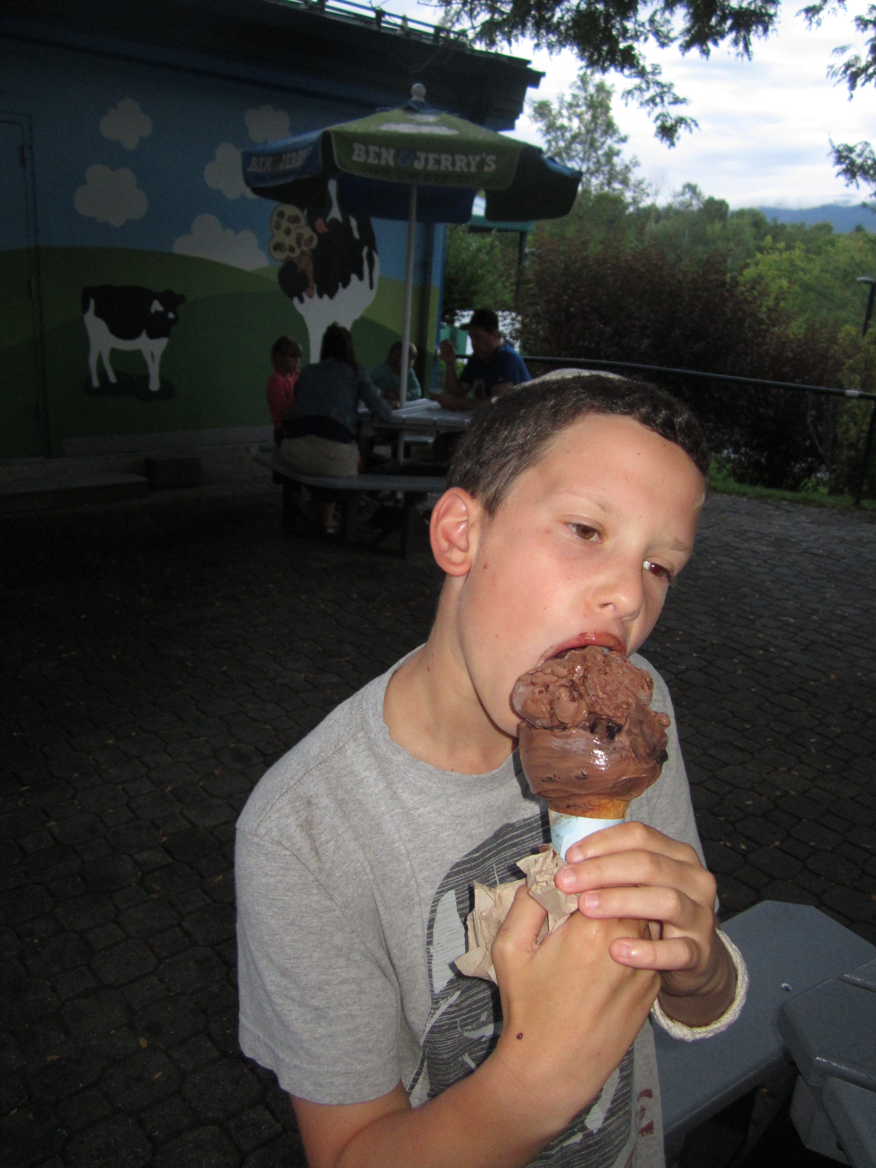
Dinner!
The ice cream was filling in every way we needed it to be. Fifteen minutes later we checked into the Econo Lodge Montpelier, which turned out to be nicer than we expected. I’m not going to pretend that it all made up for the hours and hours of driving and all the disappointment over missing out on the moose and on Mt. Washington. But the day did show us one important thing: You can’t always get what you want. But if you try sometimes, you mind find you get what you need.
Tide Is High
There was one day on this trip for which I was woefully under-planned. That day was today.
I knew we’d be going to the Bay of Fundy to see the world’s highest tides, but I had no idea where along this massive body of water we’d go, what we’d do there, or even what the choices were. I picked Saint John as our base because it’s the biggest city on the Bay and also the closets to America, which meant less travel time. All I knew was that, wherever we ended up going, we should go there at low tide and at high tide so that we could see the difference. It was only once we got to Saint John that I realized I had no real plan and no real knowledge with which to formulate one.
So Sunday night, with my back to the wall, I finally started researching in earnest. It turns out that Saint John is a great place to watch reversing rapids, which is kind of hard to explain but is actually a pretty simple in concept. See, rivers run downstream into oceans. The Bay of Fundy is part of the Atlantic, so it’s an ocean. The Saint John river empties into the bay. During low tide, when the bay waters are receding away from the shore, the river flows normally. But when the tide is rising, it rises so fast that it rushes up into the river, briefly shoving the river’s flow into reverse. Saint John has a public park, called Reversing Falls park, where you can stand and watch the river hit the bay, and if you’re there at the right time you can watch this reversal. It all sounded pretty cool to me, so I decided that Reversing Falls Park would be our default plan unless I could come up with something better.
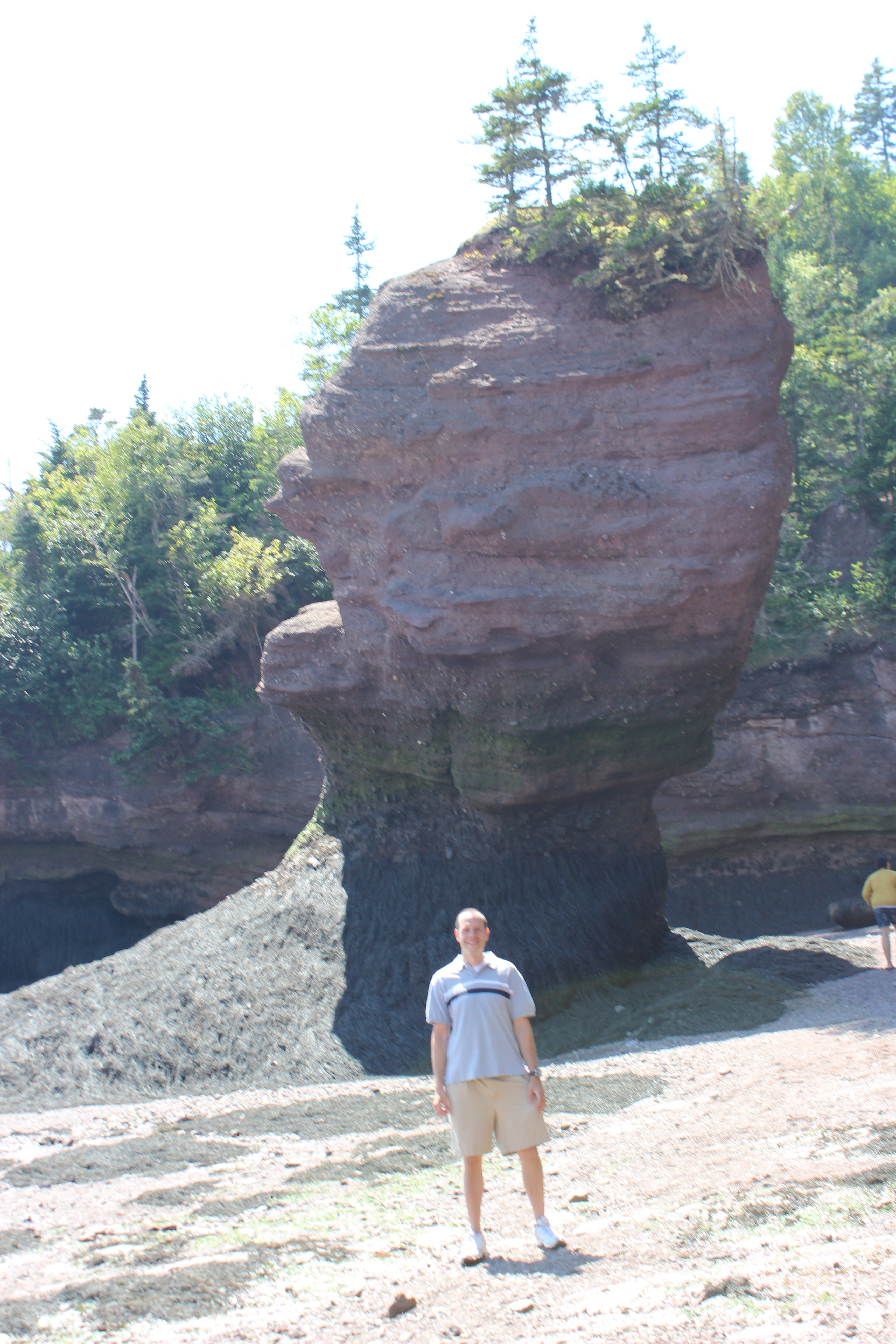
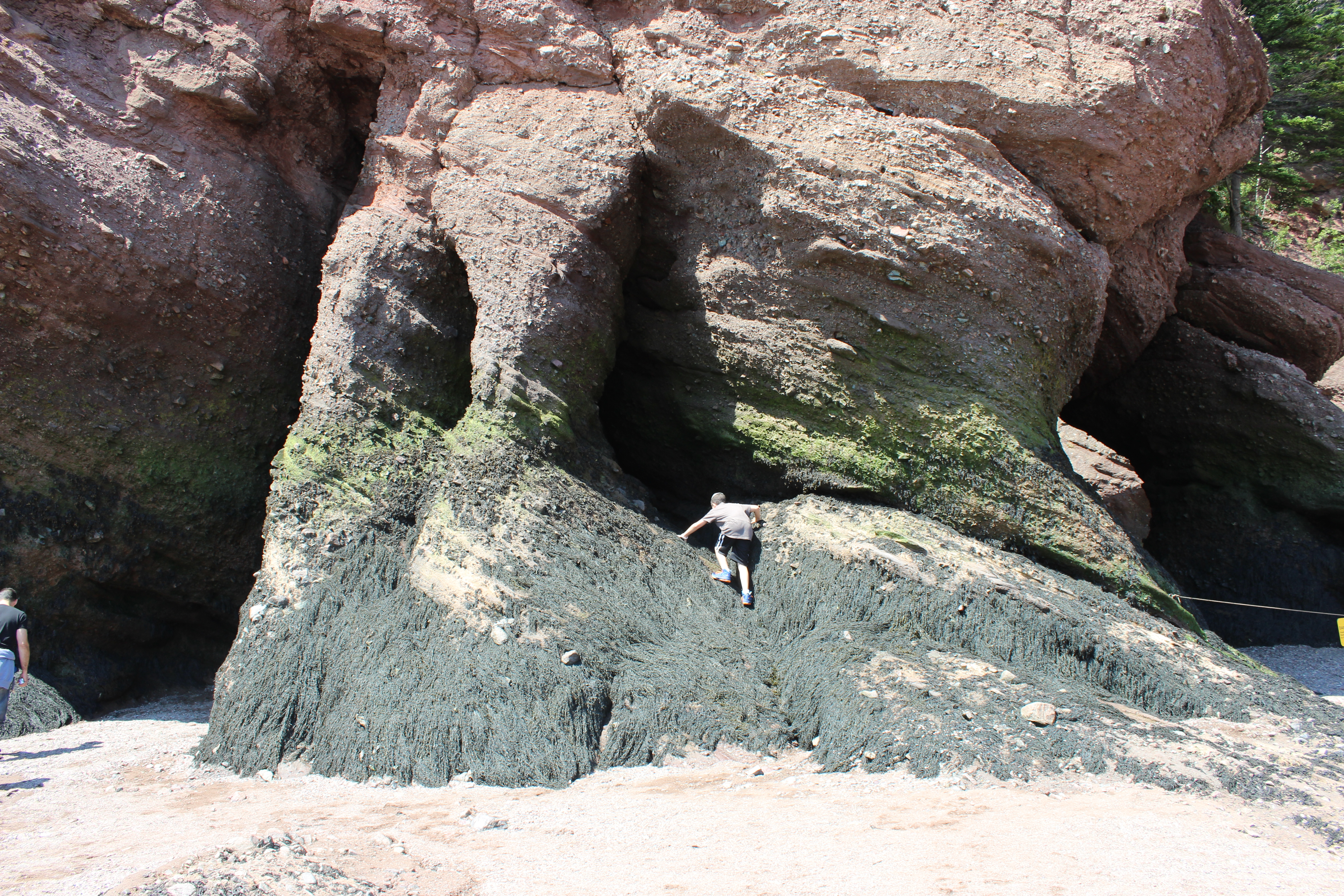
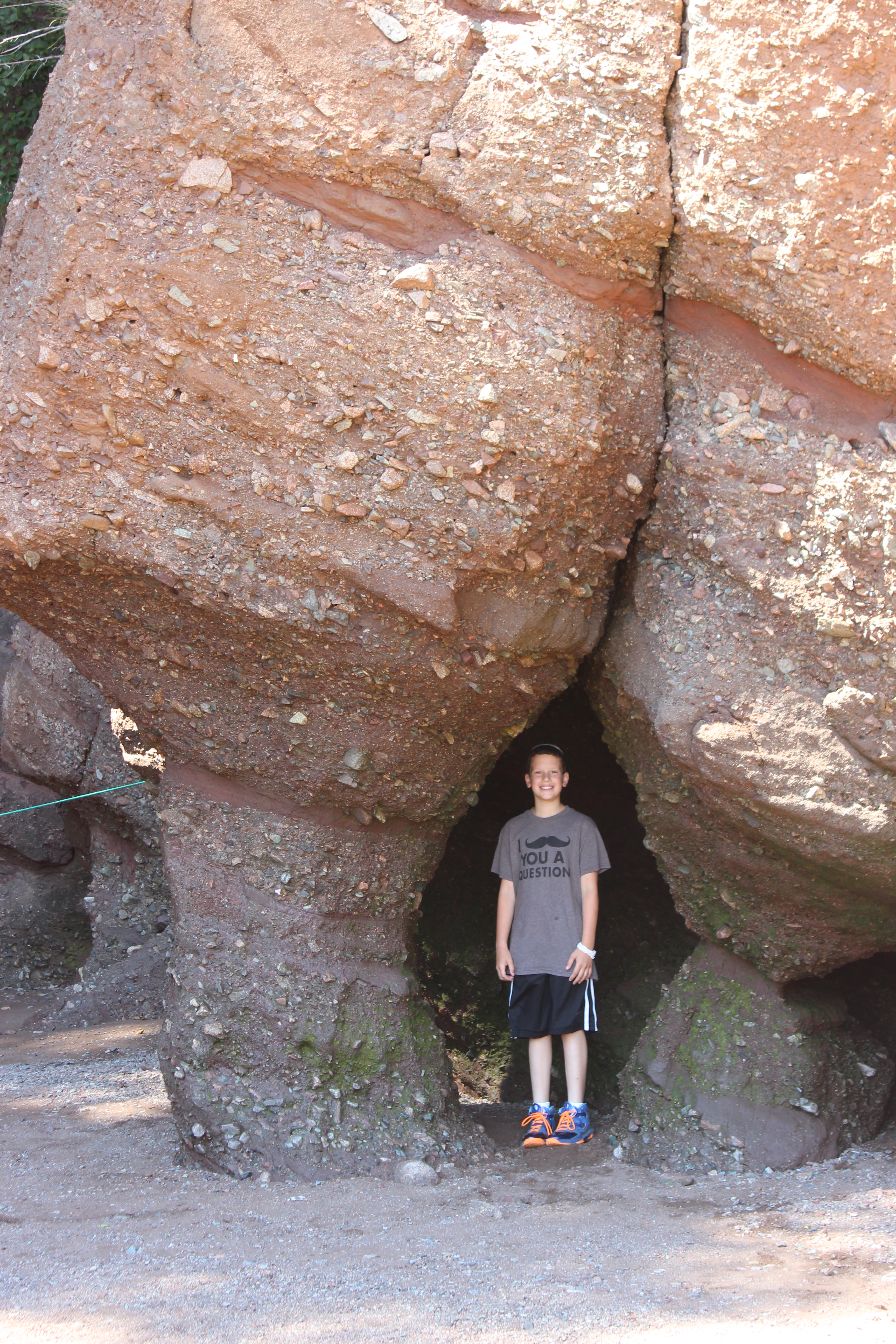
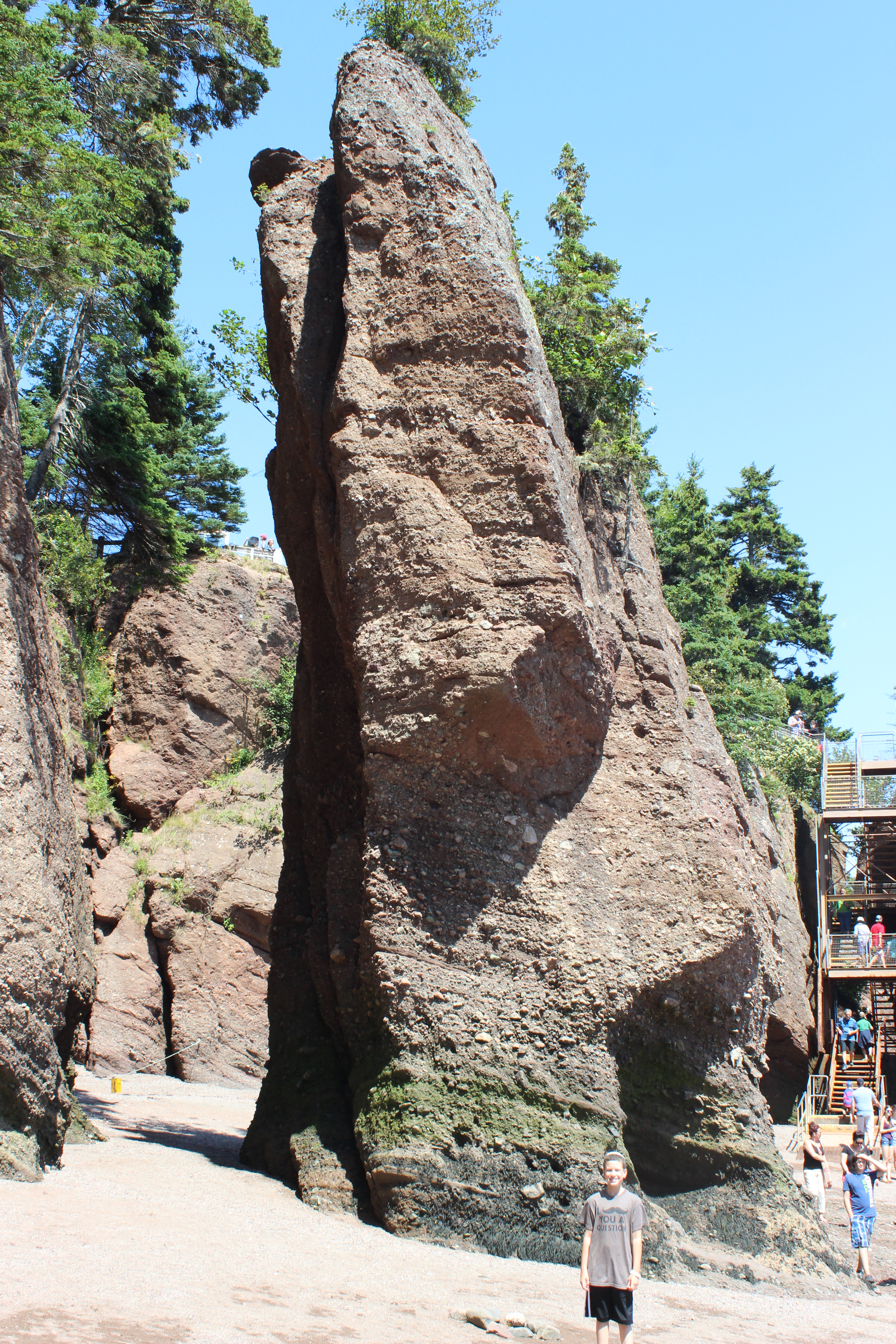
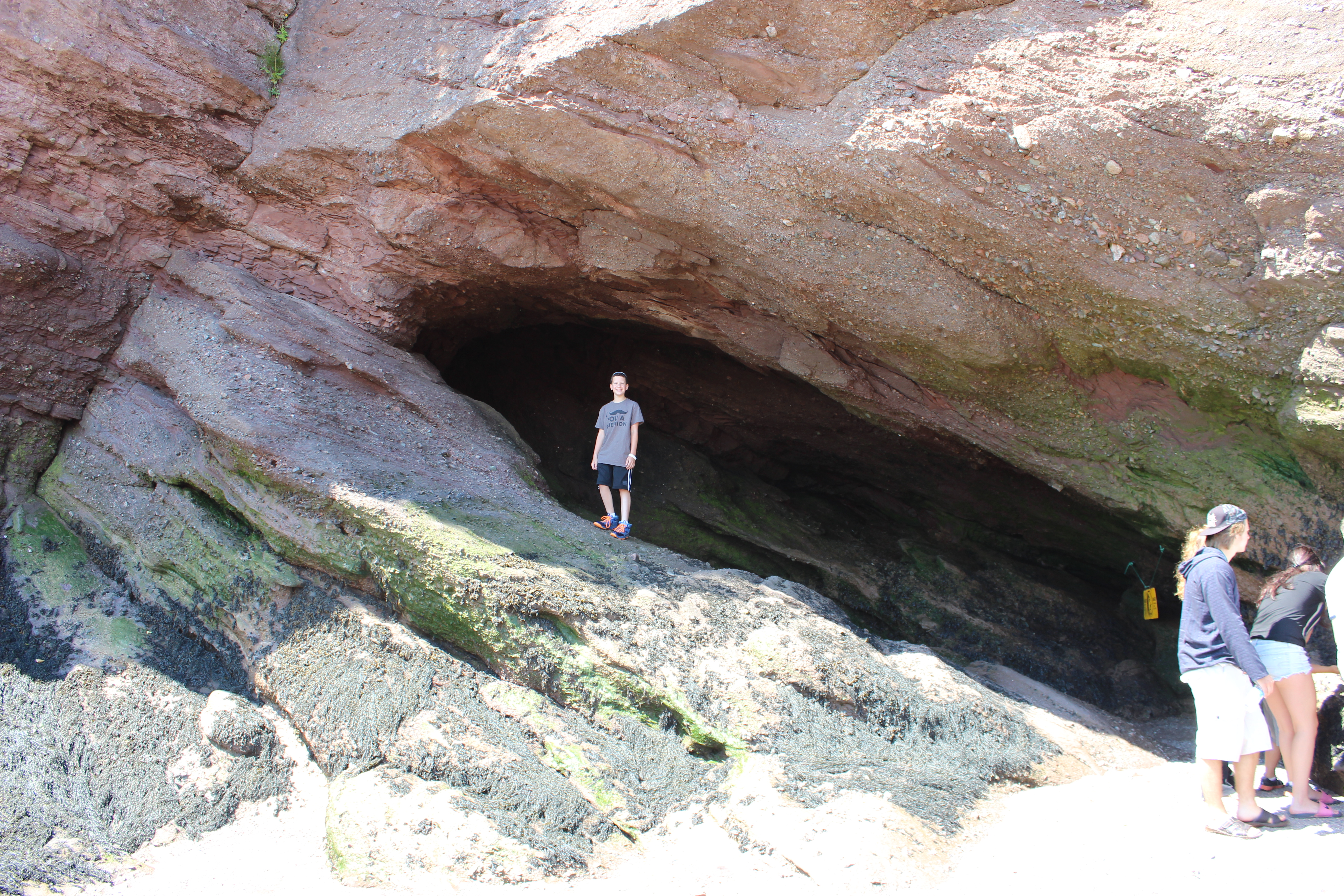
That’s when I remembered the rocks. If you live in the northeast, you’ve probably seen that magazine/bus/subway ad for New Brunswick tourism that shows the freaky-looking rock–you know, the tall one that’s wide at the top with trees growing out of it but skinny at the bottom, like a freaky, disproportioned hourglass. The ad explains that the weird rock formations are the result of the 40-foot tides that rush in and out twice daily. I had forgotten all about those rocks until Sunday night. So I started researching. Turns out they’re called the Hopewell Rocks and they’re only found in Hopewell Cape, which is two hours east of Saint John, which meant that a trip there would include an additional four hours of driving. Sigh.
It was pretty late at night by this time, and my thinking may not have been its clearest, but I decided to go for it. The Reversing Falls thing is OK, but the Hopewell Rocks are by far the coolest part of the Bay of Fundy. When we first thought about going to the Bay of Fundy, it was probably because of those rocks. Well, the rocks plus the fact that Fundy is a funny name. And I haven’t even told you the best part: if you go there during low tide you can walk around on the dry ocean floor among the rocks, and if you get there during high tide you can kayak around and between the rocks. And if you can be there for both, well, how awesome would that be?
I checked tide times for Monday and hatched my plan: we’d leave our terrible motel as early as possible, head to the Reversing Falls a little before low tide, and then trek to Hopewell Cape to see the world famous Hopewell Rocks. We’d get there while there was still time to walk the ocean floor, then we’d have lunch and wait around another hour or so, and then we’d either kayak through or just stare at the rocks at high tide. It would set us back half a day and require hundreds of miles of driving, but it’d be worth it.
It was. The Reversing Falls was interesting, if not especially exciting. When the tide is low, as it was for us, the rocky bottom of the riverbed causes roaring rapids and occasional whirlpools. We saw a few brief whirlpools and were tempted to stick around for an hour or so to see the river reverse its flow, but it would’ve been at the cost of seeing the Hopewell Rocks from below, so we headed to Hopewell. Low tide was at around 11a.m. there. We arrived at 12:40, which meant the tide was creeping back up but we still had plenty of time to explore.
WOW! Seeing the rocks up close was infinitely better than looking at that magazine ad! Sam had mentioned on Sunday that visiting the easternmost point in the U.S. was the first thing we’ve done this entire trip that felt especially adventurous. Even the skydiving, he said, was at some company. Wandering around a dry ocean floor climbing through and over and in between giant freaky rocks gave us the feeling we were exploring some foreign planet. And knowing all the while that if we didn’t leave in time we’d be caught by the quickly rising tide just heightened our excitement. We spent almost an hour wandering and exploring and examining and photographing and laughing about being in the Bay of Fundy on Mondy. It was extraordinary.


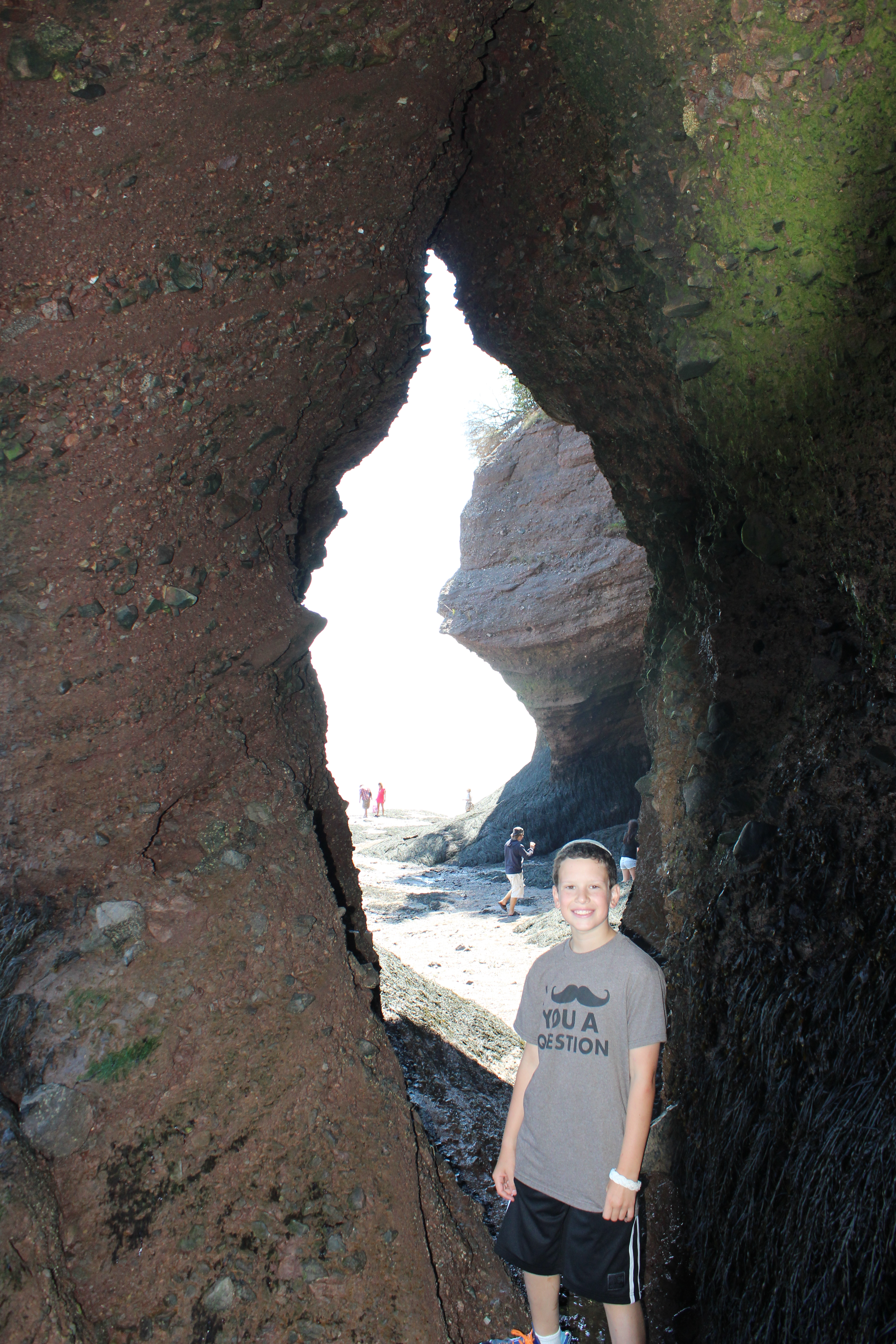
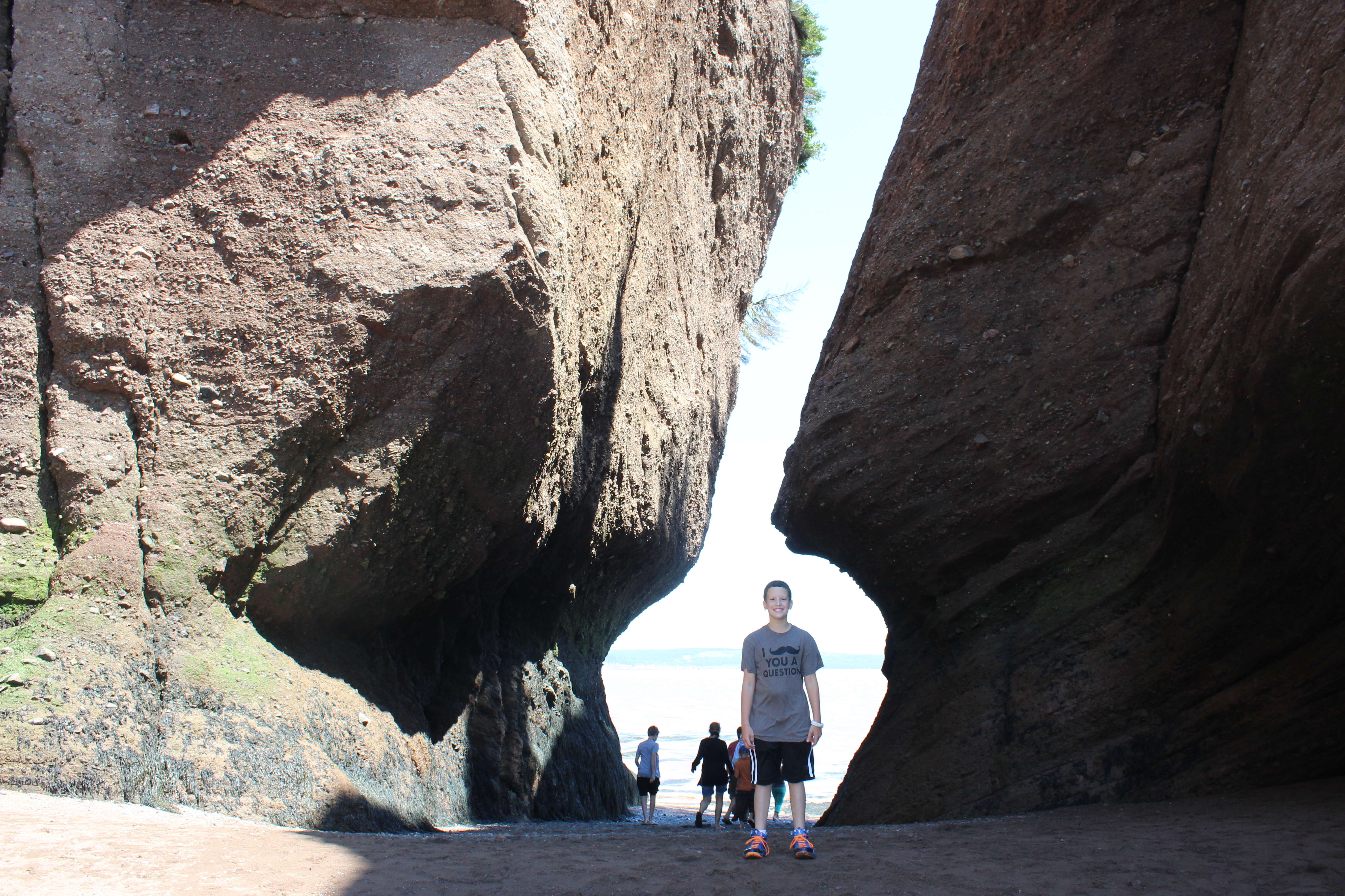

Sorry, I know it’s a lot of photos. It was just so cool I have to share!
On our way back up to the car, we stopped off at the kiosk for the company that leads the kayaking tours. Sadly, we were told that the water was choppier than usual today so they weren’t allowing anyone younger than 16 to kayak. We were disappointed, of course. But took our sweet time eating a picnic lunch, enjoying the weather, and making our way through the gift shop, and by the time we were done it was about an hour and a half before high tide and we were back in good spirits. Not having the patience to wait around any longer, we headed back down to the rocks to see what had changed. Of course, our view was limited due to the fact that the ocean floor was now covered with 15 or so feet of water, but it was still pretty amazing. Check out the before and after:

Low tide
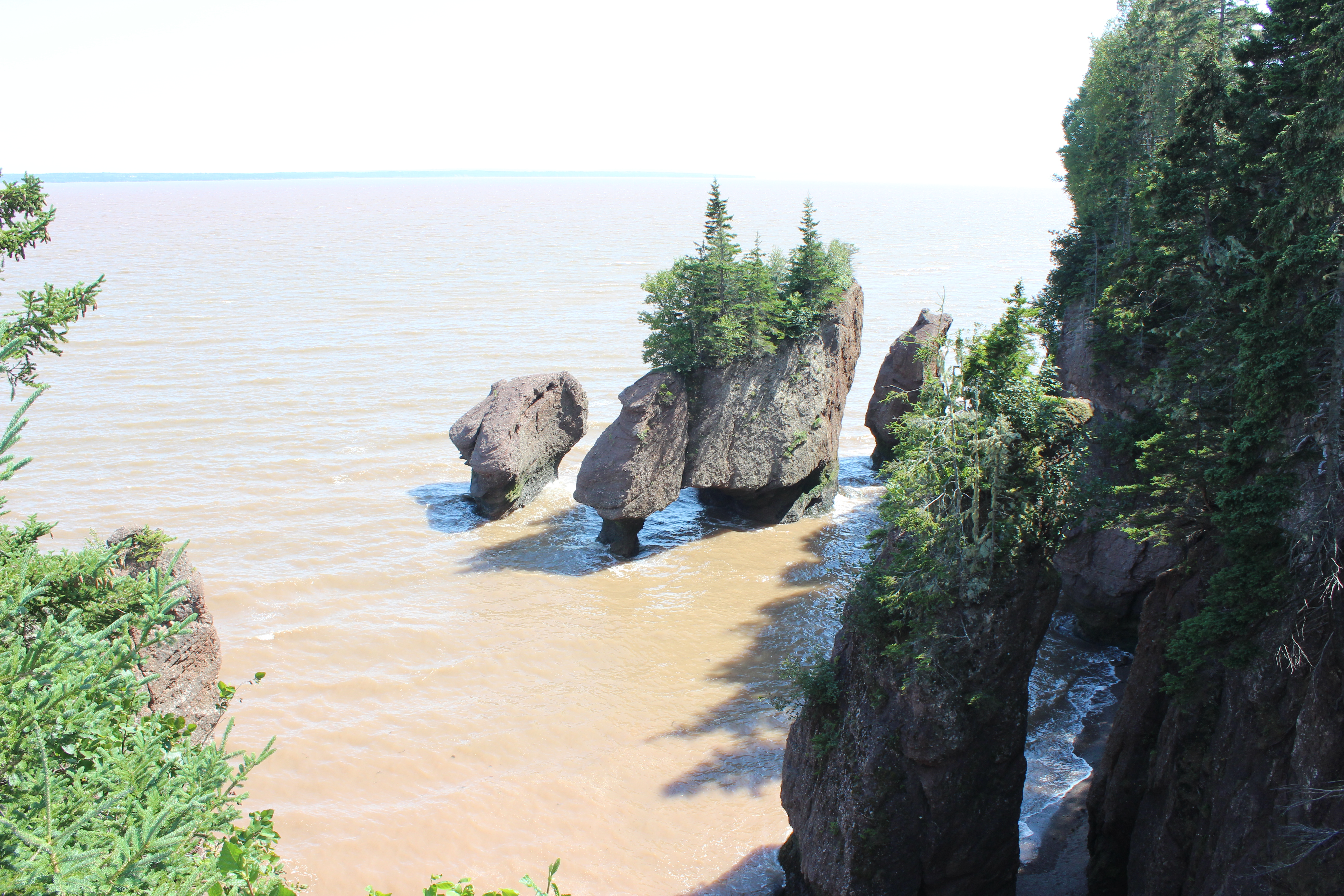
High tide
We stayed to gaze and to appreciate nature’s freakiest abilities for a few minutes. We left when the kayakers came out, which was really cool to watch but also made us jealous.
Finally it was time to head back stateside. Sam passed the time by watching “Ghostbusters” for the first time (he loved it, by the way), and I passed the time by marveling at how poorly my car’s GPS works in Canada and how much gas costs ($1.30 per litre, which works out to more than $5 per gallon). Eventually we made it back across the border, at which point we chanted “U-S-A! U-S-A!” and got our hour back by switching back to Eastern time. 7:45 magically became 6:45, and we stopped at the first rest stop we came to on I-95 to make dinner. At Sam’s suggestion, we celebrated Fundy Mondy with a treat: ribs. As we ate, we talked about how fantastic and magical the Hopewell Rocks were. Sam thanked me for the day’s adventure, which he tends to do during dinner almost every night on these trips. But this time I responded by thanking him in return. He asked what for.
“For being my excuse for taking these trips, and for being the one who comes along with me.”
He thought for a few seconds, and then he said something I don’t think I’ll ever forget:
“If I have a son, I’m going to do this with him every year.”
My heart melted. He continued.
“And I’m going to use your itineraries, unless there’s new stuff by then, like flying cars or something.”
The day may not have been perfectly planned (OK, or even planned at all), but often life’s best moments are not the one you plan but the ones you never see coming, that just pop up without warning and take your breath away.
Going to Extremes
I loved C.S. Lewis’s Narnia books when I was a kid. I read the whole series, one right after the other, and was disappointed when I got to the end and had no more Narnia books to read. I had no idea at the time that it was all a thinly veiled religious allegory, I just loved the story. I’ve since forgotten much of those books, but one thing that stuck with me through the years was a plot point in the third book, Voyage of the Dawn Treader, in which the kids go in search of the end of the world, or as they called it, “the utter east.” That’s where we went today.
We started the day at Stephen King’s house, however. We slept in Bangor and I didn’t want to leave town without at least having seen King’s house. We didn’t know the exact address, just the street it was on, but it wasn’t that hard to find, what with it being the only house in the neighborhood with large iron bats and a spider web adorning its front gate.

What I liked about the house was that it’s in an actual neighborhood, as opposed to being completely secluded on a massive estate behind giant walls and hedges, as you might expect from a famous mega-millionaire. It’s in a nice but unpretentious part of town, which I think says as much about the guy as the bats on the gate do.
Anyway, our next stop was a bridge. When I started researching things to do in Maine, the names of three bridges kept coming up. One of them was the Androscoggin Swinging Bridge, which we saw a few days ago. By far the coolest of the three is the Bailey Island Bridge, which is architecturally mindblowing as it’s basically just a bunch of large slabs of granite piled on top of each other with large gaps that allow the rising and ebbing tides to pass right through. I was intrigued, but its location made it completely impractical for us to see it. The third bridge, the Penobscot Narrows Bridge, was almost directly on our route, and appeared to be quite pretty, but not especially exciting in anyway. That was, until I discovered that the very top of one of the two pillars that hold up the bridge’s suspension cables houses an observatory. There are only four bridges in the world that have observatories at the top, and the Penobscot Narrows is the only such bridge in the United States, and it’s the tallest in the world. So that’s where we headed after leaving Bangor this morning.
You reach the observatory by taking an elevator at the base of the pillar, which is located in Fort Knox State Park (no, not that Fort Knox, sorry). You actually have to drive over the bridge to get there, which helped increase our anticipation a bit. And the observatory didn’t disappoint. It towers 420 feet above the Penobscot River and everything else around it.
And, with Friday’s terrible weather completely forgotten, the sky was beautifully clear, allowing us to see for miles in every direction. There were some cool views–watching boats snake down the Penobscot, looking down onto the bridge itself, looking out over neighboring (and ugly) Bucksport all the way to Bangor–but I think my favorite view was this one:

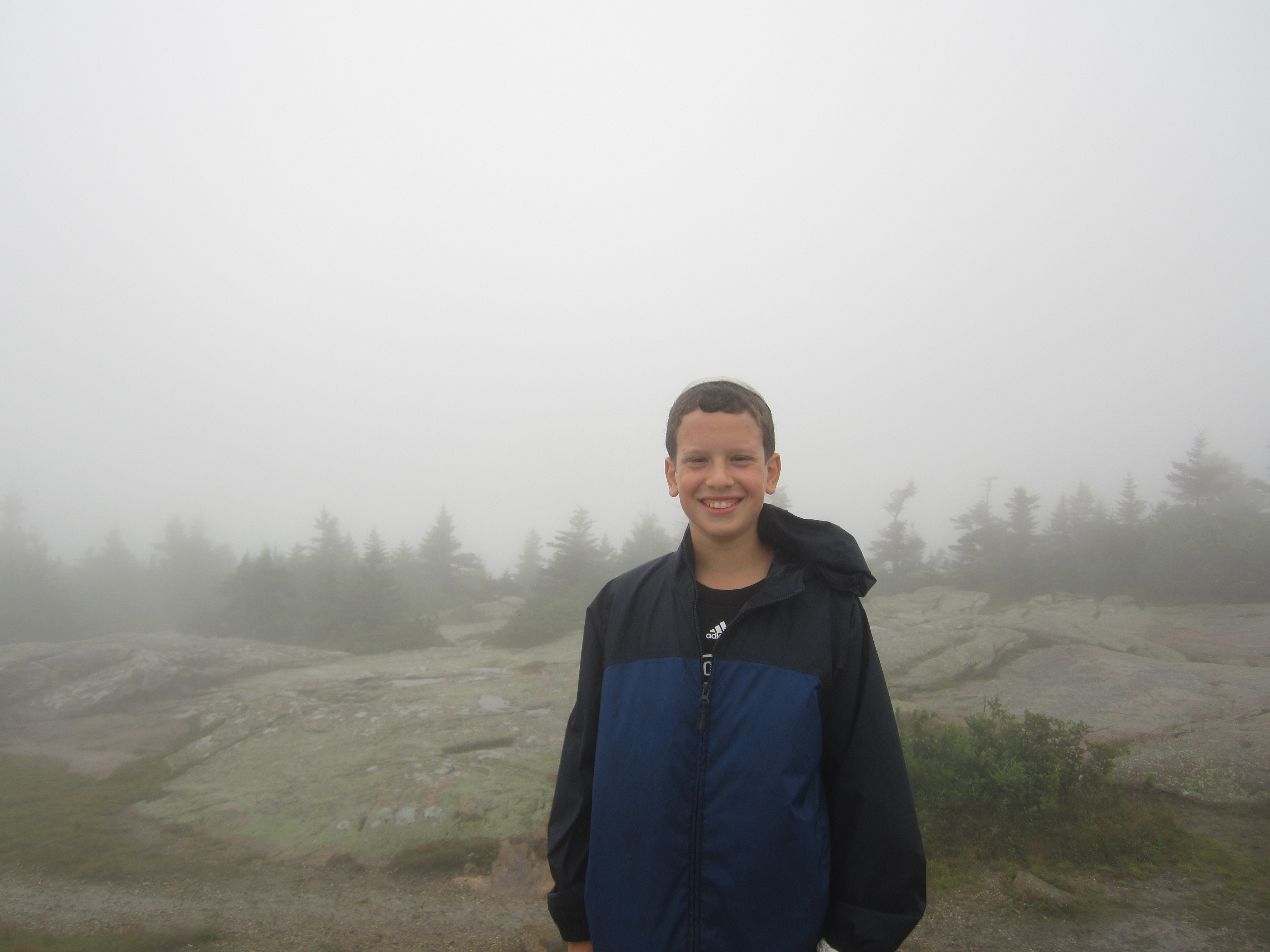
No, not the cell tower. See that mountain in the distance behind the tower? It’s Cadillac Mountain, the peak in Acadia that was covered in dense fog when we were there to enjoy its views a couple of days ago. We may not have enjoyed the view from Cadillac, but at least we were able to enjoy a view of it.
When we were done with the bridge we headed east. In fact we spent the rest of the day heading east. Among other things, Maine is famous for its blueberries, and US1 winds its way through blueberry country, staying near the coast as it transverses the bottom part of the state. We passed countless blueberry stands and blueberry barrens, but we finally stopped at one that stood out among all the blueberry places in Maine: Wild Blueberry Land. It’s a store that sells all manner of blueberry-related goods you can imagine, from actual berries and freshly made pies to blueberry flavored coffee, blueberry liqueur, and even blueberry soap. But what really sets it part is not the name or the merchandise but the exterior:
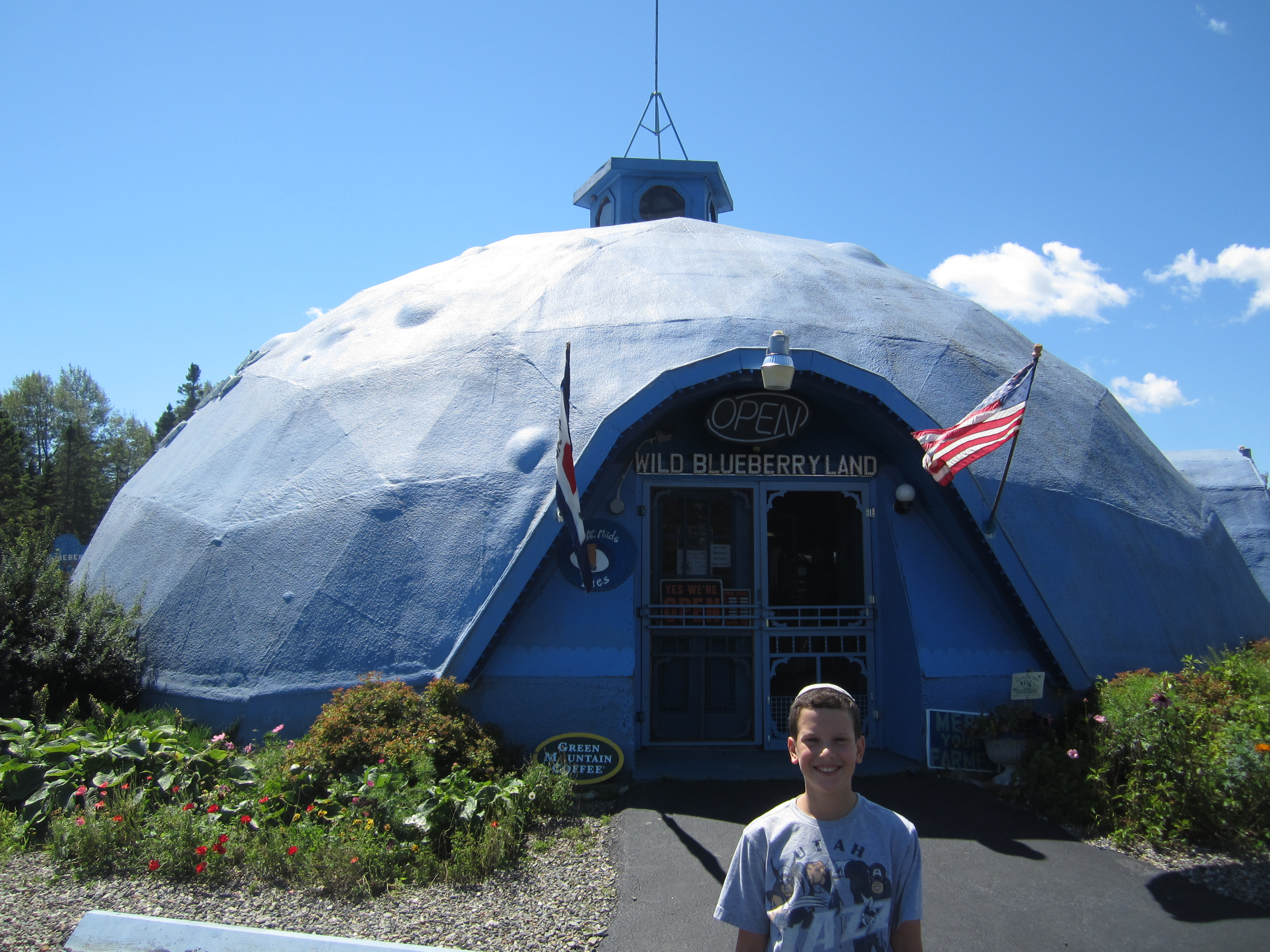
Yup, the store is a giant blueberry. The biggest on earth, they claim. I will say that what matched our delight at the sight of the place was our delight at the smell of the place. As soon as we walked in we were hit with the most incredible aroma of fresh blueberries, and when we got close to the counter inside the smell of the fresh pies started turning into a hand and beckoning us like it sometimes did in the old Bugs Bunny cartoons.
One of the most frustrating things about being a kosher traveler is not the inconvenience or the limited options but the inability to sample the local cuisine everywhere we go. Lobster is obviously out of the question, but I figured we’d at least be able to partake in the blueberry mania that is rampant in Downeast Maine. Everywhere we go we see blueberry jams, blueberry honey, and of course the pies. But none of it is certified kosher (and I’ve checked every single one) so we’ve had to pass on it every time. The pies at Wild Blueberry Land aren’t kosher either, but I did finally find one kosher item: canned blueberries in syrup. I know, it probably tastes just as gross as it sounds, but I had to have blueberry something. They were also selling local wild blueberries by the pint, and I snatched up one of those, too.
Sam insisted on playing the blueberry-themed mini-golf course that was next to Wild Blueberry Land, which I was happy to do, but all I really wanted was to get into the car and tear into those fresh blueberries as we drove further east. The aroma in the store definitely fed the craving. Finally we finished golf and I got to taste them. And they were so good. These were no doubt the best blueberries I’ve ever had. And they looked great, too. Not like supermarket blueberries, but like individuals. There was no uniformity in size; small ones, big ones, and medium ones all comingled in the container crying out to be enjoyed. Even Sam had a few, and he doesn’t like blueberries. Before I knew it half the pint was gone. The only thing that stopped me from finishing the whole thing was that we got to our next stop.
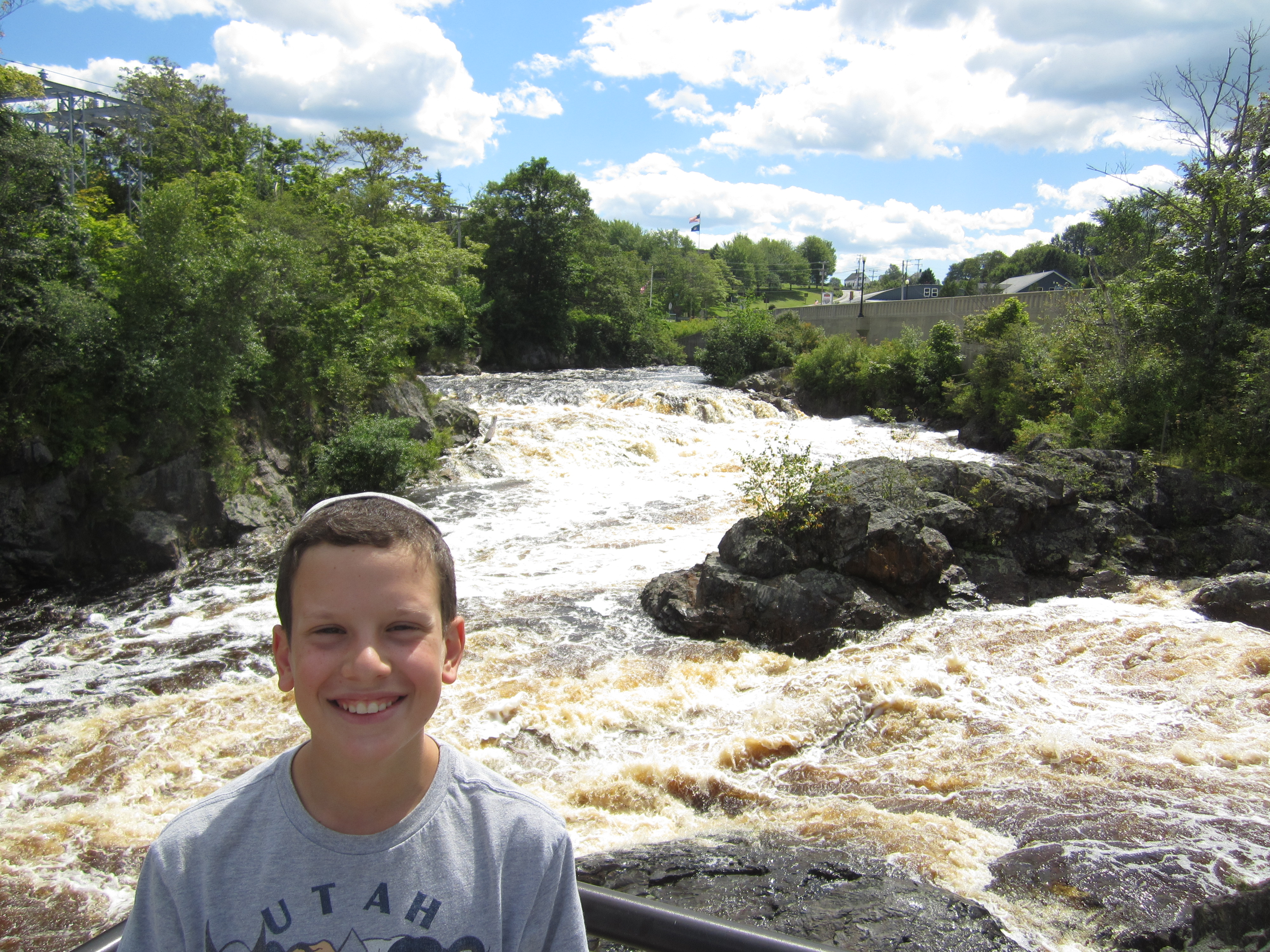
The town of Machias, Maine, is known for two things: blueberry barrens and a handful of waterfalls that gave the town its name. Native Americans named the place Machias after the Machias Falls, which translates to “Bad Little Falls.” We may not have stopped off to see the falls except that they are literally directly under the highway. We immediately understood where the name came from. The falls are not tall but they’re powerful; the water doesn’t fall over the edge, it gushes and jumps and smashes over the edge. It was also oddly colored, especially since upstream the water was blue and several yards after the falls the water calmed and returned to blue. But in its rage over the falls it was brown–Sam said it looked like a Coke waterfall.
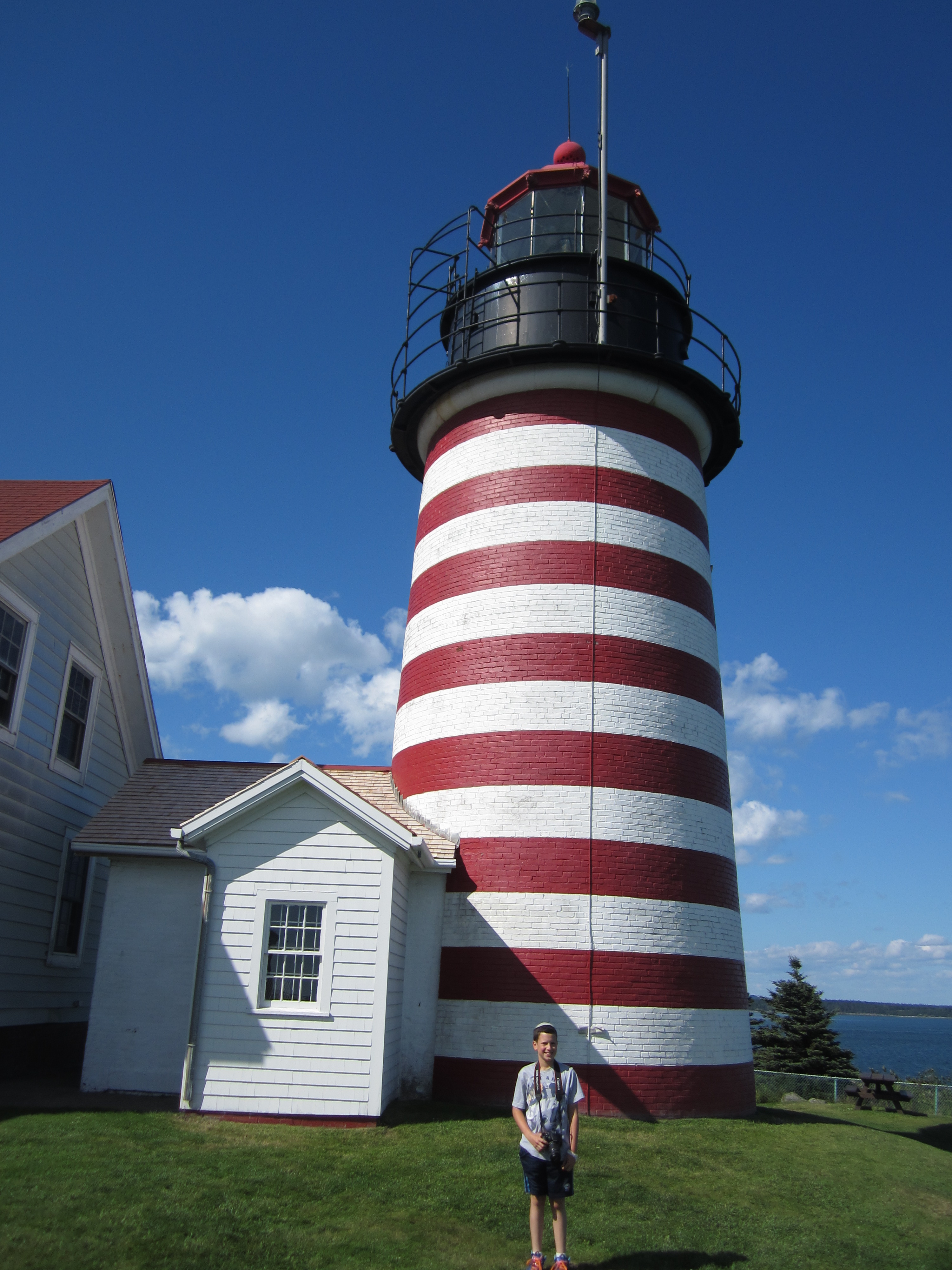
Once we were done with the falls there was nothing between us and our journey to the utter east. Maine, obviously, is the easternmost state in the U.S. Lubec is the easternmost town in the state. Quoddy Head State Park is the easternmost part of Lubec. The easternmost tip of the park, therefore, is the easternmost tip of the contiguous United States. Standing at that tip is the West Quoddy Head Light, an iconic lighthouse painted with wide, horizontal red and white stripes. We love lighthouses and we love extremes and superlatives, so this was a natural for us.
Our original plan was to get to the lighthouse before sunrise so that we could be the first people in America to see the sun come up. Unfortunately, the park doesn’t open until 9a.m., so that wasn’t an option. (We did notice, however, that the park is unstaffed, so if you ever plan to visit this spot it’ll be easy enough for you to sneak in early to see the sunrise if you so desire.)
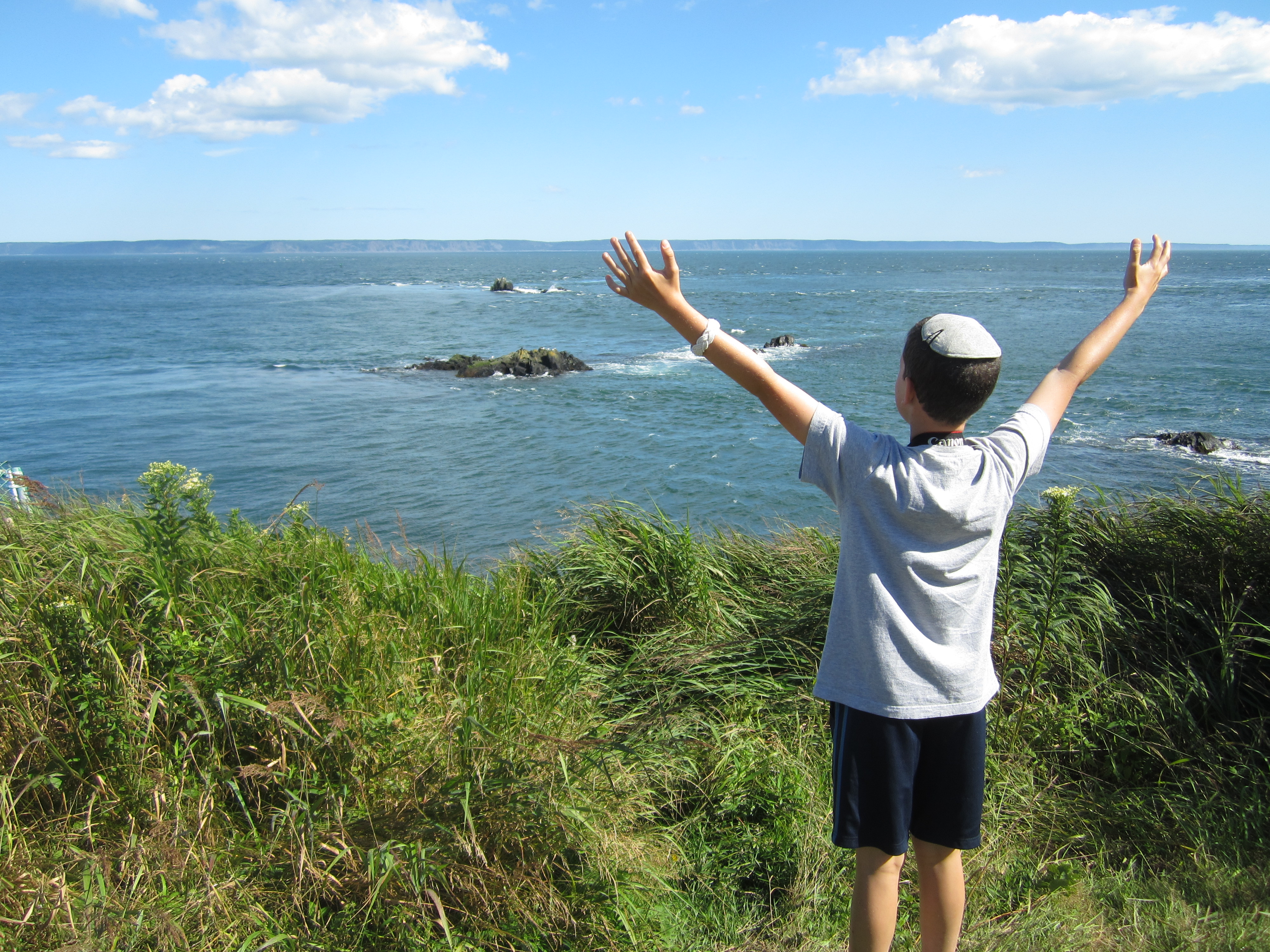
The drive to Lubec, through Lubec, and to and through Quoddy Head State Park felt exactly like such a journey should. The buildings became increasingly sparse, the distance between road and water increasingly thinned, cell service waned and disappeared, and Hamster and I remarked to each other how much it felt like we were driving to the end of the world. Of course, we were merely driving to the end of the country, and Canada was just a short distance further east across the Bay of Fundy, but still. There was something specifically adventurous about the trip, as if we were explorers charting new territory. It helped that few people live there and fewer still are crazy enough to trek all the way out there just to see a lighthouse and be really far east.
Before we even went to the lighthouse, though, we stopped off at a different part of the park for lunch. Exploring the world can really work up an appetite. And for the second time today we were stopped in our tracks by an extraordinary aroma. This one was of pine and balsam fir, and it was strong and extraordinary. You know those old Pine Sol commercials where the lady said it smelled like she was in a Carolina pine forest? This was way better.
Eventually we left the balsam and made our way to the lighthouse, which did not disappoint. It’s difficult to pick just one photo to share but it looks great from every angle, so there’s really no bad choice. Even so, I can’t decide so here’s a few:


Of course there’s an official marker declaring this to be the easternmost spot, next to which we posed. And like he did a few years ago when we were in Hawaii and went to the southernmost spot in the U.S., Sam declared it all as his own.
I’m Yertle, the ruler of all that I see!
Incredibly, we were not yet done with geographical oddities for the day. We were already the furthest east we could get and we were pretty far north compared to the rest of the country, but we could go further north still. We didn’t have to travel far to get to Perry, ME, where we crossed the 45th latitudinal parallel, which meant we were not merely far north, we were halfway to the North Pole!

The sign in the photo is actually outside a gift shop called the 45th Parallel. The official U.S. Geological marker is a few yards up the street, and we took pictures there too, but it’s pretty dull, especially compared to this one.
With all that done, we had just one more line to cross:
Yup. Canada. The Hamster and I have been semi-obsessed with the Bay of Fundy ever since he learned about Canada in depth in fifth grade. Forty-foot tidal flows! Crazy rock formations! We were planning to see a bit this evening and then some more tomorrow, but I forgot we’d be losing an hour when we crossed into New Brunswick (they’re on Atlantic time, which is an hour ahead of Eastern time), so by the time we checked into our motel in Saint John, NB, it was about 7:30 and both sun and son were starting to fade.
Speaking of our motel, if you ever find yourself in Saint John overnight, you’d be better off sleeping in your car than in the Regent Motel. It’s tiny and decrepit, and those are the positives. There’s a three-inch gap between window and frame that I had to stuff with flimsy towels, there’s someone else’s food in our fridge, there’s no phone in the room, there’s a bright light right outside our front door, and there’s an army of vicious, hungry mosquitos right outside the door, too. You know you’re in a bad motel when your first reaction is, “I wish we had stayed at the Howard Johnson’s instead.”
Which means that after a day full of superlatives of all sorts, the Regent Motel provided our final superlative of the day: the absolute worst motel I have ever had the misfortune to stay in.
The Rain in Maine Falls Mainly on Acadia
I think it’s safe to say our luck with the weather has run out.
The Hamster and I had been looking forward to visiting Acadia National Park as much as we’ve been looking forward to any part of this trip. In general, we’ve come to love National Parks. Plus, Acadia is reputed to be one of the most beautiful places on earth. We’ve been to several of the rest of the most beautiful spots, so we had pretty high hopes. But those hopes were dashed as soon as we woke up Friday morning and saw the rain pouring down outside our motel window.
It’s not like you can’t visit National Parks in the rain, but it’s a whole let less fun, especially when the particular park you’re visiting is specifically known for its beautiful views and its many picturesque hiking trails rather than for any specific attractions.
We decided we weren’t going to let the rain beat us, and we were going to make the most of the day (and the park) despite the conditions. I was thankful that I had remembered to pack an umbrella and rain ponchos. So we put on pants for the first time all summer and we donned our rain gear and headed out. In case you were wondering, it is neither easy nor quick nor enjoyable to pack everything you own into a car outdoors in the pouring rain. But the hourly weather report for the day said the rain would stop from 10 a.m. until 2 p.m., so I was hopeful.
The weather report was wrong. It never stopped raining for more than a few minutes from the time we woke up until the time we went to sleep. And I’m not talking about regular rain, either. You know how sometimes, out of nowhere, it will start raining so hard you think your roof is going to cave in, but then five or 10 minutes later it stops? It was that kind of rain all day long.
Getting back to the park itself, there are few spots of particular beauty that are must-sees in the park. If you take the 27-mile loop road that circles the main section of the park (which we did), the first of these spots you come to is Sand Beach, which is exactly what the name suggests: a sandy beach tucked between rocky cliffs along the eastern edge of Mount Desert Island. Probably very nice on a hot sunny day. In furious rain and with temperatures in the high 60s, not so much. We stopped there anyway. Well, at least it wasn’t crowded.
Worst. Beach day. Ever.
A few minutes past Sand Beach is a spot called Thunder Hole, so named because it’s a little natural cutout in the rocky cliffs and when rushing tides come in and hit the alcove, it sounds like thunder. We got there about an hour before high tide, and the weather was pretty stormy, which in this case should’ve actually worked in our favor. Sadly, Thunder Hole turned out to be pretty quiet. We still heard plenty of thunder, but it was real thunder.
Then, off the southern tip of the island we were supposed to see the Bass Harbor Head Light, the most famous of the several lighthouses allegedly visible from parts of Acadia. Here’s a picture:

Next up was Jordan Pond, a rather large and particularly pretty pond (almost a lake, really) that we were planning to circle on foot. We were told that from one side of the pond there are great views of The Bubbles, which are a pair of tiny, rounded mountains that supposedly look like two bubbles rising up out of the pond. I’m sure The Bubbles were there, but this is the view we got:

Are you starting to sense a theme?
It was at about this time that the rain somehow started coming down even more ferociously. We decided not to walk the perimeter of the pond. In fact I would’ve been content to spend the rest of the day seeing the park from the relative safety of our car. However, we had been hearing so much about the miles and miles of interconnected carriage roads that John D. Rockefeller Jr. had built throughout the park out of crushed granite, and how the roads included dozens of pretty little stone bridges that spanned various streams, each bridge different in design than all the rest. I picked out a small section of carriage road that would enable us to see two bridges while only walking half a mile. Sam resisted. I put my foot down and insisted. I felt like we couldn’t leave the park without at least seeing the carriage roads. Besides, how much wetter could we possibly get?
A whole lot wetter, it turns out. Even in the rain and fog, the bridges were as pretty as advertised, and the woodland surroundings were lovely. Still, by the time we got back to the car we were so thoroughly soaked that we may as well have swam across Jordan Pond with all our clothes on.
Yay, carriage roads!
The loop road took us closer to The Bubbles, and there was a pull-off for hiking trails that led to each one. We opted against the hike, but we weren’t ready to give up on bubbles just yet…
Finally it was time for the grand finale, a drive to the top of Mt. Cadillac. It’s pretty small for a mountain (1,530 ft) but it’s the tallest peak on the island and the summit offers breathtaking views 360-degree views of the whole park and beyond. Or so we’re told. We’ll have to take everybody’s word for it. Here’s Sam at the summit:
View? What view?
Well, at least it stopped raining, right? On the drive down the mountain the fog was so thick that I couldn’t see more than about 30 feet in front of me. We laughed as we passed pull-offs for scenic overlooks. Just for fun, we even stopped at one. This is what we saw:

Sigh. OK, so our trip to Acadia wasn’t what were hoping for. And when it was all over we still had to unpack the car to move into our hotel room in the rain. I’m just glad we did a better job of staying positive than we did of staying dry.
The Hamster’s Turn
I could tell you all about today myself but instead I’ll let Sam do all the work. The only thing he leaves out is that it started raining pretty hard soon after we finished recording, so we finished grilling burgers in the rain and ate them in the car, soaking wet. Anyway, here he is. Photos are below the video.
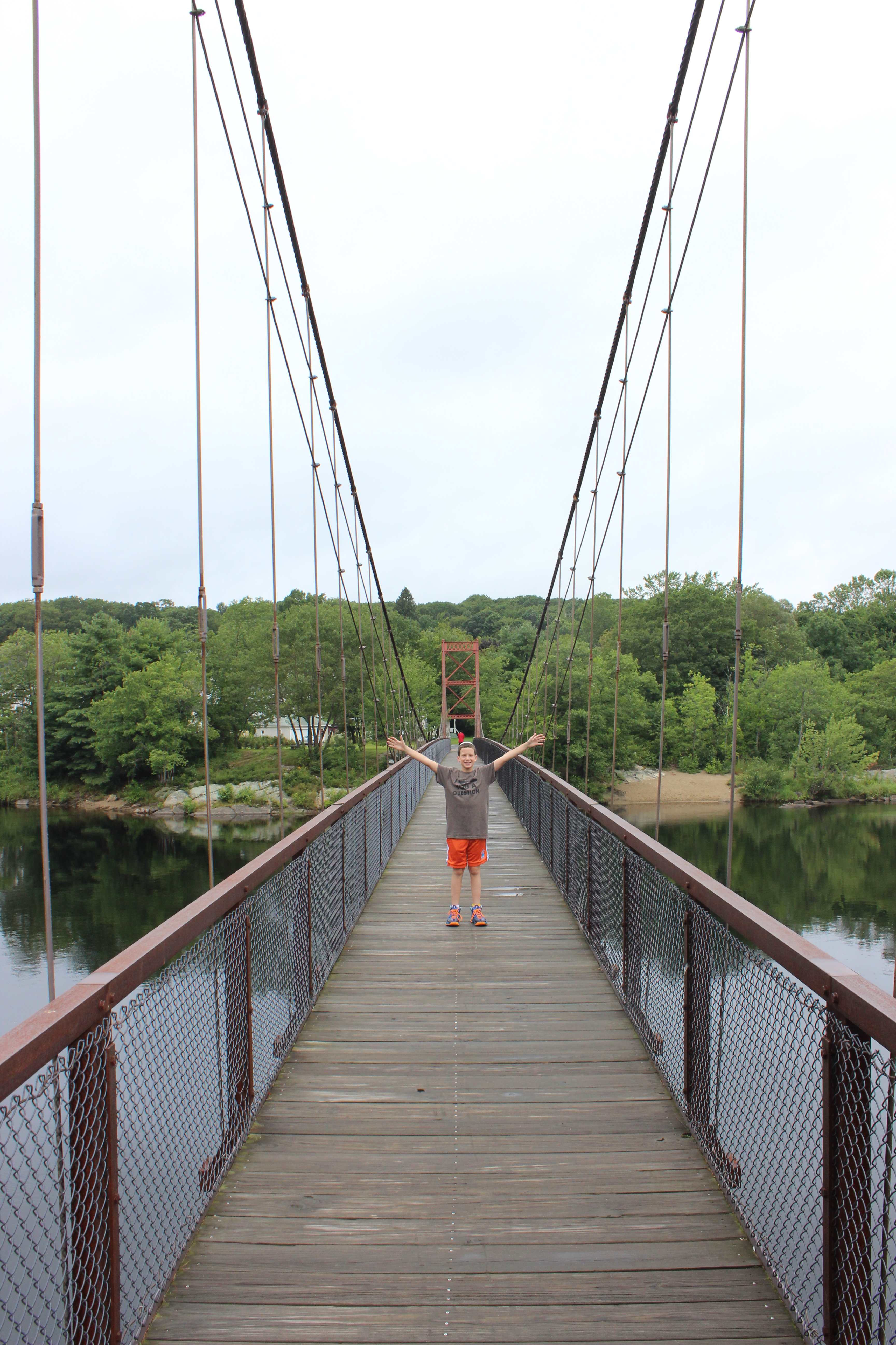
Swinging pedestrian bridge built by the John Roebling company
What’s holding the bridge together?
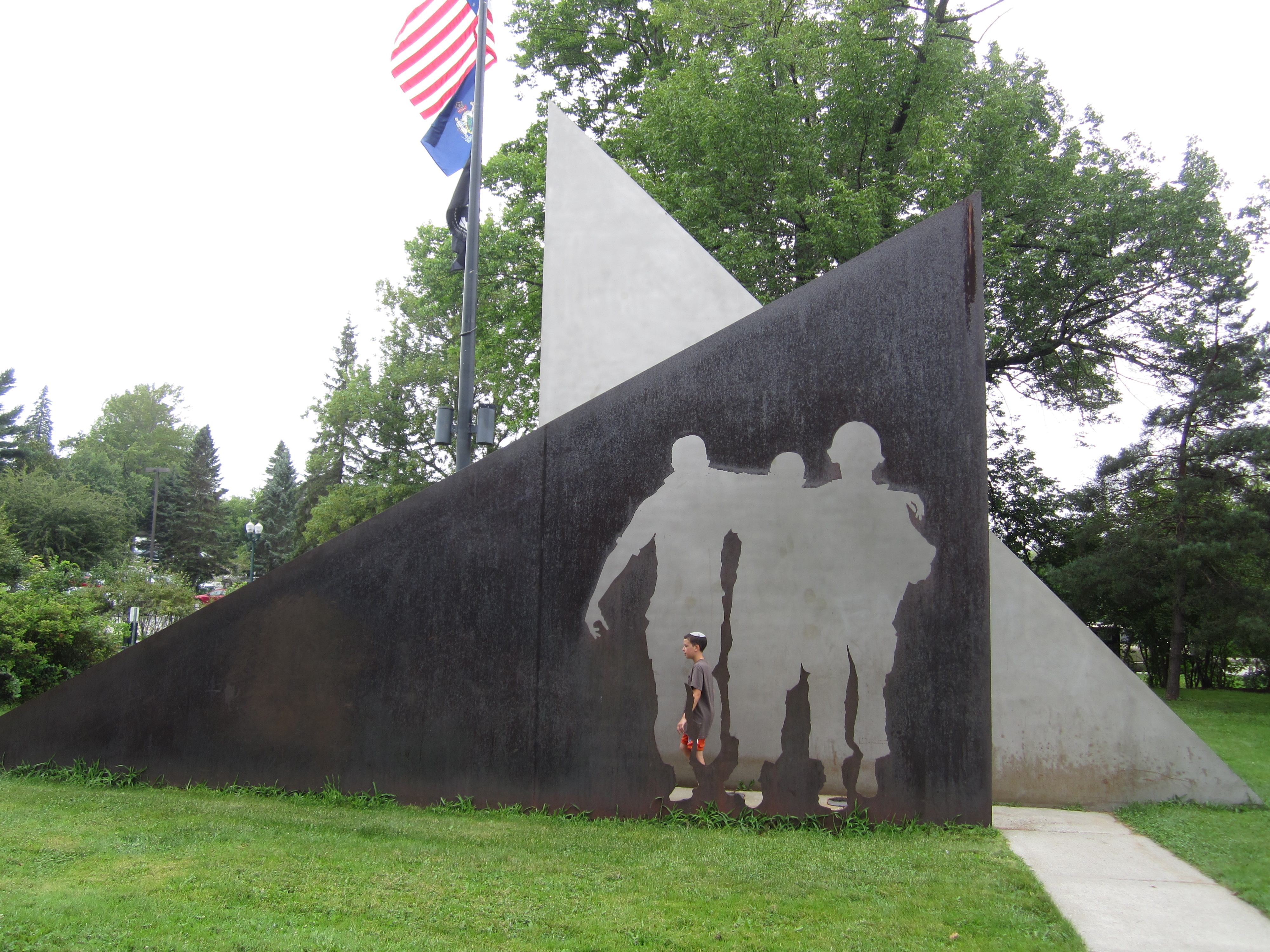
Sam investigates the Vietnam Memorial in the park across from the Maine Capitol
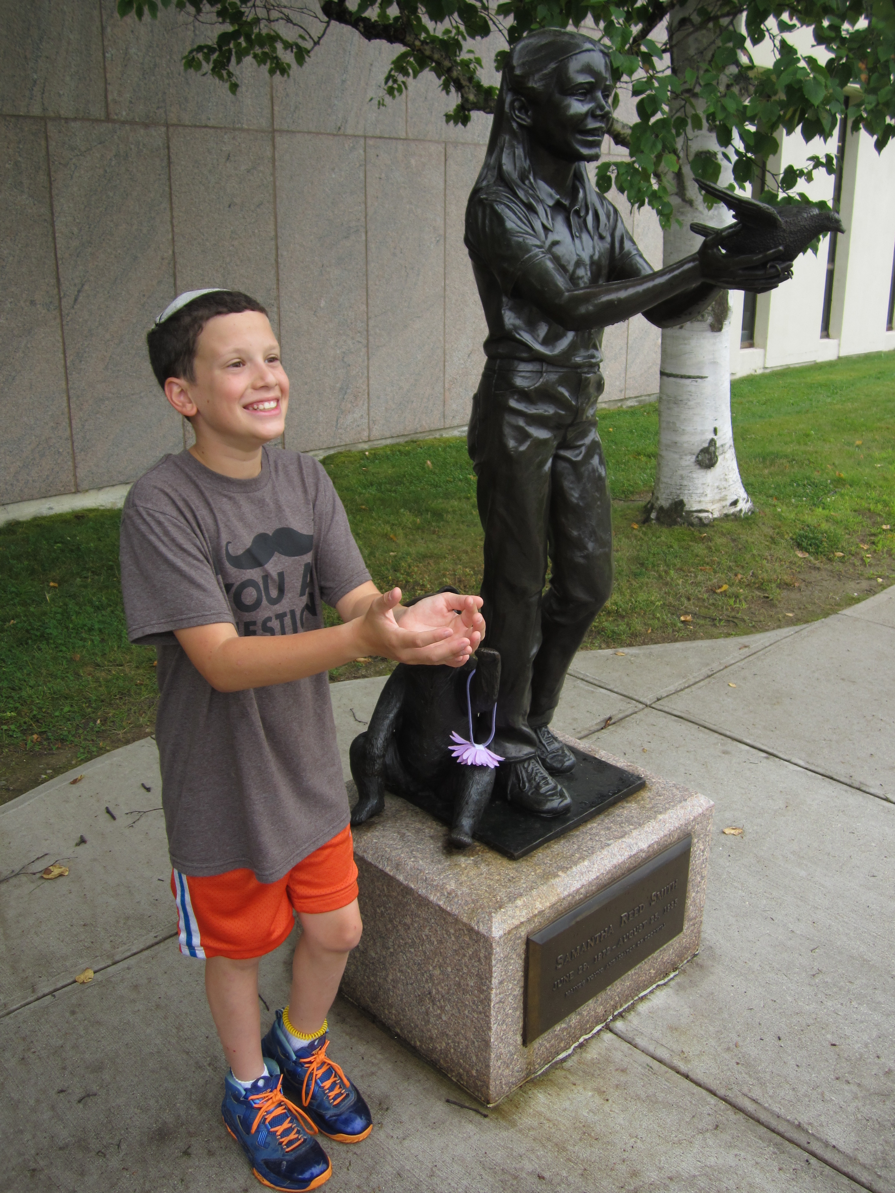
Sam and Samantha
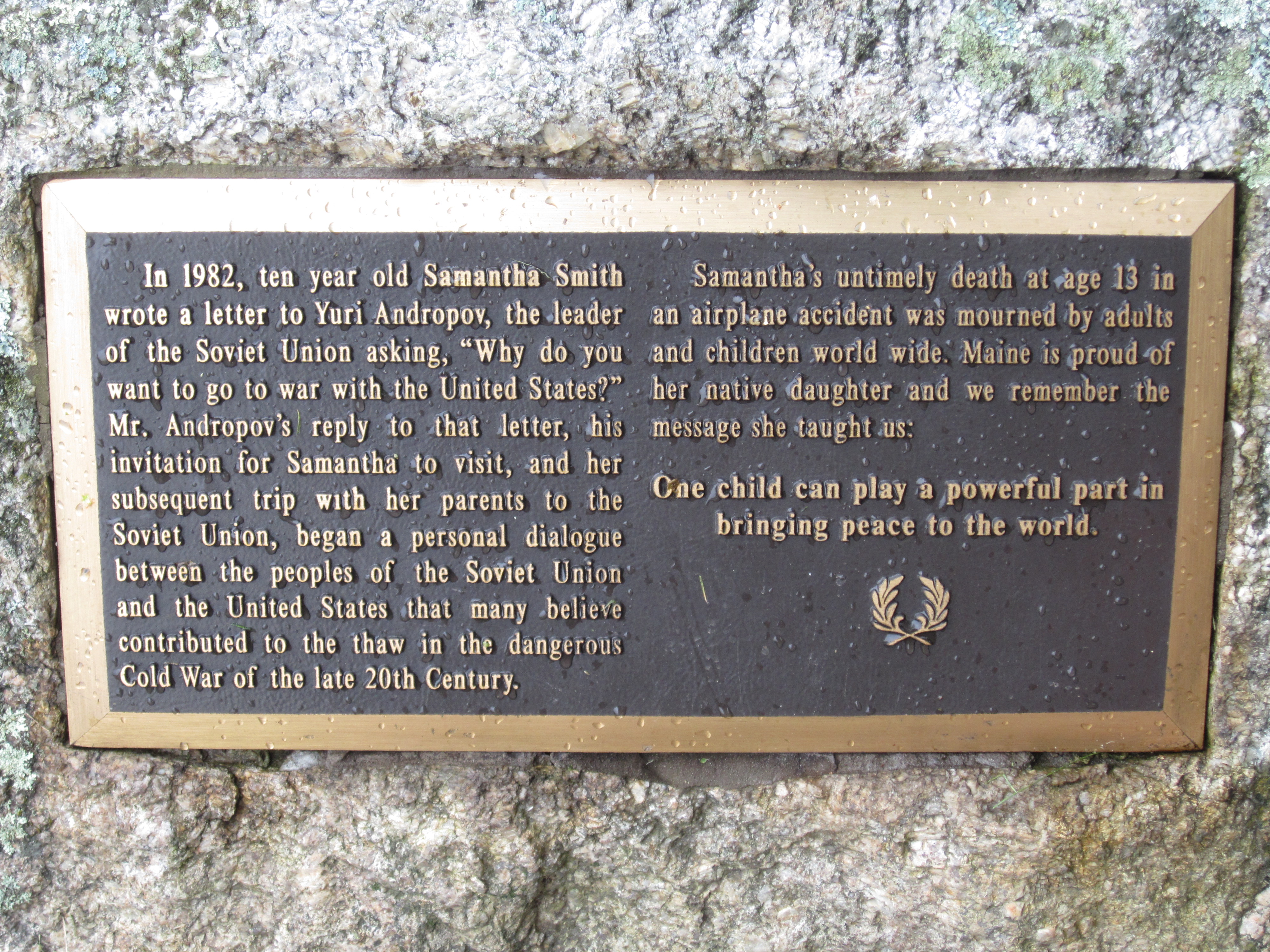
The story behind the statue
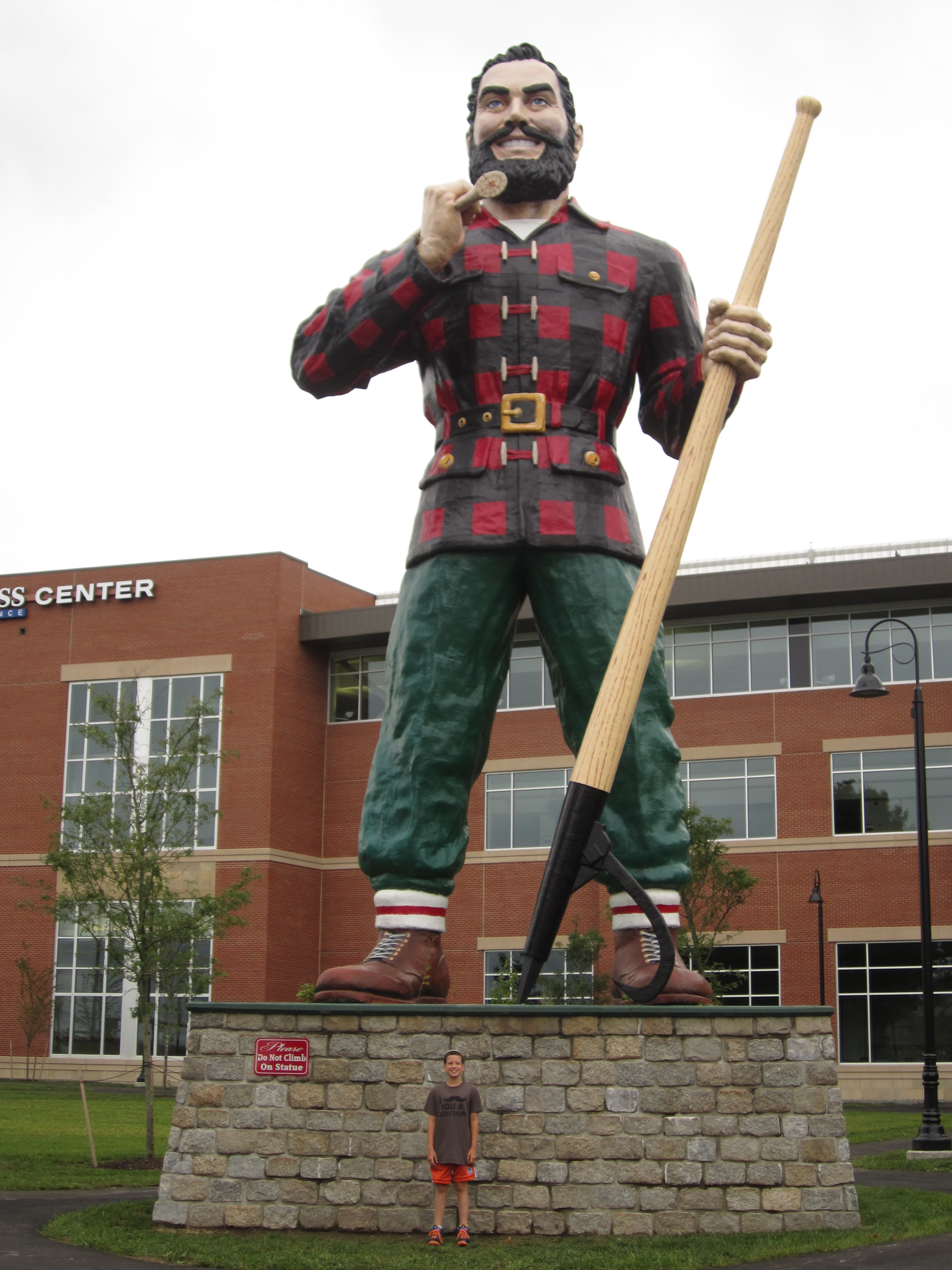
Sam: 5 feet tall. Paul: 31 feet tall.
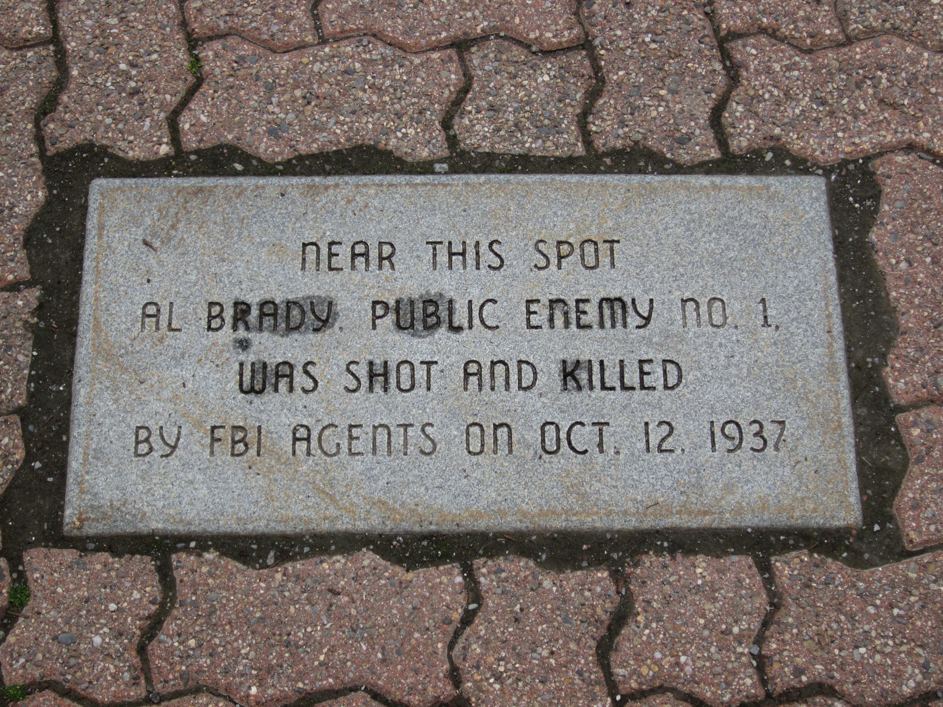
All that remains of Prohibition-era bank robber Al Brady in Bangor
In the early 1900s, much of Bangor was destroyed by fire. dozens of different masonry companies arrived to rebuild it, leaving downtown Bangor a patchwork of different bricks.
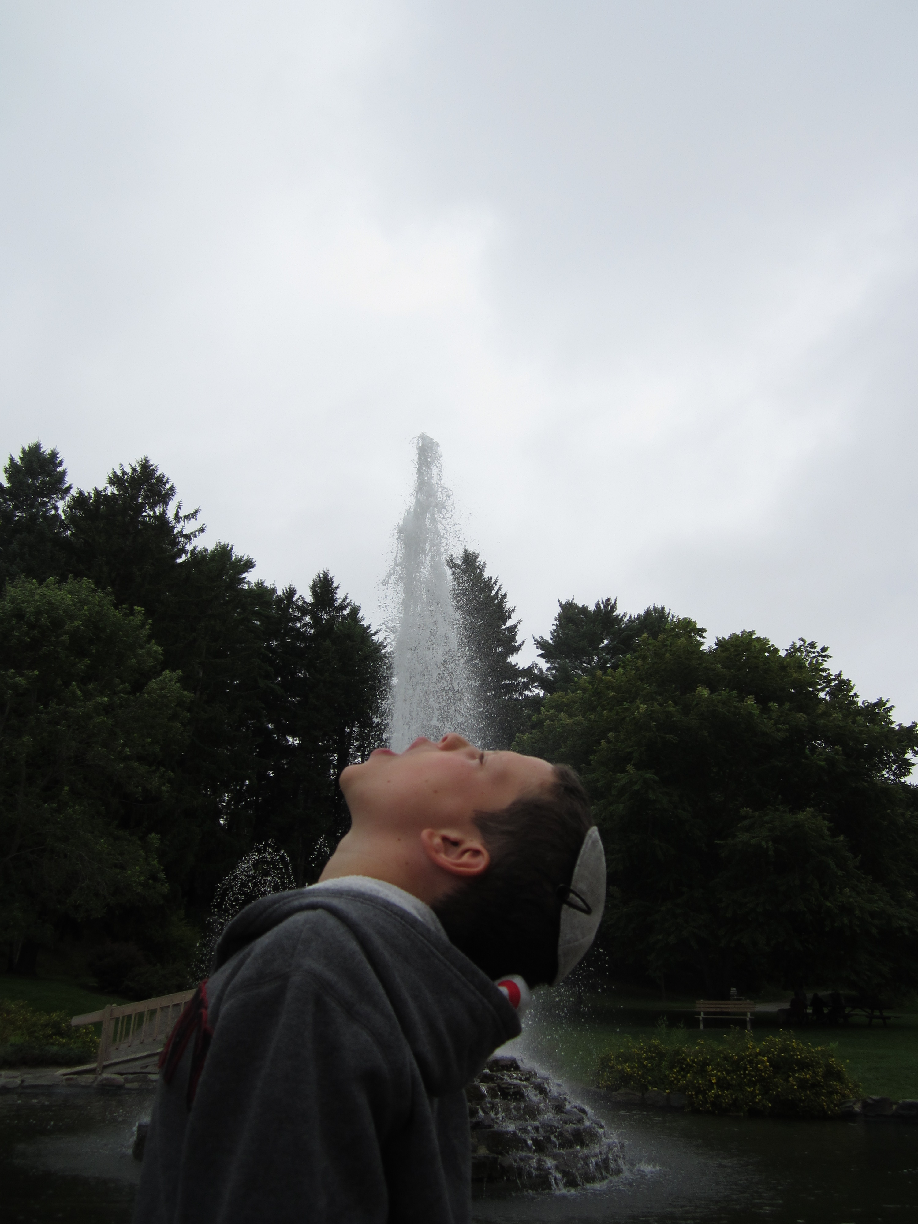
Fun at the fountain in Cascade Park, Bangor
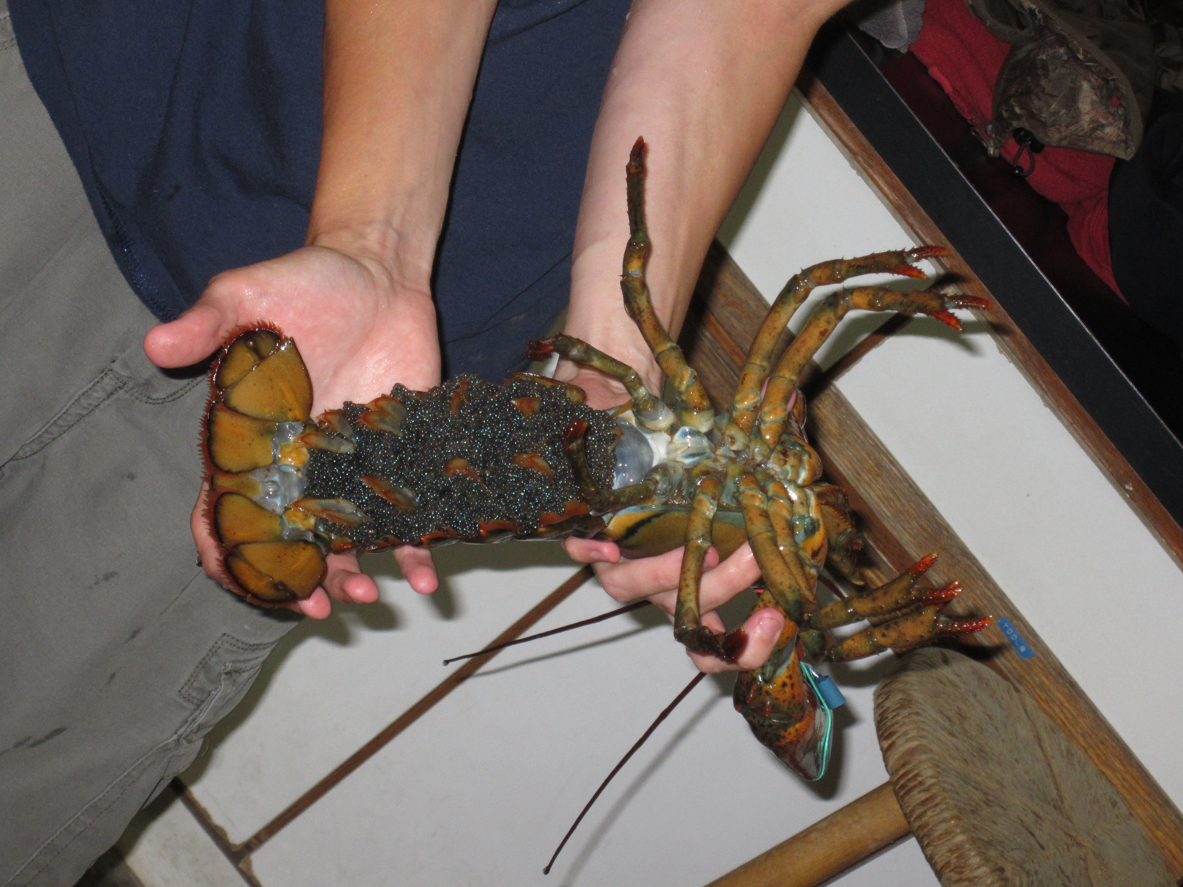
Those dots all over the tail of this mama lobster are her 6,000 eggs, most of which will be hatched by the time you read this (after 2 years of pregnancy)
Tiny lobster babies, soon to be released in the wild
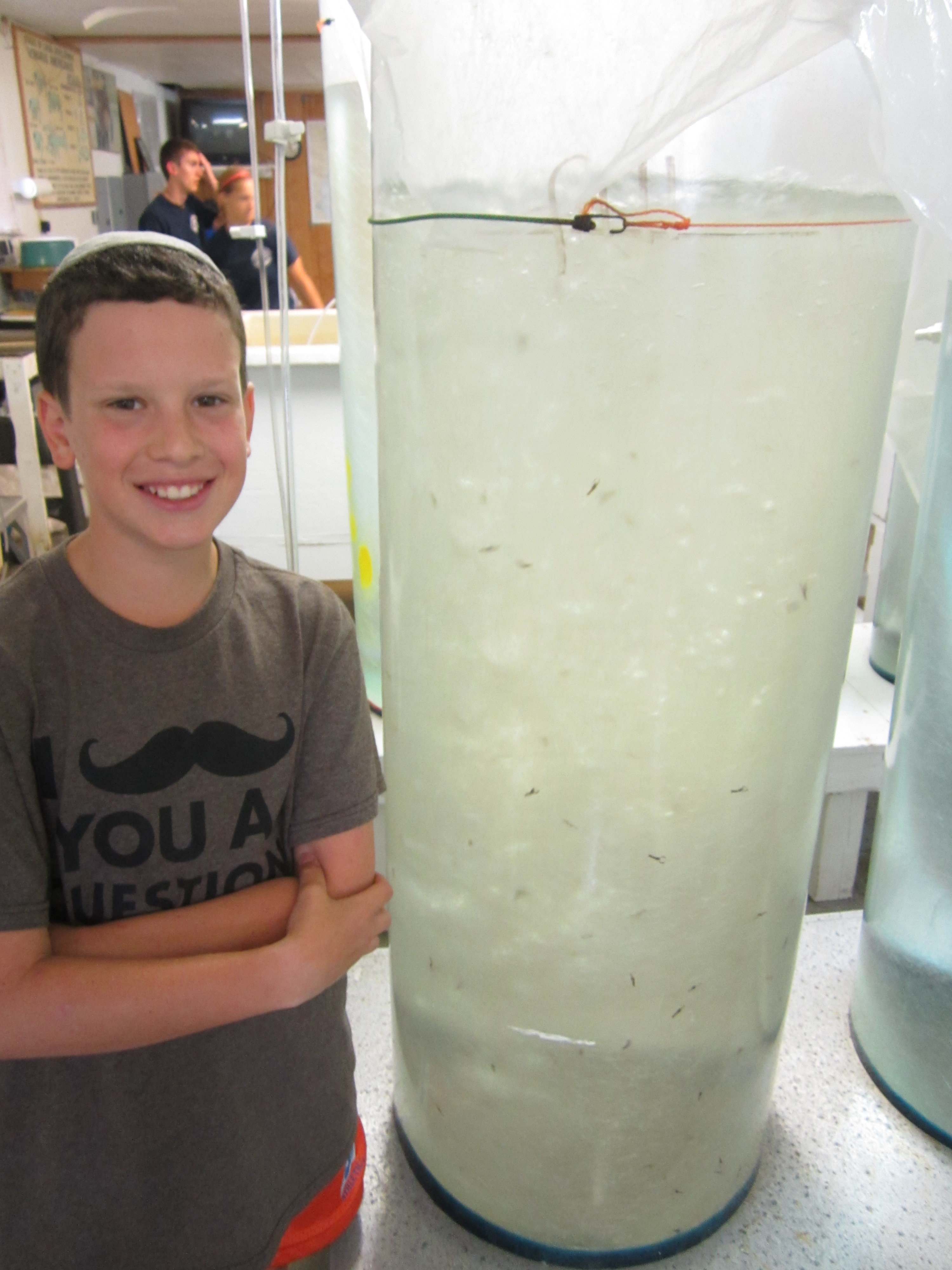
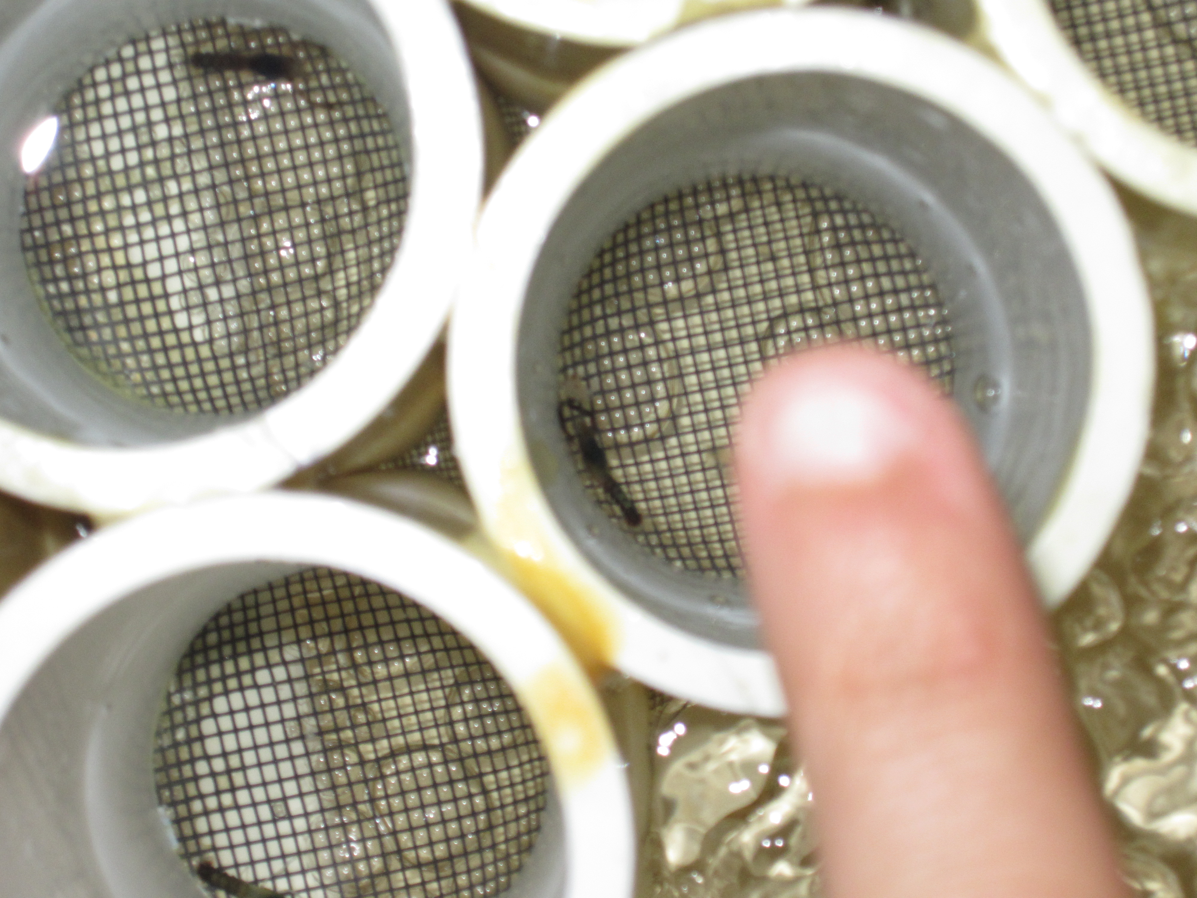
Hundreds of younger baby lobsters not yet ready for release
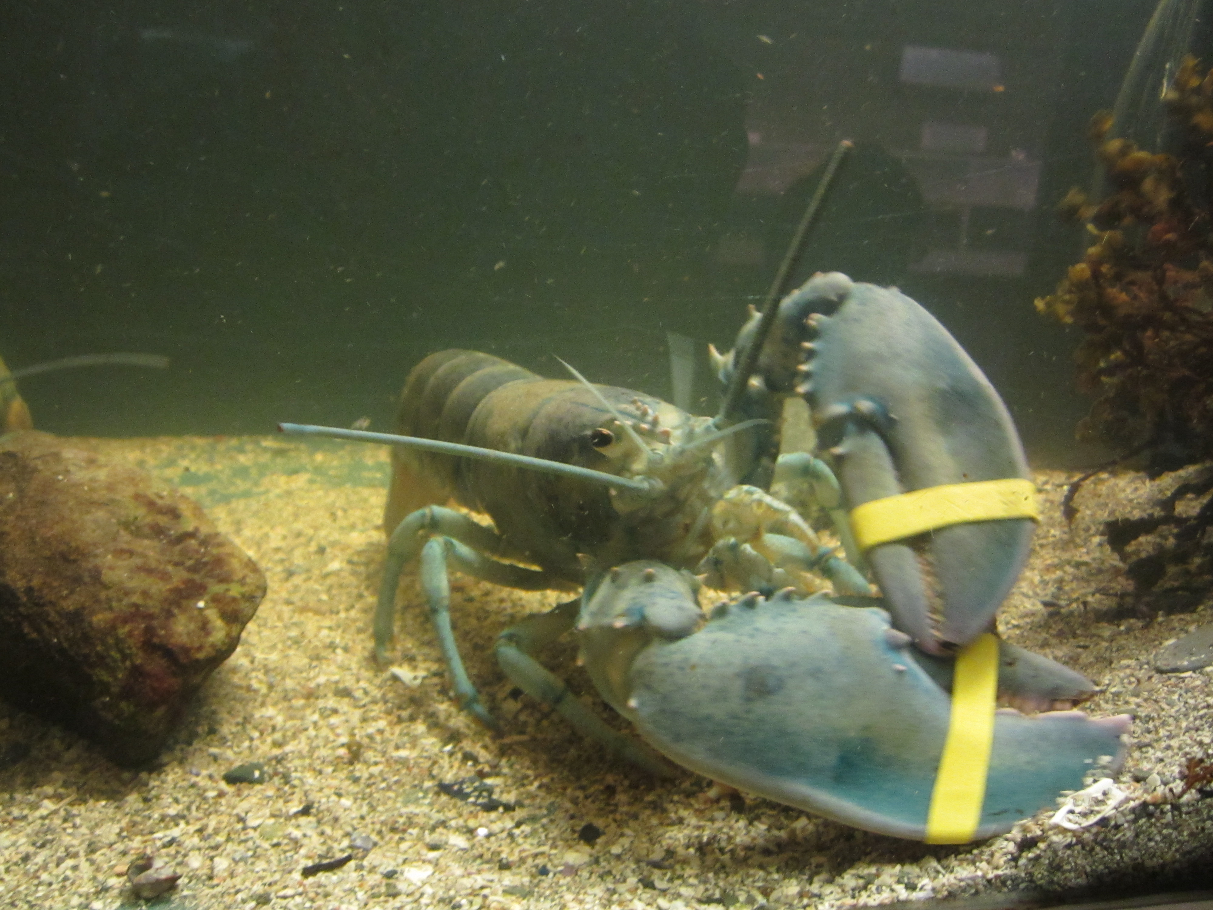
Blue lobsters occur naturally but rarely: only about one in every 1,000,000 lobsters is blue
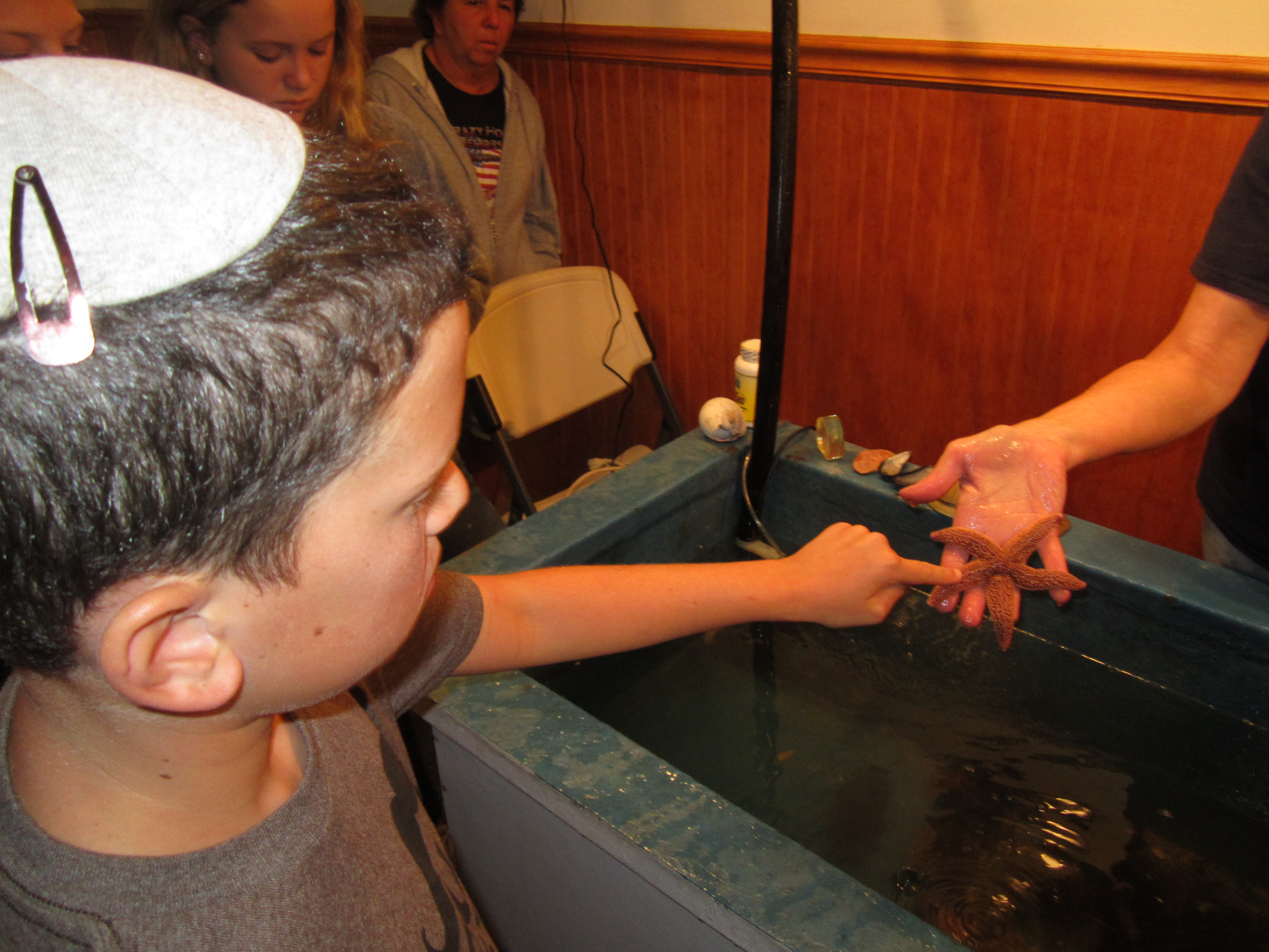
At the Bar Harbor Oceanarium and Lobster Hatchery, we got to touch some odd sea creatures, including a sea cucumber, a scallop, and this sea star
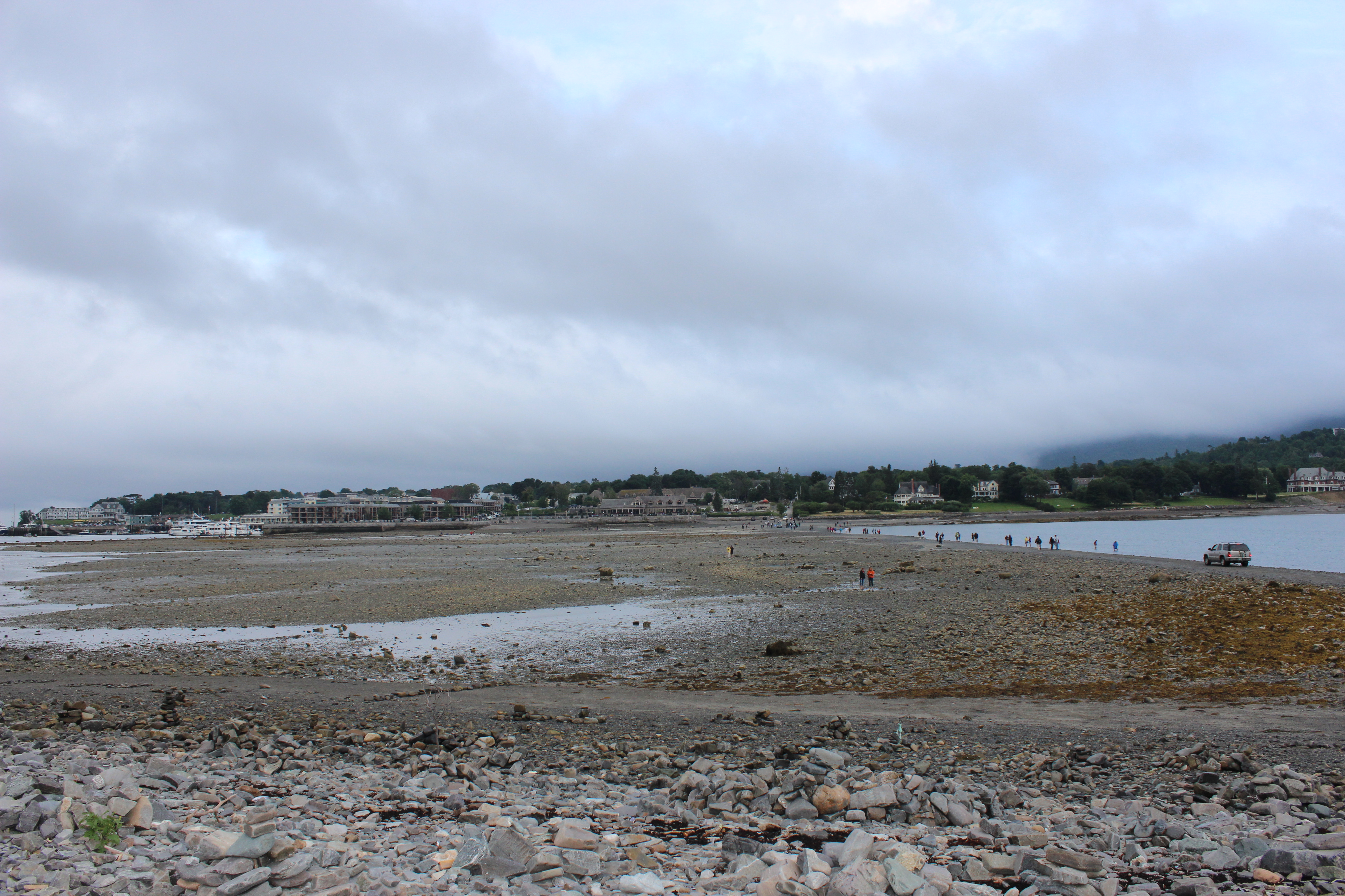
This sand bar connects downtown Bar Harbor to nearby Bar Island, but it’s completely underwater except at low tide.
You can even drive across the sand bar, but you REALLY do not want to leave your car there for very long.
A one-mile hike to the highest point on Bar Island yielded a pretty great view.
No Vacancy
There’s a saying that any trip to Maine has to include the four L’s: lighthouses, lobster, and L.L. Bean. Today’s plan was to hit all four. It didn’t quite work out that way.
With a light schedule we woke up late this morning and immediately realized that today is the start of the Hebrew month of Elul, which is also Sam’s Hebrew birthday. And what better way to turn 12 Hebraically than with chocolate? Just a few miles from our motel outside of Portland is one of Maine’s odder attractions (and an additional L), Len Libby’s Candies, a regionally famous chocolatier known more for its moose than for its chocolate. That’s not a typo; the store sells all sorts of chocolate confections but it also houses a life-size moose made out of chocolate. (Yes, a chocolate moose. Wakka wakka!)
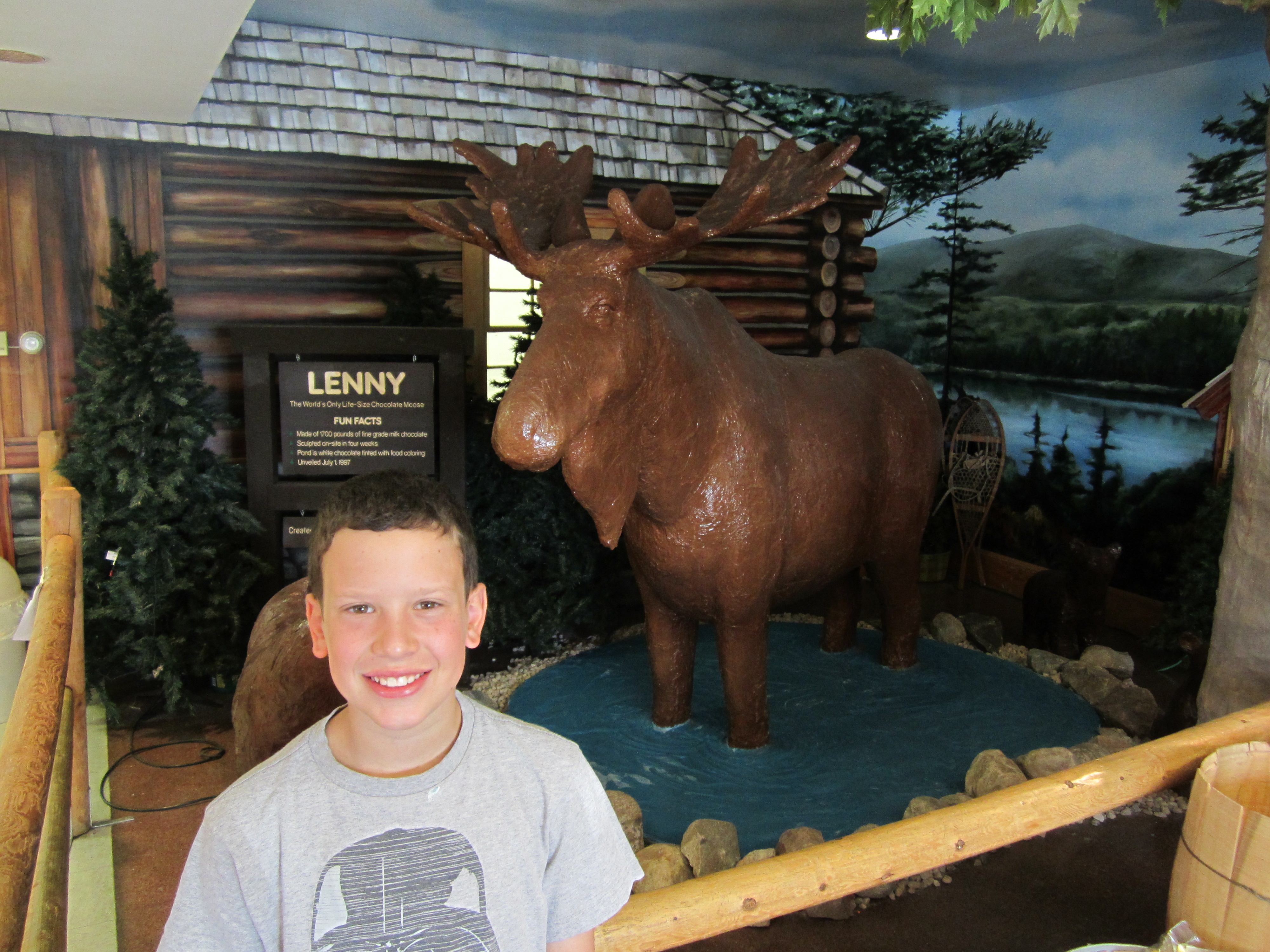
His name is Lenny. He’s made out of 1,700 lbs of milk chocolate. You can imagine what this sight did for Sam’s appetite. We had slept passed the end of the motel’s breakfast, so at Len Libby’s Sam got ice cream for breakfast.
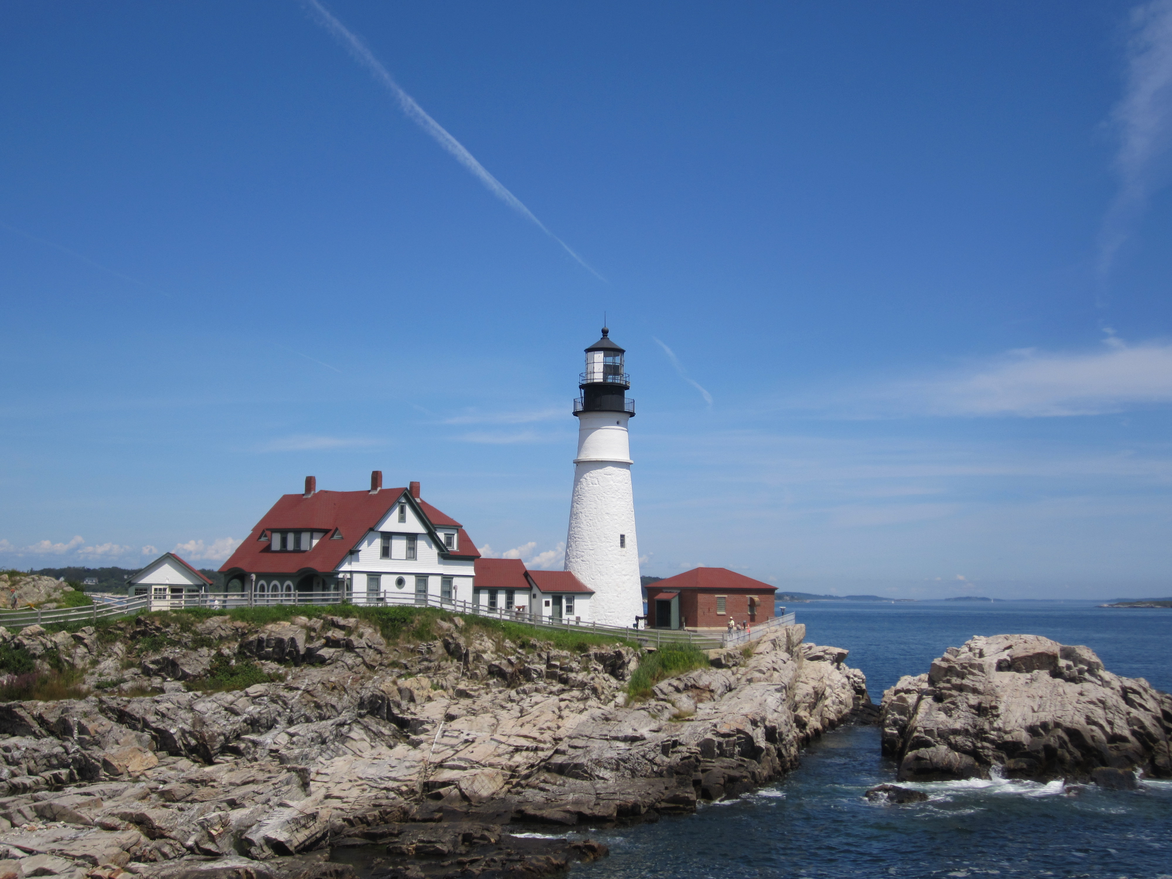
With the moose behind us it was time for the final lighthouse of our trip: the Portland Head Light, which is not only the oldest lighthouse in Maine but is situated in such a place that on a clear day you can stand at its base and see four other lighthouses in the distance. And today was a clear day. The four other lighthouses were cute but they were minor leaguers compared to the Portland Head Light. It was beautiful, majestic, stately, and tall. If lighthouses dated, you would want to set this one up with all of your single friends.
After a quick lunch at the lighthouse, the plan was to go lobstering: specifically, a working cruise in which we’d help the crew of a lobster boat pull up their traps from all over beautiful Casco Bay and then rubber-band the claws and measure the lobsters to see what could be kept and what had to be thrown back. But something happened.
I’m quickly learning that the biggest difference between this year’s trip and the previous two is that this time everyone else in America is coming along with us. Everywhere we go is packed to capacity, and all the hotels and motels on our route are either full or priced double what they should be or both. It’s kind of our own fault; we’re touring summer resort town after summer resort town, and we’re doing it in the peak of the peak season. Just looking for a place to stay for last night, for example, we spent hours looking online for anything within 45 minutes of Portland, ME. Any place that had a vacancy either didn’t serve breakfast (a big inconvenience for us), didn’t have fridges available (a dealbreaker), or cost a ridiculous amount for a musty, dumpy place far away from where we wanted to be. There was a Days Inn in the middle of nowhere that wanted $160/night. For a Days Inn! We ended up “lucking” into the last room in a Super 8 for a mere $93 plus tax. On previous trips a place like this would’ve been more like $60 and we would’ve passed it up for a similar place down the street that was charging only $55. In general I’m paying much more for motels this time around, which isn’t horrible because this trip is shorter than the others so it all evens out, I guess.
Anyway, this trend worsened this morning when I called the lobstering cruise company to make reservations and I was told that all five of their cruises for the day were fully booked and had people on waiting lists, and the same was true for tomorrow’s cruises as well. And this one company is the only one like it in Portland. Sam was bummed. I was extremely bummed. Our disappointment at not going lobstering sunk in just deep enough to paralyze us for a little while in terms of finding something else to do to fill the sudden gaping hole in our day.
Portland is a decent-size city but there’s just not a whole lot to do there that’s of interest to an 11-year old. I looked up Trip Advisor’s list of 63 attractions in Portland, and the only one Sam found enticing was bowling. I didn’t drive 900 miles to go bowling. We would’ve just left town and moved on, but we had tickets to the Portland Sea Dogs game at 7p.m., so we were anchored in Portland.
Ultimately I decided to drive through downtown Portland to get a peek at the heart of the city. It was cute and pleasant, but just a few blocks outside of the downtown area was a real gem: the Eastern Promenade, a thin strip of a public park that runs along the waterfront with fantastic views of the bay. We parked, we explored, we evaded joggers, we saw a regatta off shore, and we found memorials to Portlanders who died in the attacks of September 11, 2001, and to the USS Portland, a highly decorated battleship from WWII. We also saw large swaths of perfectly trimmed grass, and on Sam’s suggestion we got our baseball mitts out of the car and had a catch until our arms got tired. Suddenly we felt a lot better. There’s just something about having a catch that makes every trouble and problem just melt away. It wasn’t the most exciting thing we’ve done this week, but it was deeply enjoyable. Hours later, when I was putting Sam to bed and we were reminiscing about the day, he mentioned our catch as a highlight, explaining: “It was son bond-y. So father-son-y.” Agreed.
As nice as it was, we still had a few hours to kill before the ballgame, so we starting tackling tomorrow’s to-do list and headed north. First we drove a few miles up I-95 to the DeLorme Publishing Company, a map publisher with a large map store at the front of the building. But the real attraction there is Eartha, a massive, four-story, working, spinning globe that is the world’s largest. If you look closely at the bottom of the photo, Sam is there to provide context of size.
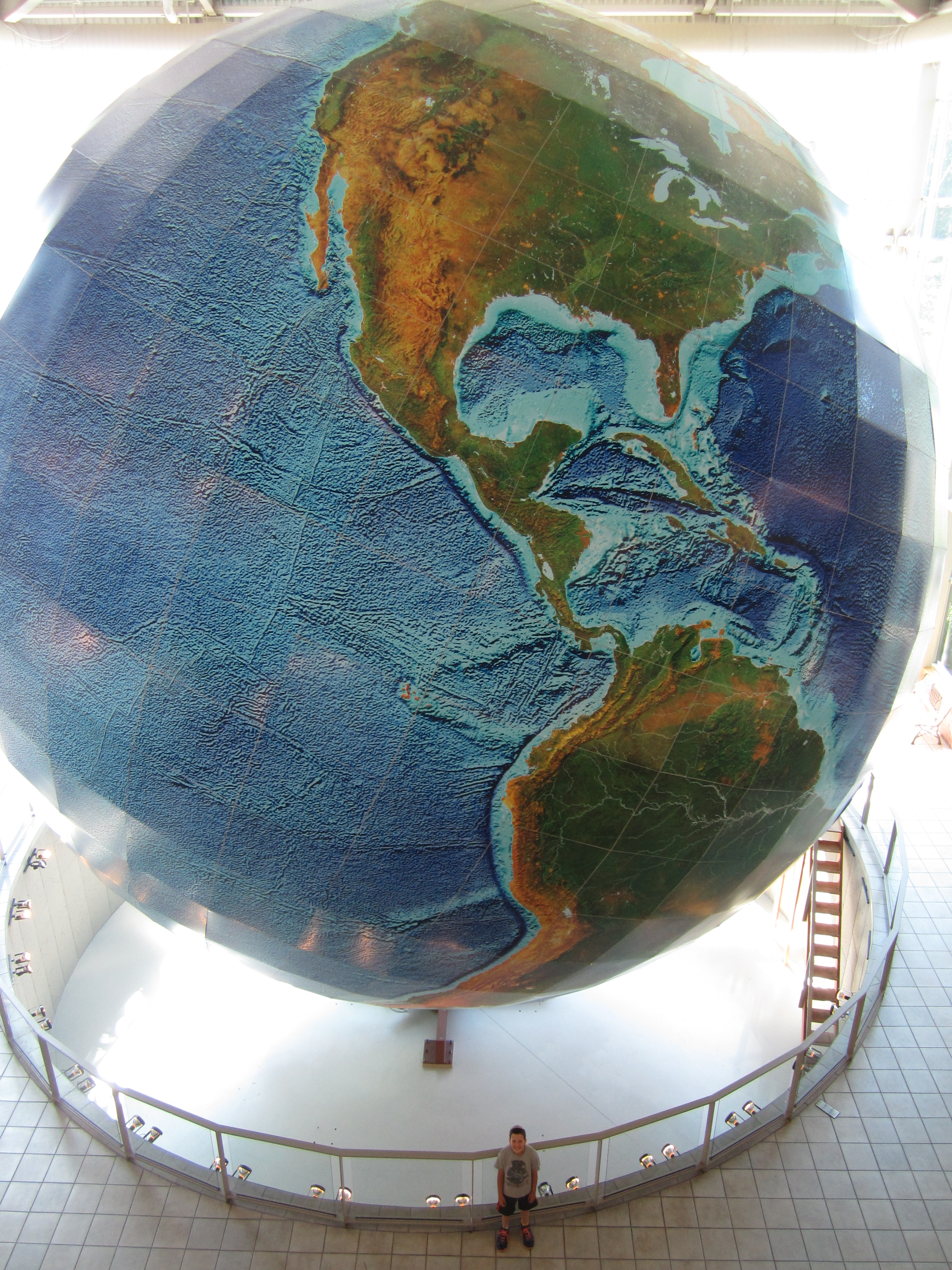
It is NOT a small world after all.
In the map store we bought Sam a new U.S. Map to put on his bedroom wall to replace the one that still hangs there with the route of our first road trip drawn in marker. I hate to replace such a treasure but it’s badly frayed and ripped in a few spots, so it’s time.
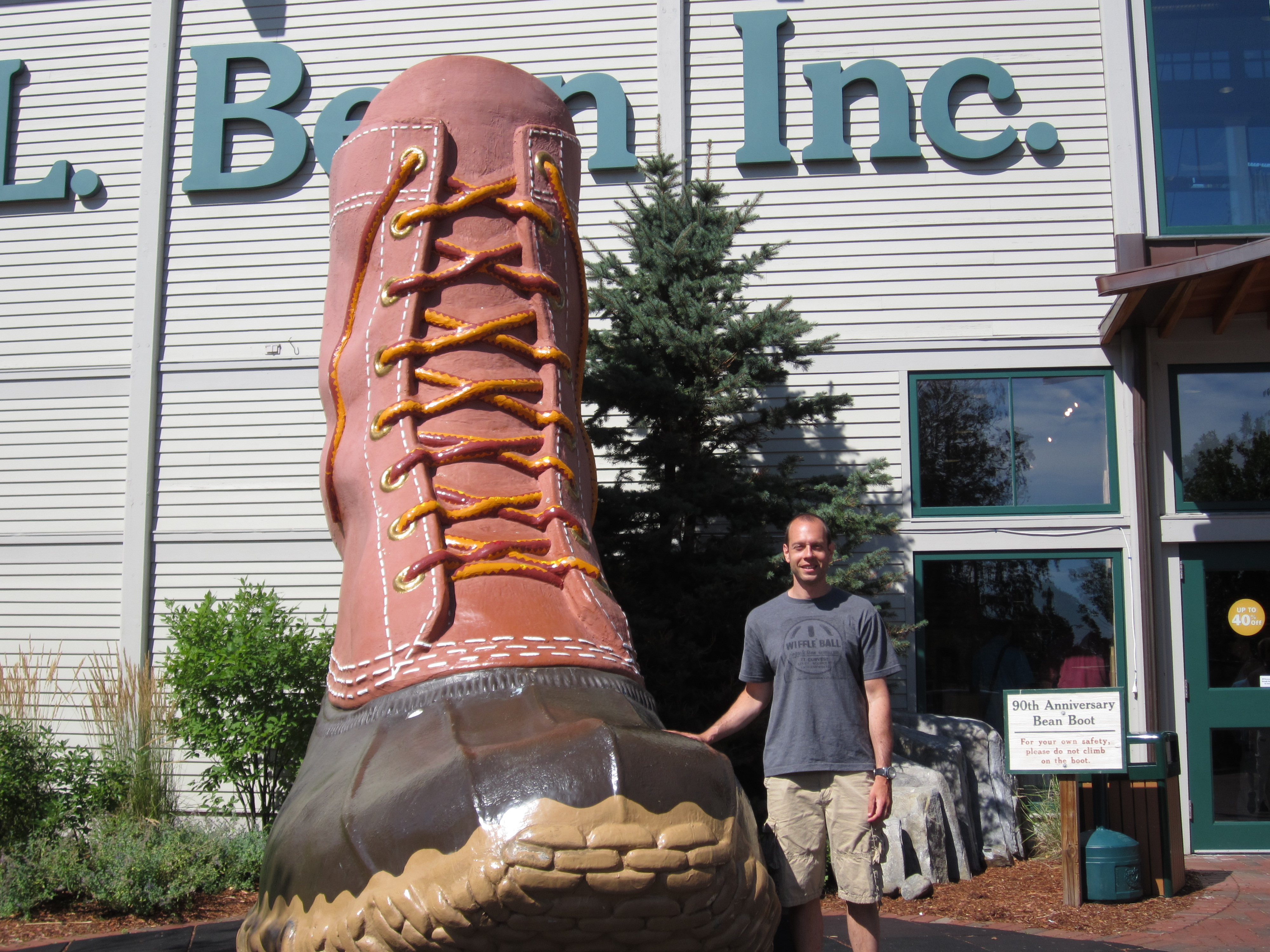
Anyway, we jumped back onto I-95 and checked off our final L’s for the day: L.L. Bean’s flagship store. It’s really more of a sprawling complex than a store, with separate buildings for clothing, outdoor sports equipment, home goods, and camping gear. We posed for pictures at the giant fiberglass duck boot outside the main entrance and at the real trout pond that was inside the store. I bought a couple pairs of pants and Sam got a wooden L.L. Bean yoyo and laughed at the newfound knowledge that the L.L. stands for Leon Leonwood. I couldn’t blame him–it’s a pretty ludicrous name.
We even had time to do a little grocery shopping, which is good because we’re OK on protein but we had run out of vegetables. For a trip like this, normal veggies don’t work. Lucky for us, Americans are extremely lazy, so there’s a huge variety of little bags of prewashed and precut veggies, which are perfect for eating with lunch or dinner in the car or at a random rest stop. And the supermarket we found made me very happy by avoiding the grammar mistake that so many other stores make: the express lane sign properly said “10 items or fewer.”
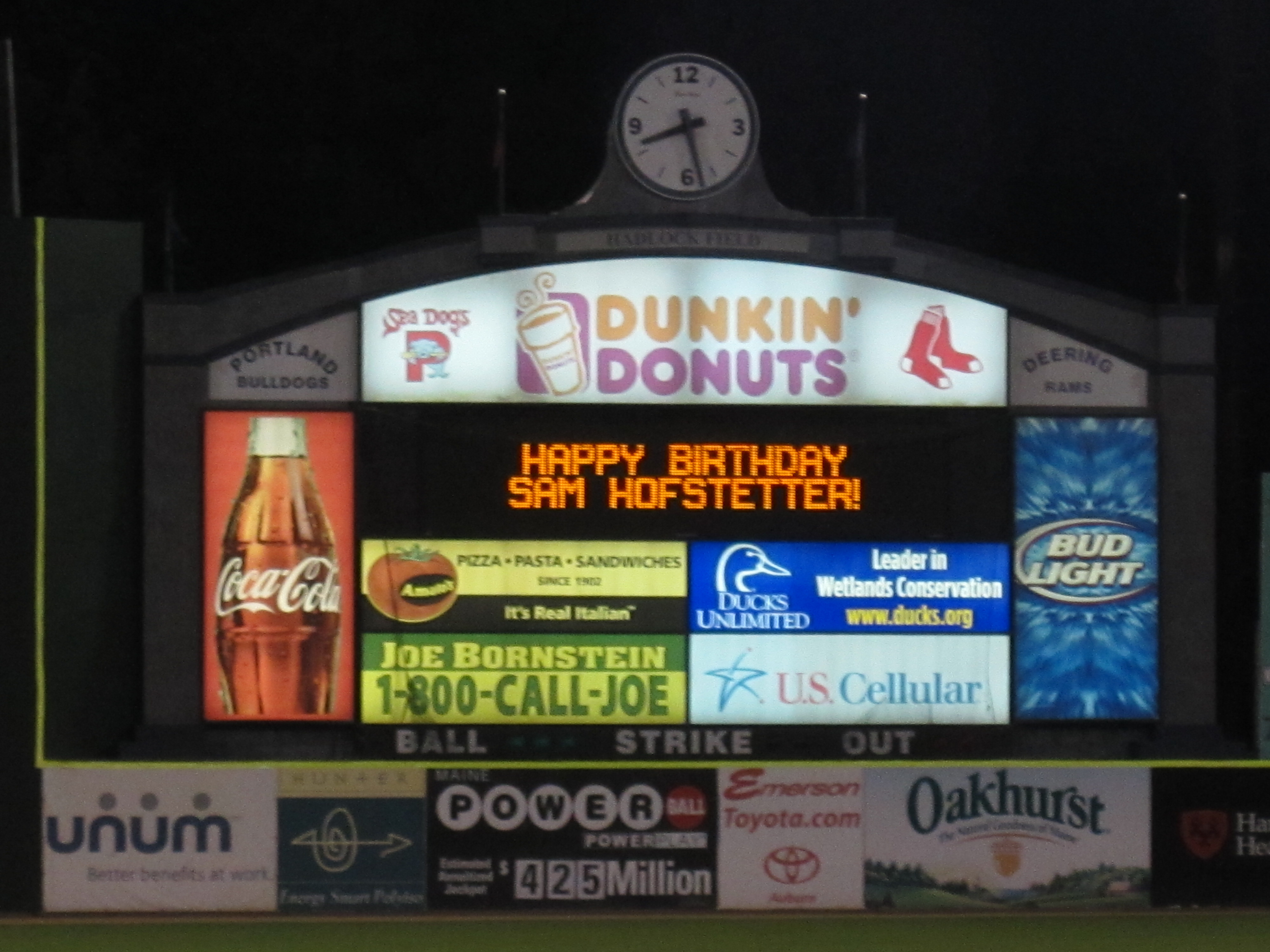
Finally it was time for the ballgame. The Sea Dogs are the double-A team for the Red Sox, which means we’ve now been to three baseball games on this trip and they all featured teams at different levels of the Red Sox organization. The weather was great once again, the game was both brisk and dramatic, Sam spent some quality time with the team mascot (Slugger the Sea Dog), and in honor of Sam’s Hebrew birthday I made a last-minute phone call to the team office that resulted in this sight during the sixth inning:
One odd thing about the Sea Dogs as an organization is that they’re clearly very uptight. No food or drink is allowed in the stadium, so we had to wolf down dinner before entering. Hawkeyed ushers spend the entire game kicking people out of good (empty) seats they don’t have tickets for, even in the ninth inning. And instead of having everyone drop their garbage under their seats like they do in pretty much every other stadium in America, there are repeated announcements to please put your trash in trash cans. On top of this they twice sent out two garbage mascots called the garbage monsters, who look like freaky aliens with trash cans for mouths, and suddenly hundreds of people were getting out of their seats to put their garbage into the mouths of the garbage monsters.
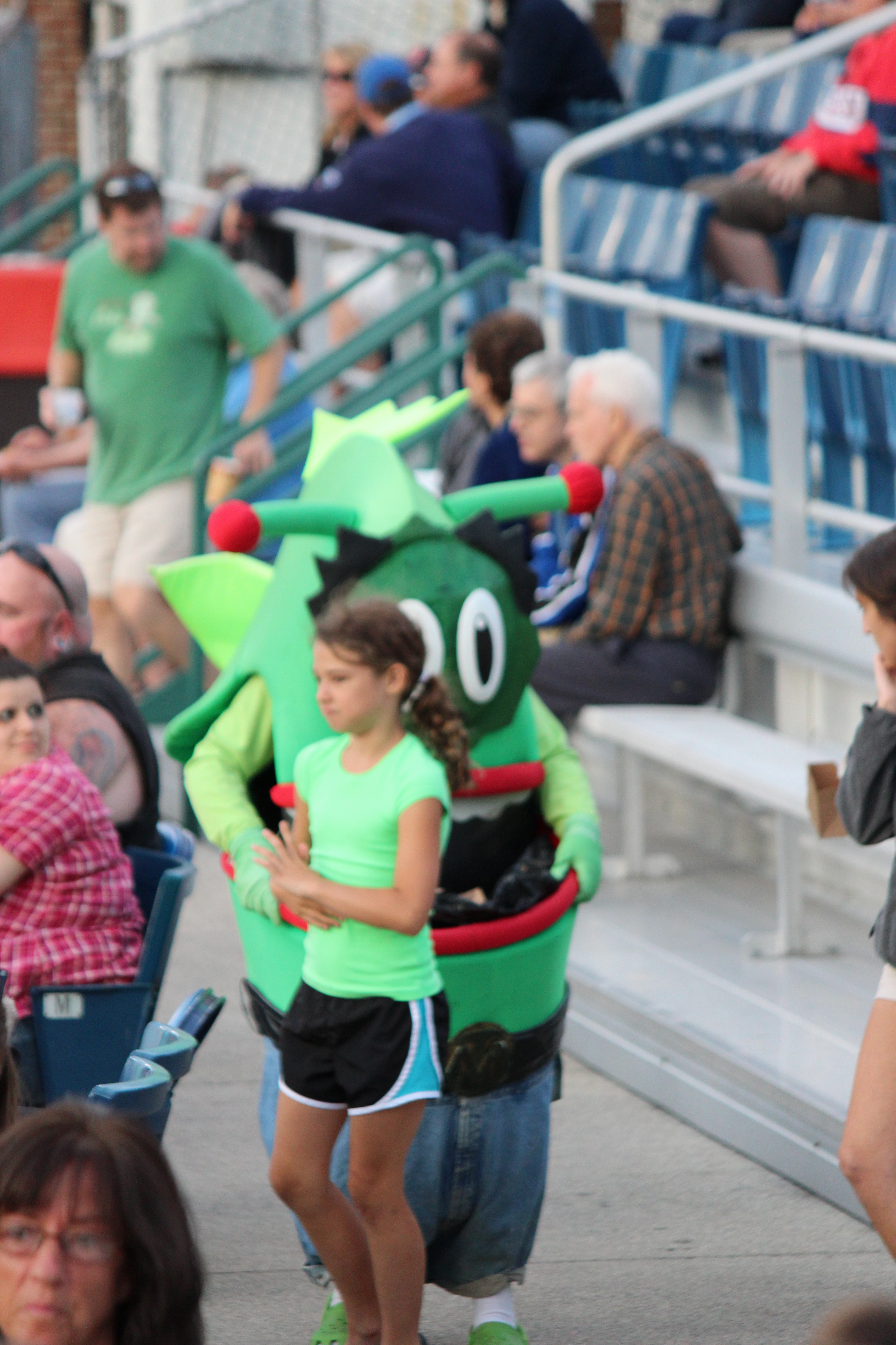
It made for a clean ballpark but it made me feel guilty for eating peanuts. And Sam and I could think of whenever the garbage monsters came out was the line from near the end of Superman II: “I’ve never seen garbage eat garbage before.”
In the top of the eighth inning the Sea Dogs coughed up their slim lead but they scored in the bottom of the eighth to go on top. But the Dogs’ closer gave up a towering two-run homer in the ninth, followed immediately by another homer, and Portland lost, 5-3, to the Richmond Flying Squirrels. Yes, they lost to the Flying Squirrels. After the game, Sam ran down to the Portland dugout and told the bat boy that it as his birthday, so the bat boy grabbed a ball and tossed it to him, which means that Sam has ended up with at least one game-used baseball at every single minor league game he’s ever been to (and he’s been to several).
I’m still a little sore that we got shut out of lobstering today, but we had a fun day anyway, and we still have severalmore days in Maine, so maybe we’ll get that last L after all.
99 Problems (But a Beach Ain’t One)
Today was looking like a dud right from the beginning.
The morning was to be spent in Portsmouth, NH, which is both right on the ocean and right on the border between NH and Maine. Our first stop was the Portsmouth Harbor Lighthouse, which is located within Fort Constitution State Historic Site. First I made a wrong turn, then we were supposed to take a little bridge that was closed for repairs, and before we knew it our 10-minute drive to the lighthouse had become a half hour. We finally arrived at the entrance to the state park, only to find out that the park, like the bridge, was closed for maintenance today. Grrrr!
The bright side of our futile detour was that we got to see a lot more of Portsmouth, which has some ugly parts but a quaint downtown and some gorgeous little bridges and islands and out-of-the-way spots. The New York Times Travel section had a feature on Portsmouth this past weekend, and it was fun for me to recognize a few of the restaurants, bars, and other recommendations from the Times as we passed them. One thing the Times said was that you haven’t seen Portsmouth until you’ve been to Strawberry Banke, which is a mostly outdoor museum that comprises several historic and replica buildings populated by costumed actors playing colonial townsfolk. It’s like Colonial Williamsburg’s little brother. But the Hamster and I have already been to Colonial Williamsburg, so we decided to ignore the Times and visit a submarine instead.
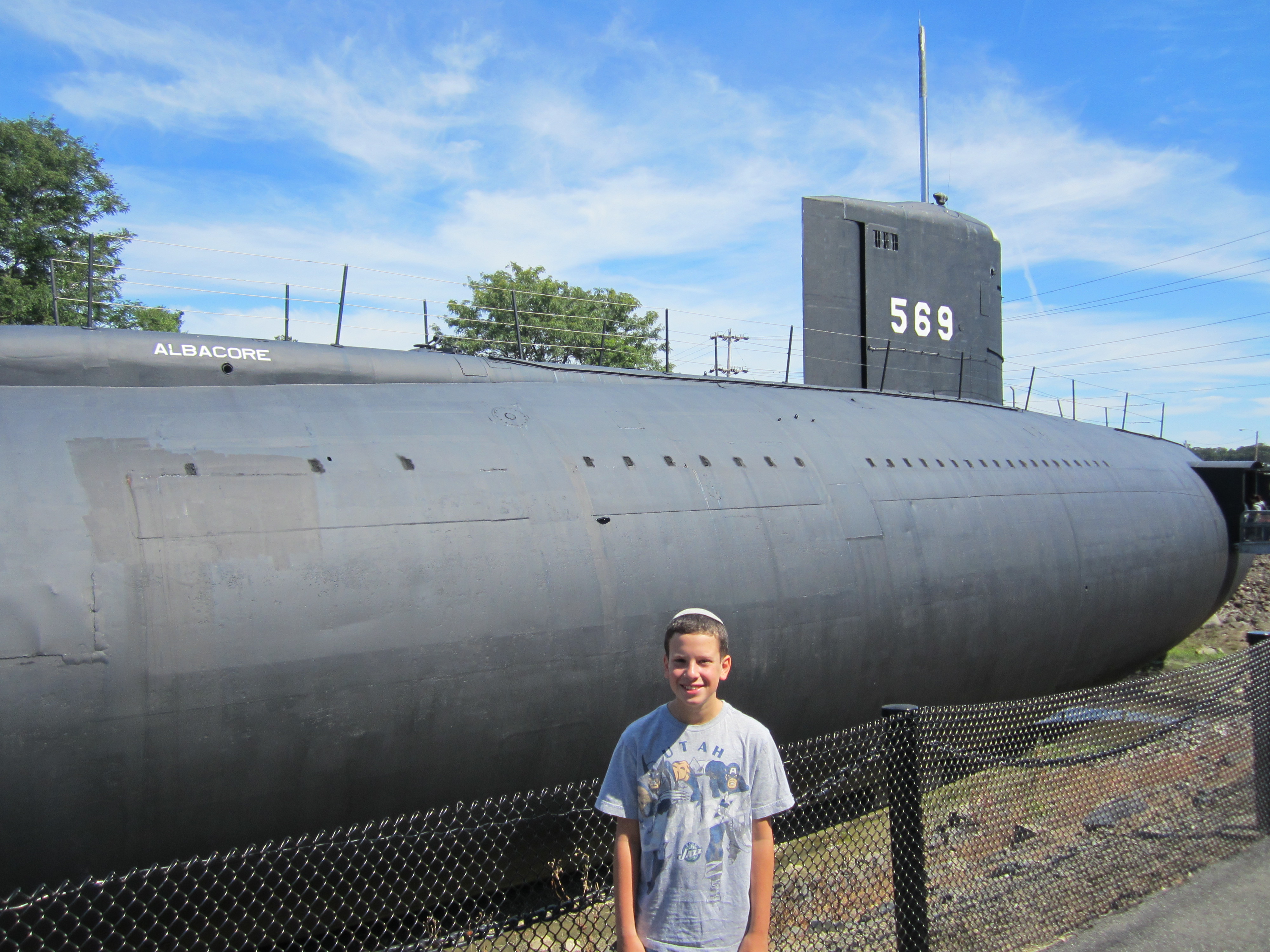
The USS Albacore is a retired 1950s-era submarine that, despite never having seen battle (in fact, it was never even outfitted with weapons), played a significant role in America’s military history. The Albacore was an experimental submarine stationed in and around Portsmouth that allowed the Navy to test out new hull designs, new engine designs, and lots of other technology, all of which became the basis for U.S. submarine design for decades to come. Not only did we get to go inside the submarine, but they encourage touching, so we also got to lie in bunks, peer through the periscope (we saw the nearby highway) and push and pull all kinds of levers, switches, telephones, etc.
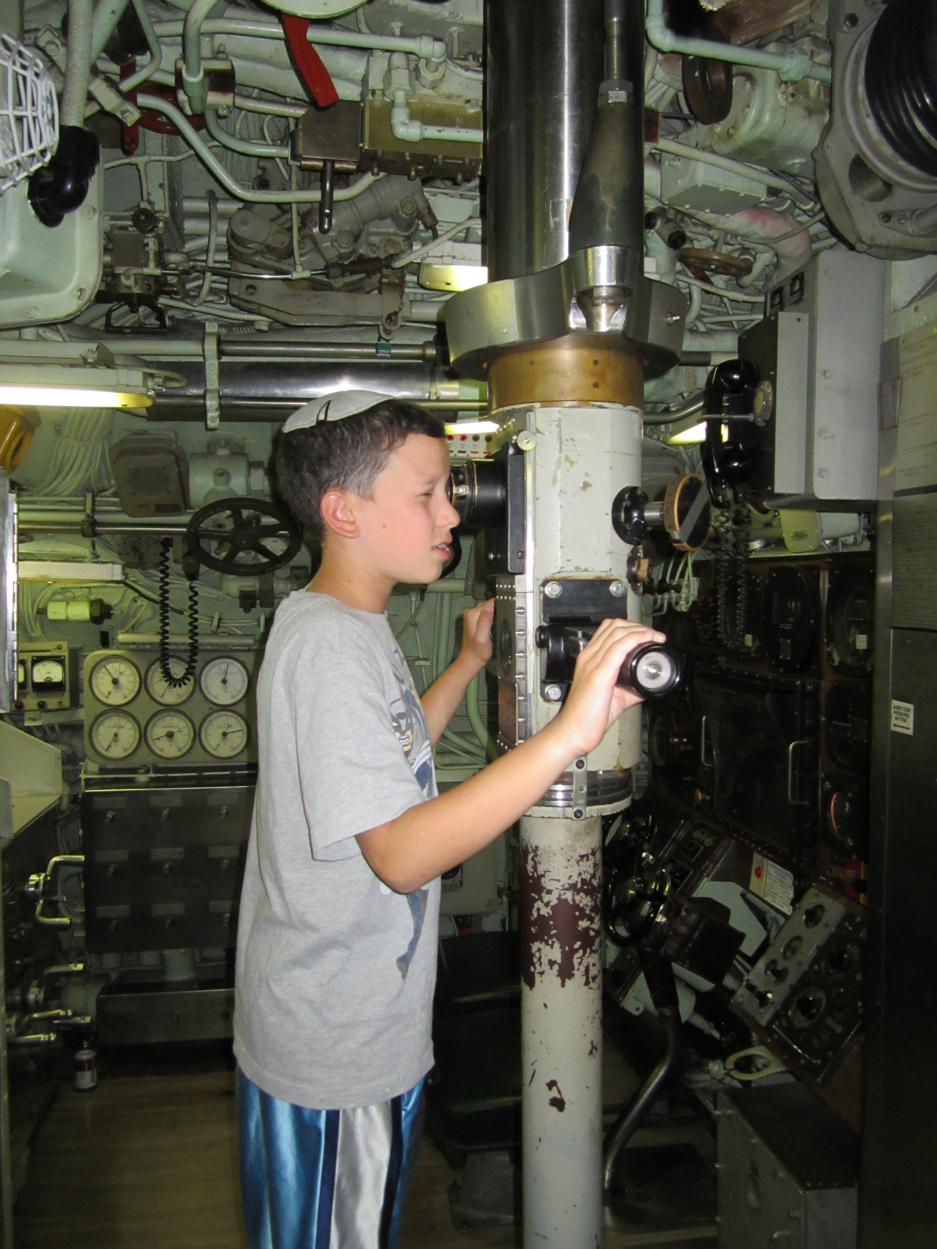
And as we explored, we listened to audio recordings of original crew members telling stories about their time aboard. I had expected everything to be pretty small and cramped, but I had no idea just how small and cramped. The galley was smaller than the kitchen in my first apartment, the waterproof hatch doors required me to scrunch down to half my size, and the sub holds more than 30 “beds,” none of which actually fit me. Heck, they barely fit Sam!
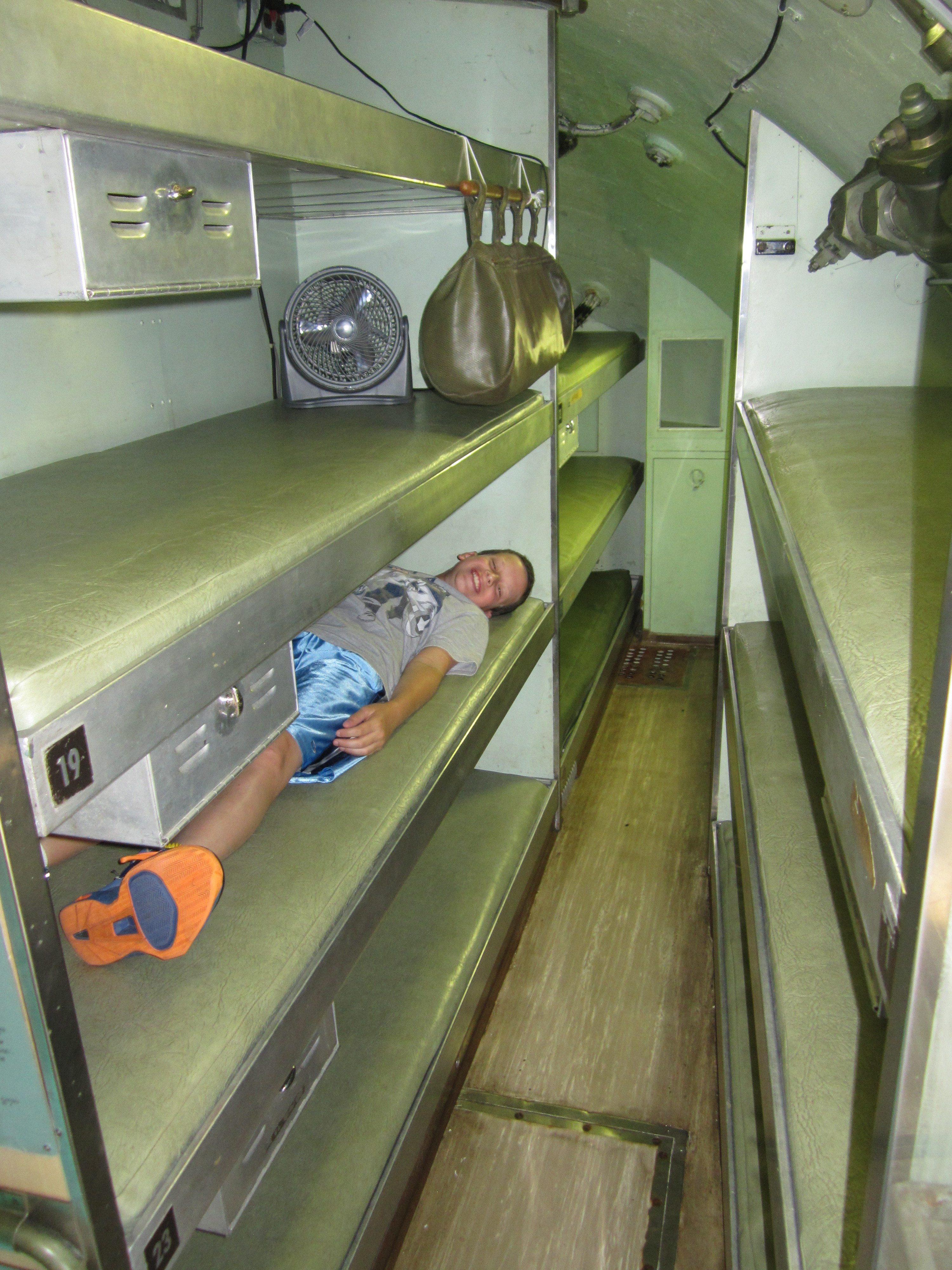
I mentioned this to one of the museum caretakers, and he told me that Navy submarines today aren’t much roomier. The bunks are the same length (6’1″) and active-duty sailors who have visited have told him they’re about the same distance apart, too. It’s so easy to think of the Navy and picture vast ships and endless oceans, but apparently it’s no place for claustrophobics.
The submarine tour went quickly so we were right back on schedule for the day, which gave us time to make a fun little stop on our way up north. Soon after we crossed into Maine (state #44 for me, 41 for Sam), we stopped for a few minutes at a small public park in York Harbor called the Hartley Mason Reservation, after a dead guy who left money and land to the town under the condition that they permanently turn it into a public “pleasure ground.” Located on a hill, it’s a beautiful little park with bright green grass, colorful flowers, and stunning views of the ocean and beach below. But the reason we wanted to visit (aside from it being directly on our way) was a sculpture, roughly four feet wide, of … people playing in a park.
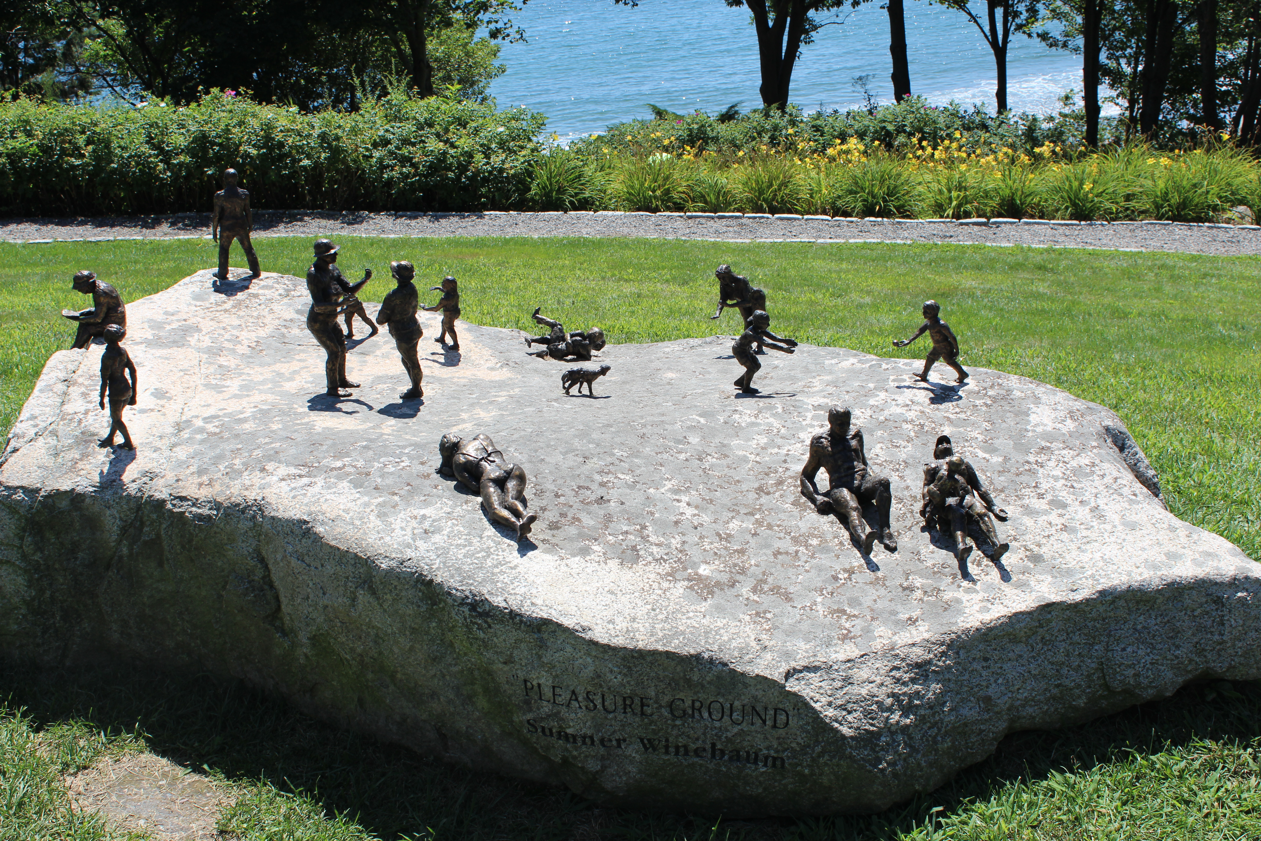
It’s definitely an usual kind of statue but the fun part was how closely it mimicked reality in that people in the park and in the statue were sunbathing, reading, and playing with a dog. It was so adorable!
The park was so pleasant that we were tempted to picnic there for lunch, but it was on the early side and we were hoping to have lunch somewhere even more picturesque.
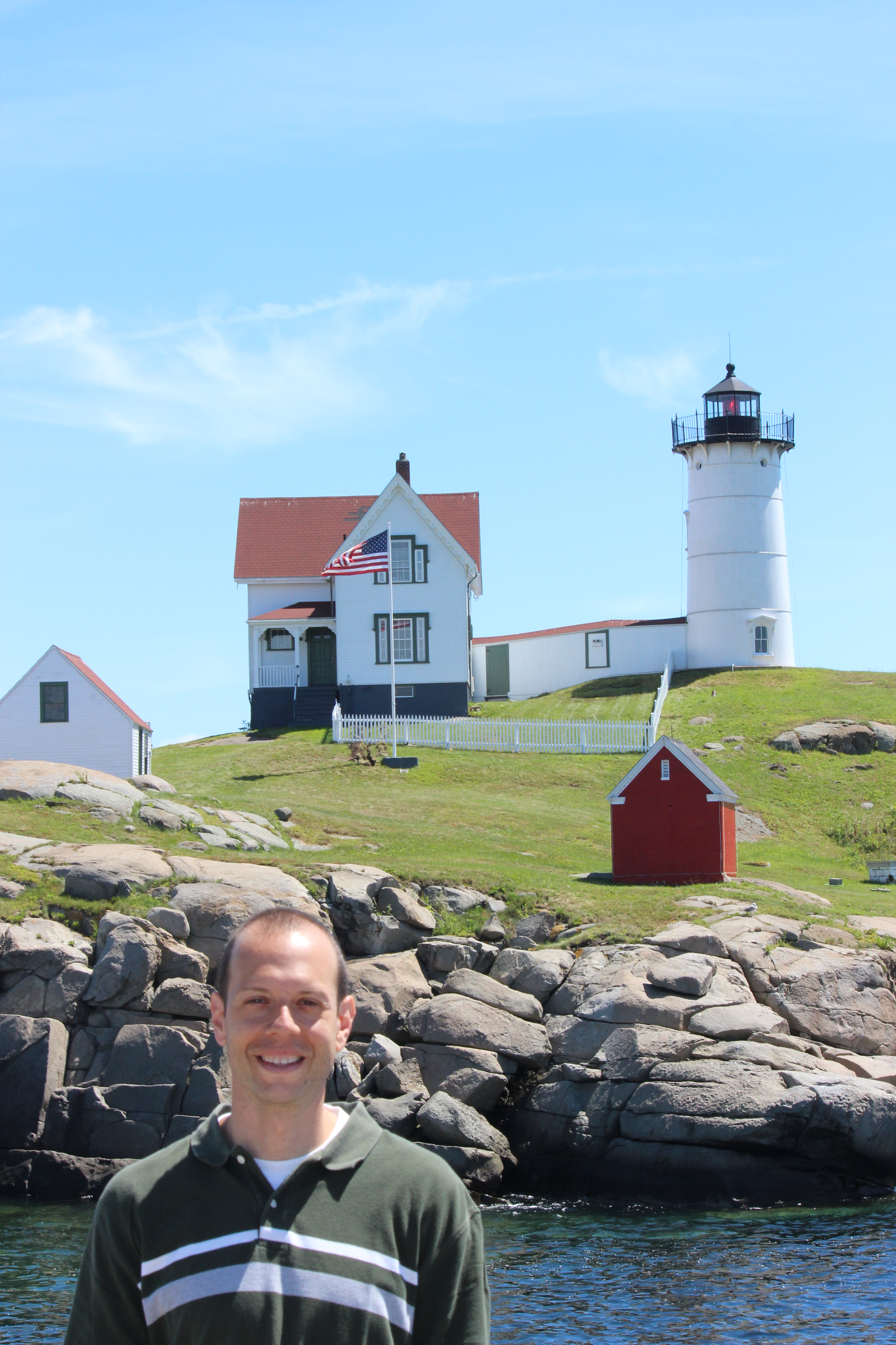
I don’t know why the Cape Neddick Lighthouse in York is also known as the Nubble, but I do know that it’s high on everybody’s list of things to do in Maine. And since it was, like the little park, basically on our way, we couldn’t resist. Yes, I know it’s the bazillionth lighthouse we’ve seen and/or tried to see in the past week. I don’t know why, but I just love lighthouses, and so does Hamster. Maybe it’s their heroic purpose, maybe it’s the idealistic vision of one lone light keeper vigilantly tending to his charge, maybe it’s their location right next to water and often rocks, or maybe it’s that they look like the offspring of a silo and a Christmas tree who fell in love. Either way we’re fascinated, and we’re not done visiting lighthouses. Maine alone has 67 of them, so we have some work to do.
For such a highly rated lighthouse I kind of expected to be able to go inside, or even right up to it, but the Nubble sits on a tiny island that’s not open to the public. There is, however, a little park that includes the rocky cliffs directly across from the lighthouse, which offers great close-up views and, of course, a gift shop. It was on those rocks that we stood, first gaping at the lighthouse, and then eating our picnic lunch. The day, it seemed, was turning in our favor.
Up next was one last crack at the beach. I know, I know, beaches haven’t gone so well for us in the past week. The best we’d done was a beautiful but insanely crowded beach with frigid water. But I got a tip that Goose Rocks Beach in Kennebunkport is not only a great beach but also secluded and therefore not very crowded. And the GPS said it was only 40 minutes away, so we figured it was worth a try. We’d be there by 1:30 or so, spend a couple of hours soaking up the sun and the salt, and then be on our way. Only … it didn’t quite work out that way.
The first problem was the traffic. There’s basically one main road that goes through a bunch of cute little coastal towns in southeastern Maine. That road is only one lane in each direction, but it was moving along pretty nicely until we got to a town called Ongunquit. Suddenly we slowed to a crawl, and I couldn’t figure out why. Ongunquit, Maine at 1p.m. on a Tuesday should not be where we get stuck in bumper-to-bumper traffic. But for more than a mile, that’s exactly where we were. Exasperated and confused, I pulled off the road into the Ongunquit Chamber of Commerce, where a very nice woman let us use the bathroom and explained that all the traffic was due to an intersection that was coming up in about a half mile and always seems to clog everything up. Back in the car, we crawled along, wondering if she could possibly be correct and reading every word of every roadside advertisement. (In case you’re interested, Clay Aiken is starring in “Joseph” at the famous Ongunquit Playhouse. If you’re going, just make sure to leave early to allow for traffic.)
We finally got through that perilous intersection and eventually made it to Goose Rocks Beach. But our trouble did not end there. Street parking near the beach was scarce, but it didn’t matter because there were signs everywhere announcing that parking on all streets is for residents only and requires a permit. I figured I would once again have to spend a lot to park in a lot, but there were no lots to be found. I couldn’t believe I came all that way and sat in all that traffic to not go to this beach. Inspiration struck: I would pay a resident a few bucks to let me park in his or her driveway. Lots of doors and windows were open all up and down the stretch of road near the beach, so I didn’t think finding a willing partner would be difficult. I was wrong. House after house had front doors left wide open but nobody was home. (They were probably all at the beach, those bastards.) After a few tries I finally found a guy in front of a house, but he was a hired painter and the owners weren’t home. A few more tries later yielded a nice couple who were perfectly willing to let us park but had no more room in their driveway.
Sigh. We left Goose Rocks Beach without ever having even seen it.
I was surprised that Sam didn’t seem to mind very much, and in fact was even more upbeat than usual. Like he does on every road trip, he’s been “collecting” state license plates, and this time around I even printed up a pictorial checklist for him. He’s got only 10 left, and he even saw an Alaska plate back in Cape Cod. The missing states have been coming slowly, though, so he decided to spice things up and proposed a new game: we would try to name what residents in each state are called. s we went through his checklist we knew some, guessed at some, and made some up (ex: people from Michigan are called Mishuggana). I told him authoritatively that people from Massachusetts are called Massholes, which he had never heard before and actually believed for a second until he realized what I had just said. (In case you’re wondering, here’s a full list of the real names of each state’s residents.
Before we knew it we were at the Rachel Carson National Wildlife Refuge, a natural salt marsh that was very pretty but was pretty disappointing in terms of wildlife. During a mile of hiking all we saw were a squirrel two chipmunks, and a handful of small birds. Sam was excited about the chipmunks but I was starting to lose steam. The good news was that because we didn’t spend any time at the beach we were way ahead of schedule. So much so that we were able to get to our next stop, Old Orchard Beach, before 5p.m.
Old Orchard Beach is both a beach and the town in which the beach resides. It’s like a much-lower-key version of Coney Island or Myrtle Beach or the Jersey Shore, with lots of little shops and restaurants and bars and a not-that-small amusement park along the beach and dozens of tiny no-name motels lining the road behind it. I originally had no intention of going to the actual beach there because I figured it would be too crowded and trashy. But there was still a couple hours of sun, and we found parking, and after the disappointment in Kennebunkport I figured it was worth a try.
The beach at Old Orchard Beach turned out to be exactly the beach we’ve been looking for all along. Plenty of soft sand, some waves, no rocks, and water that was reasonably clear and not terribly cold. Better still was our timing; by the time we got there the lifeguard was gone but so were most of the people, and we had plenty of room to spread out and enjoy ourselves.

We dropped our stuff on the sand and headed right into the water, where we bounced around and rode waves for a while before the sun started to get lower and the water colder. Sam buried himself in the sand, which was much easier than usual because there were plenty of big holes already dug by people who had been there before us.

It took a week and a bunch of tries, but we finally had a great beach experience, and in the place I least expected.
After heading back to the car and changing into dry clothes we walked down to The Pier, which is the center of all the Old Orchard Beach touristy-ness. It was pretty much exactly what you’d expect of such a place: T-shirt shops, pizza counters, loud bars, henna tattoos palm readings, pay bathrooms, a live band singing about Jesus … OK, maybe not EXACTLY what you’d expect. Anyway, Hamster and I had a brief argument about whether to spend $20 renting a side-by-side tandem bike that looked kind of like the Flintstones’ car, but otherwise we had a nice time strolling and gawking as the sun went down.
[Side note: Going to the beach during a road trip present many logistical challenges. At home, we put towels on the seats and drive home in bathing suits and then shower and change. On the road this is not an option. We’ve got a full car that we’d like to avoid covering in sand, but we have nowhere to change. So we’ve worked out a system that’s not easy but does the job. First I shake out our beach blanket and towels and dump them in the trunk on top of our luggage. Then we sit in the car with the doors open and our feet outside the car, and we brush of our feet. Then we take turns changing inside the car, which is super uncomfortable in every way. We seal our wet bathing suits up in Ziploc bags, throw them in the trunk, and hang them up in the bathroom hours later when we finally get to whatever motel we’re staying in that night. Meanwhile I spread out the towels to dry overnight before folding them up and putting them back in the beach bag for tomorrow.]
It was at about this point that we realized we were starving. We headed back to the car and started driving up I-95 toward Portland, where we’d be staying for the night. We were hoping to find a rest stop along the way where we could grill dinner, but there was nothing. So when we checked into the Super 8 I convinced the manager to let us grill in the back corner of the parking lot. It wasn’t the most beautiful place we’d been all day, but 10 minutes later we were eating burgers and reminiscing about a weird but very satisfying day.
Beached, Whales
This is why you ask the locals for advice. Monday was spent almost entirely following the advice of people who have been there before, and it’s no wonder that the day worked out so well.
The plan was to head back into Massachusetts and spend most of the day in Gloucester before finish up with an evening in Portsmouth, New Hampshire. We’ve been mostly hugging the East Coast this whole time, partly because that’s where a lot of the fun stuff is and partly because the Hamster and I both love the beach. Of course, that hasn’t worked out so well, but today we decided to take another crack at it. On the advice of friend and Boston native Amy, we hit up Good Harbor Beach in Gloucester, which made Amy three-for-three so far on this trip. The beach was exactly as she described it: soft sand met by water that was mostly calm, perfectly clear, and FREEZING!
We didn’t do much swimming because the water was so cold, but it was so clear and nice that we ended up just standing knee-deep for a while and watching the sand formations change under the tiny waves. The beach was more crowded than I have ever seen any beach, but everyone was pretty well behaved and everything was so pleasant that the crowds didn’t really detract. The only negative, besides the $20 parking fee, was that we weren’t able to spend more time there. That we blame squarely on the Massachusetts DOT, which shut down a lane of the highway so that they could mow the grass on the shoulder. I’d never seen lane closures for landscaping before, but we got delayed by half an hour on the way to the beach for about 200 yards worth of mowing of grass that nobody even cares about. We would’ve just stayed at the beach longer, but we had an appointment with some whales.
When I first started planning this trip I figured we would do some whale watching when we got to Maine. But the more research I did, the more signs pointed to Gloucester, which is consistently named one of the best places in the world for whale watching and whose whale watching companies all get good reviews. Then an old friend told me he went whale watching in Gloucester just a couple of weeks ago and had a great time, so Gloucester it would be. We went with Capt. Bill & Sons, which works hand in hand with a whale conservation organization and had a naturalist from the organization on the boat with us explaining all sorts of things about whales and telling us which whales we were seeing. I don’t just mean which types of whales we were seeing (one minke whale, one fin whale, and four humpbacks), but also the name of each individual whale. Humpbacks especially tend to be pretty loyal to their feeding grounds, and they each have a slightly different pattern of black and/or white splotches on the underside of their tales, so the naturalists know all the whales by sight. For example, this humpback is named Pinball because of the little black pinball-shaped spots on her otherwise white tail:

We also saw a female humpback named Nile and two others, Geometry and Etch-A-Sketch, who were travelling together today. In fact, although we saw mostly dorsal fins and tails all afternoon, Geometry and Etch-A-Sketch gave us a little show when they simultaneously popped their ugly faces up.
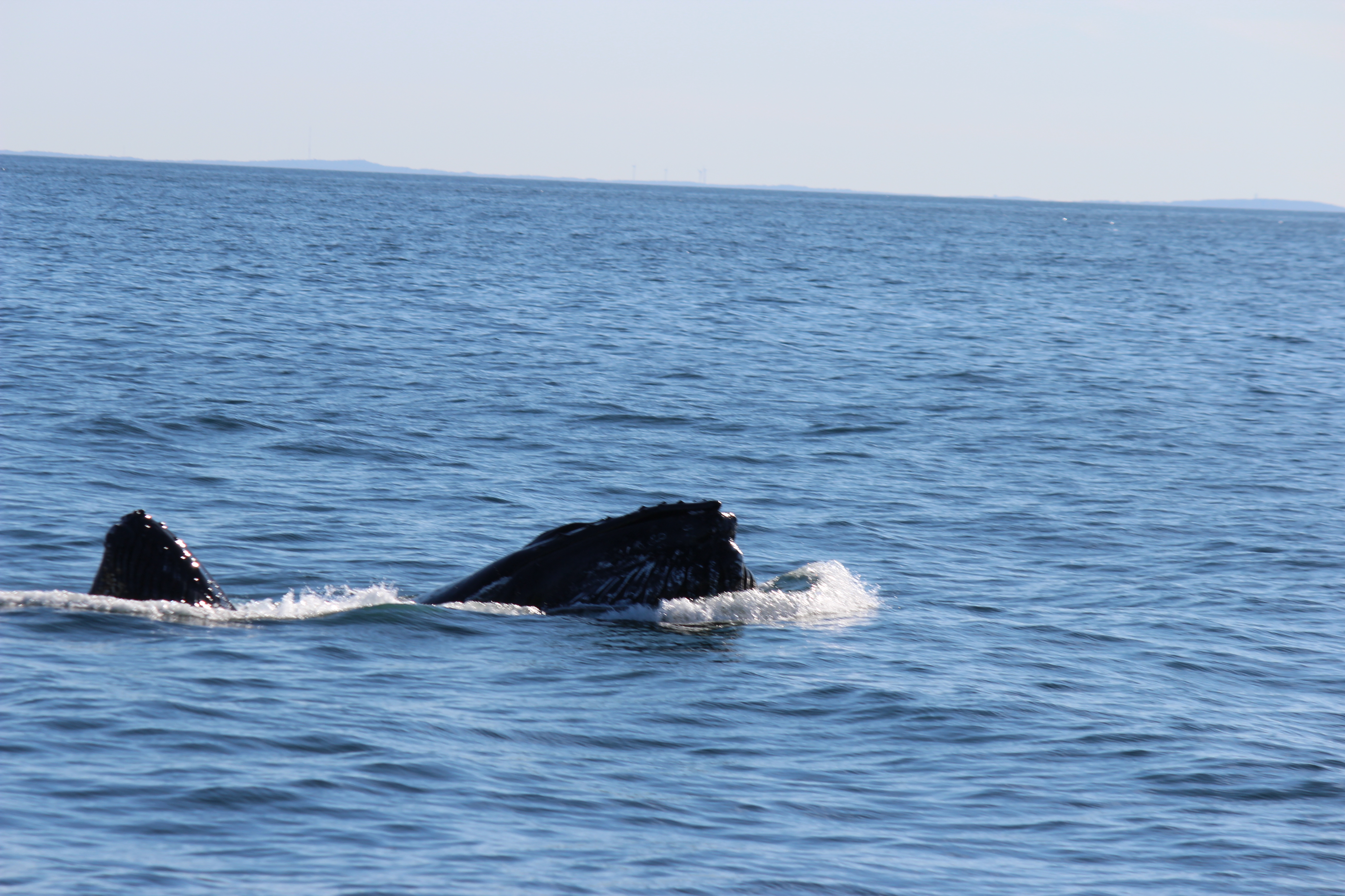
Sam and I saw several humpback whales a couple of years ago when we were in Hawaii, but that was more accidental and so the sightings tended to be brief and somewhat distant. This time the whales were the goal, so we lingered and we got very close at times. Just as the naturalist was explaining that fin whales, at 60-80 feet long, are the second-largest creatures on earth (behind only blue whales, which grow up to 90 feet long), a fin whale showed itself just 20 yards or so from our boat:

Watching the whales was lots of fun, especially because we saw so many tails. It is an established fact in our family that the tails are the coolest part because they look like upside down mustaches. But if you catch one at just the right moment, it actually looks like a right-side-up mustache.
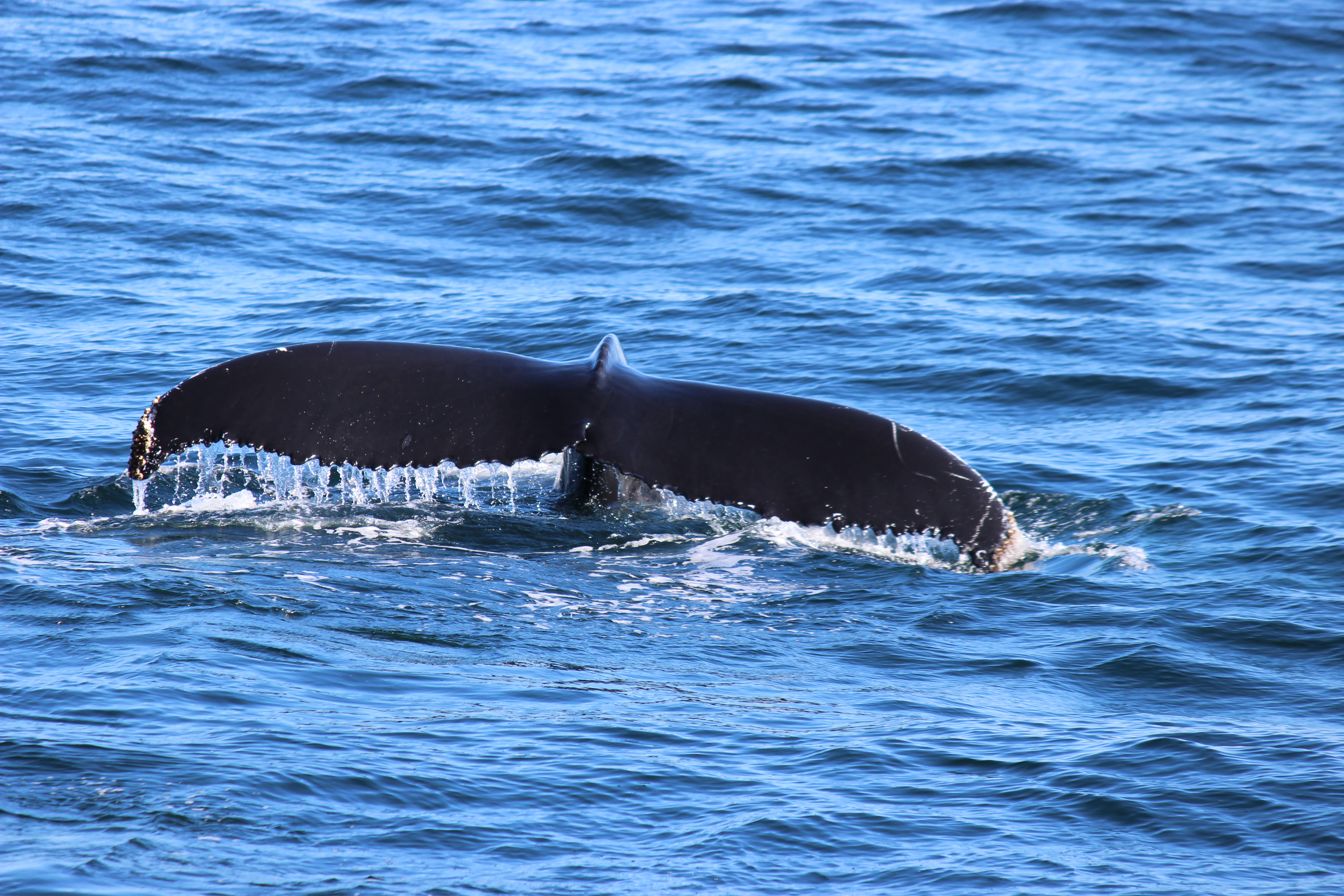
Unfortunately, the whales were feeding much further off the coast than usual today, which meant much more time spent traveling to and from whale-ville than usual. Sam got bored and hungry, but I was perfectly happy to occupy the time by noticing the scenery, which included a distant view of Boston …
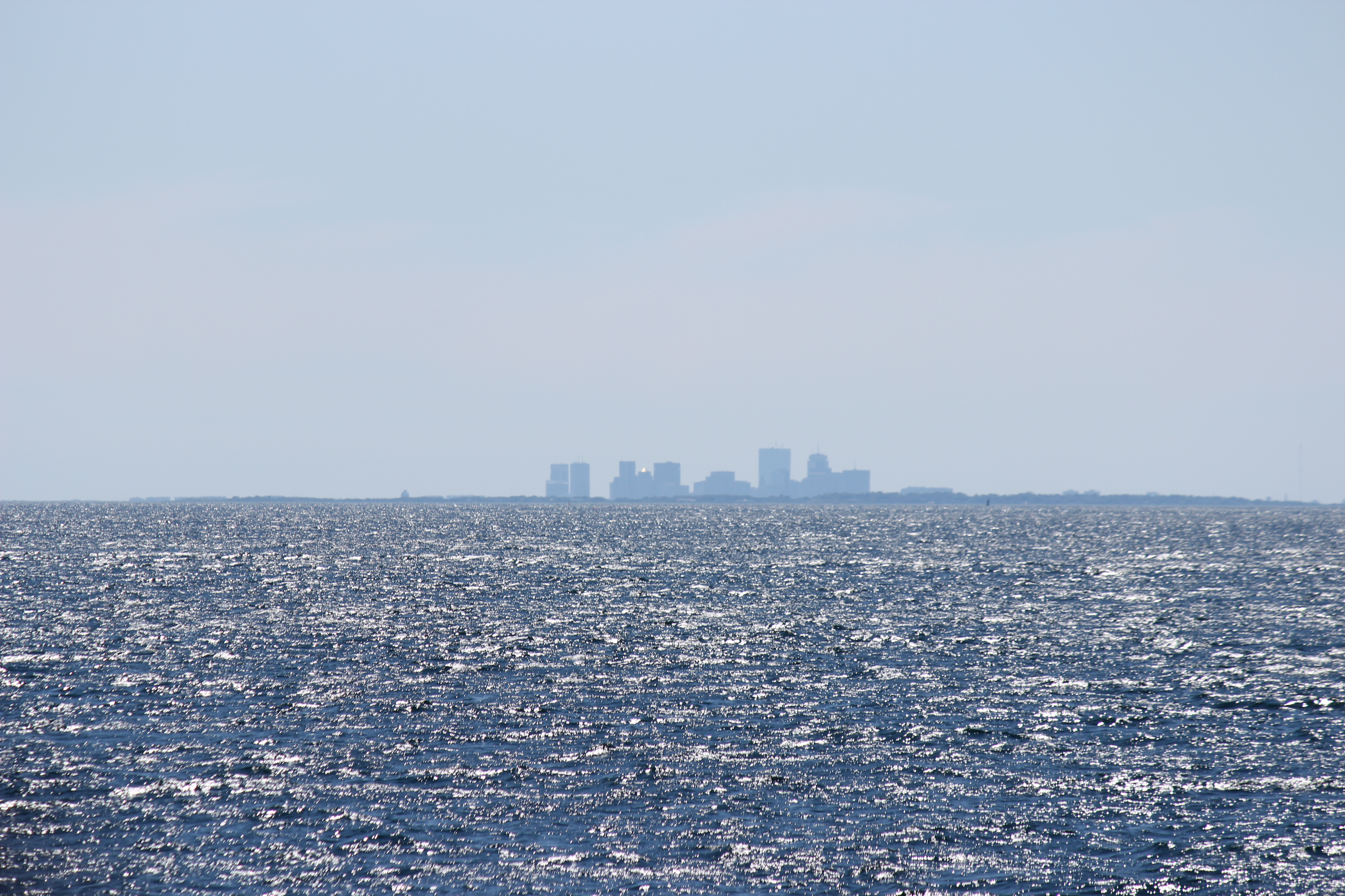
… a cute lighthouse …
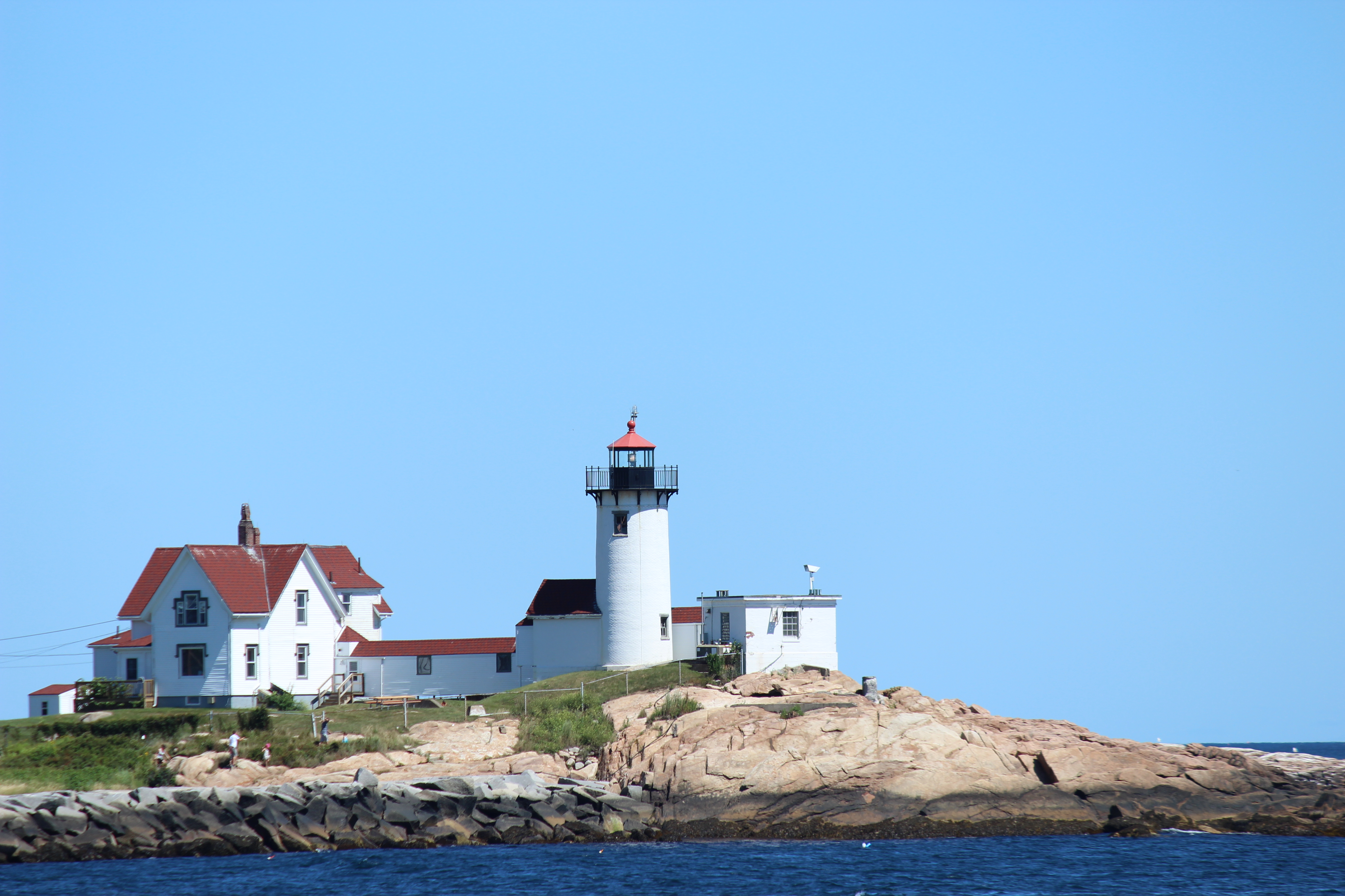
… and one weirdo on our boat who was making absolutely sure he didn’t get any sun today.

When someone tells you to stick something where the sun don’t shine, just give it to this guy.
Anyway, the problem with the extra travel time was that our 3.5-hour cruise turned into a 5-hour cruise and we didn’t get back to the dock until 7, which meant we lost the rest of the day. We were originally planning to get to a particular state park in New Hampshire by around 6:30 and then grill dinner there and check out the park’s lighthouse, but it was after eight before we even got close. Sam was ravenous and it was getting dark, so the Seabrook Rest Area and Welcome Center off of I-95 near the MA/NH border became our new dinner spot.
To make up for the lack of ambience I decided to skip the hot dogs and burgers and I pulled out all the stops. A couple of steaks I had kept frozen in the bottom of the cooler since we left home matched up perfectly with some mushrooms, and voila: a special dinner to end a special day.

Look at those grill marks! That perfect degree of doneness! Not bad for a portable grill at a highway rest stop in the dark, eh?
Today could have gone horribly wrong before it even started. There was rain in the forecast for a day we would spend at the beach and on the water. Meanwhile we had debated whether to take the morning whale cruise or the afternoon one, and high winds caused them to cancel the morning cruise but the wind and the waves died down for us and we set sail in perfect weather. Even dinner ended up working out pretty well, all things considered. We’re a little behind schedule now, but I think we can make it up over the next couple of days.
